


需求:
在地图上给定2个坐标点,然后将2个坐标点通过缩放都能显示出来。
实现:
通过查阅高德地图接入文档和API能找到缩放的API高德地图文档,看到以下说明
限制地图的显示范围
LatLng southwestLatLng = new LatLng(33.789925, 104.838326);
LatLng northeastLatLng = new LatLng(38.740688, 114.647472);
LatLngBounds latLngBounds = new LatLngBounds(southwestLatLng, northeastLatLng);
aMap.setMapStatusLimits(latLngBounds);
注意,我们并不需要限制地图的缩放功能,所以最终仅仅调用地图的缩放功能即可
给定左下的坐标和右上的坐标来确定一个显示范围,那么实际开发中我们拿到的坐标还需要进行比较后在创建该对象
对比坐标,使用坐标A和坐标B中的经纬度,谁的大谁就在右上角,谁小谁就在左下角,为此封装了一个方法:
/**
     * 根据2个坐标返回一个矩形Bounds
     * 以此来智能缩放地图显示
     */
    public static LatLngBounds createBounds(Double latA,Double lngA,Double latB,Double lngB){
        LatLng northeastLatLng;
        LatLng southwestLatLng;

        Double topLat,topLng;
        Double bottomLat,bottomLng;
        if(latA>=latB){
            topLat=latA;
            bottomLat=latB;
        }else{
            topLat=latB;
            bottomLat=latA;
        }
        if(lngA>=lngB){
            topLng=lngA;
            bottomLng=lngB;
        }else{
            topLng=lngB;
            bottomLng=lngA;
        }
        northeastLatLng=new LatLng(topLat,topLng);
        southwestLatLng=new LatLng(bottomLat,bottomLng);
        return new LatLngBounds(southwestLatLng, northeastLatLng);
    }
最后调用cameraAPI即可,这里使用的动画的方式,10代表的是padding内边距
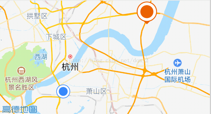
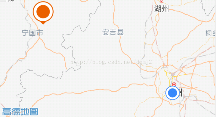
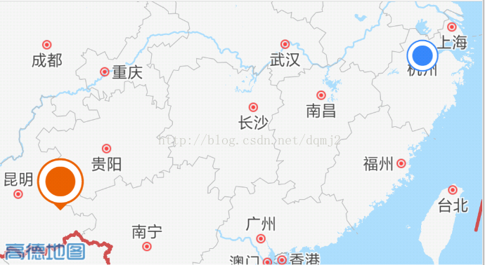
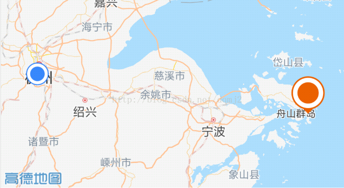
mAMap.animateCamera(CameraUpdateFactory.newLatLngBounds(latLngBounds, 10),1000L,null);4方位种效果


 2798
2798

 被折叠的 条评论
为什么被折叠?
被折叠的 条评论
为什么被折叠?
 到【灌水乐园】发言


