


在geoserver中,我们已经分析过getFeature的url了。
通过getFeature,访问类似如下的url,可以返回一个geojson。
http://localhost:8080/geoserver/wms?SERVICE=WMS&VERSION=1.1.1&REQUEST=GetFeatureInfo&FORMAT=image%2Fpng&TRANSPARENT=true&QUERY_LAYERS=gismap%3Av6_time_pref_pgn_utf_wgs84&LAYERS=gismap%3Av6_time_pref_pgn_utf_wgs84&exceptions=application%2Fvnd.ogc.se_inimage&INFO_FORMAT=application/json&FEATURE_COUNT=50&X=50&Y=50&SRS=EPSG%3A4326&STYLES=&WIDTH=101&HEIGHT=101&BBOX=114.59951733789063%2C39.30990146214762%2C116.59951733789063%2C41.30990146214762
但因为geoserver默认不支持跨域,所以我们要先解决一个geoserver的跨域问题。
一、配置geoserver支持跨域
打开geoserver-2.16.2webappsgeoserverWEB-INF web.xml,用sublime打开就行。
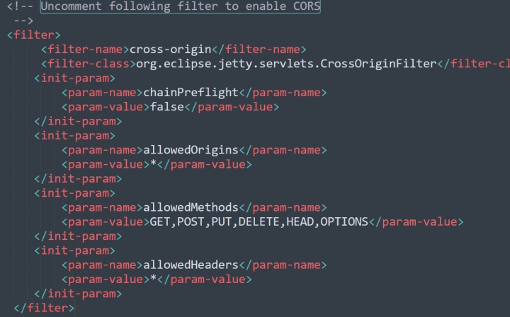
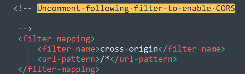
搜索Uncomment following filter to enable CORS,一共有两处,都被注释掉了,把注释掉的内容拿出来,使其支持跨域。
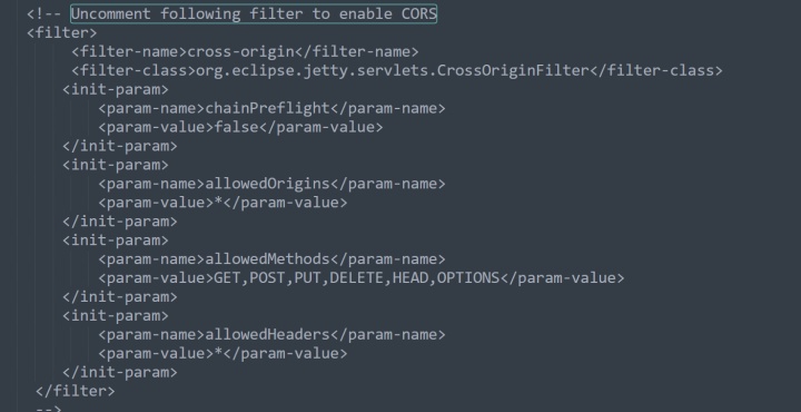
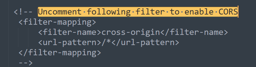
改成这样就行:
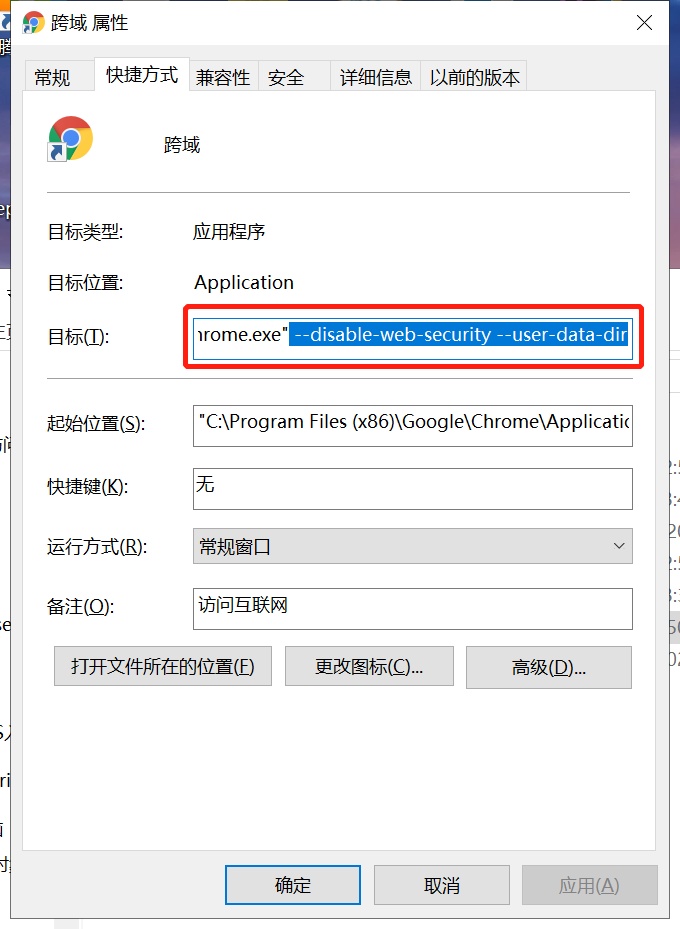
二、配置浏览器支持跨域
我使用的是chrome浏览器。
在桌面快捷方式中,目标后面加上 --disable-web-security --user-data-dir,即可,注意有空格。
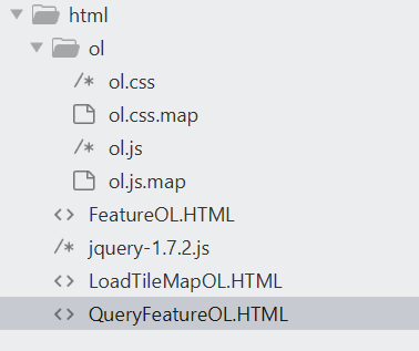
三、前端实现
新建一个QueryFeatureOL.HTML文件。
代码如下:
<!DOCTYPE html>
<html lang="en">
<head>
<meta charset="UTF-8">
<title>openlayer矢量要素渲染查询</title>
<link rel="stylesheet" href="ol/ol.css">
<script src="ol/ol.js"></script>
<script src="jquery-1.7.2.js"></script>
<style type="text/css">
#map,
html,
body {
height: 100%;
width: 100%;
}
.content {
width: 100px;
}
</style>
</head>
<body>
<div id="map"></div>
<div id="attributetable">
<table>
<thead>
<tr>
<th>name_py</th>
<th>name_ch</th>
</tr>
</thead>
<tbody id="attributetbody">
</tbody>
</table>
</div>
</body>
<script type="text/javascript">
//线上线下访问url不同,可变配置提出
var baseurl ='http://localhost:8080/';
//视窗,openlayer默认坐标系是平面墨卡托
var view = new ol.View({
center: ol.proj.transform([116.400146,40.250184], 'EPSG:4326', 'EPSG:3857'),
zoom: 9
});
//图层,加载腾讯底图和geoserver发布的wmts
var layers = [
new ol.layer.Tile({
source: new ol.source.XYZ({
url: "http://rt{0-3}.map.gtimg.com/realtimerender?z={z}&x={x}&y={-y}&type=vector&style=0"
})
}),
new ol.layer.Image({
source: new ol.source.ImageWMS({
ratio: 1,
url: 'http://localhost:8080/geoserver/wms?',//这个可以打开geoserver的preview,看openlayer页面截取url
// 请求参数
params: {
'SERVICE': 'WMS',
'VERSION': '1.1.0',
'REQUEST': 'GetMap',
'FORMAT': 'image/png',
'TRANSPARENT': true,
'tiled': true,
'LAYERS': 'gismap:v6_time_pref_pgn_utf_wgs84',//图层,前面是工作空间,后面是图层名,
'exceptions': 'application/vnd.ogc.se_inimage',
'singleTile': true//单瓦片,渲染成一张图片
}
}),
}),
];
//地图
var map = new ol.Map({
target: 'map',
layers: layers,
view: view
});
//地图点击事件
$("#map").click(function (e) {
//获取地图上点击的地理坐标,平面墨卡托坐标系
var t3857=map.getEventCoordinate(e);
console.log(t3857);
t4326=ol.proj.transform(t3857, 'EPSG:3857', 'EPSG:4326');
console.log(t4326);
// BBOX,minlng,minlat,maxlng,maxlat,平面墨卡托就是minx,miny,maxx,maxy,下面的url3857里的bbox是一个2m×2m的小矩形
//构造请求url的时候,把坐标系写成3857,虽然后台数据是4326坐标系的,但geoserver能内部转换
var url3857=baseurl+'geoserver/wms?SERVICE=WMS&VERSION=1.1.1&REQUEST=GetFeatureInfo&FORMAT=image%2Fpng&TRANSPARENT=true&QUERY_LAYERS=gismap%3Av6_time_pref_pgn_utf_wgs84&LAYERS=gismap%3Av6_time_pref_pgn_utf_wgs84&exceptions=application%2Fvnd.ogc.se_inimage&INFO_FORMAT=application/json&FEATURE_COUNT=50&X=50&Y=50&SRS=EPSG%3A3857&STYLES=&WIDTH=101&HEIGHT=101&BBOX='+(t3857[0]-1).toString()+'%2C'+(t3857[1]-1).toString()+'%2C'+(t3857[0]+1).toString()+'%2C'+(t3857[1]+1).toString();
console.log(url3857);
$.ajax(
{
url:url3857,
type:'GET',
dataType:'json',
headers:{'Content-Type':'application/json;charset=utf8'},
success:function(data){
//这个方法直接把geojson转为feature数组
features=(new ol.format.GeoJSON()).readFeatures(data);
//新建矢量资源
var vectorSource = new ol.source.Vector({
features: features
});
//新建矢量图层
var vectorLayer = new ol.layer.Vector({
source: vectorSource,
style: polygonStyleFunction
});
//将矢量图层添加到map
map.addLayer(vectorLayer);
//更新属性表
for(var i=0;i<data['features'].length;i++){
var properties=data['features'][i]['properties'];
var name_py=properties['name_py'];
var name_ch=properties['name_ch'];
var tabletxt='<tr><td>'
+name_py+'</td><td>'
+name_ch+'</td></tr>';
$("#attributetbody").append(tabletxt);
}
},
error:function(data){
console.log('faile');
console.log(data);
}
}
);
});
//制图风格,标注内容要从要素中获取,每个要素的name_ch属性不同,所以制图风格是方法,而不是静态的
function polygonStyleFunction(feature) {
return new ol.style.Style({
stroke: new ol.style.Stroke({
color: 'rgba(192, 0, 0, 1)',
width: 2
}),
fill: new ol.style.Fill({
color: 'rgba(192, 192, 192, 0.5)'
}),
text: createTextStyle(feature)
});
};
//创建注记
function createTextStyle(feature) {
return new ol.style.Text({
font: '20px Microsoft YaHei',
text: getText(feature),
fill: new ol.style.Fill({
color: 'rgba(192, 0, 0, 1)'
}),
stroke: new ol.style.Stroke({color: 'rgba(255, 255, 255, 1)', width: 1}),
})
};
//获取要素属性内容
function getText(feature) {
return feature.get('name_ch').toString();
};
</script>
<style type="text/css">
* {
margin: 0px;
padding: 0px;
}
body,
button,
input,
select,
#map {
width: 100%;
height: 100%;
}
#attributetable {
width: 100%;
height: 5%;
margin: 10px;
}
table {
border-collapse: collapse;
border-spacing: 0;
border: 1px solid #c0c0c0;
}
th,td {
border: 1px solid #d0d0d0;
color: #404060;
padding: 10px;
}
th {
background-color: #C00000;
font: bold 16px "微软雅黑";
color: #fff;
}
td {
font: 14px "微软雅黑";
}
tbody tr {
background-color: #f0f0f0;
}
tbody tr:hover {
cursor: pointer;
background-color: #fafafa;
}
</style>
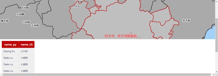
</html>四、前端效果
点击地图,既可以渲染矢量要素和注记,并展现属性表。


 500
500


 被折叠的 条评论
为什么被折叠?
被折叠的 条评论
为什么被折叠?
 到【灌水乐园】发言


