


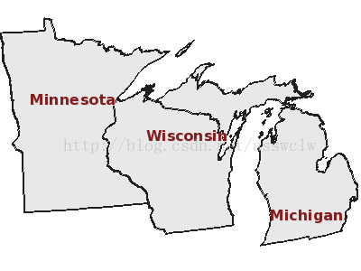
示例1.7添加OGC WMS图层
(http://www.mapserver.org/tutorial/example1-7.html#example1-7)
MapServer另一个让人兴奋的特点在于它具备使用其他地图服务器的能力。此例中MapServer应用成为了WMS(或WFS)客户端。MapServer也可以与其他地图服务器共享(或作为服务)mapfile文件中的图层。这样它就是一个WMS(或WFS)服务器。什么是WMS或WFS?这些是开放地理联盟(Open Geospatial Consortium , OGC)发布的“基于网络的互操作服务”规范。WMS代表网络地图服务,WFS代表网络要素服务。简单来说这两个规范之间的差别在于WMS是用网络栅格格式(PNG,GIF,JPEG)来使用图层,而WFS用的是地理标记语言(GeographyMarkup Language, GML)。第三OGC互操作规范是网络覆盖服务规范(Web Coverage Services, WCS)。MapServer仅支持服务端层次的WCS。可以去 OGC’s web site查找关于WMS,WFS和WCS的更多信息,也可以看看OGC ImplementationSpecifications 或 OGC AbstractSpecifications。MapServer官网上也有这些规范的文档和WIKI页。
这个例子向你展示了如何在你的mapfile文件中添加一个WMS图层。
MapFile
下面是示例1-7的mapfile文件:
Theannotated map file (sort of)
#Created by Pericles S. Nacionales for the MapServer tutorial
#20050408
#
#MapServer map file uses the pound sign (#) to denote the start of a line
#comment--each line that needs to be commented has to be prepended with a"#".
#
#Map files begin with MAP keyword to signify the start of the map object.
#Well, the entire map file is THE map object. Enclosed between MAP and END
#at the very bottom of this map file, are keyword/value pairs and other
#objects.
MAP
IMAGETYPE PNG
EXTENT 201621.496941 -294488.2853331425518.020722 498254.511514 # LAEA
#EXTENT -97.5 41.619778 -82.122902 49.38562 #Geographic
SIZE 400 300
SHAPEPATH "../data"
SYMBOLSET "../symbols/symbols35.sym"
FONTSET "../fonts/fonts.list"
# The projection object is typically usedwithin the map and the layer
# objects. You only define it once withinthe map object and this definition
# becomes your outputprojection--MapServer will render your maps in this
# projection. You also use the projection object within thelayer object to
# define your input projection. Your layers can be in different
# projections--MapServer willreproject them into your output projection.
# If no projection is defined within thelayer object, MapServer assumes
# your input projection is the same asyour output projection. This is not
# a required object unless you're creatinga map file that supports one of
# the OGC interoperability web servicesspecifications (WMS/WFS/WCS).
#
# This is the output PROJECTION definition------
PROJECTION
# Projection parameters can be definedin two ways...
# This is the traditional Proj.4definition of Lambert Azimuthal Equal-Area
# projection for the Continental U.S.
# "proj=laea"
# "ellps=clrk66"
# "lat_0=45"
# "lon_0=-100"
#
# Alternatively, you can specify an EPSGcode.
# This is the EPSG code for LambertAzimuthal Equal-Area
# projection for the U.S.
"init=epsg:2163"
END
# The web object is defined at the levelbelow the map object. All
# web-related parameters (I interchange"parameters" and "keyword/value
# pairs" quite frequently, sorryabout that) are defined in this object.
WEB
IMAGEPATH "/ms4w/tmp/"
IMAGEURL "/tmp/"
END
# Layer objects are defined beneath themap object. You need at least one
# layer defined in your map file beforeyou can display a map... You can
# define as many layers as you'd likealthough a limit is typically hard-coded
# in map.h in the MapServer source. The default limit is set at 100. You'd
# have to have a very specialized applicationto need more than 100 layers in
# your application.
#
# Start of LAYER DEFINITIONS---------------------------------------------
LAYER # States polygon layer beginshere
NAME states
DATA states_ugl
STATUS OFF
TYPE POLYGON
# Here's an example of the inputprojection definition.
# EPSG:4326 is code for geographic(latlong) projection
# using the WGS84 datum.
#
# PROJECTION objects within the LAYERobject define the input
#projection--this is the native projection of your data.
PROJECTION
"init=epsg:4326"
END
# CLASSITEM defines the non-spatialattribute that you will be using to
# separate a layer into classes. This attribute will be in the DBF file
# of your shapefile (it will bedifferent for each data format). In this
# example the shapefile states_ugl hasan associated database
# (states_ugl.dbf) that contains anattribute called "CLASS". Youwill be
# using two values in the CLASSattribute to separate the classes (also
# called themes) used in thislayer--land and water. CLASSITEM is usedin
# association with the EXPRESSIONparameter in the CLASS object. Seebelow.
CLASSITEM "CLASS"
# The class object is defined within thelayer object. You can define as
# many classes as you need (well, thereare limits as with layers, but it's
# senseless to define more than ten on a"normal" layer. There are
# situations, however, where you mighthave to do it.)
CLASS
NAME 'States'
EXPRESSION 'land'
# There are styles in a class, justlike there are classes in a layer,
# just like there are layers in amap. You can define multiple styles in
# a class just as you can definemultiple classes in a layer and multiple
# layers in a map.
STYLE
COLOR 232 232 232
END
END
END # States polygon layer endshere
# In addition to vector data (shapefilesare vector data), MapServer supports
# a host of raster formats. In GIS world, one of the most common raster
# formats is GeoTIFF, a TIFF image withgeospatial headers. MapServer also
# supports JPEG, PNG, GIF, and othercommon formats. Other raster formats
# supported by MapServer include ESRIArc/Info grid, HDF and HDF-EOS, NetCDF,
# Generic raster binaries, OGC Web MapService (WMS) layers, etc. Pretty much
# any raster format you can think of isprobably supported, thanks to the
# impressive Geospatial Data AbstractionLibrary (GDAL, pronounced "GOODALL"
# or GOODLE?). More information on GDAL is available athttp://www.gdal.org.
#
# MapServer 4.x can read and displaybitmapped (like GIFs), RGB/A (true
# color), and multispectral (images withmore than 3 bands, like raw LandSat
# images) rasters.
LAYER # MODIS raster layer beginshere
NAME modis
DATA "raster/mod09a12003161_ugl_ll_8bit.tif"
STATUS OFF
TYPE RASTER
PROCESSING "BANDS=1,2,3"
OFFSITE 71 74 65
PROJECTION
"init=epsg:4326"
END
END # MODIS raster layer ends here
# MapServer can consume (in ESRI parlance)layers from other map servers as
# long as those servers are Web MappingService (WMS) providers. WMS is a
# web service specification from OpenGeospatial Consortium (OGC) and is
# intended to be an interoperabilitystandard for web mapping applications.
# This allows us to display layers wedon't usually have (or can't store in
# our computers due to space limitations). The downside is that we have to
# depend on some other server to displayour layer, and that server can be
# down when you really needit. The cool thing is that JPL has a WMSserver
# that serves out MODIS and LandSat mapsfor the whole world--try storing
# those datasets on your computer!
LAYER # MODIS WMS map from JPL
NAME modis_jpl
TYPE RASTER
OFFSITE 0 0 0
STATUS OFF
CONNECTIONTYPE WMS
CONNECTION"http://wms.jpl.nasa.gov/wms.cgi?"
METADATA
"wms_srs" "EPSG:4326"
"wms_name" "modis"
"wms_server_version""1.1.1"
"wms_format""image/jpeg"
END
PROJECTION
"init=epsg:4326"
END
END # Modis WMS image ends here
LAYER # States line layer beginshere
NAME states
DATA states_ugl
STATUS OFF
TYPE LINE
PROJECTION
"init=epsg:4326"
END
CLASSITEM "CLASS"
CLASS
NAME 'State Boundary'
EXPRESSION 'land'
STYLE
SYMBOL 'line5'
COLOR 32 32 32
SIZE 1
END
END
END # States line layer ends here
LAYER # States label layer beginshere
NAME states_label
DATA states_ugl
STATUS OFF
TYPE ANNOTATION
PROJECTION
"init=epsg:4326"
END
CLASSITEM "CLASS"
# Just like CLASSITEM, LABELITEM definesthe database attribute that you
# will be using to draw labels. In this case, the values of the attribute
#"STATE" will be used to label the states polygons.
LABELITEM "STATE"
CLASS
EXPRESSION 'land'
STYLE
COLOR -1 -1 -1
END
# There can be labels in a class, justlike there are classes in a layer,
# just like there are layers in amap. You can define multiple labels in
# a class just as you can definemultiple classes in a layer and multiple
# layers in a map.
# MapServer has a very flexiblelabeling system. With that flexibility
#comes complexity, specially when using truetype fonts. Please read
# through the LABEL section of theMapServer map file documentation at
# http://www.mapserver.org/mapfile formore information.
LABEL
COLOR 132 31 31
SHADOWCOLOR218 218 218
SHADOWSIZE 1 1
TYPE TRUETYPE
FONT arial-bold
SIZE 12
ANTIALIAS TRUE
POSITION CL
PARTIALS FALSE
MINDISTANCE 200
BUFFER 4
END # end of label
END # end of class
END # States label layer ends here
# End of LAYER DEFINITIONS-------------------------------
END # end of map file
图层对象和WMS参数
让我们看看WMS图层。
LAYER #MODISWMS map from JPL
WMS LAYER对象开始标记。
NAME modis-jpl
LAYER标识符
TYPE RASTER
因为WMS图层是一个图像,我们设置LAYERTYPE 为 RASTER。
OFFSITE 0 0 0
忽略的背景色。
STATUS OFF
默认关闭这个图层。
CONNECTIONTYPE WMS
LAYER连接类型。默认值是LOCAL。
注意:如果需要显示定义LOCAL,需要在mapfile文件所有矢量和栅格图层中加入CONNECTIONTYPELOCAL。否则只需要定义外部图层的连接类型。WMS是另一个地图服务器上的外部数据图层。
CONNECTION http://mapus.jpl.nasa.gov/wms.cgi?
允许我们从另一个服务器上获取数据的连接字符串。在WMS连接示例中,它就是一个网址(URL)。如果使用PostGIS数据库,它可能就是一个SQL语句。请注意字符串在mapfile文件中必须是单独一行。
METADATA
WMS图层METADATA对象开始标记。MapServer用它与此对象内前面CONNECTION参数组合成一个合法的WMS请求,传递给WMS服务器。
“wms_srs” “epsg:4326”
WMS投影。有时WMS服务器支持多个投影。如果是这种情况你可能想以你输出投影方式(epsg:2163)请求地图。不幸的是JPL服务器不支持这种投影。
"wms_name" "modis"
WMS图层名称。这就像添加了参数“layers=modis”
"wms_server_version""1.1.1"
服务器编译的WMS版本。可查看MapServer OGCSpecification support.获得更多选项。
"wms_format" "image/jpeg"
希望从WMS服务器接收的图像格式。你可以试着用image/png或其他格式替换这个值。
END
METADATA对象结束标记。
要了解关于添加WMS图层到应用中的更多信息,请访问MapServerWMS Client Howto.
WEB对象参数
除了洄WMS图层对象外,在MAP下面还有一个新对象。它就是WEB对象。在WEB对象里面有两个参数:
IMAGEPATH "/ms4w/tmp/"
网络可访问临时目录的本地绝对路径。运行网络服务器进程的用户必须具备对此目录的写权限。确保此路径最后包含斜杠(/)。(你的IMAGEPATH可能看起来像 “/home/apache/htdocs/tmp/” 或“C:/Inetpub/wwwroot/tmp/”.)
IMAGEURL "/tmp/"
IMAGEPATH相对于网络服务器要目录的相对目录。如果我们输入完整URL,将会是 “http://terrasip.gis.umn.edu/tmp/”.确保路径末尾包含斜杠(/)。
最后在MAP对象内添加了一个新参数:NAME。这个是MAP对象的标识符。MapServer将它作为服务器产生并输出到tmp目录的所有图像的前缀。此刻还不需要,但是放在这里也没有什么不对。
如果你想与其他地图服务器共享你的数据图层,你需要在你所有想要共享的MAP对象和LAYER对象内添加METADATA对象。你从其他服务器所有WMS图层也将自动级连并可被他人访问。为了解如何将MapServer应用变成WMS服务器的更多信息,请阅读 MapServer WMSServer HowTo.。那里也存在配置MapServer应用(作为服务器或客户端)使之支持WFS标准的文档。
PS:中文版权为asswclw所有,请尊重劳动成果,转载将注明出处。


 4813
4813


 被折叠的 条评论
为什么被折叠?
被折叠的 条评论
为什么被折叠?
 到【灌水乐园】发言


