


 该数据集包含自2001年以来(除谋杀案外)芝加哥市的已报告犯罪记录,最近7天的数据未包含。数据源自芝加哥警察局的CLEAR系统,地址信息进行了部分隐藏。犯罪类型通过IUCR代码表示,包括主次类别,同时包含逮捕、 domestics、地点描述等详细信息。数据集提供7.38M条记录,每条记录代表一起犯罪事件,涵盖22个字段,如案件编号、日期、坐标等。请注意,数据可能存在错误或遗漏,不适用于长期比较。
1 摘要
该数据集反映了芝加哥市从 2001 年至今发生的已报告犯罪事件(谋杀案除外,其中每个受害者都有数据),减去最近 7 天。数据是从芝加哥警察局的 CLEAR(公民执法分析和报告)系统中提取的。为了保护犯罪受害者的隐私,地址仅在块级别显示,不标识具体位置。 免责声明:这些罪行可能基于举报方提供给警察局但未经核实的初步信息。初步犯罪分类可能会在以后根据进一步调查进行更改,并且始终存在机械或人为错误的可能性。因此,芝加哥警察局不保证(无论是明示的还是暗示的)信息的准确性、完整性、及时性或正确排序,并且信息不应随着时间的推移用于比较目的。芝加哥警察局不对任何错误或遗漏,或使用此信息或使用此信息而获得的结果负责。地图上的所有数据可视化都应被视为近似数据,并且严禁尝试推导特定地址。除了芝加哥市或芝加哥警察局官方网页之外,芝加哥警察局不对本网页引用或引用的任何场外页面的内容负责。用户明确承认,芝加哥警察局不对其他用户、链接或第三方的任何诽谤、攻击性、误导性或非法行为负责,并且因前述行为造成伤害的风险完全由用户承担。
更新至:2021.08.25
2 数据集概述
共:7.38M rows,22 Columns, Each row is a Reported crime
3 特征含义
| Column Name | Description | Type | Data Type | API Field Name |
|---|---|---|---|---|
| ID | Unique identifier for the record. | Number | Number | id |
| Case Number | The Chicago Police Department RD Number (Records Division Number), which is unique to the incident. | Plain Text | Text | case_number |
| Date | Date when the incident occurred. this is sometimes a best estimate. | Date & Time | Floating Timestamp | date |
| Block | The partially redacted address where the incident occurred, placing it on the same block as the actual address. | Plain Text | Text | block |
| IUCR | The Illinois Unifrom Crime Reporting code. This is directly linked to the Primary Type and Description. See the list of IUCR codes at https://data.cityofchicago.org/d/c7ck-438e. | Plain Text | Text | iucr |
| Primary Type | The primary description of the IUCR code. | Plain Text | Text | primary_type |
| Description | The secondary description of the IUCR code, a subcategory of the primary description. | Plain Text | Text | description |
| Location Description | Description of the location where the incident occurred. | Plain Text | Text | location_description |
| Arrest | Indicates whether an arrest was made. | Checkbox | Checkbox | arrest |
| Domestic | Indicates whether the incident was domestic-related as defined by the Illinois Domestic Violence Act. | Checkbox | Checkbox | domestic |
| Beat | Indicates the beat where the incident occurred. A beat is the smallest police geographic area – each beat has a dedicated police beat car. Three to five beats make up a police sector, and three sectors make up a police district. The Chicago Police Department has 22 police districts. See the beats at https://data.cityofchicago.org/d/aerh-rz74. | Plain Text | Text | beat |
| District | Indicates the police district where the incident occurred. See the districts at https://data.cityofchicago.org/d/fthy-xz3r. | Plain Text | Text | district |
| Ward | The ward (City Council district) where the incident occurred. See the wards at https://data.cityofchicago.org/d/sp34-6z76. | Number | Number | ward |
| Community Area | Indicates the community area where the incident occurred. Chicago has 77 community areas. See the community areas at https://data.cityofchicago.org/d/cauq-8yn6. | Plain Text | Text | community_area |
| FBI Code | Indicates the crime classification as outlined in the FBI’s National Incident-Based Reporting System (NIBRS). See the Chicago Police Department listing of these classifications at http://gis.chicagopolice.org/clearmap_crime_sums/crime_types.html. | Plain Text | Text | fbi_code |
| X Coordinate | The x coordinate of the location where the incident occurred in State Plane Illinois East NAD 1983 projection. This location is shifted from the actual location for partial redaction but falls on the same block. | Number | Number | x_coordinate |
| Y Coordinate | The y coordinate of the location where the incident occurred in State Plane Illinois East NAD 1983 projection. This location is shifted from the actual location for partial redaction but falls on the same block. | Number | Number | y_coordinate |
| Year | Year the incident occurred. | Number | Number | year |
| Updated On | Date and time the record was last updated. | Date & Time | Floating Timestamp | updated_on |
| Latitude | The latitude of the location where the incident occurred. This location is shifted from the actual location for partial redaction but falls on the same block. | Number | Number | latitude |
| Longitude | The longitude of the location where the incident occurred. This location is shifted from the actual location for partial redaction but falls on the same block. | Number | Number | longitude |
| Location | The location where the incident occurred in a format that allows for creation of maps and other geographic operations on this data portal. This location is shifted from the actual location for partial redaction but falls on the same block. | Location | Location | location |
4 数据示例
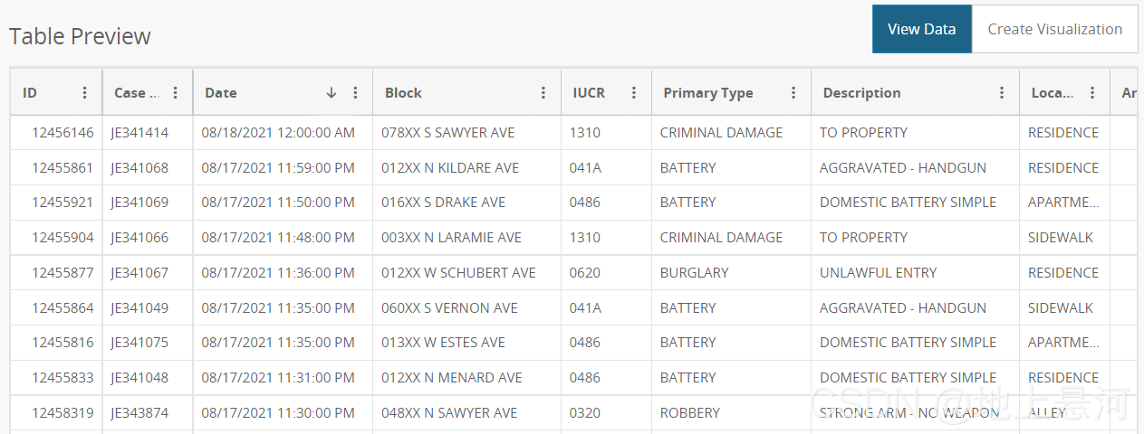
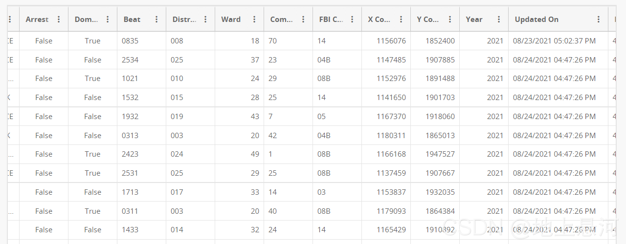
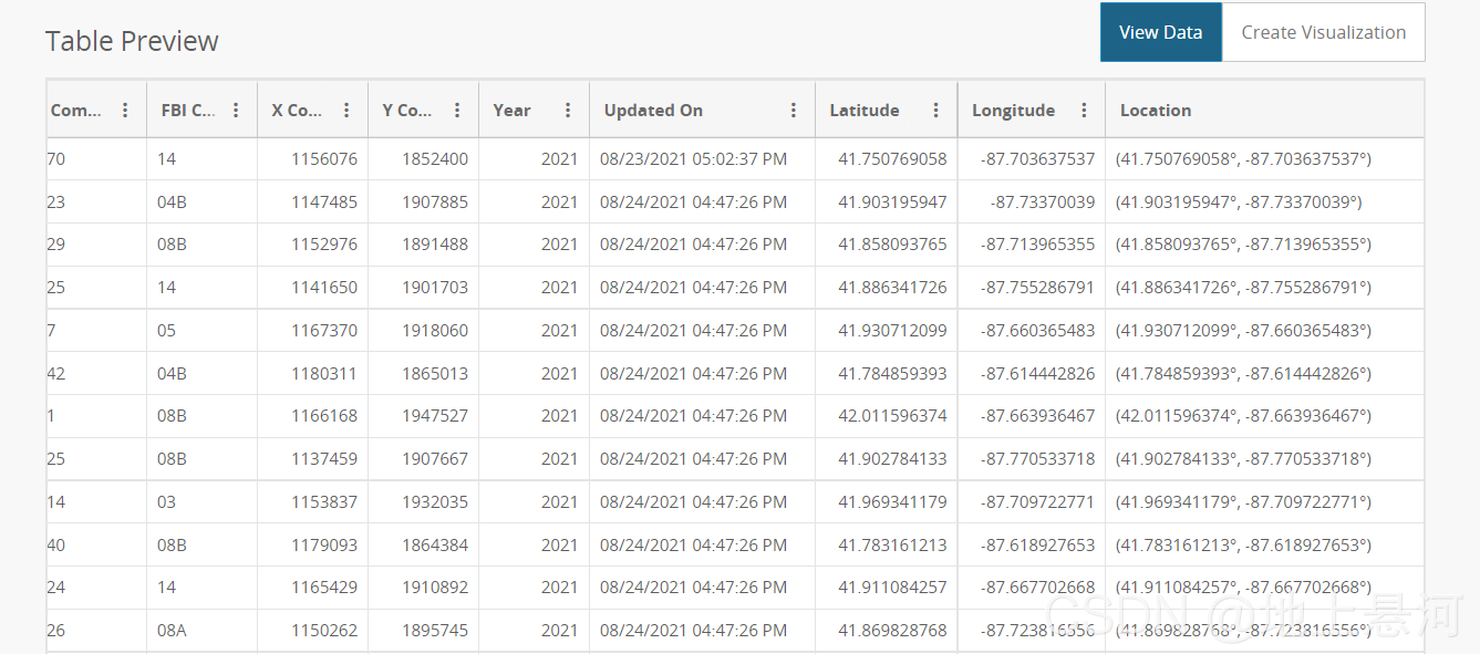
拼长图太累了,就这么看把。
数据集有1.62G,不知道怎么上传 自行去下把。


 2993
2993

 被折叠的 条评论
为什么被折叠?
被折叠的 条评论
为什么被折叠?
 到【灌水乐园】发言


