


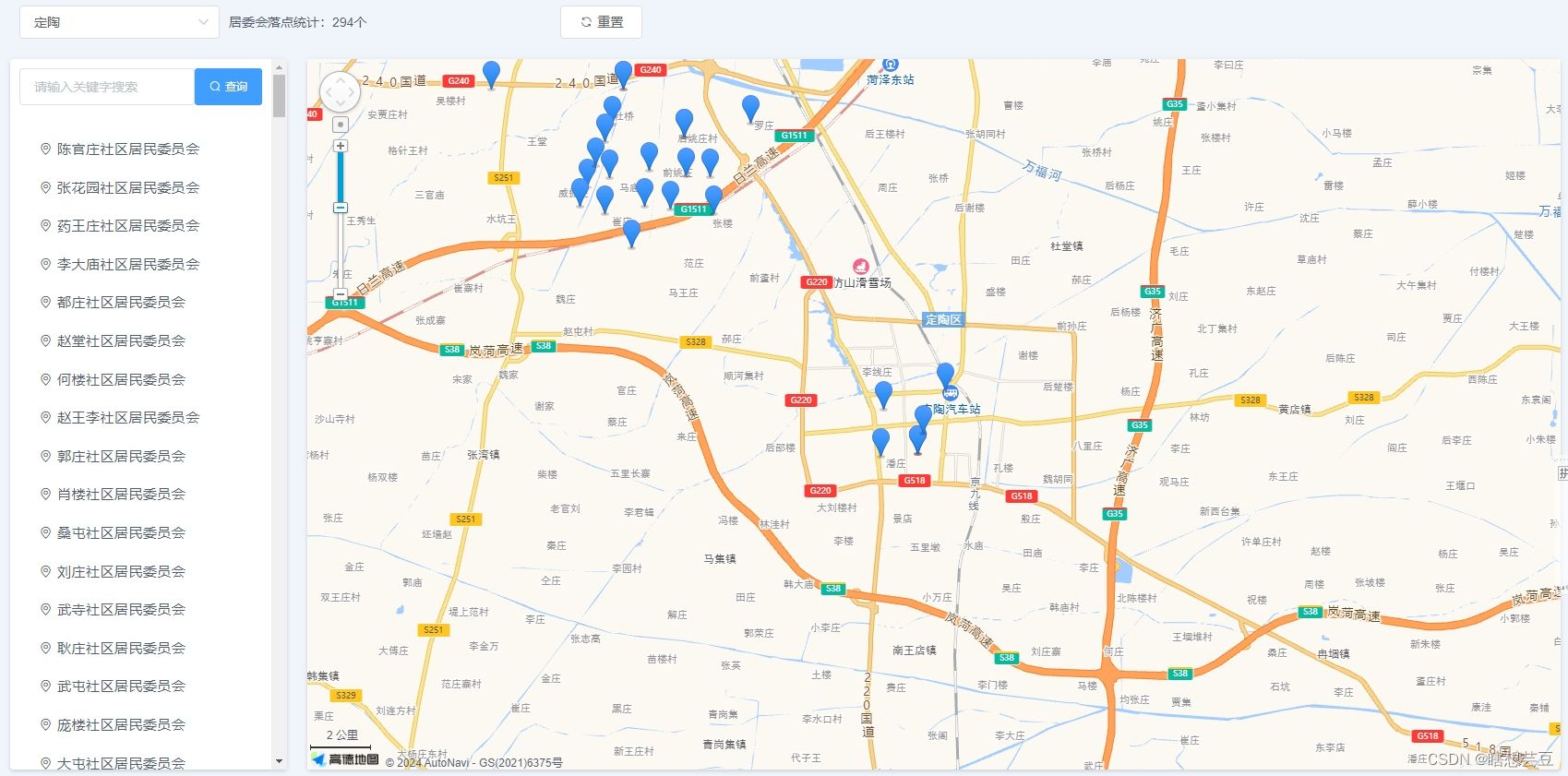
点位
实现效果:
参考:基于vue+elementUI的网页中使用地图组件vue-amap高德地图
这个超详细!宝藏!
覆盖物
实现效果:
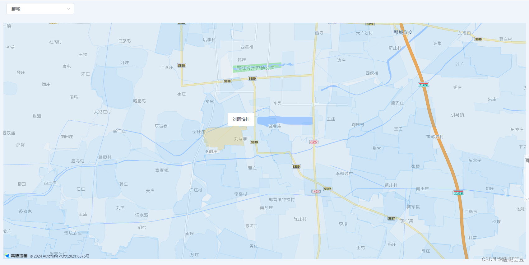
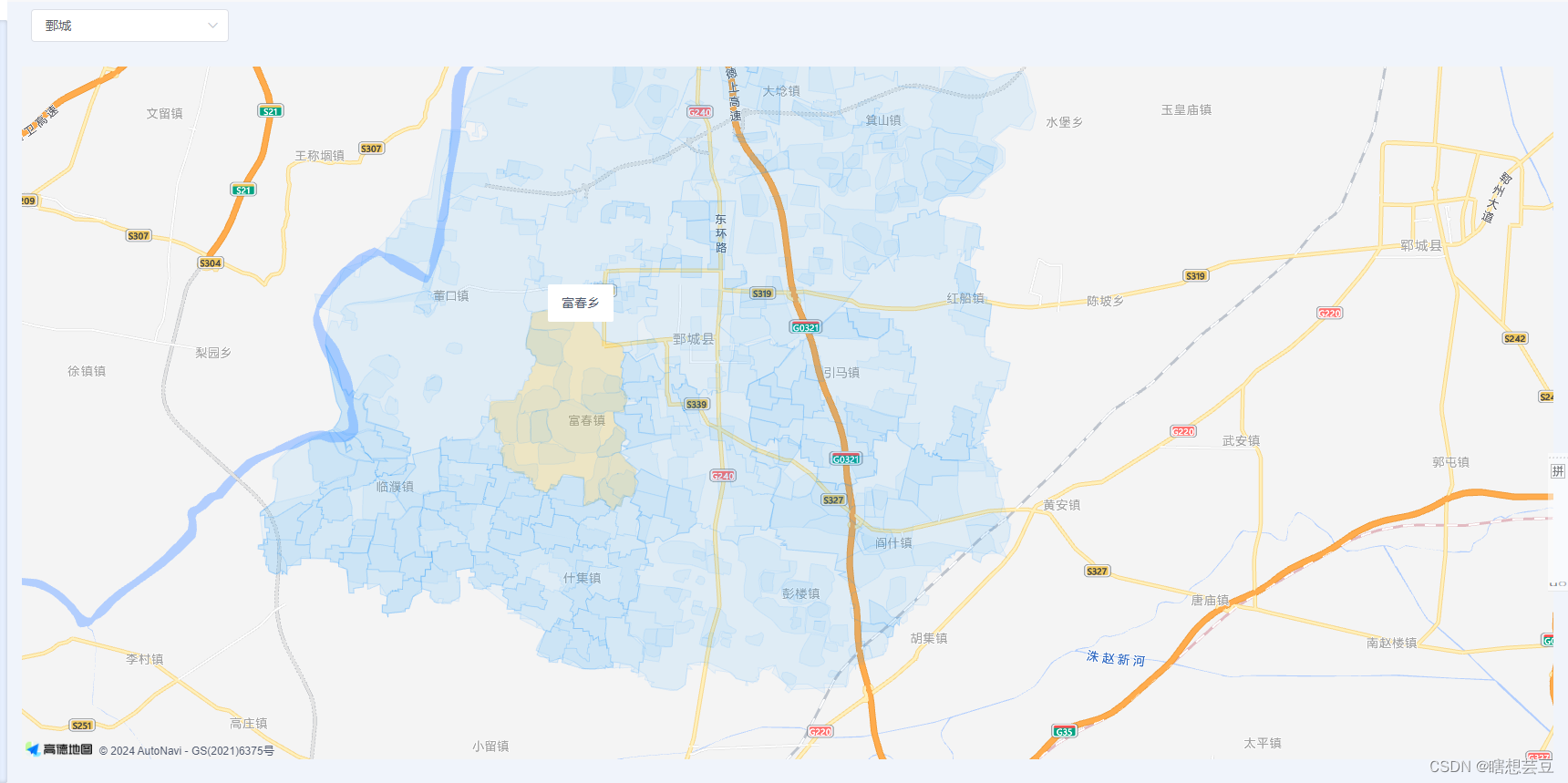 在上面地图基础配置上进行操作的。
<template>
  <div>
  	…………
    <el-container class="searchBox"> <!-- 这个控制地图显示位置大小 -->
      <!-- 显示地图的div -->
      <template>
        <div id="map"></div>
      </template>
    </el-container>
  </div>
</template>
<script
  type="text/javascript"
  src="https://webapi.amap.com/maps?key=申请的key&v=1.4.4&plugin=AMap.Geolocation,AMap.Autocomplete,AMap.PlaceSearch,AMap.Scale,AMap.OverView,AMap.ToolBar,AMap.MapType,AMap.PolyEditor,AMap.CircleEditor"
></script>
<script src="https://a.amap.com/jsapi_demos/static/demo-center/js/demoutils.js"></script>
<script>
import api from "@/api";
import Vue from "vue";
import AMapLoader from '@amap/amap-jsapi-loader'
import VueAMap from "vue-amap";

export default {

  name: "neighborhood-gridding-droppoint",
  components: {
     },
  data() {

    ret
最低0.47元/天 解锁文章


 6758
6758

 被折叠的 条评论
为什么被折叠?
被折叠的 条评论
为什么被折叠?
 到【灌水乐园】发言


