


 本文详细介绍了微信小程序中地图模块的使用,包括markers、polyline、circles、controls的添加和事件绑定,以及遇到的经纬度类型问题。此外,还对比了百度、高德和腾讯地图API在小程序中的应用。
转载请注明出处:http://blog.csdn.net/crazy1235/article/details/55004841
本篇blog主要介绍微信小程序中的地图模块相关功能。
基本使用
地图组件使用起来也很简单。
.wxml
<map id="map" longitude="{
   {
   longitude}}" latitude="{
   {
   latitude}}" scale="14" controls="{
   {
   controls}}" bindcontroltap="controltap" markers="{
   {
   markers}}" bindmarkertap="markertap" polyline="{
   {
   polyline}}" circles="{
   {
   circles}}" bindregionchange="regionchange" show-location style="width: 100%; height: 350px;">
</map>
参数列表及说明如下:
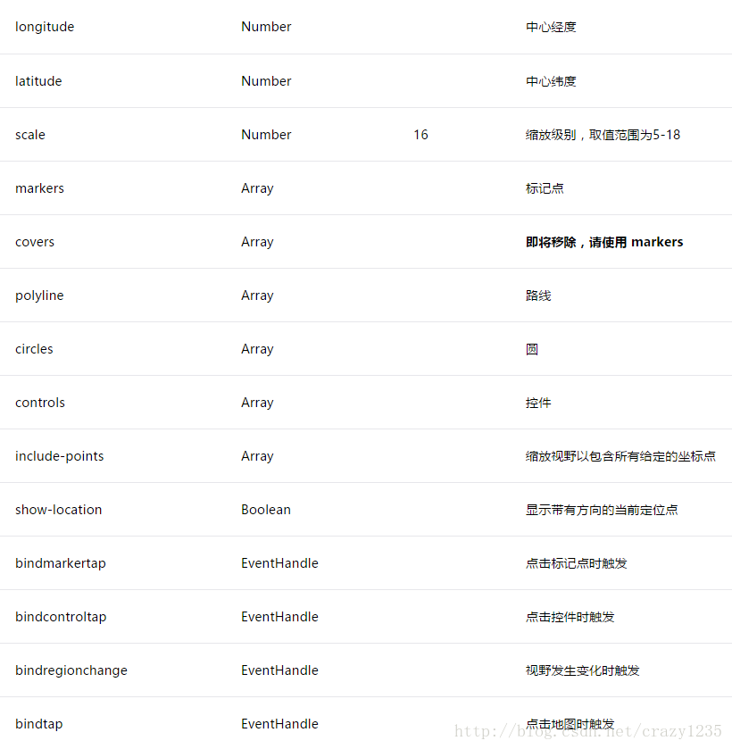
除了显示基本地图,还可以在地图上添加markers–标注,polyline–折线,circles–圆形,controls–控件。
markers
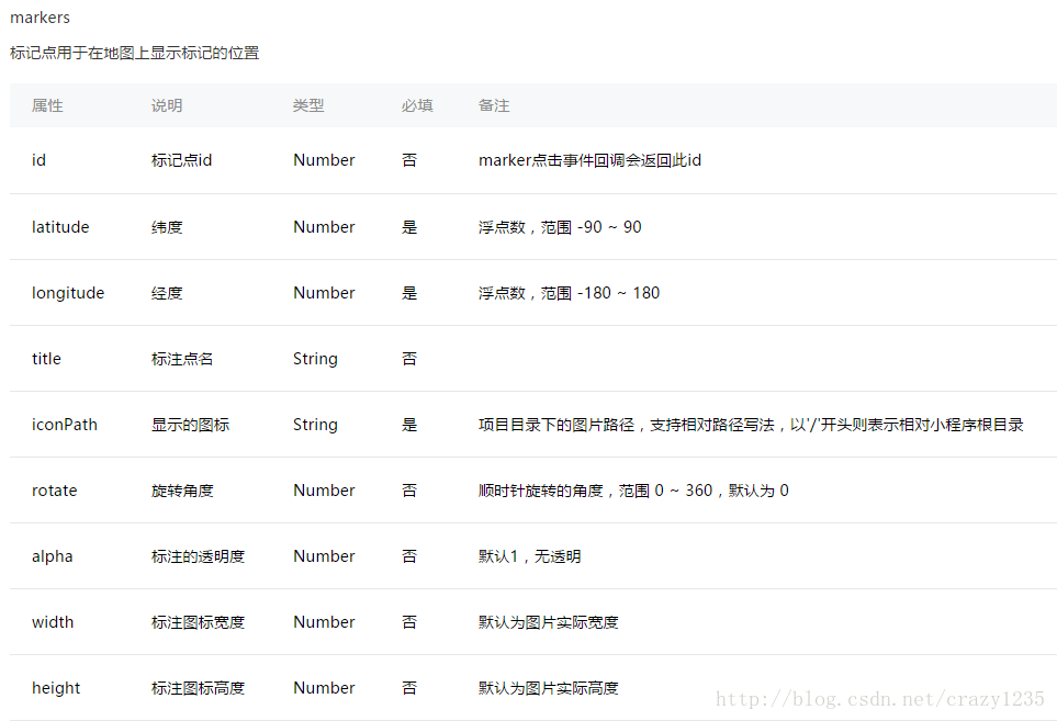
data: {
    //
    markers: [{
      iconPath: "../../img/marker_red.png",
      id: 0,
      latitude: 40.002607,
      longitude: 116.487847,
      width: 35,
      height: 45
    }],
    ... //省略代码
    }
在data中定义markers变量来表示覆盖物
然后map控件引入即可:
<map id="map" longitude="{
   {longitude}}"  markers="{
   {markers}}" style="width: 100%; height: 350px;" ...//省略代码>
</map>
效果如下:
 最低0.47元/天 解锁文章


 被折叠的 条评论
为什么被折叠?
被折叠的 条评论
为什么被折叠?
 到【灌水乐园】发言


