【ArcGIS For JS】前端geojson渲染行政区划图层并加标签

原理

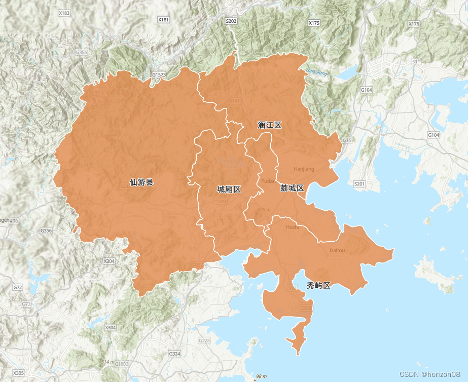
通过DataV工具 生成行政区的geojson(得到各区的面元素数据), 随后使用手动绘制featureLayer与Label,并加载到地图。

    //vue3加载geojson数据public/geojson/pt.json,在MapView渲染上加载geojson数据 type是"MultiPolygon"
      fetch(baseUrl+'/geojson/pt.json')
        .then(response => response.json())
        .then(data => {
          console.log(data)
          // debugger
          let graphics = data.features.map((feature) => {
            //Polygon 单个多边形绘制
            let geometry = {
              type: 'polygon',
              rings: feature.geometry.coordinates[0]
            }
            return new Graphic({
              geometry: geometry,
              attributes: feature.properties
            })
          })
                      
          let featureLayer = new FeatureLayer({
            fields: [
              {
                name: 'ObjectID',
                alias: 'ObjectID',
                type: 'oid'
              },
              {
                name: 'name',
                alias: 'name',
                type: 'string'
              },
              {
                name: 'adcode',
                alias: 'adcode',
                type: 'integer'
              }
            ],
            objectIdField: 'ObjectID',
            geometryType: 'polygon',
            spatialReference: {
              wkid: 4326
            },
            source: graphics,
            renderer: {
              type: 'simple',
              symbol: {
                type: 'simple-fill',
                color: [227, 139, 79, 0.8],
                outline: {
                  color: [255, 255, 255],
                  width: 1
                }
              }
            },
            labelingInfo: [
              {
                labelExpressionInfo: {
                  expression: '$feature.name'
                },
                symbol: {
                  type: 'text',
                  color: [0, 0, 0, 1],
                  haloColor: [255, 255, 255, 1],
                  haloSize: 1,
                  font: {
                    size: 12
                  }
                }
              }
            ]
          })

          //地图加载featureLayer
          view.map.layers.add(featureLayer)
        })

    })

源码地址

https://github.com/Billyas/arcgis-vue3-demo

演示站点

https://billyas.github.io/arcgis-vue3-demo/

效果

在这里插入图片描述

  • 1
    点赞
  • 2
    收藏
    觉得还不错? 一键收藏
  • 1
    评论
评论 1
添加红包

请填写红包祝福语或标题

红包个数最小为10个

红包金额最低5元

当前余额3.43前往充值 >
需支付:10.00
成就一亿技术人!
领取后你会自动成为博主和红包主的粉丝 规则
hope_wisdom
发出的红包
实付
使用余额支付
点击重新获取
扫码支付
钱包余额 0

抵扣说明:

1.余额是钱包充值的虚拟货币,按照1:1的比例进行支付金额的抵扣。
2.余额无法直接购买下载,可以购买VIP、付费专栏及课程。

余额充值