


属性
| 名称 | 类型 | 意义 | 默认 |
|---|---|---|---|
| annotations | [{latitude: number, longitude: number, animateDrop: bool, title: string, subtitle: string, hasLeftCallout: bool, hasRightCallout: bool, onLeftCalloutPress: function, onRightCalloutPress: function, id: string}] | 设置地图基本属性 | 无 |
| legalLabelInsets | {top: number, left: number, bottom: number, right: number} | 插入地图的合法标签 | 无 |
| mapType | enum(‘standard’, ‘satellite’, ‘hybrid’) | 地图的类型(标准版2D图,卫星图,混合版) | ‘standard’ |
| maxDelta | number | 显示最大的区域值,精度 | 无 |
| minDelta | number | 最小精度 | 无 |
| onAnnotationPress | function | 点击注释调用的方法 | 无 |
| onRegionChange | function | 拖拽地图调用的方法 | 无 |
| onRegionChangeComplete | function | 地图移动结束调用的方法 | 无 |
| pitchEnabled | bool | 设置为true时,可以改变我们视角的角度,如果为false,那就是垂直往瞎看 | 无 |
| region | {latitude: number, longitude: number, latitudeDelta: number, longitudeDelta: number} | 定义地图中心点的经纬度 | 无 |
| rotateEnabled | bool | 是否可以旋转地图 | 无 |
| scrollEnabled | bool | 是否可以滚动地图,以改变region显示的点 | true |
| showsUserLocation | bool | 是否显示用户位置 | false |
| style | Style | 样式 | 无 |
| zoomEnabled | bool | 是否可以缩放地图 | true |
实例
默认
首先我们来显示一张默认的地图:
'use strict';

var React = require('react-native');

var {
    AppRegistry,
    StyleSheet,
    View,
    MapView,
} = React;

var helloworld = React.createClass({


    render: function() {
    return (
        <MapView
        style={{ height: 150, margin: 10, borderWidth: 1, borderColor: '#000000', }}
        />
    );
    },
});

var styles = StyleSheet.create({


});

AppRegistry.registerComponent('hellowrold',() => helloworld);
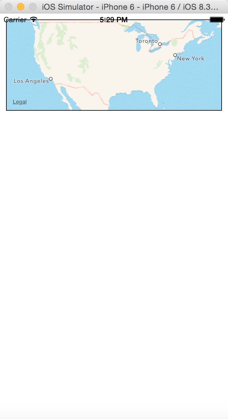
默认情况下,我们需要设置MapView控件的size,这样才能显示出来我们控件,比如上面我设置的{ height: 150, margin: 10, borderWidth: 1, borderColor: '#000000', },这个是必须的。
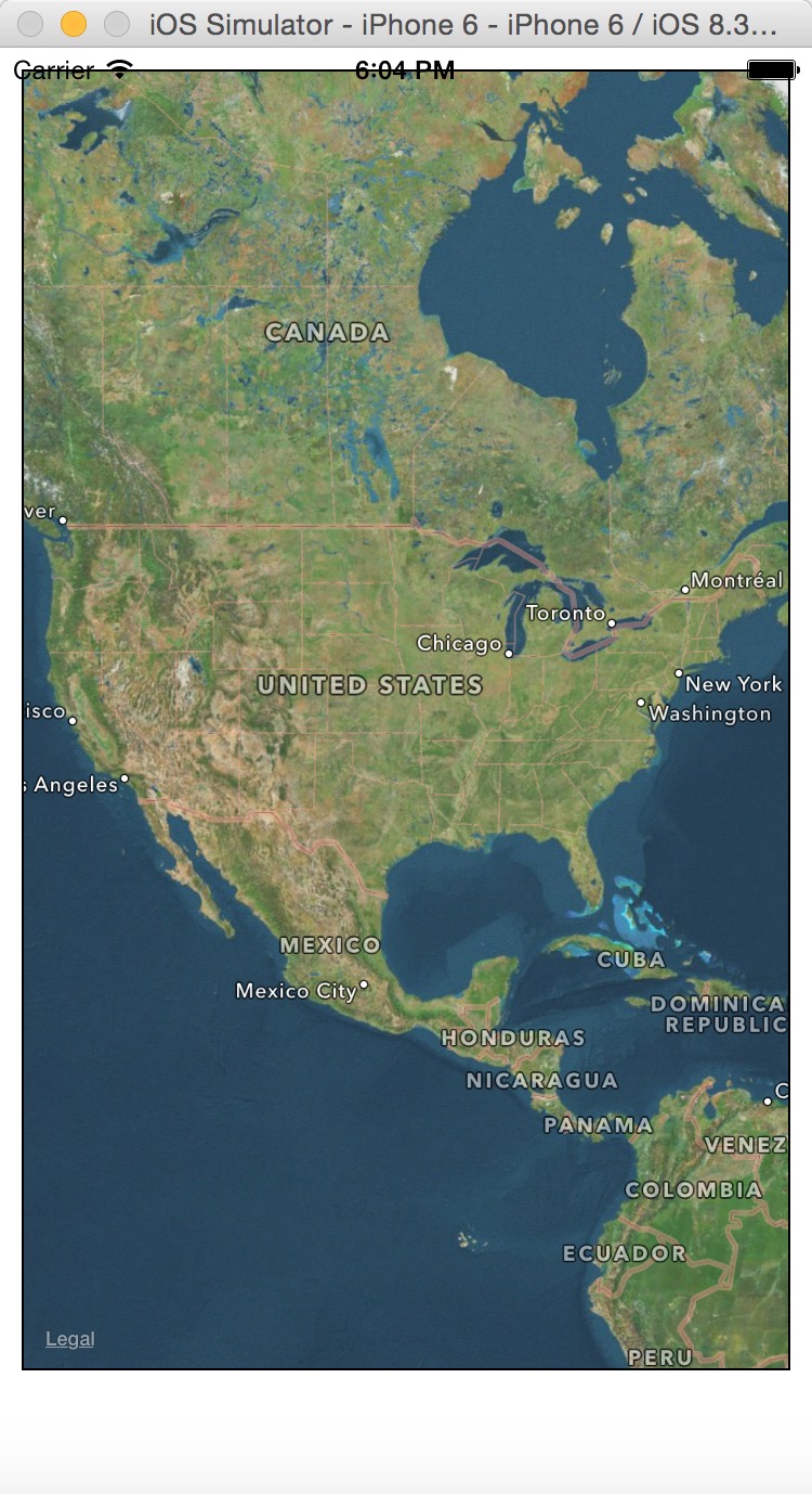
上面的图显示我们在美国(vpn的作用),但是这个地图还是很龊的。需要我们一步一步去修善。
zoomEnabled
缩放,放大属性,默认是为true,所以,我们在上面的例子中,双击就能达到放大的作用。如果你将zoomEnabled设置为false,就不能缩放了。
scrollEnabled
拖拽,默认该属性为true,可以拖拽地图到不同的位置。如果你不想拖拽,设置该属性为false。
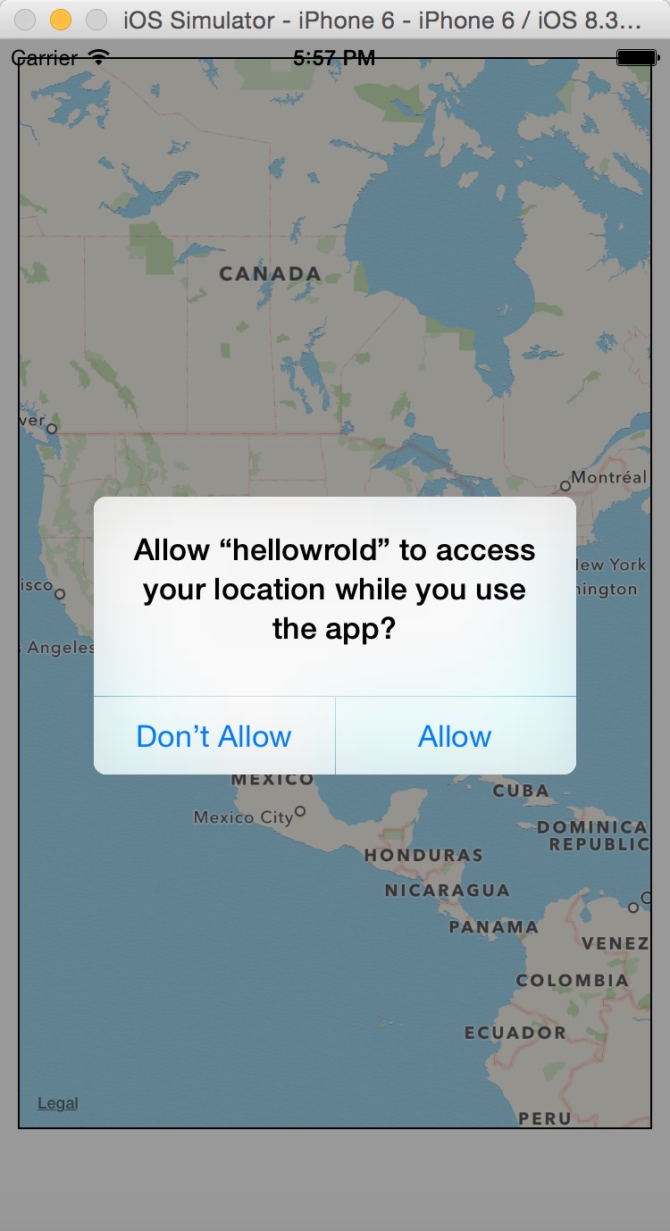
showsUserLocation
发送位置信息,默认该属性为false,如果设置为true,处于隐私的考虑,会弹出确认对话框:
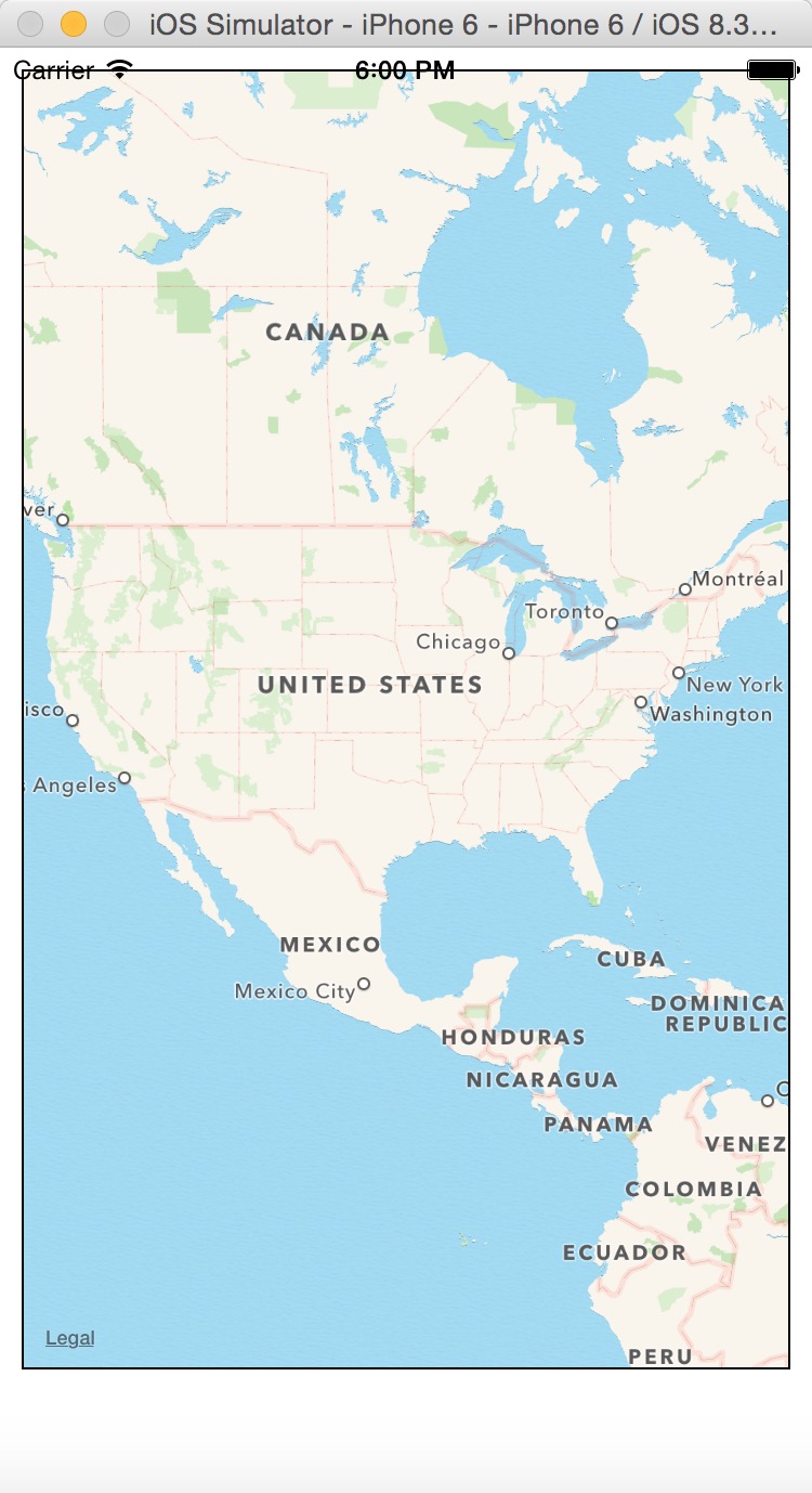
mapType
standard
<MapView
        style={{ height: 600, margin: 10, borderWidth: 1, borderColor: '#000000', }}
        zoomEnabled={true}
        scrollEnabled={true}
        showsUserLocation={true}
        mapType='standard'

        />
默认就为该属性,所以显示的效果也没啥变化:
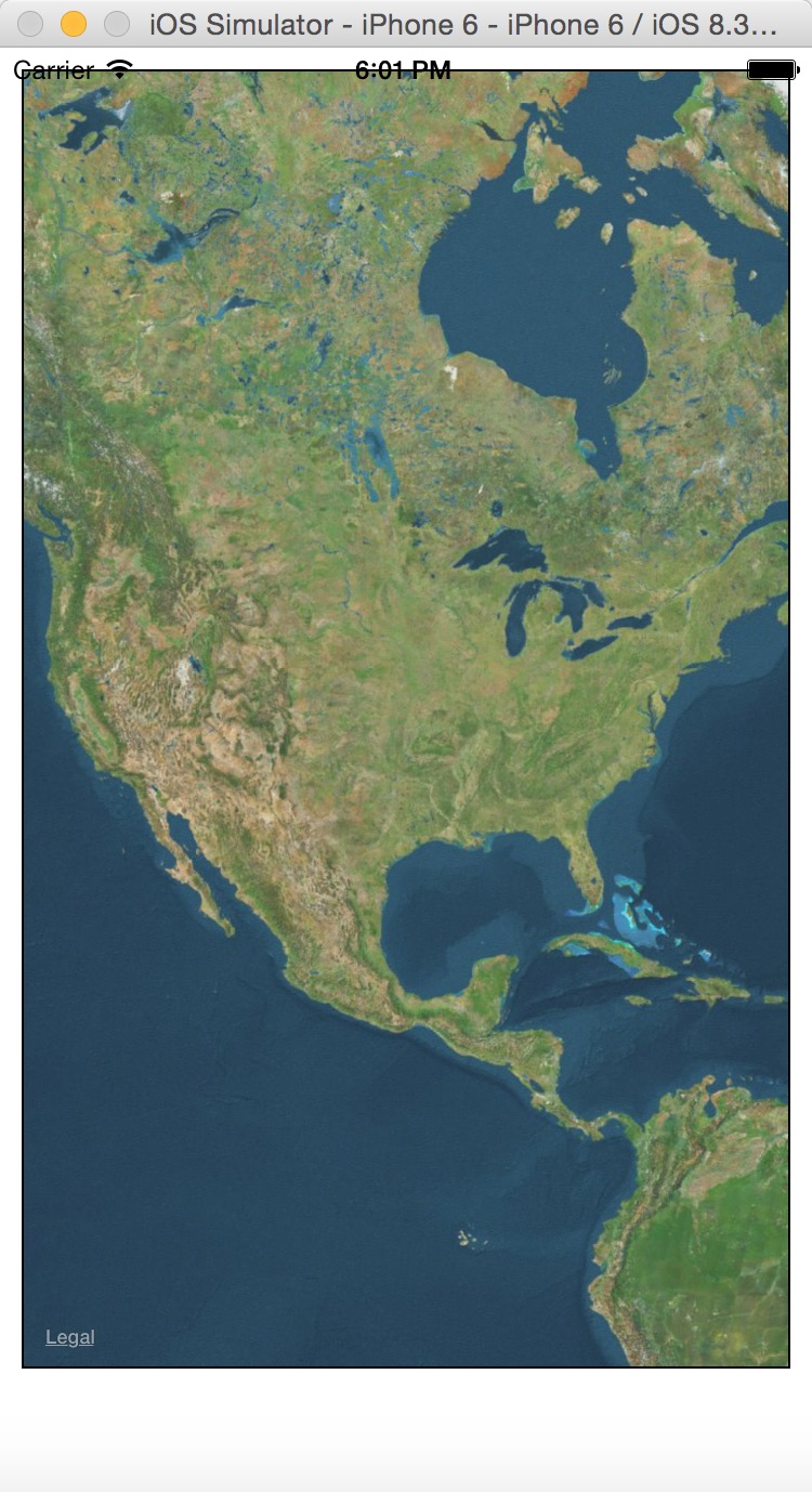
satellite
<MapView
        style={{ height: 600, margin: 10, borderWidth: 1, borderColor: '#000000', }}
        zoomEnabled={true}
        scrollEnabled={true}
        showsUserLocation={true}
        mapType='satellite'

        />
hybrid
<MapView
        style={{ height: 600, margin: 10, borderWidth: 1, borderColor: '#000000', }}
        zoomEnabled={true}
        scrollEnabled={true}
        showsUserLocation={true}
        mapType='hybrid'

        />
就比satellite效果了一些标签。
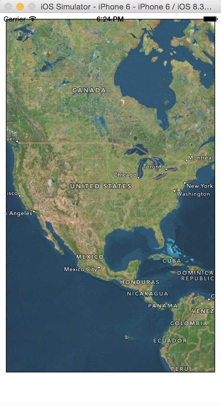
legalLabelInsets
设置Legal标签的位置,默认在是左下角,我们可以将其移到左上角:
    <MapView
        style={{ height: 600, margin: 10, borderWidth: 1, borderColor: '#000000', }}
        zoomEnabled={true}
        scrollEnabled={true}
        showsUserLocation={true}
        mapType='hybrid'
        pitchEnabled={true}
        rotateEnabled={true}
        legalLabelInsets={{top:20,left:20}}
        />


 442
442

 被折叠的 条评论
为什么被折叠?
被折叠的 条评论
为什么被折叠?
 到【灌水乐园】发言


