


1准备一个DEM地形,打开GlobalMap,如下选择

1 选择否,生成边界,将边界导出为shp文件,打开QGIS,坐标系转为4326坐标并保存
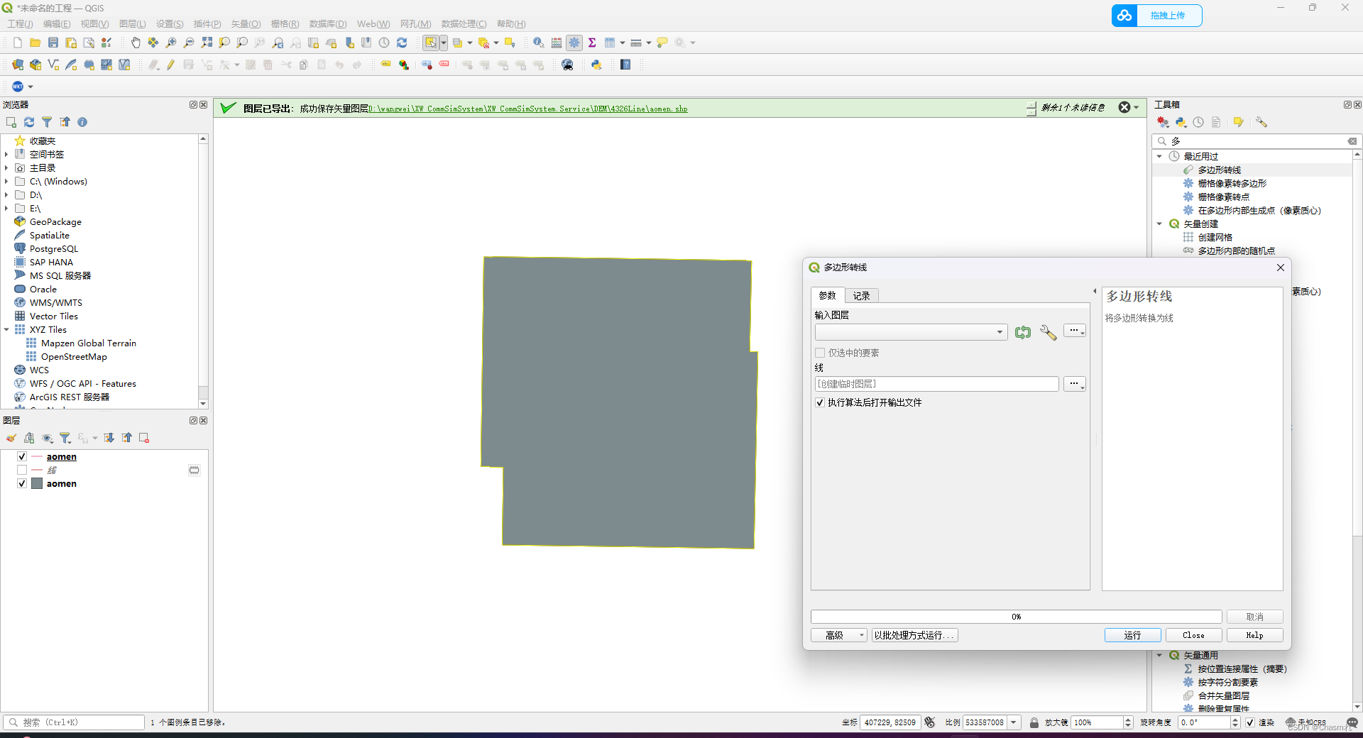
2多边形转线,将4326坐标系的shp文件转为线shp
3安装get wkt插件,选择对应坐标系,获取wkt,如图
保存为json数据
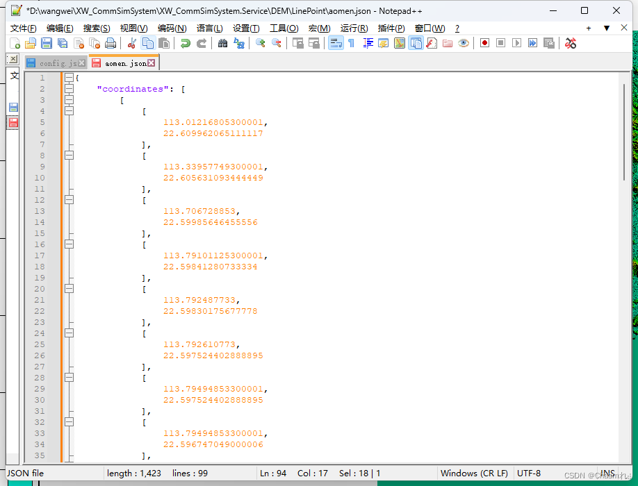
经验证,数据无误

附判断点是否在此坐标范围内代码
 /// <summary>
        /// 判断点是否在多边形内或多边形上
        /// </summary>
        /// <param name="ALon">经度</param>
        /// <param name="ALat">纬度</param>
        /// <param name="Points">多边形边界点集合</param>
        /// <returns></returns>
        public static bool IsPtInPoly(double ALon, double ALat, string rainfallRange)
        {
            //rainfallRange转为区域点对象


            string[] rainfallArray = rainfallRange.Split(';');

            List<Point> Points = new List<Point>(); // 换成自己的

            foreach (string strs in rainfallArray)
            {
                string[] strPoint = strs.Split(',');

                Point point = new Point(Convert.ToDouble(strPoint[0]), Convert.ToDouble(strPoint[1])); // 换成自己的

                Points.Add(point);
            }

            int iSum, iCount, iIndex;
            double dLon1 = 0, dLon2 = 0, dLat1 = 0, dLat2 = 0, dLon;
            if (Points.Count < 3)
            {
                return false;
            }
            iSum = 0;
            iCount = Points.Count;
            for (iIndex = 0; iIndex < iCount; iIndex++)
            {
                if (ALon == Points[iIndex].getX() && ALat == Points[iIndex].getY())  //A点在多边形上
                    return true;

                if (iIndex == iCount - 1)
                {
                    dLon1 = Points[iIndex].getX();
                    dLat1 = Points[iIndex].getY();
                    dLon2 = Points[0].getX();
                    dLat2 = Points[0].getY();
                }
                else
                {
                    dLon1 = Points[iIndex].getX();
                    dLat1 = Points[iIndex].getY();
                    dLon2 = Points[iIndex + 1].getX();
                    dLat2 = Points[iIndex + 1].getY();
                }

                //以下语句判断A点是否在边的两端点的纬度之间,在则可能有交点
                if (((ALat > dLat1) && (ALat < dLat2)) || ((ALat > dLat2) && (ALat < dLat1)))
                {
                    if (Math.Abs(dLat1 - dLat2) > 0)
                    {
                        //获取A点向左射线与边的交点的x坐标:
                        dLon = dLon1 - ((dLon1 - dLon2) * (dLat1 - ALat)) / (dLat1 - dLat2);
                        //如果交点在A点左侧,则射线与边的全部交点数加一:
                        if (dLon < ALon)
                        {
                            iSum++;
                        }
                        //如果相等,则说明A点在边上
                        if (dLon == ALon)
                            return true;
                    }
                }
            }
            if ((iSum % 2) != 0)
            {
                return true;
            }
            return false;
        }
public class Point
{
private Double x;
private Double y;
public Point(Double x, Double y)
{
this.x = x;
this.y = y;
}
public Double getX()
{
return x;
}
public void setX(Double x)
{
this.x = x;
}
public Double getY()
{
return y;
}
public void setY(Double y)
{
this.y = y;
}
}


 2128
2128


 被折叠的 条评论
为什么被折叠?
被折叠的 条评论
为什么被折叠?
 到【灌水乐园】发言


