


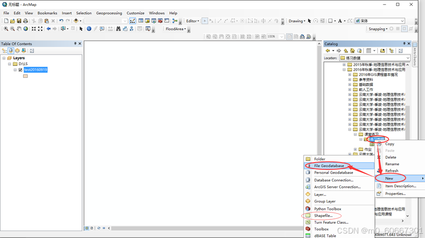
1、矢量数据文件创建
首先打开ArcMap,创建Geodatabase(从ArcCatalog),在ArcCatalog中浏览到要存储文件的目录,然后单击右键 → New → File Geodatabase,如下图所示;
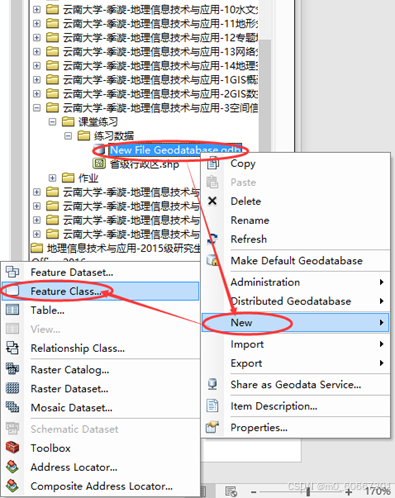
2、建立Polygon类型的Feature Class
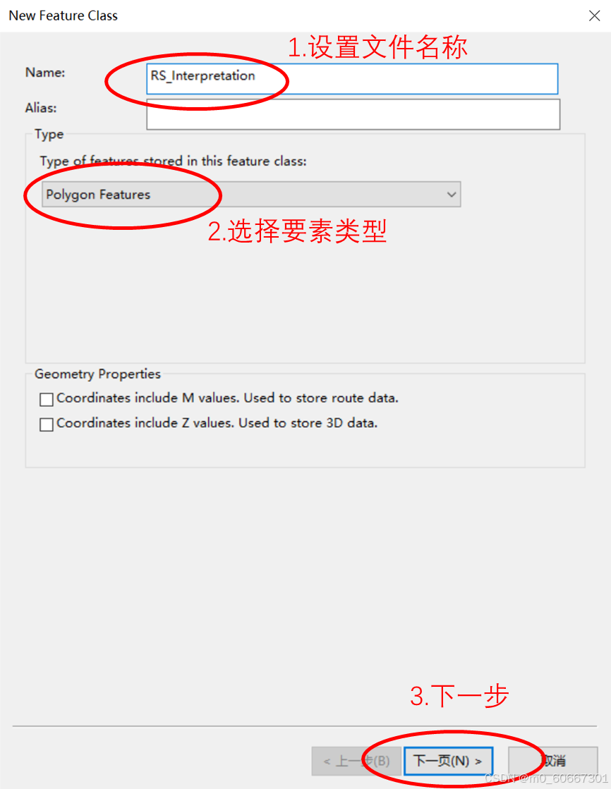
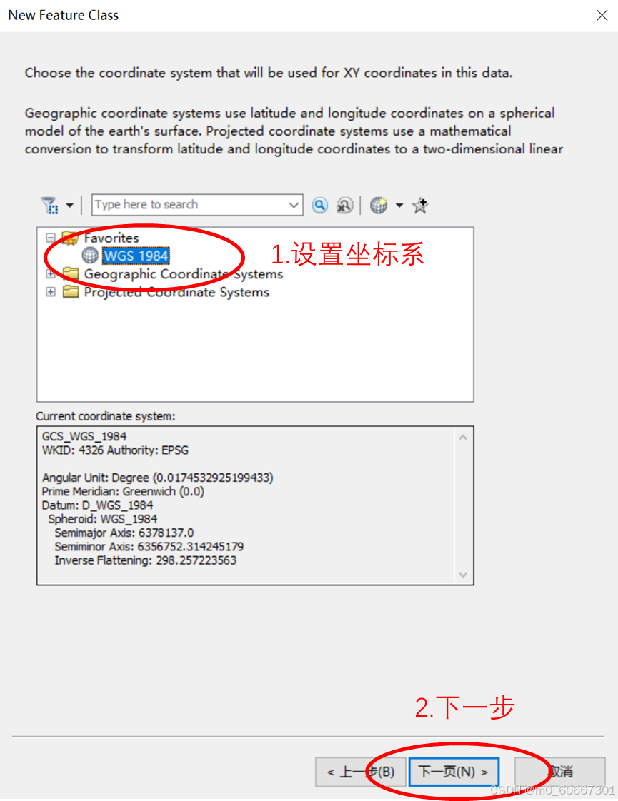
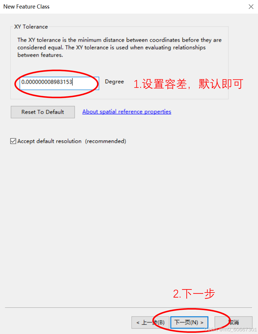
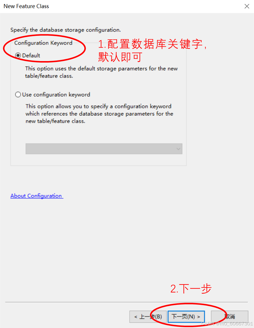
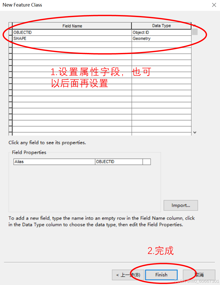
选中新建的Geodatabase单击右键 → New → Feature Class,在弹出的(New Feature Class)对话框中将要素类命名为“RS_Interpretation”,要素类型(Type of features)选择“Polygon Features”,设置坐标系为“WGS 1984”;
 最低0.47元/天 解锁文章


 2万+
2万+

 被折叠的 条评论
为什么被折叠?
被折叠的 条评论
为什么被折叠?
 到【灌水乐园】发言


