


 用精细的过程管理模式提供优质的服务用先进的地理信息技术推动社会的发展1.Create Fishnet先准备好需要格网化的polygon矢量打开Toolbox中的 Data Management Tools,选择 Create FishnetCreate Fishnet creates a feature class containing a net of rectangular cells.创造一...
用精细的过程管理模式提供优质的服务
用先进的地理信息技术推动社会的发展
1.Create Fishnet
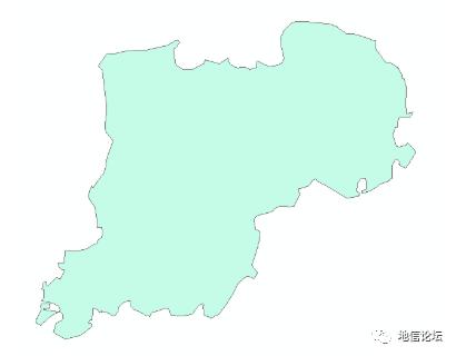
先准备好需要格网化的polygon矢量
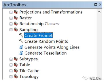
打开Toolbox中的 Data Management Tools,选择 Create Fishnet
Create Fishnet creates a feature class containing a net of rectangular cells.创造一个包含一些列矩形Polygon的shp
使用该工具要求以下三个基本信息:
the spatial extent of the fishnet, the number of rows and columns, and the angle of rotation. 空间范围 行列数 旋转角度
The tool has 11 parameters, and you should think of these in four distinct groups:
The spatial extent of fishnet
The number of rows and columns and height and width of each cell in the fishnet 输入好行列数/输入cell高度和宽度
The angle of rotation for the fishnet
Parameters that define the output feature class name and type (polygons or lines) and an optional point dataset containing centroids of each cell
 最低0.47元/天 解锁文章


 1万+
1万+


 被折叠的 条评论
为什么被折叠?
被折叠的 条评论
为什么被折叠?
 到【灌水乐园】发言


