


JAVA解析气象GRB2数据
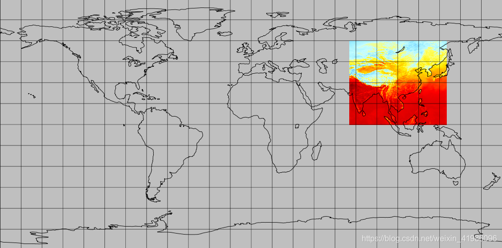
数据展示上图:
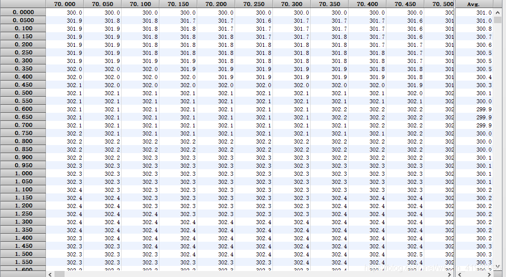
数据展示:
public static Map<String, Object> readGrib(String path, String needElement, Double lon, Double lat) {
SimpleDateFormat sdf = new SimpleDateFormat("yyyy-MM-dd");
File originFile = new File(path);
Map<String, Object> resultMap = new HashMap<>();
if (originFile.exists()) {
RandomAccessFile raf = null;
try {
raf = new RandomAccessFile(path, "r");
Grib2RecordScanner scanner = new Grib2RecordScanner(raf);
while (scanner.hasNext()) {
Grib2Record grib2Record = scanner.next();
Grib2SectionIdentification ids = grib2Record.getId();
/**==========================日期处理=======================*/
// long millis = ids.getReferenceDate().getMillis();
//Date dTime = new Date(millis);
// int hour = ids.getHour();
/**==========================日期处理=======================*/
Grib2SectionGridDefinition gdSsection = grib2Record.getGDSsection();
Grib2Gds gds = gdSsection.getGDS();
if (gds.isLatLon()) {
Grib2Gds.LatLon ll = (Grib2Gds.LatLon) gds;
//经纬度、分辨率、范围值获取
float startLat = ll.la1;
float endLat = ll.la2;
float startLon = ll.lo1;
float endLon = ll.lo2;
float resolutionLat = ll.deltaLat;
float resolutionLon = ll.deltaLon;
int lonCount = ll.getNxRaw();
int latCount = ll.getNyRaw();
int indexGrib2 = Grib2Utils.inLatLon(startLat, endLat, startLon, endLon, resolutionLat, resolutionLon, lonCount, latCount, lon, lat);
if (indexGrib2 == -1) {
resultMap.put("code", "ERROR");
return resultMap;
}
Grib2SectionProductDefinition pdSsection = grib2Record.getPDSsection();
Grib2Pds pds = pdSsection.getPDS();
//时效
// int valid = pds.getForecastTime();
//种类
int c = pds.getParameterCategory();
//参数
int n = pds.getParameterNumber();
// int level = (int) pds.getLevelValue1();
Grib2SectionIndicator iss = grib2Record.getIs();
//产品状态
int d = iss.getDiscipline();
if (path.contains("QC")) {
n = 0;
}
Grib2Parameter param = NcepLocalParams.getParameter(d, c, n);
if (param == null) {
continue;
}
//获取单位和要素国际名称
// String unit = param.unit;
String name = param.getName();
// String elementVal = param.abbrev;
if (!name.contains(needElement)) {
continue;
}
//数据读取
Grib2SectionDataRepresentation drs = grib2Record.getDataRepresentationSection();
float[] datas = grib2Record.readData(raf, drs.getStartingPosition());
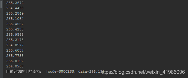
for(float f : datas){
System.out.println("数据: " + Double.valueOf((f+"").trim()));
}
int length = datas.length;
if (indexGrib2 > length) {
resultMap.put("code", "ERROR");
}
// String time = sdf.format(dTime);
resultMap.put("code", "SUCCESS");
resultMap.put("data", Arith.round(datas[indexGrib2], 2));
}
}
raf.close();
} catch (Exception e) {
e.printStackTrace();
} finally {
if (raf != null) {
try {
raf.close();
} catch (IOException e) {
e.printStackTrace();
}
}
}
}
return resultMap;
}
测试:
  public static void main(String[] args) {
        Map<String, Object>  map = Grib2Utils.readGrib("D:\\tmp\\CLDAS\\20210330000000\\Z_NAFP_C_BABJ_20210330000805_P_CLDAS_RT_CHN_0P05_HOR-TEM-2021033000.GRB2","",103.2,38.5);
        System.out.println("目前经纬度上的值为: " + map);
    }
输出:


 1590
1590

 被折叠的 条评论
为什么被折叠?
被折叠的 条评论
为什么被折叠?
 到【灌水乐园】发言


