


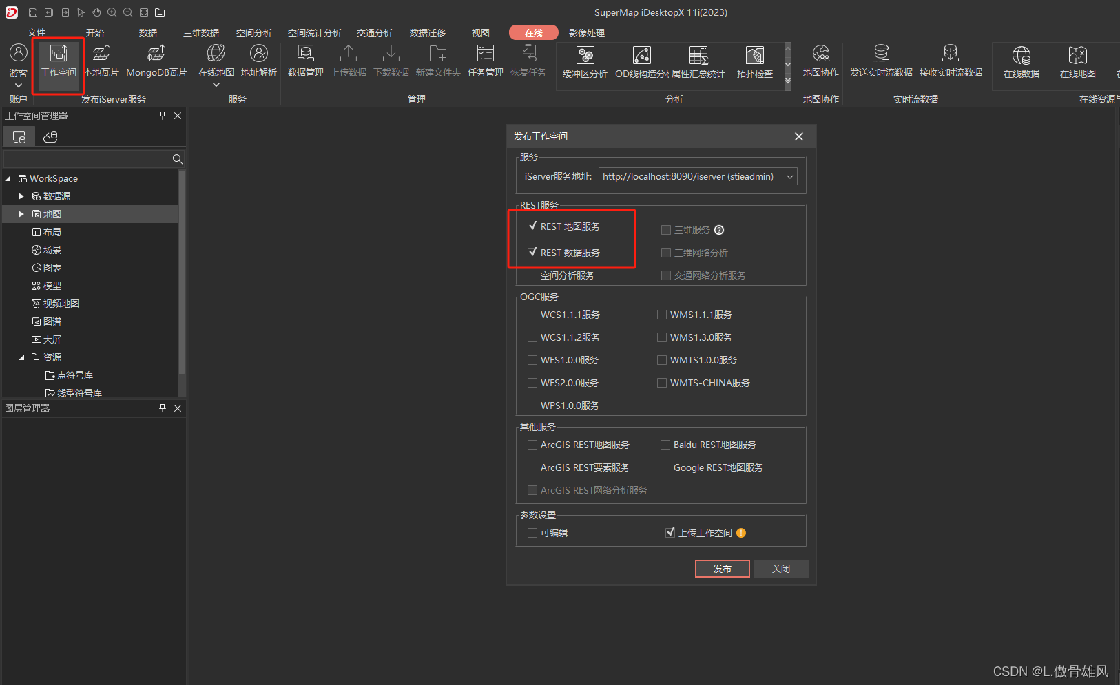
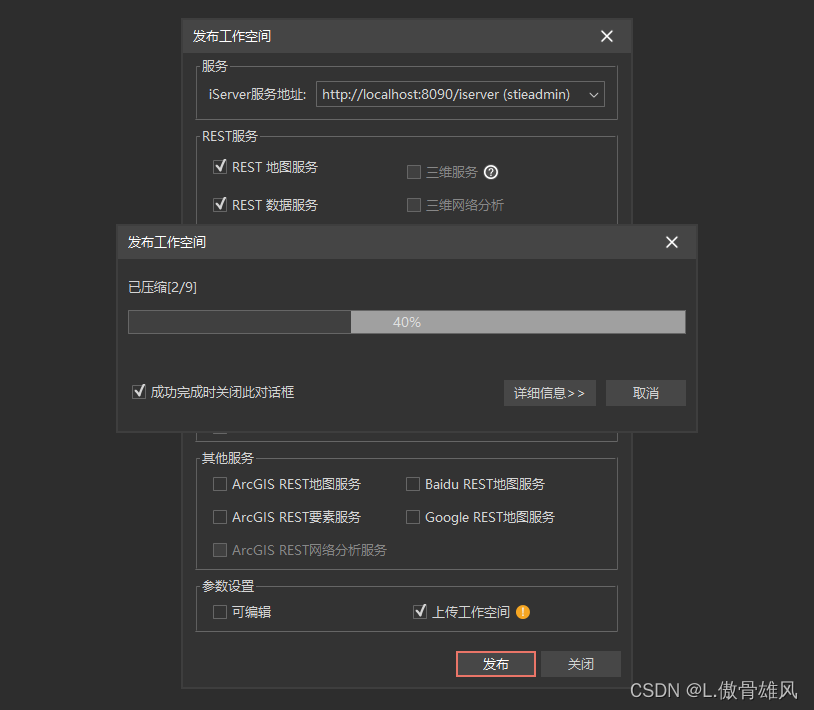
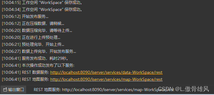
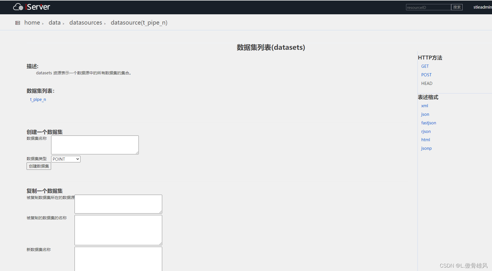
一、发布地图服务和数据服务,发布的时候将数据打包上传。
服务发布完,在输出窗口能看到结果,点击其中的REST数据服务
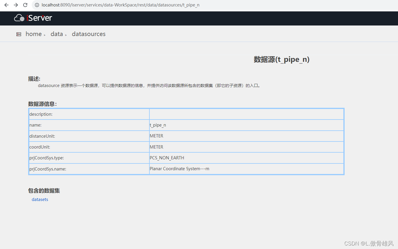
数据服务

数据源为t_pipe_n,数据集为t_pipe_n
二、空间查询代码,注意查询几何参数 toIndex和maxFeatures都设置成-1,才能可以返回所有的要素类。
<!DOCTYPE html>
<html>
<head>
<meta charset="UTF-8">
<title data-i18n="resources.title_layerService"></title>
<script type="text/javascript" include="bootstrap-css" src="../js/include-web.js"></script>
<script type="text/javascript" src="../../dist/ol/include-ol.js"></script>
<style>
.ol-popup {
position: absolute;
background-color: white;
-webkit-filter: drop-shadow(0 1px 4px rgba(0, 0, 0, 0.2));
filter: drop-shadow(0 1px 4px rgba(0, 0, 0, 0.2));
padding: 15px;
border-radius: 10px;
border: 1px solid #cccccc;
bottom: 12px;
left: -50px;
min-width: 280px;
}
.ol-popup:after,
.ol-popup:before {
top: 100%;
border: solid transparent;
content: " ";
height: 0;
width: 0;
position: absolute;
pointer-events: none;
}
.ol-popup:after {
border-top-color: white;
border-width: 10px;
left: 48px;
margin-left: -10px;
}
.ol-popup:before {
border-top-color: #cccccc;
border-width: 11px;
left: 48px;
margin-left: -11px;
}
</style>
</head>
<body style=" margin: 0;overflow: hidden;background: #fff;width: 100%;height:100%;position: absolute;top: 0;">
<div id="map" style="width: 100%;height:100%"></div>
<div id="popup" class="ol-popup">
<div id="popup-content"></div>
</div>
<script type="text/javascript">
//加载iserver发布的超图格式的切片服务(epsg:3857)
var map,
url =
(window.isLocal ? window.server : 'https://iserver.supermap.io') +
'/iserver/services/map-china400/rest/maps/China';
var nanjingUrl = "http://localhost:8090/iserver/services/map-NanJing-3/rest/maps/t_pipe_n%40t_pipe_n";
ol.supermap.initMap(url, {
viewOptions: {
center: [13223863.649053223, 3766879.2003594767],
zoom: 14
}
}).then(({ map, source }) => {
var Jinjing = new ol.layer.Tile({
source: new ol.source.TileSuperMapRest({
url: nanjingUrl,
tileGrid: source.getTileGrid()
})
});
// map.addLayer(Jinjing);
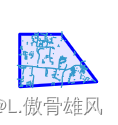
var polygon = new ol.geom.Polygon([[[13226146.221186891, 3767716.8042928106], [13229098.601404406, 3767903.119549256],
[13227732.289523808, 3769730.4422566984], [13226146.221186891, 3769730.4422566984], [13226146.221186891, 3767716.8042928106]]]);
var polygonSource = new ol.source.Vector({
features: [new ol.Feature(polygon)],
wrapX: false
});
vectorLayer = new ol.layer.Vector({
source: polygonSource,
style: new ol.style.Style({
stroke: new ol.style.Stroke({
color: 'blue',
width: 3
}),
fill: new ol.style.Fill({
color: 'rgba(0, 0, 255, 0.1)'
})
})
});
map.addLayer(vectorLayer);
//toIndex和maxFeatures都设置成-1可以返回所有的。
var geometryParam = new ol.supermap.GetFeaturesByGeometryParameters({
datasetNames: ["t_pipe_n:t_pipe_n"],
toIndex:-1,
geometry: polygon,
spatialQueryMode: "INTERSECT"
});
geometryParam.maxFeatures=-1;
var queryUrl = "http://localhost:8090/iserver/services/data-WorkSpace/rest/data";
new ol.supermap.FeatureService(queryUrl).getFeaturesByGeometry(geometryParam).then(function (serviceResult) {
console.log(serviceResult);
var vectorSource = new ol.source.Vector({
features: (new ol.format.GeoJSON()).readFeatures(serviceResult.result.features),
wrapX: false
});
resultLayer = new ol.layer.Vector({
source: vectorSource,
});
console.log(resultLayer)
map.addLayer(resultLayer);
});
});
</script>
</body>
</html>空间查询结果如下:
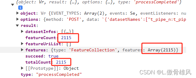


 2033
2033


 被折叠的 条评论
为什么被折叠?
被折叠的 条评论
为什么被折叠?
 到【灌水乐园】发言


