


GIS二次开发学习专题(二) 基本地图控件使用
学习资料来自《牟乃夏 AE开发教程—基于C#.NET》
发的代码是我整理+老师布置的作业
这一部分是地图基本控件的使用与编写,包括:
一、二维控件的使用
二、自行编写代码:添加数据、控制地图:打开文件、添加数据、漫游、全图、放大、缩小、刷新、保存、另存为
三、TOCControl的右键菜单
四、鹰眼视图
一、二维控件的使用
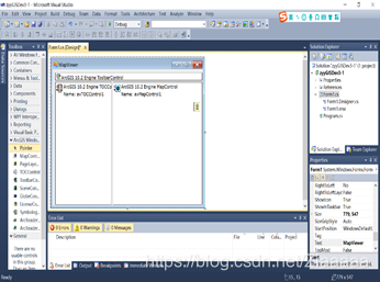
拖入“ToolBarControl”,“TOCControl”,“MapControl”,“LicenseControl”控件,在“ToolBarControl”中添加按钮、设置“LicenseControl”
二、自行编写代码:添加数据、控制地图
using System.Collections.Generic;
using System.ComponentModel;
using System.Data;
using System.Drawing;
using System.Linq;
using System.Text;
using System.Windows.Forms;
using ESRI.ArcGIS.SystemUI;
using ESRI.ArcGIS.esriSystem;
using ESRI.ArcGIS.Carto;
using ESRI.ArcGIS.Geometry;
using ESRI.ArcGIS.DataSourcesFile;
using ESRI.ArcGIS.Controls;
using ESRI.ArcGIS.DataSourcesRaster;
using ESRI.ArcGIS.Geodatabase;
using ESRI.ArcGIS.Display;

string m_BasicOperationTool = "";     //定义一个操作按钮变量
        public Form1()
        {
            ESRI.ArcGIS.RuntimeManager.Bind(ESRI.ArcGIS.ProductCode.Engine);
            InitializeComponent();
        }
1.ToolBarControl:
打开文件:
采用OpenFileDialog进行操作:
 /*打开文件按钮*/
        private void tlbOpen_Click(object sender, EventArgs e)
        {
            System.Windows.Forms.OpenFileDialog openFileDialog;
            openFileDialog = new OpenFileDialog();
            openFileDialog.Title = "open map document";
            openFileDialog.Filter = "map document(*.mxd)|*.mxd";        //文件过滤器
            openFileDialog.ShowDialog();
            string strFilePath = openFileDialog.FileName;               //选择文件路径
            if (axMapControl1.CheckMxFile(strFilePath))
            {
                //加载mxd文档之前的鼠标指针,esriPointerArrowHourglass为等待光标
                axMapControl1.MousePointer = ESRI.ArcGIS.Controls.esriControlsMousePointer.esriPointerArrowHourglass;
                //LoadMxFile方法有三个参数,文件路径、地图名称或索引和密码,也可以直接重载为只有一个文件路径参数
                axMapControl1.LoadMxFile(strFilePath, 0, Type.Missing);//axMapControl1.LoadMxFile(strFilePath);
                //加载mxd文档后的鼠标指针,esriPointerDefault为默认箭头
                axMapControl1.MousePointer = ESRI.ArcGIS.Controls.esriControlsMousePointer.esriPointerDefault;
            }
            else
            {
                //不能加载mxd或加载失败时出现消息对话框
                MessageBox.Show(strFilePath + " is not a valid map document");
            }
        }
全图、放大、缩小、漫游、刷新:
都是采用点击之后用一个记录操作的字符串去记录,然后用一个方法根据操作去执行。此处是给每一个操作赋予名字,且改变光标样式。
/*全图浏览按钮*/
        private void tlbGlobal_Click(object sender, EventArgs e)
        {
            m_BasicOperationTool = "isZoomFull";
            axMapControl1.Extent = axMapControl1.FullExtent; //变为全图显示,按钮直接生效
            axMapControl1.MousePointer = esriControlsMousePointer.esriPointerZoom;//设置鼠标指针样式
        }
        /*放大按钮*/
        private void tlbZoomIn_Click(object sender, EventArgs e)
        {
            m_BasicOperationTool = "ZoomIn";
            axMapControl1.MousePointer = esriControlsMousePointer.esriPointerZoomIn;
        }
        /*缩小按钮*/
        private void tlbZoomOut_Click(object sender, EventArgs e)
        {
            m_BasicOperationTool = "ZoomOut";
            axMapControl1.MousePointer = esriControlsMousePointer.esriPointerZoomOut;
        }
        /*刷新*/
        private void tlbRefresh_Click(object sender, EventArgs e)
        {
            m_BasicOperationTool = "Refresh";
            axMapControl1.Refresh();                //点击直接生效
            axMapControl1.MousePointer = esriControlsMousePointer.esriPointerZoom; //```
        }
        /*漫游*/
        private void tlbPan_Click(object sender, EventArgs e)
        {
            m_BasicOperationTool = "ZoomPan";
            axMapControl1.MousePointer = esriControlsMousePointer.esriPointerPan;
        }
点击地图的操作,需要设置axMapControl1的onMouseDown属性
/*点击地图界面的操作*/
private void axMapControl1_OnMouseDown(object sender, IMapControlEvents2_OnMouseDownEvent e)
        {
            //在axMapControl1上进行点击后才生效的功能,如放大缩小和漫游
            IEnvelope objEnvelope = null;  //地物包路线,地物最小外接矩形
            IPoint pPoint = null;
            IActiveView pActiveView = axMapControl1.ActiveView.FocusMap as IActiveView;
            pPoint = pActiveView.ScreenDisplay.DisplayTransformation.ToMapPoint(e.x, e.y);  //获取mousedown点
            switch (m_BasicOperationTool)
            {
               case "ZoomIn":
                    objEnvelope = axMapControl1.TrackRectangle(); //TrackRectangle为拉框矩形橡皮筋
                    axMapControl1.Extent = objEnvelope;
                    break;
                case "ZoomOut":
                    objEnvelope = axMapControl1.TrackRectangle();
                    double mapWidth = objEnvelope.Width;
                    double mapHeight = objEnvelope.Height;
                    double x1 = pPoint.X;
                    double x2 = pPoint.X + mapWidth;
                    double y1 = pPoint.Y;
                    double y2 = pPoint.Y - mapHeight * 2;
                    objEnvelope.XMax = x2 + mapWidth * 2;
                    objEnvelope.XMin = x1 - mapWidth * 2;
                    objEnvelope.YMax = y2 - mapHeight * 2;
                    objEnvelope.YMin = y1 + mapHeight * 2;
                    axMapControl1.Extent = objEnvelope;
                    break;
                case "ZoomPan":
                    axMapControl1.Pan();
                    break;

            }
        }
添加数据:
添加矢量数据与栅格数据:
private void tlbAddDate_Click(object sender, EventArgs e)
        {
            OpenFileDialog pOpenFileDialog = new OpenFileDialog();
            pOpenFileDialog.CheckFileExists = true;
            pOpenFileDialog.Title = "选择需要加载的地理数据文件";
            pOpenFileDialog.Filter = "Shape格式文件(*.shp)|*.shp|栅格文件(*.bmp;*.tif;*.jpg;*.img)|*.bmp;*.tif;*.jpg;*.img|(*.bmp)|*.bmp|(*.tif)|*.tif|(*.jpg)|*.jpg|(*.img)|*.img";
            pOpenFileDialog.ShowDialog();
            string pRasterFileName = pOpenFileDialog.FileName;
            if (pRasterFileName == "")
                return;
            string strFNaExten = System.IO.Path.GetExtension(pRasterFileName); //获得文件扩展名
            string pPath = System.IO.Path.GetDirectoryName(pRasterFileName); //返回指定路径字符串的目录信息
            string pFileName = System.IO.Path.GetFileName(pRasterFileName); //返回指定路径字符串的文件名和扩展名
            if (strFNaExten == ".shp")
            {
                string oFileName = System.IO.Path.GetFileNameWithoutExtension(pRasterFileName); //返回不具有扩展名的指定路径字符串的文件名
                axMapControl1.AddShapeFile(pPath, oFileName);       //加载地图
            }
            else
            {
                IWorkspaceFactory pWorkspaceFactory = new RasterWorkspaceFactory();//创建工作空间工厂对象
                IWorkspace pWorkspace = pWorkspaceFactory.OpenFromFile(pPath, 0); //打开
                IRasterWorkspace pRasterWorkspace = pWorkspace as IRasterWorkspace;  //接口的实现
                IRasterDataset pRasterDataset = pRasterWorkspace.OpenRasterDataset(pFileName);
                //影响金字塔判断与创建
                IRasterPyramid3 pRasPyrmid;
                pRasPyrmid = pRasterDataset as IRasterPyramid3;
                if (pRasPyrmid != null)
                {
                    if (!(pRasPyrmid.Present))
                    {
                        pRasPyrmid.Create();//创建金字塔
                    }
                }
                IRaster pRaster;
                pRaster = pRasterDataset.CreateDefaultRaster();
                IRasterLayer pRasterLayer;
                pRasterLayer = new RasterLayerClass();
                pRasterLayer.CreateFromRaster(pRaster);
                ILayer pLayer = pRasterLayer as ILayer;
                axMapControl1.AddLayer(pLayer, 0);
            }
        }
保存:
private void tlbSaveMap_Click(object sender, EventArgs e)
        {
            try
            {
                string filePath = axMapControl1.DocumentFilename;
                IMapDocument pMapDocument = new MapDocumentClass();
                if (filePath != null && axMapControl1.CheckMxFile(filePath))
                {
                    if (pMapDocument.get_IsReadOnly(filePath))
                    {
                        MessageBox.Show("本地图文档为只读,不能保存!");
                        pMapDocument.Close();
                        return;
                    }
                }
                else
                {
                    SaveFileDialog pSaveFileD = new SaveFileDialog();
                    pSaveFileD.Title = "请选择保存路径";
                    pSaveFileD.OverwritePrompt = true;      //
                    pSaveFileD.Filter = "ArcMap文档(*.mxd)|X.mxd|ArcMap模板(*.mxt)|*.mxt";
                    pSaveFileD.RestoreDirectory = true;     //
                    if (pSaveFileD.ShowDialog() == DialogResult.OK)     //
                    {
                        filePath = pSaveFileD.FileName;
                    }
                    else
                    {
                        return;
                    }
                }
                pMapDocument.New(filePath);
                pMapDocument.ReplaceContents(axMapControl1.Map as IMxdContents);    //
                pMapDocument.Save(pMapDocument.UsesRelativePaths, true);
                pMapDocument.Close();
                MessageBox.Show("保存地图文档成功!");
            }
            catch (Exception ex)
            {
                MessageBox.Show(ex.Message);
            }
        }
另存为:
private void tlbSaveAs_Click(object sender, EventArgs e)
        {
            try
            {
                SaveFileDialog pSaveFileD = new SaveFileDialog();
                pSaveFileD.Title = "另存为";
                pSaveFileD.OverwritePrompt = true;      //
                pSaveFileD.Filter = "ArcMap文档(*.mxd)|X.mxd|ArcMap模板(*.mxt)|*.mxt";
                pSaveFileD.RestoreDirectory = true;     //
                if (pSaveFileD.ShowDialog() == DialogResult.OK)     //
                {
                    string filePath = pSaveFileD.FileName;
                    IMapDocument pMapDocument = new MapDocumentClass(); //
                    pMapDocument.New(filePath);
                    pMapDocument.ReplaceContents(axMapControl1.Map as IMxdContents);
                    pMapDocument.Save(true, true);       //
                    pMapDocument.Close();
                }
            }
            catch (Exception ex)
            {
                MessageBox.Show(ex.Message);
            }
        }
三、TocControl右键菜单
支持的功能:

需要新建一个form,拖入GirdView窗格,用于显示属性表
设置axTOCControl1的OnMouseDown属性:
	IFeatureLayer pTocFeatureLayer = null;
        private FormAtrribute frmAttribute = null;
        private ILayer pMoveLayer = null;
        private int toIndex;
private void axTOCControl1_OnMouseDown(object sender, ESRI.ArcGIS.Controls.ITOCControlEvents_OnMouseDownEvent e)
        {
            if (e.button == 2)              //单击右键,左键为1
            {
                esriTOCControlItem item = esriTOCControlItem.esriTOCControlItemNone;
                IBasicMap map = null;     //对属性值初始化,也可以=null;
                ILayer pLayer = null;
                object other = null;
                object index = null;
                axTOCControl1.HitTest(e.x, e.y, ref item, ref map, ref pLayer, ref other, ref index); //实现赋值,ref的参数必须初始化
                pTocFeatureLayer = pLayer as IFeatureLayer;
                if (item == esriTOCControlItem.esriTOCControlItemLayer && pTocFeatureLayer != null)   //点击的是图层的话,就显示右键菜单
                {
                    tsm_Selectable.Enabled = !pTocFeatureLayer.Selectable;
                    tsm_unSelectable.Enabled = pTocFeatureLayer.Selectable;
                    ContextMenuStrip1.Show(Control.MousePosition);
                }
            }
        }
        /*属性表*/
        private void tsm_property_Click(object sender, EventArgs e)
        {
            if (frmAttribute == null || frmAttribute.IsDisposed)
            {
                frmAttribute = new FormAtrribute();
            }
            frmAttribute.CurFeatureLayer = pTocFeatureLayer;
            frmAttribute.InitUI();
            frmAttribute.ShowDialog();
        }
        /*移除图层*/
        private void tsm_Remove_Click(object sender, EventArgs e)
        {
            if (pTocFeatureLayer == null) return;
            DialogResult result = MessageBox.Show("是否删除[" + pTocFeatureLayer.Name + "]图层", "提示", MessageBoxButtons.OKCancel, MessageBoxIcon.Information);
            if (result == DialogResult.OK)
            {
                axMapControl1.Map.DeleteLayer(pTocFeatureLayer);
            }
            axMapControl1.ActiveView.Refresh();
        }
        /*缩放到图层*/
        private void tsm_ScaleToLayer_Click(object sender, EventArgs e)
        {
            if (pTocFeatureLayer == null) return;
            (axMapControl1.Map as IActiveView).Extent = pTocFeatureLayer.AreaOfInterest;
            (axMapControl1.Map as IActiveView).PartialRefresh(esriViewDrawPhase.esriViewGeography, null, null);
        }
        /*图层可选*/
        private void tsm_Selectable_Click(object sender, EventArgs e)
        {
            pTocFeatureLayer.Selectable = true;
            tsm_Selectable.Enabled = !tsm_Selectable.Enabled;
        }
        /*图层不可选*/
        private void tsm_unSelectable_Click(object sender, EventArgs e)
        {
            pTocFeatureLayer.Selectable = false;
            tsm_Selectable.Enabled = !tsm_Selectable.Enabled;
        }
四、鹰眼视图
/// <summary>
/// 鹰眼
/// </summary>
        private bool bCanDrag;              //鹰眼地图上矩形框可移动的标志
        private IPoint pMoveRectPoint;      //记录在移动鹰眼地图上的矩形框时鼠标的位置
        private IEnvelope pEnv;             //记录数据视图的Event
/*确保鹰眼视图与数据视图的一致*/
        private void axMapControl1_OnMapReplaced(object sender, IMapControlEvents2_OnMapReplacedEvent e)
        {
            if (EagleEyeMapControl2.LayerCount > 0)
            {
                EagleEyeMapControl2.ClearLayers();
            }
                //设置鹰眼和主地图的坐标系一致
            EagleEyeMapControl2.SpatialReference = axMapControl1.SpatialReference;
            for (int i = axMapControl1.LayerCount - 1; i >= 0;i-- )
            {
                //使鹰眼地图与数据视图的图层上下顺序保持一致
                ILayer pLayer = axMapControl1.get_Layer(i);
                if (pLayer is IGroupLayer || pLayer is ICompositeLayer)
                {
                    ICompositeLayer pCompositeLayer = (ICompositeLayer)pLayer;
                    for (int j = pCompositeLayer.Count - 1; j >= 0; j--)
                    {
                        ILayer pSubLayer = pCompositeLayer.get_Layer(j);
                        IFeatureLayer pFeatureLayer = pSubLayer as IFeatureLayer;
                        if (pFeatureLayer != null)
                        {
                            if (pFeatureLayer.FeatureClass.ShapeType != esriGeometryType.esriGeometryPoint && pFeatureLayer.FeatureClass.ShapeType != esriGeometryType.esriGeometryMultipoint)
                            {
                                EagleEyeMapControl2.AddLayer(pLayer);
                            }
                        }
                    }
                }
                else
                {
                    IFeatureLayer pFeatureLayer = pLayer as IFeatureLayer;
                    if (pFeatureLayer != null)
                    {
                        if (pFeatureLayer.FeatureClass.ShapeType != esriGeometryType.esriGeometryPoint && pFeatureLayer.FeatureClass.ShapeType != esriGeometryType.esriGeometryMultipoint)
                        {
                            EagleEyeMapControl2.AddLayer(pLayer);
                        }
                    }
                    //设置鹰眼地图全图显示
                    EagleEyeMapControl2.Extent = axMapControl1.FullExtent;
                    pEnv = axMapControl1.Extent as IEnvelope;
                    DrawRectangle(pEnv);
                    EagleEyeMapControl2.ActiveView.Refresh();
                }
            }
            copyToPageLayout();             //数据视图与布局视图的数据拷贝
        }
  /*鹰眼与数据视图同步*/
        private void SynchronizeEagleEye()
        {
            if (EagleEyeMapControl2.LayerCount > 0)
            {
                EagleEyeMapControl2.ClearLayers();
            }
                   //设置鹰眼和主地图的坐标系一致
            EagleEyeMapControl2.SpatialReference = axMapControl1.SpatialReference;
            for (int i = axMapControl1.LayerCount - 1; i >= 0; i--)
            {
                //使鹰眼地图与数据视图的图层上下顺序保持一致
                ILayer pLayer = axMapControl1.get_Layer(i);
                if (pLayer is IGroupLayer || pLayer is ICompositeLayer)
                {
                    ICompositeLayer pCompositeLayer = (ICompositeLayer)pLayer;
                    for (int j = pCompositeLayer.Count - 1; j >= 0; j--)
                    {
                        ILayer pSubLayer = pCompositeLayer.get_Layer(j);
                        IFeatureLayer pFeatureLayer = pSubLayer as IFeatureLayer;
                        if (pFeatureLayer != null)
                        {
                            if (pFeatureLayer.FeatureClass.ShapeType != esriGeometryType.esriGeometryPoint && pFeatureLayer.FeatureClass.ShapeType != esriGeometryType.esriGeometryMultipoint)
                            {
                                EagleEyeMapControl2.AddLayer(pLayer);
                            }
                        }
                    }
                }
                else
                {
                    IFeatureLayer pFeatureLayer = pLayer as IFeatureLayer;
                    if (pFeatureLayer != null)
                    {
                        if (pFeatureLayer.FeatureClass.ShapeType != esriGeometryType.esriGeometryPoint && pFeatureLayer.FeatureClass.ShapeType != esriGeometryType.esriGeometryMultipoint)
                        {
                            EagleEyeMapControl2.AddLayer(pLayer);
                        }
                    }
                    //设置鹰眼地图全图显示
                    EagleEyeMapControl2.Extent = axMapControl1.FullExtent;
                    pEnv = axMapControl1.Extent as IEnvelope;
                    DrawRectangle(pEnv);
                    EagleEyeMapControl2.ActiveView.Refresh();
                }
            }
        }

/*画矩形框*/
        private void DrawRectangle(IEnvelope pEnvelope)
        {
            //绘制前,清除之前的矩形框
            IGraphicsContainer pGraphicsContainer = EagleEyeMapControl2.Map as IGraphicsContainer;
            IActiveView pActiveView = pGraphicsContainer as IActiveView;
            pGraphicsContainer.DeleteAllElements();
            //当前视图范围
            IRectangleElement pRectangleElement = new RectangleElementClass();
            IElement pElement = pRectangleElement as IElement;
            pElement.Geometry = pEnvelope;
            //设置矩形框
            IRgbColor pColor = new RgbColor();
            pColor = GetRgbColor(255,0,0);   //红
            pColor.Transparency = 255;
            ILineSymbol pOutLine = new SimpleLineSymbol();
            pOutLine.Width = 2;
            pOutLine.Color = pColor;
            IFillSymbol pFillSymbol = new SimpleFillSymbol();
            pColor = new RgbColor();        //
            pColor.Transparency = 0;
            pFillSymbol.Color = pColor;
            pFillSymbol.Outline = pOutLine;
            //添加矩形框
            IFillShapeElement pFillShapeElement = pElement as IFillShapeElement;
            pFillShapeElement.Symbol = pFillSymbol;
            pGraphicsContainer.AddElement((IElement)pFillShapeElement, 0);
            //刷新
            pActiveView.PartialRefresh(esriViewDrawPhase.esriViewGraphics,null,null);
        }

/*添加矩形框与数据视图范围的联动*/
        private void EagleEyeMapControl2_OnExtentUpdated(object sender, IMapControlEvents2_OnExtentUpdatedEvent e)
        {
            IEnvelope pEnvelope = (IEnvelope)e.newEnvelope;
            DrawRectangle(pEnvelope);
        }
/*点击鹰眼视图绘制矩形框*/
        private void EagleEyeMapControl2_OnMouseDown(object sender, IMapControlEvents2_OnMouseDownEvent e)
        {
            if (EagleEyeMapControl2.Map.LayerCount > 0)
            {
                if (e.button == 1)          //左键
                {
                    if (e.mapX > pEnv.XMin && e.mapY > pEnv.YMin)
                    {
                        bCanDrag = true;
                    }
                    pMoveRectPoint = new ESRI.ArcGIS.Geometry.Point();      //
                    pMoveRectPoint.PutCoords(e.mapX,e.mapY);
                }
                else if (e.button == 2)         //鼠标右键
                {
                    IEnvelope pEnvelope = EagleEyeMapControl2.TrackRectangle();
                    IPoint pTempPoint = new ESRI.ArcGIS.Geometry.Point();       //
                    pTempPoint.PutCoords(pEnvelope.XMin + pEnvelope.Width / 2, pEnvelope.YMin + pEnvelope.Height / 2);
                        axMapControl1.Extent=pEnvelope;
                    //矩形框的高宽进行中心调整
                    axMapControl1.CenterAt(pTempPoint);
                }
            }
        }
/*拖动矩形框*/
        private void EagleEyeMapControl2_OnMouseMove(object sender, IMapControlEvents2_OnMouseMoveEvent e)
        {
            if (e.mapX > pEnv.XMin && e.mapY > pEnv.YMin && e.mapX < pEnv.XMax && e.mapY < pEnv.YMax)
            {
                //
                EagleEyeMapControl2.MousePointer = esriControlsMousePointer.esriPointerHand;
                if (e.button == 2)
                {
                    EagleEyeMapControl2.MousePointer = esriControlsMousePointer.esriPointerDefault;
                }
            }
            else
            {
                EagleEyeMapControl2.MousePointer = esriControlsMousePointer.esriPointerDefault;
            }
            if (bCanDrag)
            {
                double Dx, Dy;
                Dx = e.mapX - pMoveRectPoint.X;
                Dy = e.mapY - pMoveRectPoint.Y;
                pEnv.Offset(Dx,Dy);
                pMoveRectPoint.PutCoords(e.mapX, e.mapY);
                DrawRectangle(pEnv);
                axMapControl1.Extent = pEnv;
            }
        }
 /*判断鼠标是否是点击*/
        private void EagleEyeMapControl2_OnMouseUp(object sender, IMapControlEvents2_OnMouseUpEvent e)
        {
            if (e.button == 1 && pMoveRectPoint != null)
            {
                if (e.mapX == pMoveRectPoint.X && e.mapY == pMoveRectPoint.Y)
                {
                    axMapControl1.CenterAt(pMoveRectPoint);
                }
                bCanDrag = false;
            }
        }
        /*此处缺失该函数 请从博主其他文章内查找···信息还来不及完全更新,抱歉*/
        private IRgbColor GetRgbColor(int p, int p_2, int p_3)
        {
            throw new NotImplementedException();
        }
其他:该代码我还写了数据视图与布局视图的切换,用不到可以删除该部分代码。
注意
鹰眼视图功能尚未完善,按照正常规划,应该小窗显示放大后数据视图中的全图,并且有矩形框显示,此部分内容改进,见后续文档
源码下载:


 1万+
1万+


 被折叠的 条评论
为什么被折叠?
被折叠的 条评论
为什么被折叠?
 到【灌水乐园】发言


