


利用jupyter notebook编写python脚本,利用h5py包读取ATL08数据,将6个波束数据分别存储到6个h5文件和csv文件,可通过ArcGIS展点展示数据。
代码:
import icepyx as ipx
import numpy as np
import xarray as xr
import pandas as pd
import h5py
import os,json
from pprint import pprint
import dask.dataframe as dd
# put the full filepath to a data file here. You can get this in JupyterHub by navigating to the file,
# right clicking, and selecting copy path. Then you can paste the path in the quotes below.
fname = r'G:\2.Data\ATL08_20200806112404_06430806_003_01.h5'
def read_atl08(fname, bbox=None):
"""
Read 1 ATL08 file and output 6 reduced files.
Extract variables of interest and separate the ATL08 file
into each beam (ground track) and ascending/descending orbits.
"""
# Each beam is a group
group = ['/gt1l', '/gt1r', '/gt2l', '/gt2r', '/gt3l', '/gt3r']
# Loop trough beams
for k,g in enumerate(group):
#-----------------------------------#
# 1) Read in data for a single beam #
#-----------------------------------#
# Load variables into memory (more can be added!)
with h5py.File(fname, 'r') as fi:
lat = fi[g+'/land_segments/latitude'][:]
lon = fi[g+'/land_segments/longitude'][:]
canopy_h_metrics = fi[g+'/land_segments/canopy/canopy_h_metrics'][:]
canopy_openness = fi[g+'/land_segments/canopy/canopy_openness'][:]
h_canopy_quad = fi[g+'/land_segments/canopy/h_canopy_quad'][:]
#---------------------------------------------#
# 2) Filter data according region and quality #
#---------------------------------------------#
# Select a region of interest
if bbox:
lonmin, lonmax, latmin, latmax = bbox
bbox_mask = (lon >= lonmin) & (lon <= lonmax) & \
(lat >= latmin) & (lat <= latmax)
else:
bbox_mask = np.ones_like(lat, dtype=bool) # get all
# Test for no data
if len(canopy_h_metrics) == 0: continue
#-----------------------#
# 4) Save selected data #
#-----------------------#
# Define output file name
ofile = fname.replace('.h5', '_'+g[1:]+'.h5')
# Save variables
with h5py.File(ofile, 'w') as f:
f['lon'] = lon
f['lat'] = lat
f['canopy_h_metrics'] = canopy_h_metrics
f['canopy_openness'] = canopy_openness
f['h_canopy_quad'] = h_canopy_quad
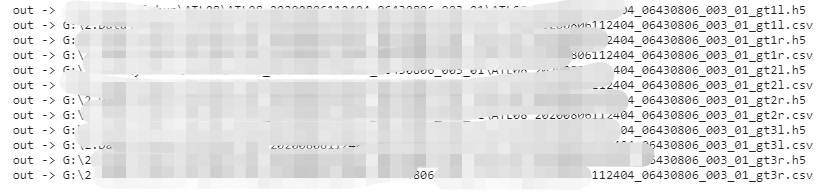
print('out ->', ofile)
# save as csv
ofilecsv = fname.replace('.h5', '_'+g[1:]+'.csv')
result = pd.DataFrame()
result['lon'] = lon
result['lat'] = lat
result['canopy_h_metrics_0'] = canopy_h_metrics[:,0]
result['canopy_h_metrics_1'] = canopy_h_metrics[:,1]
result['canopy_h_metrics_2'] = canopy_h_metrics[:,2]
result['canopy_h_metrics_3'] = canopy_h_metrics[:,3]
result['canopy_h_metrics_4'] = canopy_h_metrics[:,4]
result['canopy_h_metrics_5'] = canopy_h_metrics[:,5]
result['canopy_h_metrics_6'] = canopy_h_metrics[:,6]
result['canopy_h_metrics_7'] = canopy_h_metrics[:,7]
result['canopy_h_metrics_8'] = canopy_h_metrics[:,8]
result['canopy_openness'] = canopy_openness
result['h_canopy_quad'] = h_canopy_quad
print('out ->', ofilecsv)
result.to_csv(ofilecsv,index=None)
read_atl08(fname, None)
运行结果:
ArcGIS展点:


 263
263


 被折叠的 条评论
为什么被折叠?
被折叠的 条评论
为什么被折叠?
 到【灌水乐园】发言


