


引入地图插件
<script type="text/javascript">
  window._AMapSecurityConfig = {
    securityJsCode: '自己的密钥'
  }
</script>
<script type="text/javascript" src="https://webapi.amap.com/maps?v=2.0&key=自己的key&plugin=AMap.Geocoder&plugin=AMap.MouseTool&plugin=AMap.DistrictSearch&plugin=AMap.PolyEditor"></script>
<script type="text/javascript" src="https://webapi.amap.com/ui/1.1/main.js"></script>
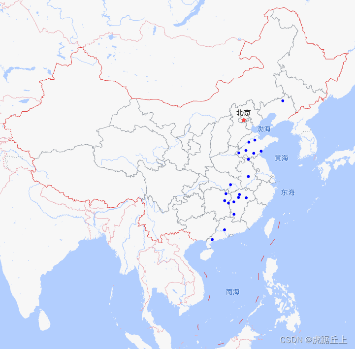
海量点
AMapUI.load(['ui/misc/PointSimplifier', "lib/$"], (DistrictCluster, PointSimplifier, $) => {
  this.PointSimplifier = new PointSimplifier({
    map: this.map, // 所属的地图实例
    autoSetFitView: false, // 禁止自动更新地图视野
    zIndex: 110,
    maxChildrenOfQuadNode: 50,
    getPosition: function(item) { // item为数据源的每一项元素
      if (!item) {
        return null
      }
      return [item.lng, item.lat] // 返回经纬度
    },
    getHoverTitle: function(dataItem) {
      return '设备编号:' + dataItem.vehicleNo
    },
    renderOptions: {
      pointStyle: { // 点的样式
        width: 6,
        height: 6,
        fillStyle: '#00f'
      },
      hoverTitleStyle: { // 鼠标hover时的title信息
        position: 'top'
      }
    }
  })
  // 添加点击事件
  this.PointSimplifier.on('pointClick', (e, point) => this.markerClick(point.data))
  // 加载数据,data为数据源,是一个数组
  this.PointSimplifier.setData(data)
})
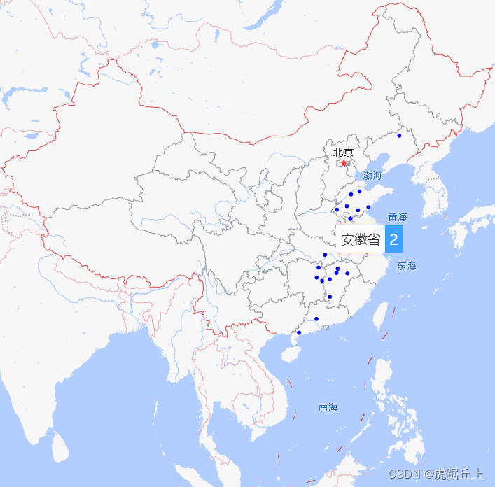
行政区划聚合
普通显示
// 加载区划聚合相关组件
AMapUI.load(['ui/geo/DistrictCluster', 'lib/$'], (DistrictCluster, $) => {
    const distCluster = new DistrictCluster({
    map: this.map, // 所属的地图实例
    zIndex: 11,
    autoSetFitView: false, // 禁止自动更新地图视野
    getPosition: function(item) {
      if (!item) {
        return null
      }
      // 返回经纬度
      return [parseFloat(item.lng), parseFloat(item.lat)]
    },
    renderOptions: {
      featureEventSupport: true,
      getClusterMarkerPosition:DistrictCluster.ClusterMarkerPositionStrategy.AVERAGE_POINTS_POSITION,
      clusterMarkerEventSupport: true,
      // 标注信息Marker上需要监听的事件
      clusterMarkerEventNames: ["click"],
      // 统计数为0的区域不显示
      getClusterMarker: function (feature, dataItems, recycledMarker) {
        let container, title, body
        const nodeClassNames = {
          title: "amap-ui-district-cluster-marker-title",
          body: "amap-ui-district-cluster-marker-body",
          container: "amap-ui-district-cluster-marker"
        };
        if (recycledMarker) {
          container = recycledMarker.getContent()
          title = $(container).find("." + nodeClassNames.title)[0]
          body = $(container).find("." + nodeClassNames.body)[0]
        } else {
          container = document.createElement("div")
          title = document.createElement("span")
          title.className = nodeClassNames.title
          body = document.createElement("span")
          body.className = nodeClassNames.body
          container.appendChild(title)
          body.style.boxSizing = "content-box"
          title.style.boxSizing = "content-box"
          container.style.boxSizing = "content-box"
          container.appendChild(body)
        }
        const props = feature.properties, routeNames = []
        const classNameList = [
          nodeClassNames.container,
          "level_" + props.level,
          "adcode_" + props.adcode
        ];
        container.className = classNameList.join(" ")
        if (routeNames.length > 0) {
          routeNames.push(props.name)
          container.setAttribute("title", routeNames.join(">"))
        } else {
          container.removeAttribute("title")
        }
        $(title).html(props.name);
        $(body).html(dataItems.length)
        const resultMarker = recycledMarker || new AMap.Marker({
          topWhenClick: true,
          offset: new AMap.Pixel(-20, -30),
          content: container
        });
        if (dataItems.length > 0) {
          return resultMarker
        }
      },
      // 基础样式
      featureStyle: {
        fillStyle: "rgba(250,250,250,0)", // 填充色
        lineWidth: 0, // 描边线宽
        hoverOptions: { // 鼠标Hover后的样式
          fillStyle: "rgba(255,255,255,0.2)"
        }
      },
      // 特定区划级别的默认样式
      featureStyleByLevel: {
        // 全国
        country: {
          fillStyle: "rgba(250,250,250,0)"
        },
        // 省
        province: {
          fillStyle: "rgba(250,250,250,0)"
        },
        //市
        city: {
          fillStyle: "rgba(250,250,250,0)"
        },
        //区县
        district: {
          fillStyle: "rgba(250,250,250,0)"
        }
      }
    }
  });
  this.distCluster = distCluster
  this.distCluster.setData(data) // data为数据源数组
  // 如果是最后一级则获取数据
  distCluster.on('clusterMarkerClick', (e, record) => {
    if (record.feature.properties.level != 'district') {
      return
    }
    this.loadData()
  })
})
鼠标移入区域显示区域聚合,移出则不显示
基于普通显示实现
window.AMapUI.load(["ui/geo/DistrictExplorer", "lib/$"], (DistrictExplorer, $) => {
  const districtExplorer = new DistrictExplorer({
    eventSupport: true, // 打开事件支持
    map: this.map,
  });
  districtExplorer.loadAreaNode(100000, (error, areaNode) => {
    districtExplorer.setAreaNodesForLocating([areaNode])
  });
  // 移入区域时显示区域聚合,移出后不显示
  districtExplorer.on('featureMouseover', (e, feature) => {
    const prop = feature.properties
    if (prop.name === this.provinceName) {
      return
    }
    this.provinceName = prop.name
    // this.allData是数据源数组
    // item.province === prop.name 是数据过滤规则,根据自己的业务需求而定
    this.distCluster.setData(this.allData.filter(item => item.province === prop.name))
  })
  // 移出区域时切换或清除区域聚合
  districtExplorer.on('featureMouseout', () => {
    this.distCluster.setData([])
    this.provinceName = ''
  })
})
Map 类
setFitView
-
为什么setFitView有时无效
原因:setFitView只对地图覆盖物生效。
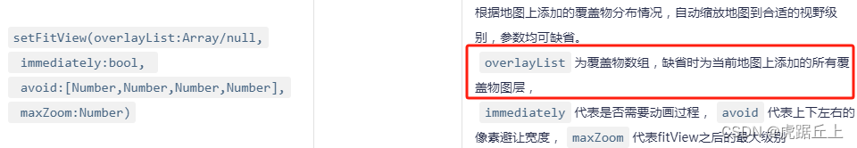
地图覆盖物只包括以下几类:

所以不属于以上几类(如信息窗体、海量点、聚合之类)的话,setFitView就不会生效。
解决方案:

示例代码:
// 获取所有数据
getAllData() {
  queryAreaList(this.listQuery).then(resData => {
    const data = resData.data.data.filter(item => item.encLon && item.encLat)
    this.PointSimplifier.setData(data)
    if (data.length) { // 若有数据则适配显示所有海量点
      this.map.setBounds(this.getDataBounds({dataList: data}))
    } else { // 若无数据则重置地图
      this.map.setZoomAndCenter(this.mapConfig.zoom, this.mapConfig.center)
    }
  });
},
/**
 * 获取地图显示范围
 * dataList: Array 数据源数组,数组的元素类型为Object,如:{encLon: 123, encLat: 456}
 * lngKey: [String, Number] 经度字段
 * latKey: [String, Number] 纬度字段
 * offset: Number 偏移量
 * @return {Array} 地图显示范围二维数组
 */
getDataBounds({dataList, lngKey = 'encLon', latKey = 'encLat', offset = 0.8}) {
  const first = dataList[0]
  let east = first[lngKey]
  let south = first[latKey]
  let west = first[lngKey]
  let north = first[latKey]
  for (let i = 1; i < dataList.length; i++) {
    const data = dataList[i]
    if (data[lngKey] > east) {
      east = data[lngKey]
    }
    if (data[lngKey] < west) {
      west = data[lngKey]
    }
    if (data[latKey] < south) {
      south = data[latKey]
    }
    if (data[latKey] > north) {
      north = data[latKey]
    }
  }
  return new AMap.Bounds([west - offset, south - offset], [east + offset, north + offset])
},
未完待续...


 9867
9867


 被折叠的 条评论
为什么被折叠?
被折叠的 条评论
为什么被折叠?
 到【灌水乐园】发言


