


数据为“全国地理信息资源目录服务系统”下载的shape数据。
一、样式准备
1.1 HYDA_Label
| 水系(面) | HYDA | 面 | 湖泊、水库、双线河流等 |
注:由cite_lakes复制改造。
<?xml version="1.0" encoding="UTF-8"?>
<StyledLayerDescriptor version="1.0.0" xmlns="http://www.opengis.net/sld" xmlns:ogc="http://www.opengis.net/ogc"
xmlns:xlink="http://www.w3.org/1999/xlink" xmlns:xsi="http://www.w3.org/2001/XMLSchema-instance"
xsi:schemaLocation="http://www.opengis.net/sld http://schemas.opengis.net/sld/1.0.0/StyledLayerDescriptor.xsd">
<NamedLayer>
<Name>Blue lake</Name>
<UserStyle>
<Title>Blue lake</Title>
<Abstract>A blue fill, solid black outline style</Abstract>
<FeatureTypeStyle>
<Rule>
<Name>name</Name>
<PolygonSymbolizer>
<Fill>
<CssParameter name="fill">
<ogc:Literal>#4040C0</ogc:Literal>
</CssParameter>
<CssParameter name="fill-opacity">
<ogc:Literal>1.0</ogc:Literal>
</CssParameter>
</Fill>
<Stroke>
<CssParameter name="stroke">
<ogc:Literal>#000000</ogc:Literal>
</CssParameter>
<CssParameter name="stroke-linecap">
<ogc:Literal>butt</ogc:Literal>
</CssParameter>
<CssParameter name="stroke-linejoin">
<ogc:Literal>miter</ogc:Literal>
</CssParameter>
<CssParameter name="stroke-opacity">
<ogc:Literal>1</ogc:Literal>
</CssParameter>
<CssParameter name="stroke-width">
<ogc:Literal>1</ogc:Literal>
</CssParameter>
<CssParameter name="stroke-dashoffset">
<ogc:Literal>0</ogc:Literal>
</CssParameter>
</Stroke>
</PolygonSymbolizer>
</Rule>
</FeatureTypeStyle>
</UserStyle>
</NamedLayer>
</StyledLayerDescriptor>
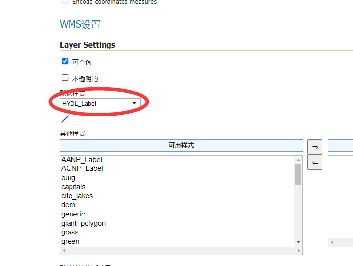
1.2 HYDL_Label
| 水系(线) | HYDL | 线 | 单线河流、沟渠、河流结构线等 |
注:由line复制改造。
<?xml version="1.0" encoding="UTF-8"?>
<StyledLayerDescriptor version="1.0.0"
xsi:schemaLocation="http://www.opengis.net/sld StyledLayerDescriptor.xsd"
xmlns="http://www.opengis.net/sld"
xmlns:ogc="http://www.opengis.net/ogc"
xmlns:xlink="http://www.w3.org/1999/xlink"
xmlns:xsi="http://www.w3.org/2001/XMLSchema-instance">
<!-- a Named Layer is the basic building block of an SLD document -->
<NamedLayer>
<Name>default_line</Name>
<UserStyle>
<!-- Styles can have names, titles and abstracts -->
<Title>Blue Line</Title>
<Abstract>A sample style that draws a line</Abstract>
<!-- FeatureTypeStyles describe how to render different features -->
<!-- A FeatureTypeStyle for rendering lines -->
<FeatureTypeStyle>
<Rule>
<Name>rule1</Name>
<Title>Blue Line</Title>
<Abstract>A solid blue line with a 1 pixel width</Abstract>
<LineSymbolizer>
<Stroke>
<CssParameter name="stroke">#0000FF</CssParameter>
</Stroke>
</LineSymbolizer>
</Rule>
</FeatureTypeStyle>
</UserStyle>
</NamedLayer>
</StyledLayerDescriptor>
1.3 HYDP_Label
| 水系(点) | HYDP | 点 | 泉、井等 |
注:由poi复制改造。
<?xml version="1.0" encoding="UTF-8"?>
<StyledLayerDescriptor version="1.0.0" xmlns="http://www.opengis.net/sld" xmlns:ogc="http://www.opengis.net/ogc"
xmlns:xlink="http://www.w3.org/1999/xlink" xmlns:xsi="http://www.w3.org/2001/XMLSchema-instance"
xsi:schemaLocation="http://www.opengis.net/sld http://schemas.opengis.net/sld/1.0.0/StyledLayerDescriptor.xsd">
<NamedLayer>
<Name>poi</Name>
<UserStyle>
<Name>poi</Name>
<Title>Points of interest</Title>
<Abstract>Manhattan points of interest</Abstract>
<FeatureTypeStyle>
<Rule>
<PointSymbolizer>
<Graphic>
<Mark>
<WellKnownName>circle</WellKnownName>
<Fill>
<CssParameter name="fill">#FF0000</CssParameter>
<CssParameter name="fill-opacity">1.0</CssParameter>
</Fill>
</Mark>
<Size>11</Size>
</Graphic>
</PointSymbolizer>
<PointSymbolizer>
<Graphic>
<Mark>
<WellKnownName>circle</WellKnownName>
<Fill>
<CssParameter name="fill">#EDE513</CssParameter>
<CssParameter name="fill-opacity">1.0</CssParameter>
</Fill>
</Mark>
<Size>7</Size>
</Graphic>
</PointSymbolizer>
</Rule>
<Rule>
<MaxScaleDenominator>32000</MaxScaleDenominator>
<TextSymbolizer>
<Label>
<ogc:PropertyName>NAME</ogc:PropertyName>
</Label>
<Font>
<CssParameter name="font-family">Arial</CssParameter>
<CssParameter name="font-weight">Bold</CssParameter>
<CssParameter name="font-size">14</CssParameter>
</Font>
<LabelPlacement>
<PointPlacement>
<AnchorPoint>
<AnchorPointX>0.5</AnchorPointX>
<AnchorPointY>0.5</AnchorPointY>
</AnchorPoint>
<Displacement>
<DisplacementX>0</DisplacementX>
<DisplacementY>-15</DisplacementY>
</Displacement>
</PointPlacement>
</LabelPlacement>
<Halo>
<Radius>
<ogc:Literal>2</ogc:Literal>
</Radius>
<Fill>
<CssParameter name="fill">#FFFFFF</CssParameter>
</Fill>
</Halo>
<Fill>
<CssParameter name="fill">#000000</CssParameter>
</Fill>
</TextSymbolizer>
</Rule>
</FeatureTypeStyle>
</UserStyle>
</NamedLayer>
</StyledLayerDescriptor>
1.4 RESA_Label
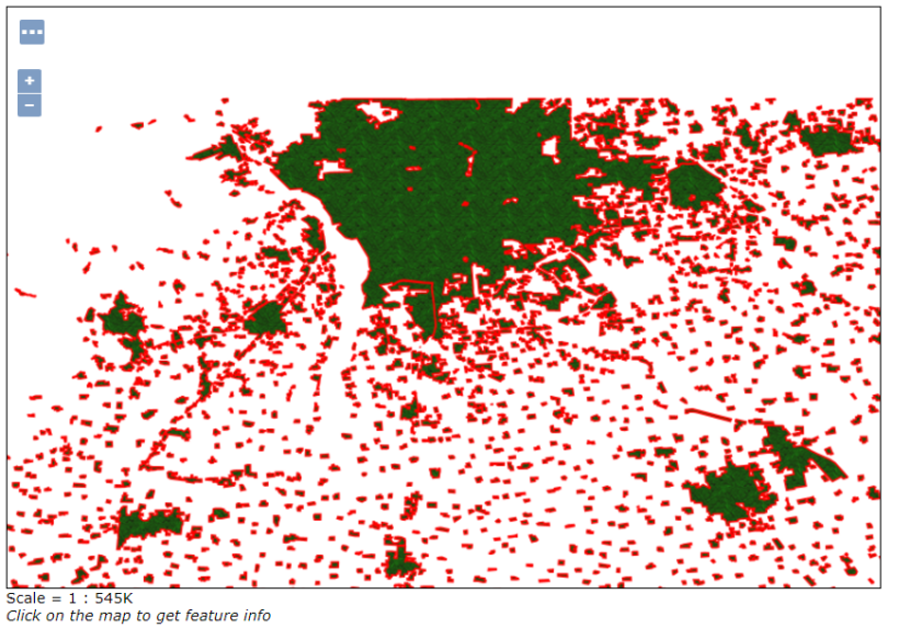
| 居民地(面) | RESA | 面 | 居民地 |
注:由grass复制改造。
<?xml version="1.0" encoding="UTF-8"?>
<StyledLayerDescriptor version="1.0.0" xmlns="http://www.opengis.net/sld" xmlns:ogc="http://www.opengis.net/ogc"
xmlns:xlink="http://www.w3.org/1999/xlink" xmlns:xsi="http://www.w3.org/2001/XMLSchema-instance"
xsi:schemaLocation="http://www.opengis.net/sld http://schemas.opengis.net/sld/1.0.0/StyledLayerDescriptor.xsd">
<NamedLayer>
<Name>Grass</Name>
<UserStyle>
<Name>grass</Name>
<Title>Grass fill</Title>
<Abstract>A style filling polygons with a grass theme coming from a PNG file</Abstract>
<FeatureTypeStyle>
<Rule>
<Name>Grass</Name>
<Abstract>Grass style that uses a texture</Abstract>
<PolygonSymbolizer>
<Fill>
<GraphicFill>
<Graphic>
<ExternalGraphic>
<OnlineResource xlink:type="simple" xlink:href="grass_fill.png" />
<Format>image/png</Format>
</ExternalGraphic>
<Opacity>
<ogc:Literal>1.0</ogc:Literal>
</Opacity>
</Graphic>
</GraphicFill>
</Fill>
<Stroke>
<CssParameter name="stroke">#FF0000</CssParameter>
<CssParameter name="stroke-width">1</CssParameter>
</Stroke>
</PolygonSymbolizer>
</Rule>
</FeatureTypeStyle>
</UserStyle>
</NamedLayer>
</StyledLayerDescriptor>
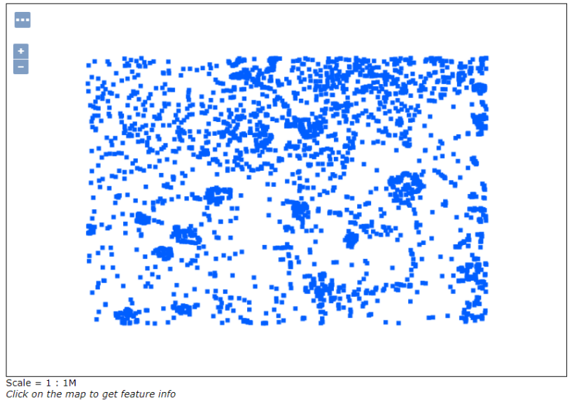
1.5 RESP_Label
| 居民地(点) | RESP | 点 | 普通房屋、蒙古包、放牧点等 |
注:由point复制改造。
<?xml version="1.0" encoding="UTF-8"?>
<StyledLayerDescriptor version="1.0.0"
xsi:schemaLocation="http://www.opengis.net/sld StyledLayerDescriptor.xsd"
xmlns="http://www.opengis.net/sld"
xmlns:ogc="http://www.opengis.net/ogc"
xmlns:xlink="http://www.w3.org/1999/xlink"
xmlns:xsi="http://www.w3.org/2001/XMLSchema-instance">
<!-- a Named Layer is the basic building block of an SLD document -->
<NamedLayer>
<Name>default_point</Name>
<UserStyle>
<!-- Styles can have names, titles and abstracts -->
<Title>Blue Square Point</Title>
<Abstract>A sample style that draws a red square point</Abstract>
<!-- FeatureTypeStyles describe how to render different features -->
<!-- A FeatureTypeStyle for rendering points -->
<FeatureTypeStyle>
<Rule>
<Name>rule1</Name>
<Title>Red Square Point</Title>
<Abstract>A 6 pixel square with a red fill and no stroke</Abstract>
<PointSymbolizer>
<Graphic>
<Mark>
<WellKnownName>square</WellKnownName>
<Fill>
<CssParameter name="fill">#005eff</CssParameter>
</Fill>
</Mark>
<Size>6</Size>
</Graphic>
</PointSymbolizer>
</Rule>
</FeatureTypeStyle>
</UserStyle>
</NamedLayer>
</StyledLayerDescriptor>
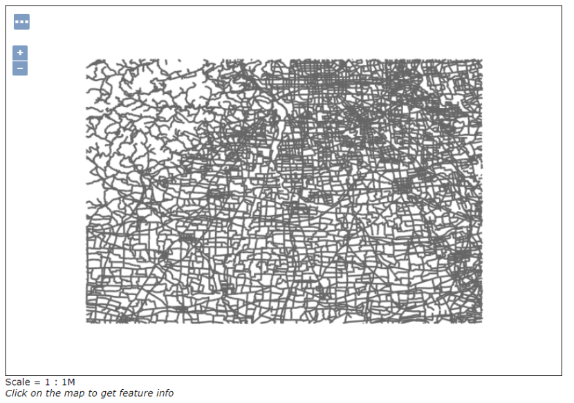
1.6 LRDL_Label
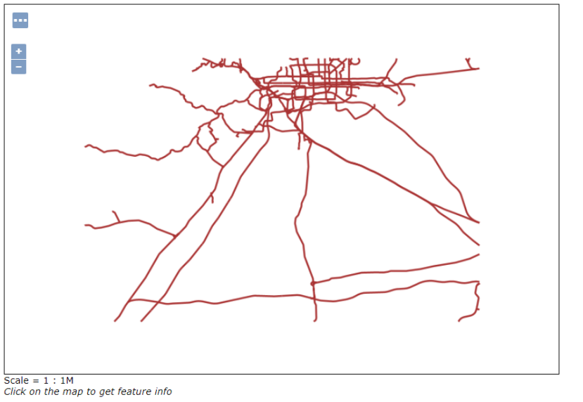
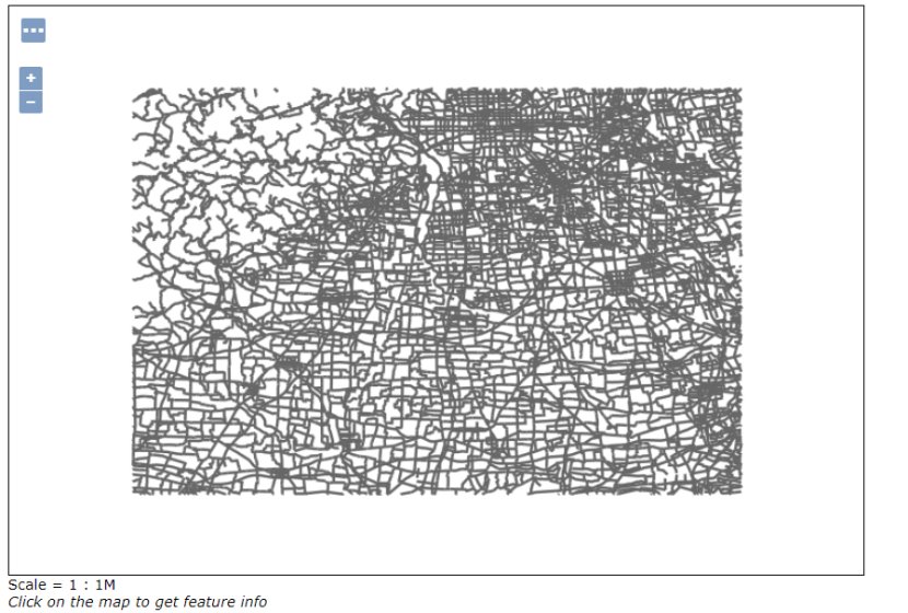
| 公路 | LRDL | 线 | 国道、省道、县道、乡道、其它公路、街道、乡村道路等 |
注:由tiger_roads复制改造。
<?xml version="1.0" encoding="UTF-8"?>
<StyledLayerDescriptor version="1.0.0"
xsi:schemaLocation="http://www.opengis.net/sld StyledLayerDescriptor.xsd"
xmlns="http://www.opengis.net/sld" xmlns:ogc="http://www.opengis.net/ogc"
xmlns:xlink="http://www.w3.org/1999/xlink"
xmlns:xsi="http://www.w3.org/2001/XMLSchema-instance">
<NamedLayer> <Name> area landmarks </Name>
<UserStyle>
<FeatureTypeStyle>
<FeatureTypeName>Feature</FeatureTypeName>
<Rule>
<MinScaleDenominator>32000</MinScaleDenominator>
<LineSymbolizer>
<Stroke>
<CssParameter name="stroke">
<ogc:Literal>#666666</ogc:Literal>
</CssParameter>
<CssParameter name="stroke-width">
<ogc:Literal>2</ogc:Literal>
</CssParameter>
</Stroke>
</LineSymbolizer>
</Rule>
<Rule> <!-- thick line drawn first-->
<MaxScaleDenominator>32000</MaxScaleDenominator>
<LineSymbolizer>
<Stroke>
<CssParameter name="stroke">
<ogc:Literal>#666666</ogc:Literal>
</CssParameter>
<CssParameter name="stroke-width">
<ogc:Literal>7</ogc:Literal>
</CssParameter>
</Stroke>
</LineSymbolizer>
</Rule>
</FeatureTypeStyle>
<FeatureTypeStyle>
<FeatureTypeName>Feature</FeatureTypeName>
<Rule> <!-- thin line drawn second -->
<MaxScaleDenominator>32000</MaxScaleDenominator>
<LineSymbolizer>
<Stroke>
<CssParameter name="stroke">
<ogc:Literal>#FFFFFF</ogc:Literal>
</CssParameter>
<CssParameter name="stroke-width">
<ogc:Literal>4</ogc:Literal>
</CssParameter>
</Stroke>
</LineSymbolizer>
</Rule>
<!-- label -->
<Rule>
<MaxScaleDenominator>32000</MaxScaleDenominator>
<TextSymbolizer>
<Label>
<ogc:PropertyName>NAME</ogc:PropertyName>
</Label>
<Font>
<CssParameter name="font-family">Times New Roman</CssParameter>
<CssParameter name="font-style">Normal</CssParameter>
<CssParameter name="font-size">14</CssParameter>
<CssParameter name="font-weight">bold</CssParameter>
</Font>
<LabelPlacement>
<LinePlacement>
</LinePlacement>
</LabelPlacement>
<Halo>
<Radius>
<ogc:Literal>2</ogc:Literal>
</Radius>
<Fill>
<CssParameter name="fill">#FFFFFF</CssParameter>
<CssParameter name="fill-opacity">0.85</CssParameter>
</Fill>
</Halo>
<Fill>
<CssParameter name="fill">#000000</CssParameter>
</Fill>
<VendorOption name="group">true</VendorOption>
</TextSymbolizer>
</Rule>
</FeatureTypeStyle>
</UserStyle>
</NamedLayer>
</StyledLayerDescriptor>
1.7 LRRL_Label
| 铁路 | LRRL | 线 | 标准轨铁路、窄轨铁路等 |
注:由simple_roads复制改造。
<?xml version="1.0" encoding="UTF-8"?>
<StyledLayerDescriptor version="1.0.0" xsi:schemaLocation="http://www.opengis.net/sld StyledLayerDescriptor.xsd"
xmlns="http://www.opengis.net/sld" xmlns:ogc="http://www.opengis.net/ogc" xmlns:xlink="http://www.w3.org/1999/xlink"
xmlns:xsi="http://www.w3.org/2001/XMLSchema-instance">
<NamedLayer>
<Name>Simple Roads</Name>
<UserStyle>
<Title>Red Line</Title>
<Abstract>Light red line, 2px wide</Abstract>
<FeatureTypeStyle>
<Rule>
<Title>Roads</Title>
<LineSymbolizer>
<Stroke>
<CssParameter name="stroke">
<ogc:Literal>#AA3333</ogc:Literal>
</CssParameter>
<CssParameter name="stroke-width">
<ogc:Literal>2</ogc:Literal>
</CssParameter>
</Stroke>
</LineSymbolizer>
</Rule>
</FeatureTypeStyle>
</UserStyle>
</NamedLayer>
</StyledLayerDescriptor>
1.8 AANP_Label
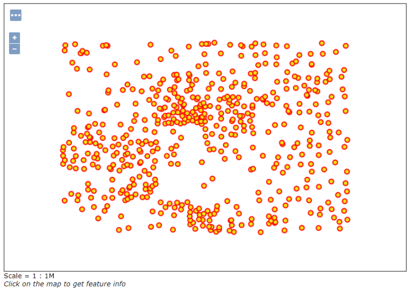
| 自然地名(点) | AANP | 点 | 交通要素名、纪念地和古迹名、山名、水系名、海洋地域名、自然地域名等 |
注:由capitals复制改造。
1.9 AGNP_Label
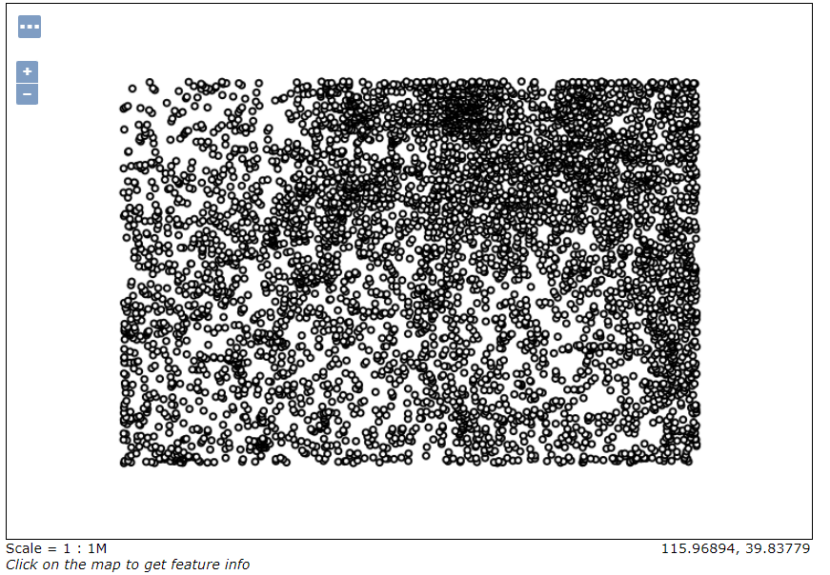
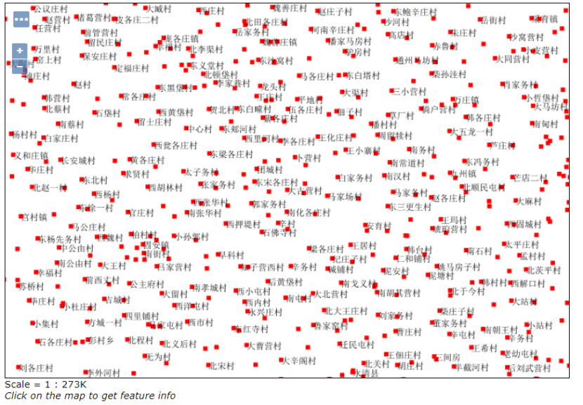
| 居民地地名(点) | AGNP | 点 | 各级行政地名和城乡居民地名称等 |
注:由point复制改造。
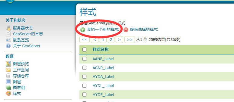
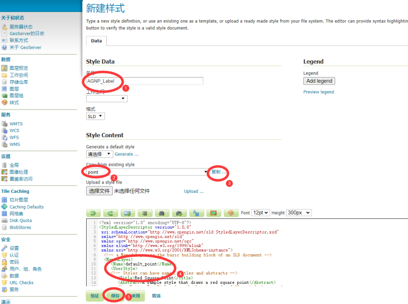
二、发布流程
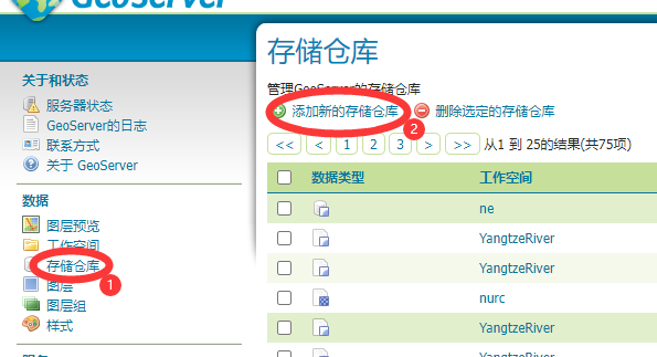
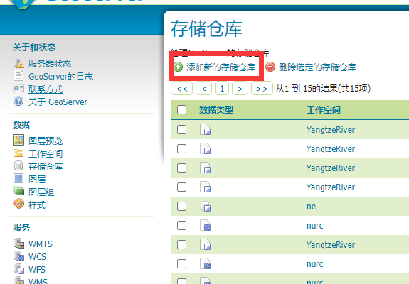
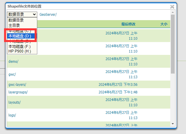
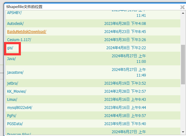
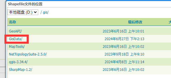
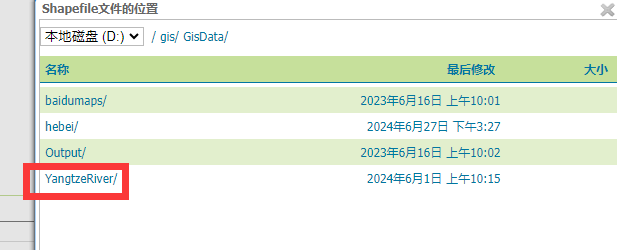
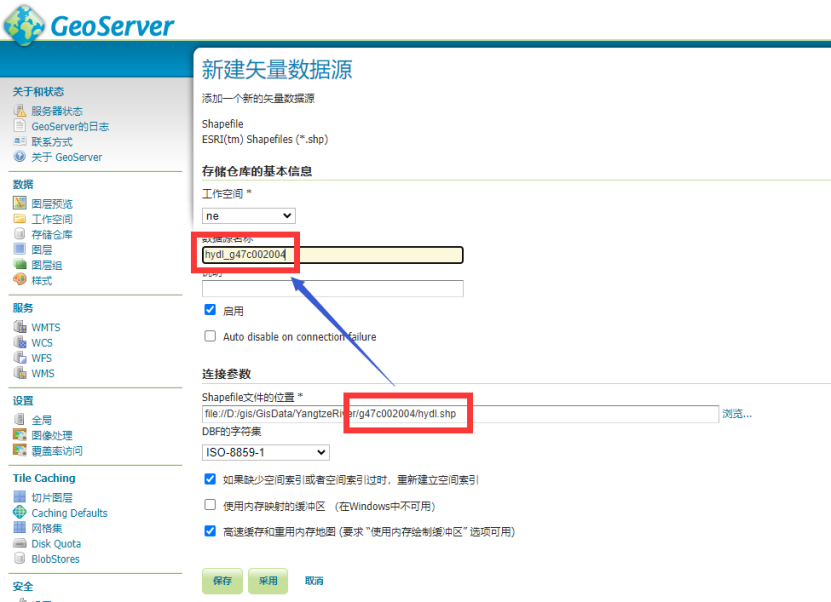
2.1 存储仓库
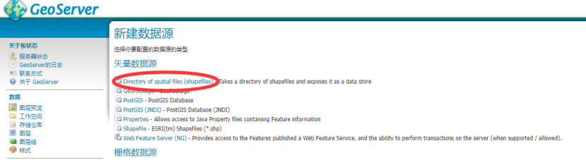
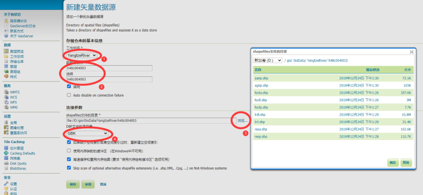
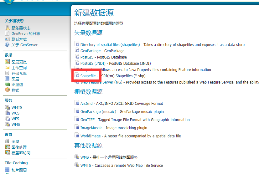
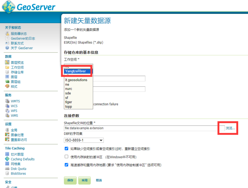
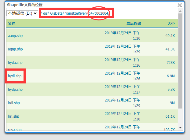
2.1.1 目录shape文件存储仓库
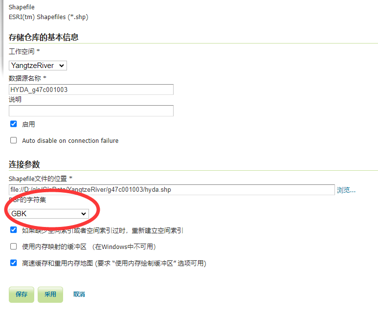
2.1.2 单shape文件存储仓库
***注意:字符集设置为GBK,否则前端展示时中文乱码。
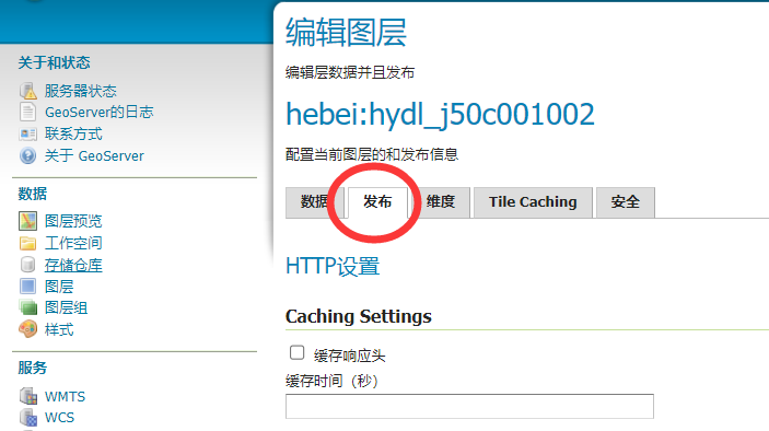
2.2 图层发布
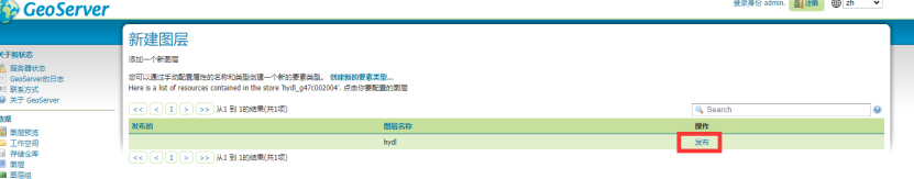
2.2.1 数据页卡
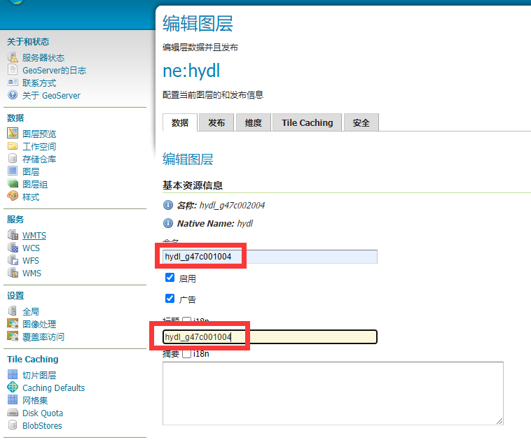
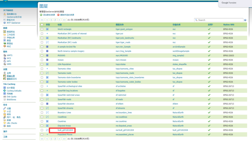
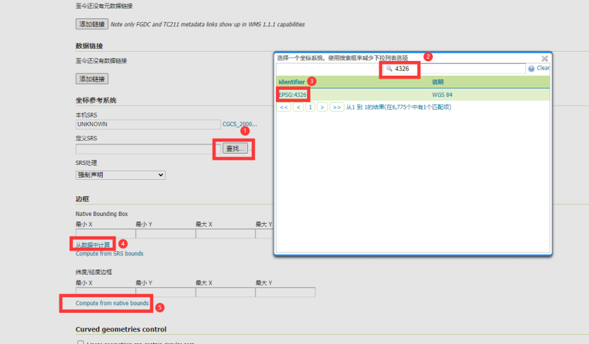
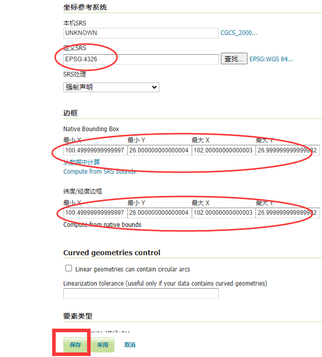
2.2.2 发布页卡
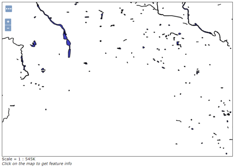
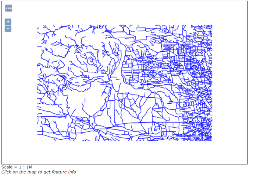
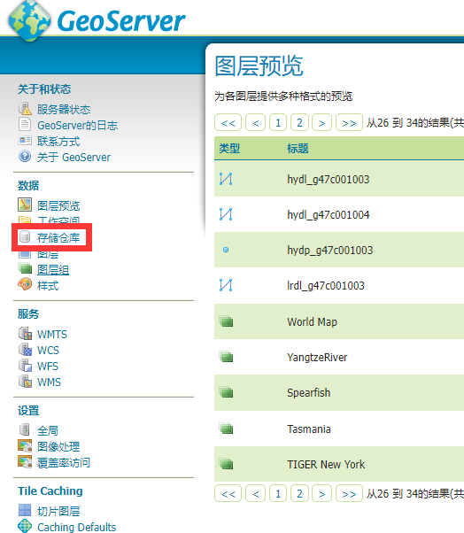
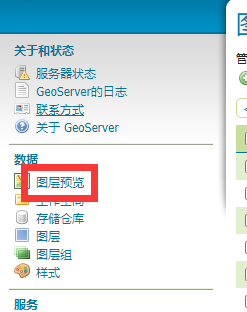
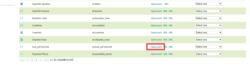
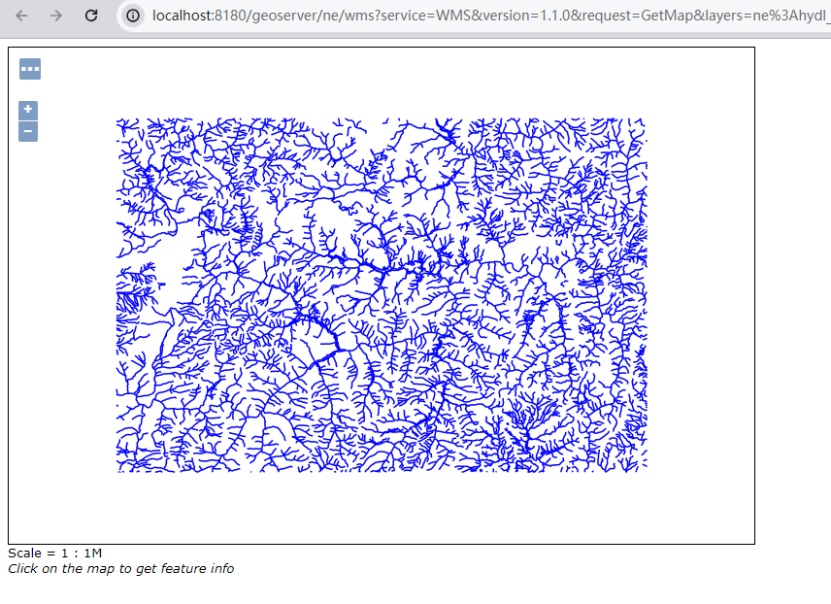
2.3 图层预览
成果数据组织
目前提供下载的1:25万公开版基础地理数据共有4个数据集9个数据层。
数据分层的命名采用四个字符,第一个字符代表数据分类,第二三个字符是数据内容的缩写,第四个字符代表几何类型。
| 要素分类 | 数据分层 | 几何类型 | 主要要素内容 | 样式 | |
| 水系(H) | 水系(面) | HYDA | 面 | 湖泊、水库、双线河流等 | HYDA_Label 复制自cite_lakes |
| 水系(线) | HYDL | 线 | 单线河流、沟渠、河流结构线等 | HYDL_Label 复制自line | |
| 水系(点) | HYDP | 点 | 泉、井等 | HYDP_Label 复制自poi | |
| 居民地及设施(R) | 居民地(面) | RESA | 面 | 居民地 | HYDA_Label 复制自 |
| 居民地(点) | RESP | 点 | 普通房屋、蒙古包、放牧点等 | HYDA_Label 复制自 | |
| 交通(L) | 铁路 | LRRL | 线 | 标准轨铁路、窄轨铁路等 | LRRL_Label 复制自simple_roads |
| 公路 | LRDL | 线 | 国道、省道、县道、乡道、其它公路、街道、乡村道路等 | LRDL_Label 复制自tiger_roads | |
| 地名及注记(A) | 居民地地名(点) | AGNP | 点 | 各级行政地名和城乡居民地名称等 | HYDA_Label 复制自point |
| 自然地名(点) | AANP | 点 | 交通要素名、纪念地和古迹名、山名、水系名、海洋地域名、自然地域名等 | AANP_Label 复制自capitals |


 453
453

 被折叠的 条评论
为什么被折叠?
被折叠的 条评论
为什么被折叠?
 到【灌水乐园】发言


