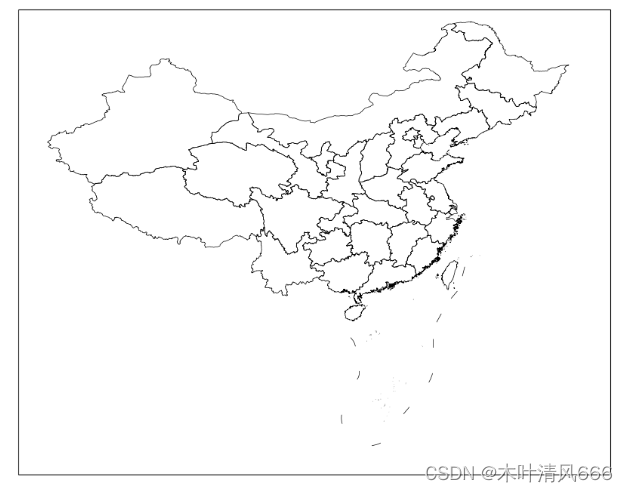
cartopy是一个用于绘制地图投影和地理数据可视化的 Python 库。 它是建立在 matplotlib 的基础上,专门用于制作地图和地理数据的图表。 cartopy 的目标是使地图制作变得更加简单和直观,同时提供了一些强大的功能来处理地理数据和投影。
import matplotlib. pyplot as plt
import cartopy. crs as ccrs
import cartopy. io. shapereader as shpreader
fig = plt. figure( figsize= ( 12 , 8 ) )
crs = ccrs. PlateCarree( )
ax = fig. add_subplot( 111 , projection= crs)
extents = [ 70 , 140 , 0 , 55 ]
ax. set_extent( extents, crs)
filepath = '.\bou2_4p.shp'
file_nineline = ".\九段线.shp"
reader = shpreader. Reader( filepath)
reader_nineline = shpreader. Reader( file_nineline)
geoms = reader. geometries( )
geoms_nineline = reader_nineline. geometries( )
ax. add_geometries( geoms, crs, lw= 0.5 , fc= 'none' )
ax. add_geometries( geoms_nineline, crs, lw= 0.5 , fc= 'none' )
reader. close( )
reader_nineline. close( )
plt. show( )
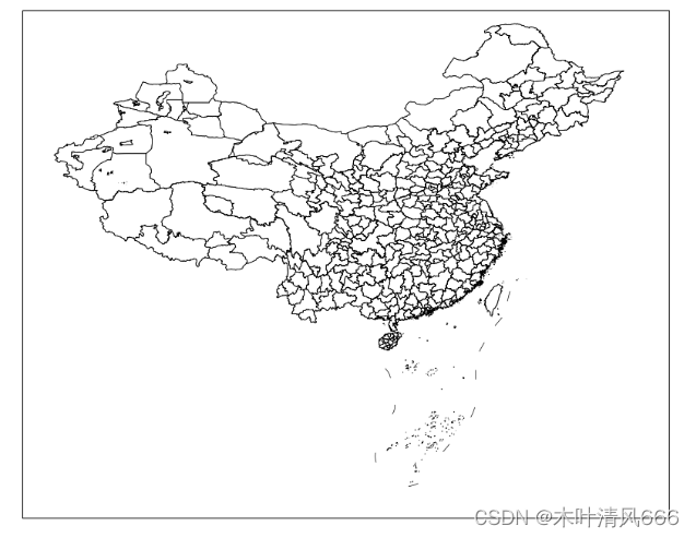
city_files = shpreader. Reader( r'.\市.shp' )
ax. add_geometries( city_files. geometries( ) , crs, lw= 0.5 , fc= 'none' )
reader. close( )
county_files = shpreader. Reader( r'.\县.shp' )
ax. add_geometries( county_file. geometries( ) , crs, lw= 0.5 , fc= 'none' )
reader. close( )
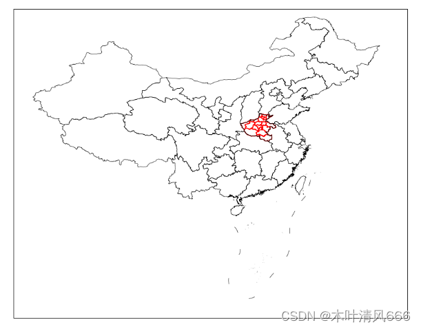
有时候我们仅仅关注一个省内细分的市区,而不关注其他省份,那么需要将单一省内的市边界画出
import matplotlib. pyplot as plt
import cartopy. crs as ccrs
import cartopy. io. shapereader as shpreader
extents = [ 70 , 140 , 0 , 55 ]
crs = ccrs. PlateCarree( )
fig = plt. figure( figsize= ( 12 , 8 ) )
ax = fig. add_subplot( 111 , projection= crs)
ax. set_extent( extents, crs)
city_reader = shpreader. Reader( r'.\市.shp' )
reader = shpreader. Reader( '.\bou2_4p.shp' )
reader_nineline = shpreader. Reader( ".\九段线.shp" )
geoms = reader. geometries( )
geoms_nineline = reader_nineline. geometries( )
for record, geos in zip ( city_reader. records( ) , city_reader. geometries( ) ) :
if record. attributes[ '省' ] == '河南省' :
ax. add_geometries( [ geos] , crs, edgecolor= 'r' , facecolor= 'none' , lw= 1 )
records = city_reader. records( )
ax. add_geometries( geoms, crs, lw= 0.5 , fc= 'none' )
ax. add_geometries( geoms_nineline, crs, lw= 0.5 , fc= 'none' )
reader. close( )
reader_nineline. close( )
city_reader. close( )
plt. show( )
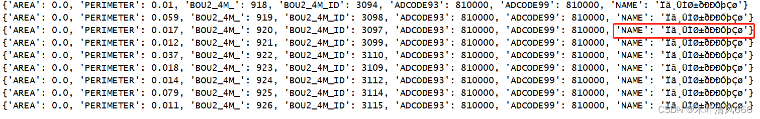
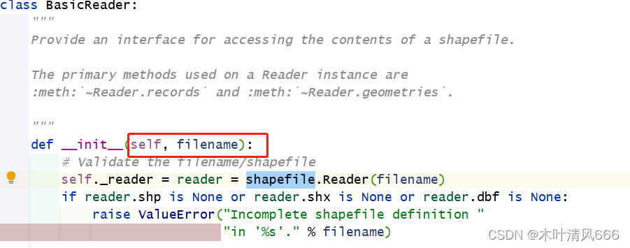
cartopy依赖于shapefile库读取文件,但是在初始化中只设置了一个参数,即文件的名称,没有不定参数的设定 。这使得文档编码格式不是UTF-8类型 的文件,读取出现乱码,无法使用关键字参数筛选数据。如图所示:
import matplotlib. pyplot as plt
import cartopy. crs as ccrs
import cartopy. io. shapereader as shpreader
import shapefile
filepath = '.\bou2_4p.shp'
x = shpreader. Reader( filepath)
for i in x. records( ) :
print ( i. attributes)
shapefile源码中只设定了filename encoding 因此,在上述画图示例中,如果想使用关键字将“河南省”边界改变比较困难,因此,查看源码,使用以下方法进行修改,完成上述功能。
import matplotlib. pyplot as plt
impor


 最低0.47元/天 解锁文章


 1591
1591


 到【灌水乐园】发言


