


在vue项目的基础上,使用openlayers创建地图,并且实现上下两个地图联动展示
前言
在vue项目的基础上,使用openlayers创建地图,并且实现上下两个地图联动展示。
提示:以下是本篇文章正文内容,下面案例可供参考
一、方法
让上下两个地图联动展示方式很简单,只要让他们使用同一个view就可以了,下面是一个简单的例子记录。
二、创建步骤
1.引入库
代码如下(示例):
import { reactive, onMounted } from 'vue';
import Map from 'ol/Map';
import View from 'ol/View';
import TileLayer from 'ol/layer/Tile';
import "ol/ol.css";
import TileArcGISRest from 'ol/source/TileArcGISRest';
2.创建地图
代码如下(示例):
// 初始化地图
const initMap = () => {
    state.view = new View({
        center: [0, 0],
        zoom: 13,
        maxZoom: 18,
        minZoom: 0,
        projection: "EPSG:4326",
        center: [104.139919, 30.674801],
        enableRotation: false, // 配置不能旋转
    });
    state.map1 = new Map({
        target: 'map-first',
        layers: [
            new TileLayer({
                //OSM地图
                //source: new OSM()
                source: new TileArcGISRest({
                    url: 'https://map.geoq.cn/ArcGIS/rest/services/ChinaOnlineCommunity/MapServer'
                })
            }),
        ],
        view: state.view,
    });
    state.map2 = new Map({
        target: 'map-second',
        layers: [
            new TileLayer({
                //OSM地图
                //source: new OSM()
                source: new TileArcGISRest({
                    url: 'https://map.geoq.cn/ArcGIS/rest/services/ChinaOnlineCommunity/MapServer'
                })
            }),
        ],
        view: state.view,
    });
}
这部分是地图的初始化创建,可以看到我们使用了同一个view。
总结
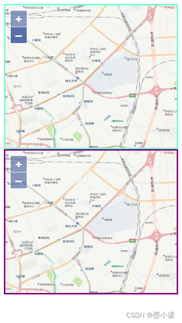
最终效果如图:(拖动地图或者放大缩小,两个地图的操作会同步进行)
完整代码如下展示:
<template>
    <div class="map-container">
        <div class="map1" id="map-first"></div>
        <div class="map2" id="map-second"></div>
    </div>
</template>

<script setup>
import { reactive, onMounted } from 'vue';
import Map from 'ol/Map';
import View from 'ol/View';
import TileLayer from 'ol/layer/Tile';
import "ol/ol.css";
import TileArcGISRest from 'ol/source/TileArcGISRest';
const state = reactive({
    map1: null,
    map2: null,
    view: null,
});

// 初始化地图
const initMap = () => {
    state.view = new View({
        center: [0, 0],
        zoom: 13,
        maxZoom: 18,
        minZoom: 0,
        projection: "EPSG:4326",
        center: [104.139919, 30.674801],
        enableRotation: false, // 配置不能旋转
    });
    state.map1 = new Map({
        target: 'map-first',
        layers: [
            new TileLayer({
                //OSM地图
                //source: new OSM()
                source: new TileArcGISRest({
                    url: 'https://map.geoq.cn/ArcGIS/rest/services/ChinaOnlineCommunity/MapServer'
                })
            }),
        ],
        view: state.view,
    });
    state.map2 = new Map({
        target: 'map-second',
        layers: [
            new TileLayer({
                //OSM地图
                //source: new OSM()
                source: new TileArcGISRest({
                    url: 'https://map.geoq.cn/ArcGIS/rest/services/ChinaOnlineCommunity/MapServer'
                })
            }),
        ],
        view: state.view,
    });
}

onMounted(() => {
    initMap();
})

</script>
<style scoped lang='less'>
.map-container {
    position: relative;
    width: 100%;
    height: 100vh;
    box-sizing: border-box;

    .map1 {
        height: 45%;
        box-sizing: border-box;
        border: 3px solid aquamarine;
    }

    .map2 {
        height: 45%;
        box-sizing: border-box;
        border: 3px solid purple;
    }
}
</style>


 22
22


 被折叠的 条评论
为什么被折叠?
被折叠的 条评论
为什么被折叠?
 到【灌水乐园】发言


