


在 OpenLayers 中实现打印地图:导出为图片或 PDF 的完整指南
目录
一、引言
在 Web GIS 应用中,导出地图功能可以让用户将地图保存为图片或 PDF,以便分享、报告或归档。OpenLayers 提供了强大的地图渲染和交互功能,结合 JavaScript 库如 html2canvas 和 jsPDF,开发者可以轻松实现地图导出功能。本文将详细介绍如何在 Vue 单页面应用中实现打印地图功能。
二、导出地图功能在 Web GIS 中的作用
导出地图功能在很多场景中都非常实用,例如地图报告、项目演示、共享地图快照等。实现此功能时,需要考虑以下方面:
导出为图片
将地图导出为 PNG 或 JPEG 图片,让用户能方便地保存和分享地图内容。
导出为 PDF
将地图嵌入 PDF 文件,并添加标题、注释等内容,方便更正式的使用场景。
包含标记和注释
在导出时保留用户在地图上绘制的标记和注释,以便用户获取完整信息。
选择导出区域
允许用户选择地图的特定区域进行导出,而不仅限于整个地图视图。
高分辨率和性能优化
导出时应确保图片或 PDF 的高分辨率,同时保持性能优化,避免因资源消耗过高而影响用户体验。
三、OpenLayers 打印地图实现方法
在 OpenLayers 中,地图导出可以通过将地图渲染到 canvas 元素,然后使用 html2canvas 进行捕获并导出为图片,再结合 jsPDF 实现 PDF 的生成。
四、代码实现步骤
1. 初始化地图
首先,创建一个基本的 OpenLayers 地图实例,并设置视图和图层。
import 'ol/ol.css';
import Map from 'ol/Map';
import View from 'ol/View';
import TileLayer from 'ol/layer/Tile';
import VectorLayer from 'ol/layer/Vector';
import VectorSource from 'ol/source/Vector';
import OSM from 'ol/source/OSM';
import { fromLonLat } from 'ol/proj';

export default {
  name: 'MapExportTool',
  data() {
    return {
      map: null,
      view: null,
      vectorSource: null,
    };
  },
  mounted() {
    this.initMap();
  },
  methods: {
    initMap() {
      this.vectorSource = new VectorSource();

      const vectorLayer = new VectorLayer({
        source: this.vectorSource,
      });

      this.view = new View({
        center: fromLonLat([0, 0]),
        zoom: 2,
      });

      this.map = new Map({
        target: this.$refs.mapContainer,
        layers: [
          new TileLayer({ source: new OSM() }),
          vectorLayer,
        ],
        view: this.view,
      });
    },
  },
};
2. 导出为图片
使用 html2canvas 捕获地图并导出为 PNG 图片。
import html2canvas from 'html2canvas';

methods: {
  async exportAsImage() {
    try {
      const mapContainer = this.$refs.mapContainer;
      const canvas = await html2canvas(mapContainer, {
        useCORS: true,
        scale: 2, // 提高分辨率
        allowTaint: true,
      });
      const link = document.createElement('a');
      link.href = canvas.toDataURL('image/png');
      link.download = 'map_export.png';
      link.click();
    } catch (error) {
      console.error('导出图片时出错:', error);
    }
  },
},
3. 导出为 PDF
使用 jsPDF 将地图内容嵌入 PDF 并保存。
import { jsPDF } from 'jspdf';

methods: {
  async exportAsPDF() {
    try {
      const mapContainer = this.$refs.mapContainer;
      const canvas = await html2canvas(mapContainer, {
        useCORS: true,
        scale: 2,
        allowTaint: true,
      });
      const pdf = new jsPDF({
        orientation: 'landscape',
        unit: 'px',
        format: [canvas.width, canvas.height],
      });
      pdf.addImage(
        canvas.toDataURL('image/png'),
        'PNG',
        0,
        0,
        canvas.width,
        canvas.height
      );
      pdf.save('map_export.pdf');
    } catch (error) {
      console.error('导出 PDF 时出错:', error);
    }
  },
},
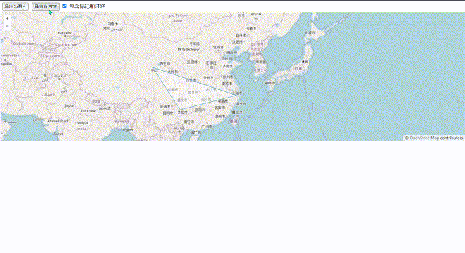
4. 处理标记和注释
通过在地图上添加 Draw 交互,用户可以在地图上绘制标记和注释,这些内容将包含在导出中。
import { Draw } from 'ol/interaction';

methods: {
  initMap() {
    this.vectorSource = new VectorSource();

    const vectorLayer = new VectorLayer({
      source: this.vectorSource,
    });

    this.view = new View({
      center: fromLonLat([0, 0]),
      zoom: 2,
    });

    this.map = new Map({
      target: this.$refs.mapContainer,
      layers: [
        new TileLayer({ source: new OSM() }),
        vectorLayer,
      ],
      view: this.view,
    });

    // 添加绘制功能供用户标记和注释
    const draw = new Draw({
      source: this.vectorSource,
      type: 'Polygon',
    });
    this.map.addInteraction(draw);
  },
},
5. 高分辨率导出和性能优化
在导出时设置 scale: 2 可以提高导出分辨率,同时通过 useCORS: true 和 allowTaint: true 选项优化性能,确保跨域资源能够正确加载。
五、总结
通过在 Vue 应用中结合 OpenLayers、html2canvas 和 jsPDF,开发者可以实现灵活的地图导出功能,满足用户的各种需求。无论是导出为图片还是 PDF,都能保留地图的样式、标记和注释,并确保高分辨率和良好的性能。


 1299
1299

 被折叠的 条评论
为什么被折叠?
被折叠的 条评论
为什么被折叠?
 到【灌水乐园】发言


