


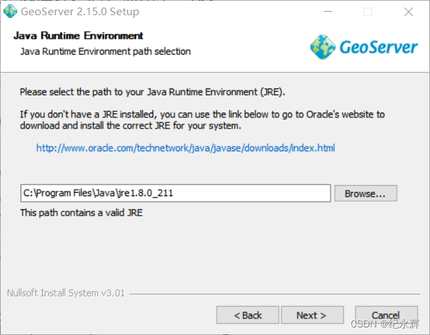
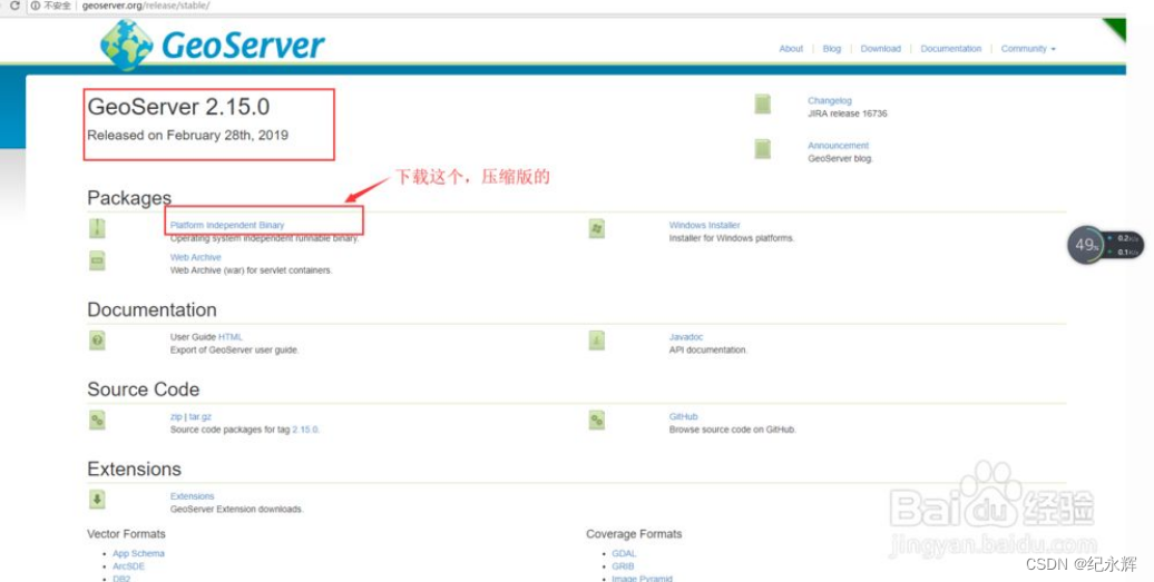
1、GeoServer的安装与初步使用
(1)windows版本
GeoServer一:GeoServer的安装与初步使用_不睡觉的怪叔叔的博客-CSDN博客_geoserver
https://jingyan.baidu.com/article/25648fc15a9c419190fd0050.html
备注:最新版本没有windows安装包,2.15.0版本是有安装包的;
基础教程:
常见问题:

GeoServer win安装及小坑_您的小透明的博客-CSDN博客
(2)linux版本
((1))、下载软件
((2))、用winSCP软件传到自定义目录并使用unzip命令解压

((3))、设置修改geoserver端口

((4))、设置环境变量
必须先安装了java,一般在/usr/lib/jvm/可以找到java
编辑 vi /etc/profile 编辑文件命令
JAVA_HOME=/usr/lib/jvm/java-1.8.0-openjdk-1.8.0.302.b08-0.el7_9.x86_64
JRE_HOME=/usr/lib/jvm/java-1.8.0-openjdk-1.8.0.302.b08-0.el7_9.x86_64/jre
CLASS_PATH=.:$JAVA_HOME/lib/dt.jar:$JAVA_HOME/lib/tools.jar:$JRE_HOME/lib
PATH=$PATH:$JAVA_HOME/bin:$JRE_HOME/bin
export JAVA_HOME JRE_HOME CLASS_PATH PATH
export GEOSERVER_HOME=/data/gis/XH/geoserver-2.19.2-bin
((5))、开启端口
iptables -I INPUT -p tcp --dport 8060 -j ACCEPT
((6))、启动geoserver
进入bin目录下,输入 ./startup.sh 命令启动geoserver
((7)).关闭客户端,让geoserver继续运行命令
nohup /data/gis/XH/geoserver-2.19.2-bin/bin/startup.sh &
nohup /data/gis/XH/geoserver-2.10.0-bin/geoserver-2.10.0/bin/startup.sh &
((8))、可以正常使用软件
http://139.9.176.17:8060/geoserver/web/
((9))、重启
先通过ps axu | grep geoserver 命令找到进程id

通过kill id停止进程
参考:
https://jingyan.baidu.com/article/afd8f4de20db8975e386e968.html
https://www.jianshu.com/p/b37b952153b3
2、利用 uDig 生成 GeoServer 可用的 SLD 渲染文件
利用 uDig 生成 GeoServer 可用的 SLD 渲染文件_李远祥的博客-CSDN博客
udig生成geoserver样式sld文件_愤怒的阿斗的博客-CSDN博客
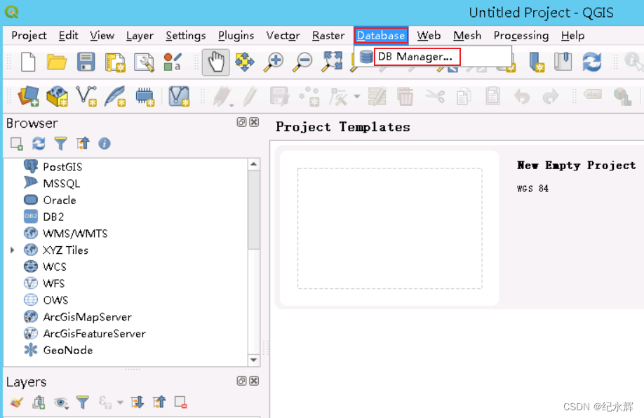
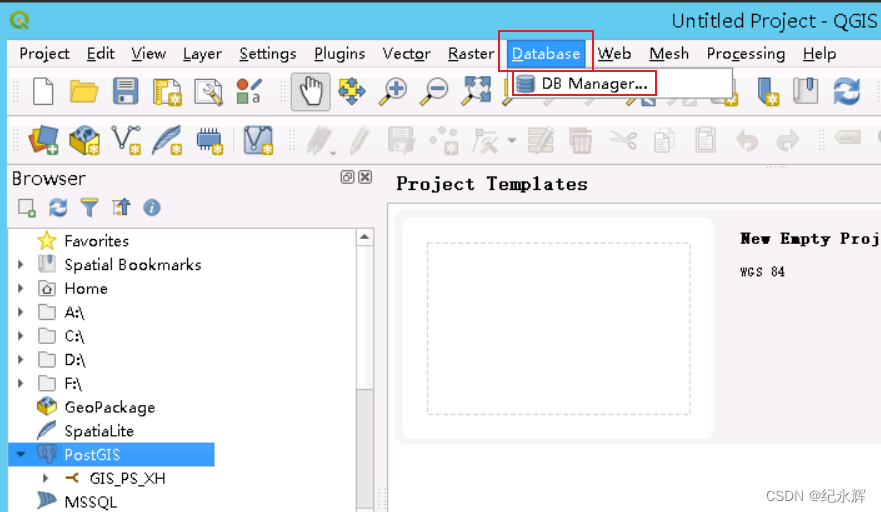
3、QGIS使用教程
4、OSGeo4W作用
OSGeo4W 开源地理空间基金会中文分会 开放地理空间实验室
5、导入shp文件:
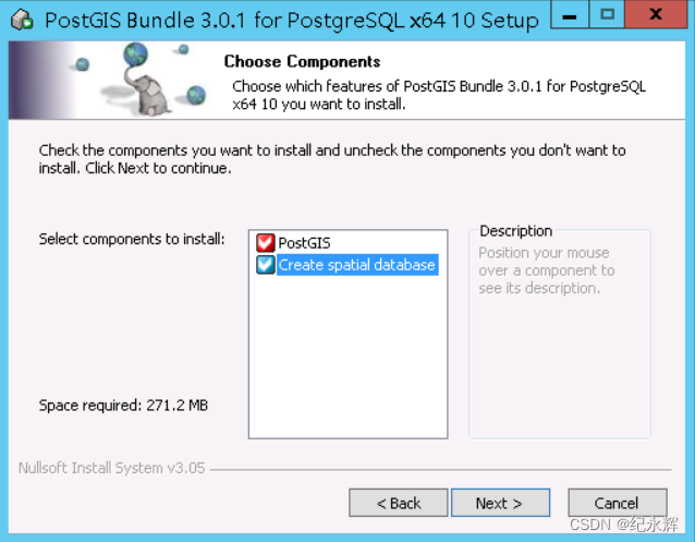
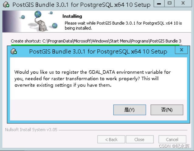
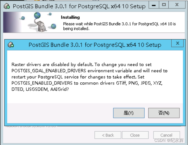
(1)、新建PG数据库;
安装过程:


安装Stack Builder


新建pg用户:
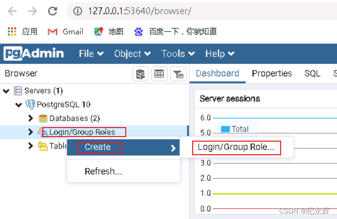


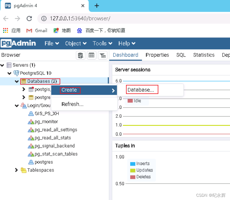
浏览器新建数据库:
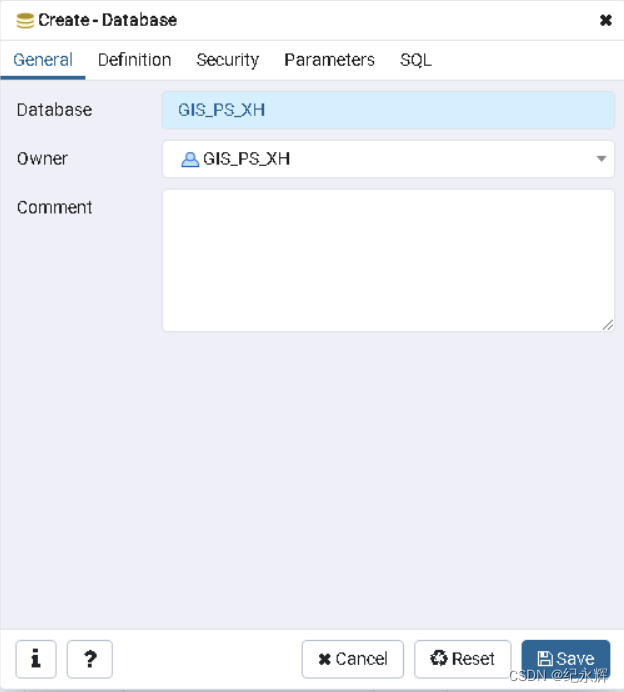
create user GIS_PS_XH superuser password 'your password';
(2)、QGIS导入数据时
先连接库
 然后在浏览器页面添加扩展,执行一个开启空间地理数据库支持的命令

然后添加数据
此处使用的postgres账户,不知道为啥,GIS_PS_XH无法使用

数据库管理器——导入数据——加载数据

参考:https://www.giserdqy.com/database/postgresql/23510/
(3)、使用postgis自带工具导入
打开工具:

导入工具连接方法:(使用postgres用户连接)


错误提示:
1、导入时如果提示dbf文件打不开,可能是因为路径包含中文;
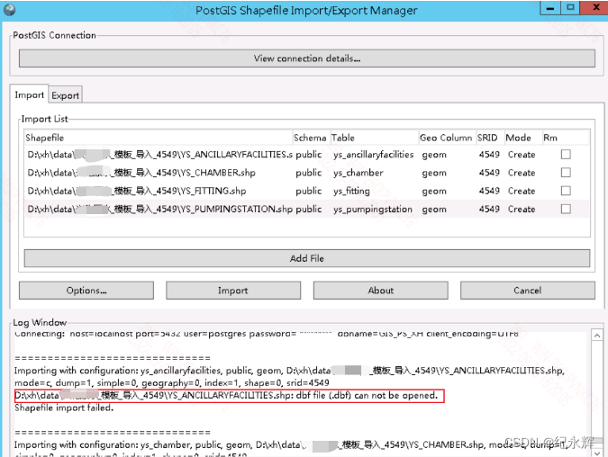 解决方法:将文件名改为英文;
2、添加数据存储时提示:

postgresql - Geoserver ERROR: function postgis_lib_version() - Stack Overflow
原因:geoserver机器和postgis机器网络不通
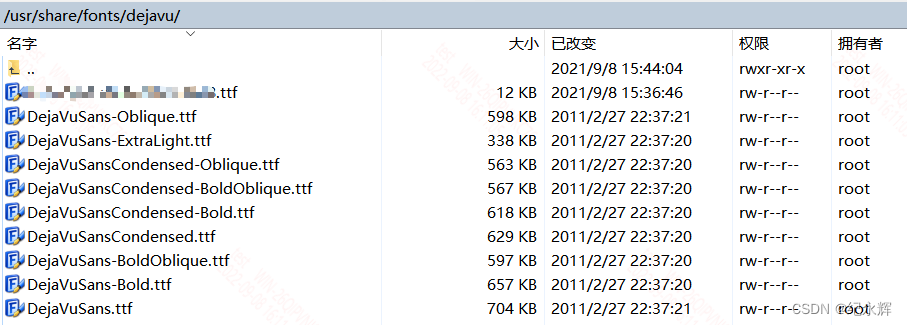
若要使用图标,远程桌面也必须有安装字体文件;
3、若提示:


解决方法:
执行语句:create extension postgis
PostgreSQL 异常处理 addgeometrycolumn_songzhilin52的博客-CSDN博客
4、只能用postgres用户登录数据库,GIS_PS_XH无法登录;
原因:暂时未知

参考:身份验证 - PostgreSQL错误:致命:角色“用户名”不存在 - ITranslater
postgresql - PostGIS仅适用于root用户 - Thinbug
导入参考:
安装postgis,使用postgis导入shapefile的步骤总结:
安装postgis,使用postgis导入shapefile的步骤总结_Geoleung的博客-CSDN博客
Shapefile导入PostGIS的两种方法介绍及比较:Shapefile导入PostGIS的两种方法介绍及比较_顽劣的石头的博客-CSDN博客_postgis shapefile
PostGIS数据库导入SHP数据:PostGIS数据库导入SHP数据_weixin_30466039的博客-CSDN博客
Qgis导入shp数据:https://www.jianshu.com/p/1f213e67b066
使用命令行Shapefile导入PostGIS的方法:新浪博客
6、发布服务
(1)、常规服务
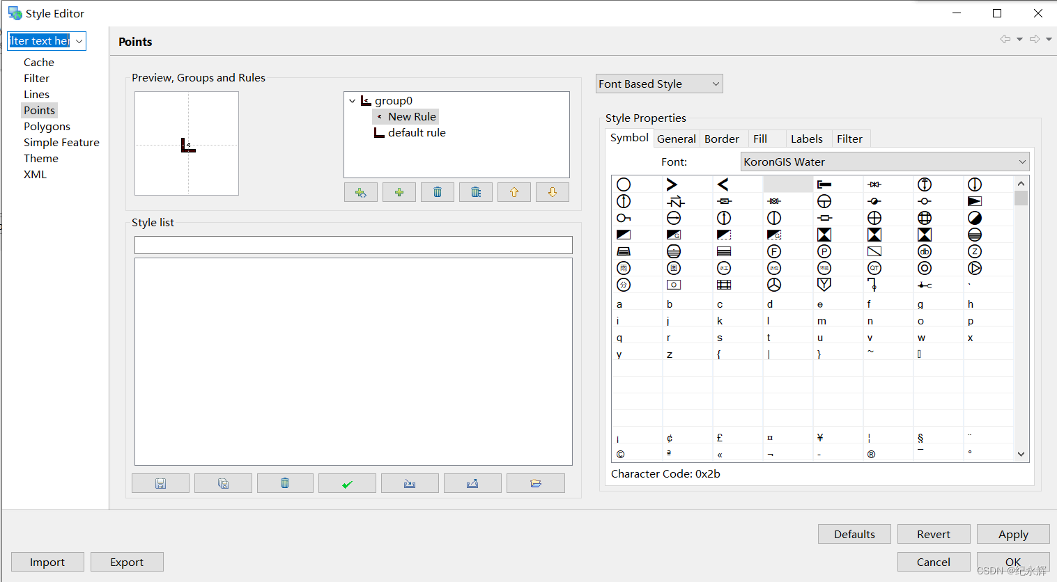
((1))新建style
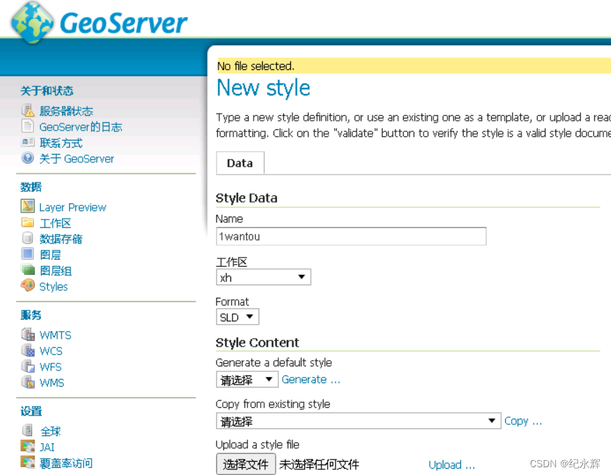
字体文件要放在固定目录才能被取到,不知道什么原因
((2))添加工作区

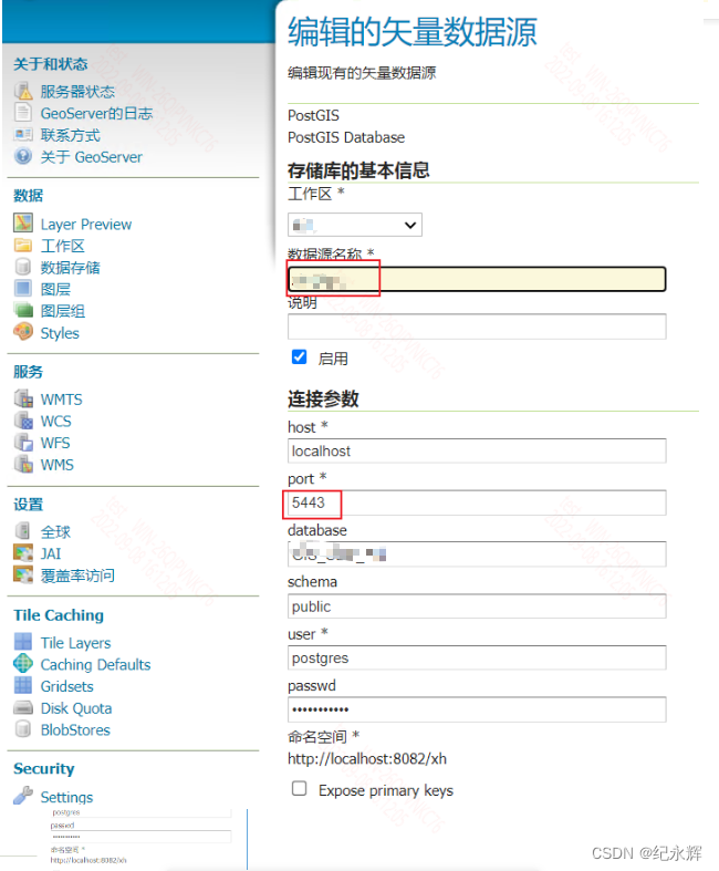
((3))添加数据存储
((4))新建图层(也就是进行图层发布)


((5))新建图层组

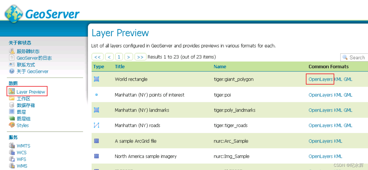
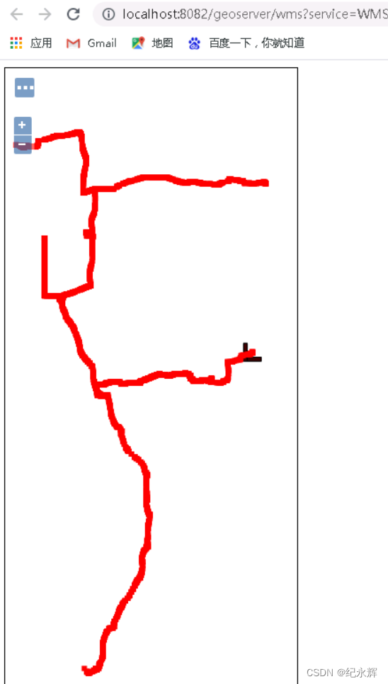
((6))预览
a、图层

b、图层组

(2)、新建遥感影像wtms服务
((1))新建切片策略

((2))添加到默认

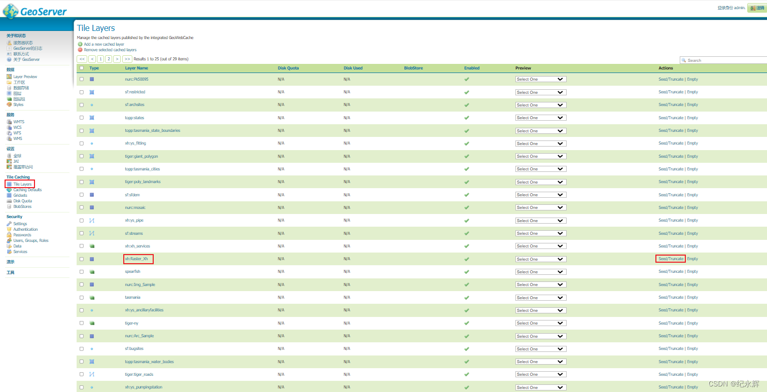
((3))图层发布tile caching里边选择新建的切片策略

((4.))在切片缓冲页面下找到发布的图层
((5))预览效果

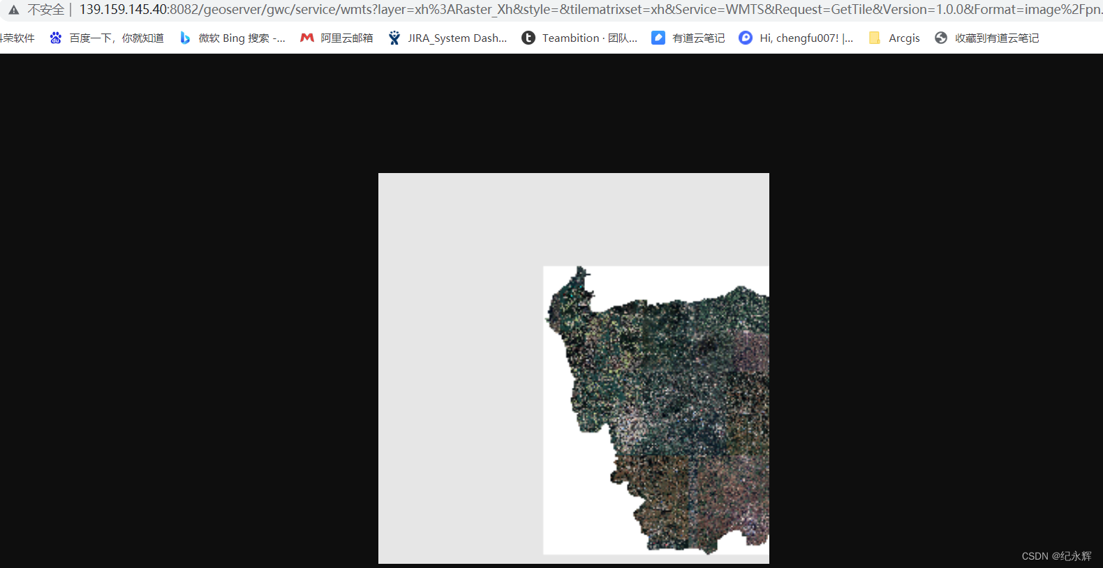
((6))预览时,按F12键可以看到每个图片地址
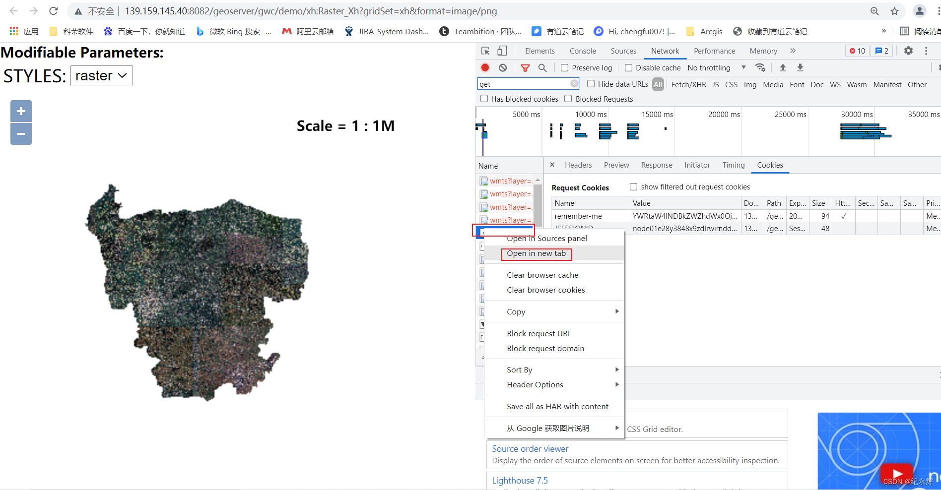
((7))在新窗口可以打开
((8))进入切片页面

开始级别,结束级别一定要选择好,否则不会切图

((9))单击提交,可以看到正在切图

参考:
使用GeoServer+QGIS发布WMTS服务 | Publishing WMTS Service Using GeoServer+QGIS - 天靖居士 - 博客园
在linux机器的geoserver上发布电子地图切片服务:
1、下载安装
选择GeoServer2.9.0和GeoWebCache1.10.0,都从官网下载,需要Java 8的支持。GeoServer可解压缩到任意位置,GeoWebCache需解压缩至GeoServer的webapps目录下,如“D:\geoserver-2.9.0\webapps\”,


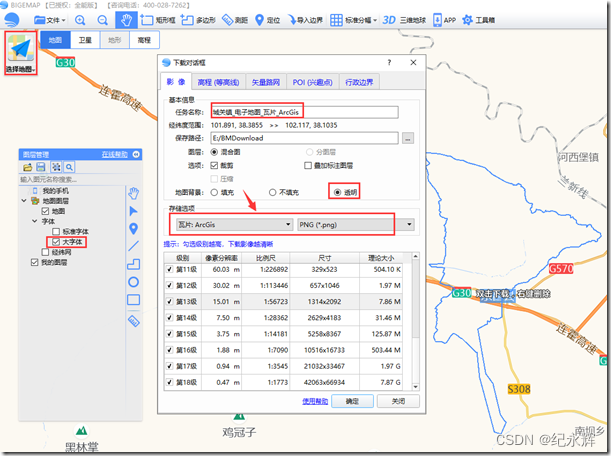
2、准备好ArcGIS瓦片数据(或者使用Bigemap下载ArcGIS瓦片数据)
3. GeoWebCache的配置
(1)新建缓存配置目录arcgiscache(姑且这么叫),并修改web-inf文件夹下的文件web.xml,在节点后添加如下节点,记录新建的目录:
GEOWEBCACHE_CACHE_DIR
/data/gis/XH/geoserver-2.10.0-bin/geoserver-2.10.0/data_dir/arcgiscache/

(2)重启服务
会发现该目录下自动生成了几个文件,注意这里的geowebcache.xml

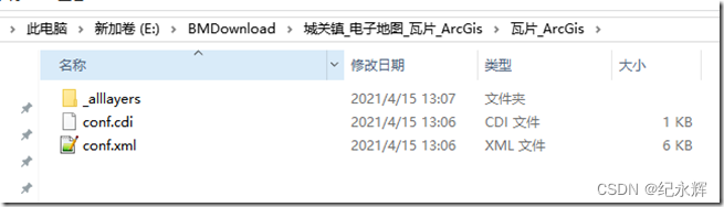
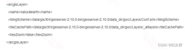
(3)添加ArcGIS切片的路径
将切片文件必须放在/data/gis/XH/geoserver-2.10.0-bin/geoserver-2.10.0/data_dir/gwc目录下,并修改/data/gis/XH/geoserver-2.10.0-bin/geoserver-2.10.0/data_dir/gwc/geowebcache.xml文件;
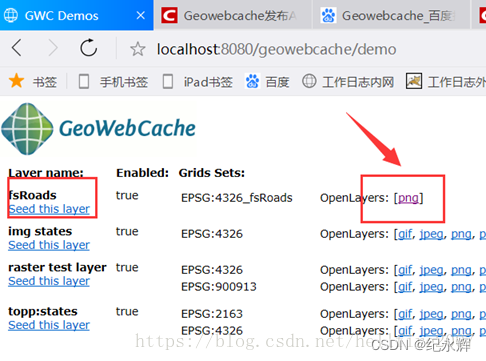
4. 浏览服务
再次重启GeoServer,进入GeoWebCache主页:
http://139.9.176.17:8060/geowebcache/home
在以下链接中可以看到发布的服务:
A list of all the layers and automatic demos

使用Openlayer即可浏览服务,出现文初的效果图。


参考:
使用GeoWebCache发布ArcGIS切片地图(实现高清电子地图) - 我命由我不由天—hao - 博客园
使用GeoServer(GeoWebCache插件)发布ArcGIS切片地图_笑轩辕的博客-CSDN博客_geoserver 发布arcgis瓦片
独立安装geoserver+geowebcache+发布arcgis切片服务_菜鸟在天的博客-CSDN博客
4、geoserver标注:


 1148
1148


 被折叠的 条评论
为什么被折叠?
被折叠的 条评论
为什么被折叠?
 到【灌水乐园】发言


