


Kibana8配置访问地图。
EFK集群升级8.13后创建Maps出现了问题,网上找不到,自己安装之前方式解决的。
错误日志:Data view does not contain any geospatial fields
解决思路:
新版本Mappings结构,可以看到比较7.10版本多了结构geo。
#旧7.10版本
"geoip": {
          "dynamic": "true",
          "properties": {
            "city_name": {
              "type": "text",
              "fields": {
                "keyword": {
                  "type": "keyword",
                  "ignore_above": 256
                }
              },
              "norms": false
            },


#新8.13版本
     "geoip": {
        "properties": {
          "geo": {
            "dynamic": "true",
            "properties": {
              "city_name": {
                "type": "text",
                "fields": {
                  "keyword": {
                    "type": "keyword",
                    "ignore_above": 256
                  }
                }
              },
.....
也可以在Data Views里面看到

且不论什么版本的geoip参数都是没有带Type:geo_point,需要修改你的Index Management。
所以根据这个思路,我们把旧版本的Index Management修改就行了。
1.logstash8.13配置geoip
修改logstash.conf
具体参数和安装.mmdb文件方法请参考我另外的置顶文章,下拉到EFK处。
filter {
    if [fields][log_topic] == "istio-ingress" {
      grok {
        match => {
              "message" => "\[%{TIMESTAMP_ISO8601:timestamp}\] \"%{WORD:verb} %{URIPATHPARAM:request} HTTP/%{NUMBER:http_version}\" %{INT:response} %{NOTSPACE:upstream_header} %{GREEDYDATA:upstream_error} %{NOTSPACE:upstream_error1} \"%{NOTSPACE:referrer}\" %{INT:bytes_in} %{INT:bytes_out} %{INT:duration} %{NOTSPACE:duration2} \"%{NOTSPACE:client_ip}\" \"%{GREEDYDATA:user_agent}\" \"%{UUID:request_id}\" \"%{HOSTNAME:hostname}\" \"%{GREEDYDATA:x_forwarded_for}\" %{GREEDYDATA:outbound_route} %{IPORHOST:destination_ip}:%{INT:destination_port0} %{IPORHOST:destination_ip}:%{INT:destination_port} %{IPORHOST:source_ip}:%{INT:source_port} %{HOSTNAME:source_hostname} %{NOTSPACE:after}"
        }
      }
      geoip {
              source => "source_ip"
              target => "geoip"
              database  =>  "/mnt/GeoLite2-City_20230707/GeoLite2-City.mmdb"
      }
     }
    }
修改完记得重启
2.kibana8.13添加Index Management
新建一个Index Management,并按照我的图步骤,没有的步骤则不需要修改。

{
  "index": {
    "number_of_shards": "1",
    "refresh_interval": "5s"
  }
}

最后保存后,Mappings长这样
{
  "dynamic_templates": [],
  "properties": {
    "@timestamp": {
      "type": "date"
    },
    "geoip": {
      "type": "object",
      "properties": {
        "geo": {
          "dynamic": true,
          "type": "object",
          "enabled": true,
          "properties": {
            "ip": {
              "index": true,
              "store": false,
              "type": "ip",
              "doc_values": true
            },
            "latitude": {
              "type": "float"
            },
            "location": {
              "type": "geo_point"
            },
            "longitude": {
              "type": "float"
            }
          }
        }
      }
    },
    "@version": {
      "type": "keyword"
    }
  }
}
3.创建Data Views

进入搜索location看是否存在geoip.geo.location,Type是geo_point。要有才行,没有就从头开始检查哪里和我的不一致。
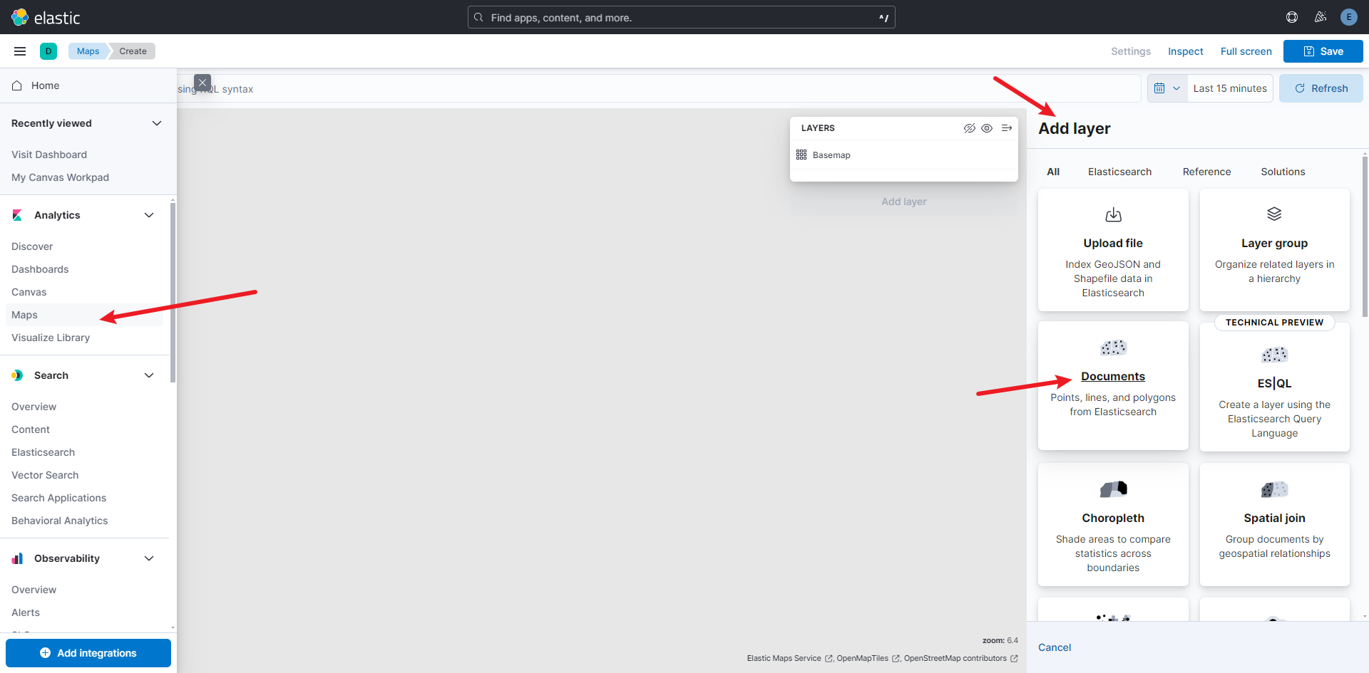
4.创建Maps
打开maps并Add layer,选择Documents,或者其它你喜欢的。
选择你的Data Views,就可以看到预览了,后续style就自己自定义吧。

算是全网独家吧,帮忙点个赞了!!!


 5593
5593


 被折叠的 条评论
为什么被折叠?
被折叠的 条评论
为什么被折叠?
 到【灌水乐园】发言


