


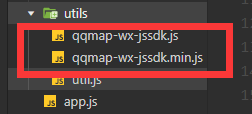
腾讯地图下载

放入
wxml页面
<button bindtap="access">获取位置</button>
<!--form表单-->
<form bindsubmit="formSubmit">
    <label>终点坐标:
    <input style="border:1px solid #000;" name="dest"></input>
    </label>
    <!--提交表单数据-->
    <button form-type="submit">计算距离</button>
</form>
<!--渲染起点经纬度到终点经纬度距离,单位为米-->
<view wx:for="{{distance}}" wx:key="index">
    <view>起点到终点的步行距离为{{item}}米</view>
</view>
<map id="myMap"
    markers="{{markers}}"
    style="width:100%;height:300px;"
    longitude="{{poi.longitude}}"
    latitude="{{poi.latitude}}" scale='16' show-location>
</map>
js
// pages/word/word.js
var QQMapWX = require('../../utils/qqmap-wx-jssdk.min.js');

// 实例化API核心类
var qqmapsdk = new QQMapWX({
    key: '自己的key' // 必填
});
Page({

  /**
   * 页面的初始数据
   */
  data: {
    res:'',
  },
  access(){
    var _this=this;
    wx.getLocation({
      type: 'wgs84',
      success (res) {
        const latitude = res.latitude
        const longitude = res.longitude
        qqmapsdk.reverseGeocoder({
          location: {
            latitude: latitude,
            longitude: longitude
          },
          success: function(res) {//成功后的回调
            console.log(res);
            var res = res.result;
            var mks = [];
            mks.push({ // 获取返回结果,放到mks数组中
              title: res.address,
              id: 0,
              latitude: res.location.lat,
              longitude: res.location.lng,
              iconPath: '',//图标路径
              width: 20,
              height: 20,
              callout: { //在markers上展示地址名称,根据需求是否需要
                content: res.address,
                color: '#000',
                display: 'ALWAYS'
              }
            });
            _this.setData({ //设置markers属性和地图位置poi,将结果在地图展示
              markers: mks,
              poi: {
                latitude: res.location.lat,
                longitude: res.location.lng
              },
              res:res.ad_info.city
            });
          },
        })
      },

     })

  },

  formSubmit(e) {
    console.log(e);
    var _this = this;
    qqmapsdk.geocoder({
      address: e.detail.value.dest, //传入地址(  address: '北京故宫', )
      success: function (res) {
        console.log(res);
        var path = res.result.location; //接口调用成功,取得地址坐标!!
        var strLocation = path.lat + ',' + path.lng;
        //调用距离计算接口
        qqmapsdk.calculateDistance({
          //mode: 'driving',//可选值:'driving'(驾车)、'walking'(步行),不填默认:'walking',可不填
          mode:'walking',
          //from参数不填默认当前地址
          //获取表单提交的经纬度并设置from和to参数(示例为string格式)
          from: '', //若起点有数据则采用起点坐标,若为空默认当前地址
          to: strLocation, //终点坐标
          success: function (res) { //成功后的回调
            console.log(res);
            var res = res.result;
            var dis = [];
            for (var i = 0; i < res.elements.length; i++) {
              dis.push(res.elements[i].distance); //将返回数据存入dis数组,
            }
            _this.setData({ //设置并更新distance数据
              distance: dis
            });
          },
          fail: function (error) {
            console.error(error);
          },
          complete: function (res) {
            console.log(res);
          }
        });
      }
    })
  },
  /**
   * 生命周期函数--监听页面加载
   */
  onLoad: function (options) {

  },

  /**
   * 生命周期函数--监听页面初次渲染完成
   */
  onReady: function () {

  },

  /**
   * 生命周期函数--监听页面显示
   */
  onShow: function () {

  },

  /**
   * 生命周期函数--监听页面隐藏
   */
  onHide: function () {

  },

  /**
   * 生命周期函数--监听页面卸载
   */
  onUnload: function () {

  },

  /**
   * 页面相关事件处理函数--监听用户下拉动作
   */
  onPullDownRefresh: function () {

  },

  /**
   * 页面上拉触底事件的处理函数
   */
  onReachBottom: function () {

  },

  /**
   * 用户点击右上角分享
   */
  onShareAppMessage: function () {

  }
})


 2157
2157


 被折叠的 条评论
为什么被折叠?
被折叠的 条评论
为什么被折叠?
 到【灌水乐园】发言


