


网站:https://search.earthdata.nasa.gov/
美国航空航天局(NASA)的 LP DAAC 在 2020 年发布的 DEM数据,分辨率为 30m,作为外部数据以消除地形对干涉相位的干扰。该产品基于 SRTM 处理改进、高程控制、空隙填充以及与其他高程数据(比如 ASTER、GDEM)的合并,改善高程数字模型的高度精度和数据覆盖范围,精度较高,覆盖了全球南北纬60度以内的区域,分为SRTM1和SRTM3,如下图所示:
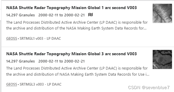
分别是1角秒和3角秒精度数据,即分辨率对应为30m,90m。
官方对SRTMGL1v003数据的描述:
Description
The Land Processes Distributed Active Archive Center (LP DAAC) is responsible for the archive and distribution of the NASA Making Earth System Data Records for Use in Research Environments (MEaSUREs) version SRTM, which includes the global 1 arc second (~30 meter) product.
NASA Shuttle Radar Topography Mission (SRTM) datasets result from a collaborative effort by the National Aeronautics and Space Administration (NASA) and the National Geospatial-Intelligence Agency (NGA - previously known as the National Imagery and Mapping Agency, or NIMA), as well as the participation of the German and Italian space agencies. The purpose of SRTM was to generate a near-global digital elevation model (DEM) of the Earth using radar interferometry. SRTM was a primary component of the payload on the Space Shuttle Endeavour during its STS-99 mission. Endeavour launched February 11, 2000 and flew for 11 days.
SRTM collected data in swaths, which extend from ~30 degrees off-nadir to ~58 degrees off-nadir from an altitude of 233 kilometers (km). These swaths are ~225 km wide, and consisted of all land between 60° N and 56° S latitude. This accounts for about 80% of Earth’s total landmass.
Each SRTMGL1 data tile contains a mosaic and blending of elevations generated by averaging all "data takes" that fall within that tile. These elevation files use the extension “.HGT”, meaning height (such as N37W105.SRTMGL1.HGT). The primary goal of creating the Version 3 data was to eliminate voids that were present in earlier versions of SRTM data. In areas with limited data, existing topographical data were used to supplement the SRTM data to fill the voids. The source of each elevation pixel is identified in the corresponding SRTMGL1N product (such as N37W105.SRTMGL1N.NUM).
The global 1 arc second SRTM product is also available in NetCDF4 format as the SRTMGL1_NC dataset with the source of each elevation pixel in the corresponding SRTMGL1_NUMNC product.
官方对3 arc second数据的描述:
Description
The Land Processes Distributed Active Archive Center (LP DAAC) is responsible for the archive and distribution of NASA Making Earth System Data Records for Use in Research Environments (MEaSUREs) SRTM, which includes the global 3 arc second (~90 meter) product. The 3 arc second data was derived from the 1 arc second using averaging methods. (See Figure 3 in the User Guide)
The NASA SRTM data sets result from a collaborative effort by the National Aeronautics and Space Administration (NASA) and the National Geospatial-Intelligence Agency (NGA - previously known as the National Imagery and Mapping Agency, or NIMA), as well as the participation of the German and Italian space agencies. This collaboration aims to generate a near-global digital elevation model (DEM) of Earth using radar interferometry. SRTM was the primary (and virtually only) payload on the STS-99 mission of the Space Shuttle Endeavour, which launched February 11, 2000 and flew for 11 days.
The SRTM swaths extended from ~30 degrees off-nadir to ~58 degrees off-nadir from an altitude of 233 kilometers (km), creating swaths ~225 km wide, and consisted of all land between 60° N and 56° S latitude to account for 80% of Earth’s total landmass.
The SRTMGL3 data were generated from SRTM1GL data that fall within that tile. These elevation files use the extension “.HGT”, meaning height (such as N37W105.SRTMGL3.HGT). The primary goal of creating the Version 3 data was to eliminate gaps, or voids, that were present in earlier versions of SRTM data. In areas with limited data, existing topographical data were used to supplement the SRTM data to fill the voids. The source of each elevation pixel is identified in the corresponding SRTMGL3N product (such as N37W105.SRTMGL3N.NUM).
The global 3 arc second SRTM product is also available in NetCDF4 format as the SRTMGL3_NC dataset with the source of each elevation pixel in the corresponding SRTMGL3_NUMNC product.


 1万+
1万+

 被折叠的 条评论
为什么被折叠?
被折叠的 条评论
为什么被折叠?
 到【灌水乐园】发言


