


 文章主要介绍了Qgis2threejs在处理三维高程数据时调整Z值以达到合理效果,解决了因浏览器限制导致的本地文件加载报错问题,通过设置高分辨率提高影像清晰度,并探讨了影像的最大显示质量。同时,文章还提到了插件的安装方法。
Qgis2threejs笔记
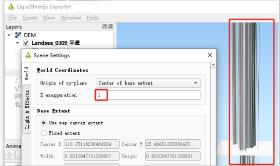
1.三维高程太高了,这里设置Z值,才合理
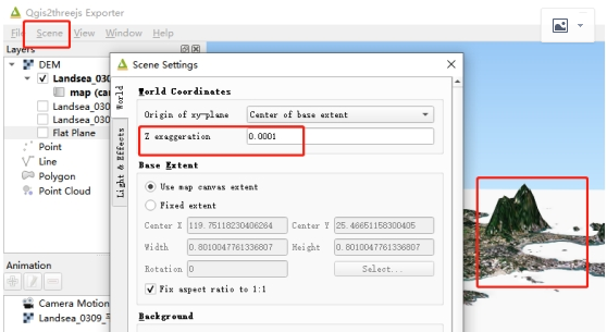
没设置前:
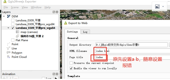
2.Qgis2threejs导出index.html
Qgis2threejs报错
This browser doesn't allow loading local files via Ajax. See plugin wiki page for details.
原因是因为导出时,设置名称不对,要设成index
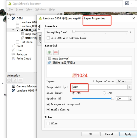
3.Qgis2threejs影像不清晰
这里设置分辨率最高4096
导出两组数据对比:
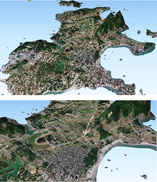
导出的三维模型也变清晰了,但这个是极限了,无法再清晰,但我的影像的清晰度还没被完全体现
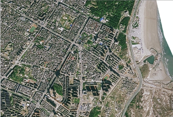
福州遥感影像16级数据
4.安装问题,直接在软件插件管理处下载


 4230
4230

 被折叠的 条评论
为什么被折叠?
被折叠的 条评论
为什么被折叠?
 到【灌水乐园】发言


