


1、DEM数据的下载:数据分享︱全国30 m分辨率DEM数据(ASTER GDEM V3、SRTM V3和NASA)本次主要分析三套数据,分别为:我国ASTER GDEM V3 、SRTM V3和NASA的30 m分辨率DME数据。 https://mp.weixin.qq.com/s/tmOc7nMd5NgvTKN2beUBLQ
ps: 根据指定的坐标范围获取DEM 数据:
2、SuperMap软件下载
SuperMap技术资源中心|为您提供全面的在线技术服务![]() http://support.supermap.com.cn/DownloadCenter/ProductPlatform.aspx
http://support.supermap.com.cn/DownloadCenter/ProductPlatform.aspx
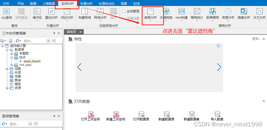
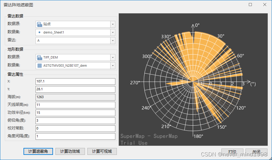
3、遮蔽角计算
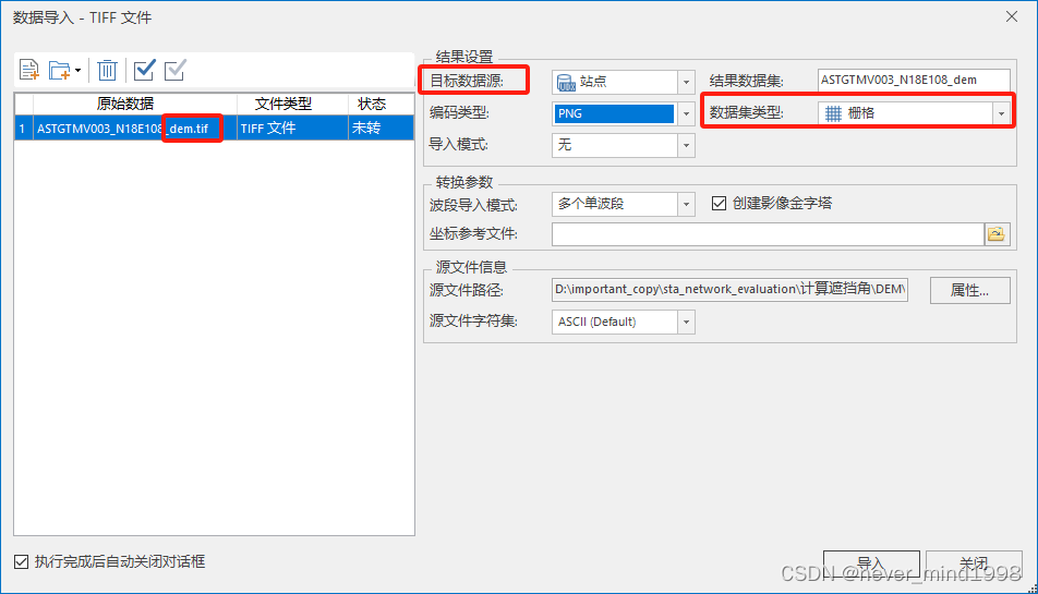
导入TIFF数据
选择*dem.tif,数据集类型选栅格,数据源不能为空
导入站点数据
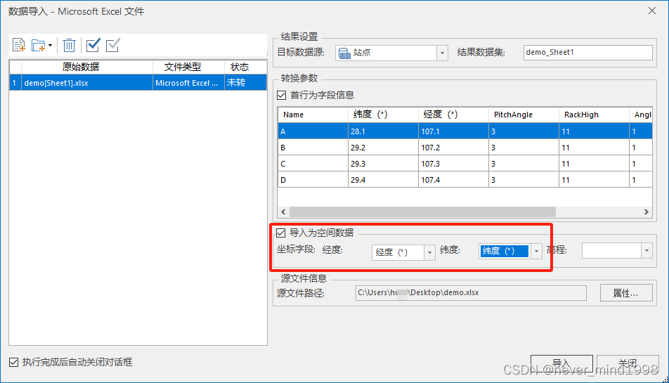
附:导入的站点数据格式(demo.xlsx)
| Name | 纬度(°) | 经度(°) | PitchAngle | RackHigh | AngleInterval | EfficacyScope |
| A | 28.1 | 107.1 | 3 | 11 | 1 | 15 |
| B | 29.2 | 107.2 | 3 | 11 | 1 | 15 |
| C | 29.3 | 107.3 | 3 | 11 | 1 | 15 |
| D | 29.4 | 107.4 | 3 | 11 | 1 | 15 |
| E | 29.5 | 107.5 | 3 | 11 | 1 | 15 |
计算遮蔽角


 4792
4792


 被折叠的 条评论
为什么被折叠?
被折叠的 条评论
为什么被折叠?
 到【灌水乐园】发言


