


Python地理做图——学习笔记
GMT
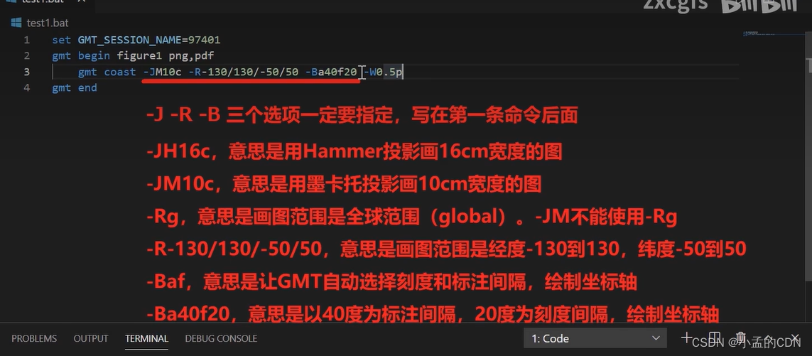
-J 投影方式
-R 区域
-B 网格
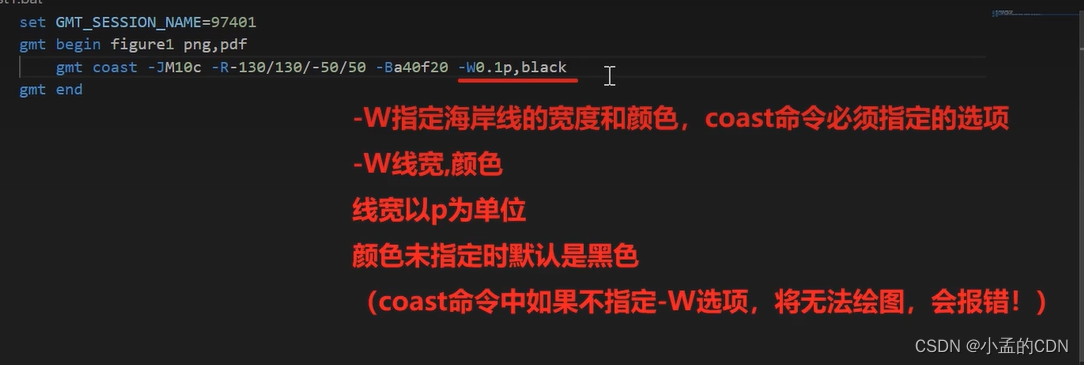
-W 线条
-G 陆地填充
-A 区域面积舍弃
-C 湖泊颜色
-D 岸线精度
-S 海洋颜色
绘制海岸线
不同投影
set GMT_SESSIOJ_NAME=97401
gmt begin test png

gmt coast -JM10c -R-130/130/-50/50 -Ba40f20g -W0.5p,red -Ggrey -A200 -Cblue -Df -Slightblue  -BESWN
Rem echo 5 2 \261 234 | gmt text -Jx1c -R0/10/0/4 -Baf -pdf test
rem echo 5 2 '\261 234' | gmt text -Jx1c -R0/10/0/4 -Baf -pdf test
gmt end

set GMT_SESSIOJ_NAME=97401
gmt begin test22 png
gmt end

绘制地形并叠加海岸线
 最低0.47元/天 解锁文章


 2601
2601


 被折叠的 条评论
为什么被折叠?
被折叠的 条评论
为什么被折叠?
 到【灌水乐园】发言


