


three.js创建3D地球
1 three-globe
three-globe是一个基于Three.js的开源项目,用于创建三维地球数据可视化。它通过WebGL技术,使用户能够在浏览器中展示地球上的各种数据,如国家边界、城市位置、温度分布等。使用three-globe开源项目可以快速的构建一个3D地球
2 使用示例
1 使用以下版本
"three": "^0.171.0",
"three-globe": "^2.35.3",
npm install three@^0.171.0 three-globe@^2.35.3
2 index.vue
<template>
    <div id="canvasEarth"></div>
    <div id="readerEarth"></div>
</template>

<script setup lang="js">
import * as THREE from "three"
import ThreeGlobe from 'three-globe'
//卫星模型
import {createSatellite} from '@/views/earth/satellite.ts';
//3D地球
import {createGlobe} from '@/views/earth/globe.ts';
//棱锥
import {createCone} from '@/views/earth/cone.ts';
//中国描边
import {createMapStroke} from '@/views/earth/cityLine.ts';
//3D地球模型对象
const Globe = new ThreeGlobe();
//场景对象
const scene = new THREE.Scene();
//设置地球材质透明度
var material=Globe.globeMaterial();
material.transparent = true;  // 启用透明度
material.opacity = 0.8;       // 设置透明度为 0.8
// 设置双面渲染,以避免穿透效果
material.side = THREE.DoubleSide;  // 双面渲染
// 设置 alpha 测试,这样可以避免透明度小于某个值时,材质仍然被渲染
material.alphaTest = 0.1;  // 透明度低于 0.1 时,材质不被渲染
scene.add(Globe);
//渲染地球
createGlobe(Globe,scene);
//渲染卫星
createSatellite( Globe);
//渲染棱锥
createCone( Globe);
//中国描边
 createMapStroke( Globe)


</script>
<style>
canvas { display: block; }

#canvasEarth {
    position: relative;
    width: 100%;
    height: 100%;
    top: -10%;
}
#readerEarth {
    position: absolute;
    top: 0;
    left: 0;
    pointer-events: none; /* Prevent it from blocking interactions */
}
.label-country{
    position: relative;
    left: 30px;
}
</style>
3 satellite.ts 需要一个卫星的3d建模
import { ColladaLoader } from 'three/addons/loaders/ColladaLoader.js';
import * as THREE from "three";
function createSatellite(Globe: any){
    const loader = new ColladaLoader();

    loader.load('/3D/model.dae', function (collada) {
        const satellite = collada.scene;
        satellite.scale.set(0.02,0.02,0.02);
        satellite.position.set(-70,70,70);

        Globe.add(satellite)
        var angle = 0;
        const radius = 130; // 轨道半径
        const path = new THREE.CurvePath();
        const curve = new THREE.EllipseCurve(0, 0, radius, radius, 0, Math.PI * 2);
        path.add(curve);
        (function animate() {
            if (satellite) {
                angle += 0.001; // 每一帧增加角度
                const position = path.getPointAt((angle % 1)); // 获取路径上的点
                satellite.position.set(position.x, position.y, 0); // 更新卫星位置
            }
            requestAnimationFrame(animate);
        })();
    });
}
export {createSatellite};
4 globe.ts
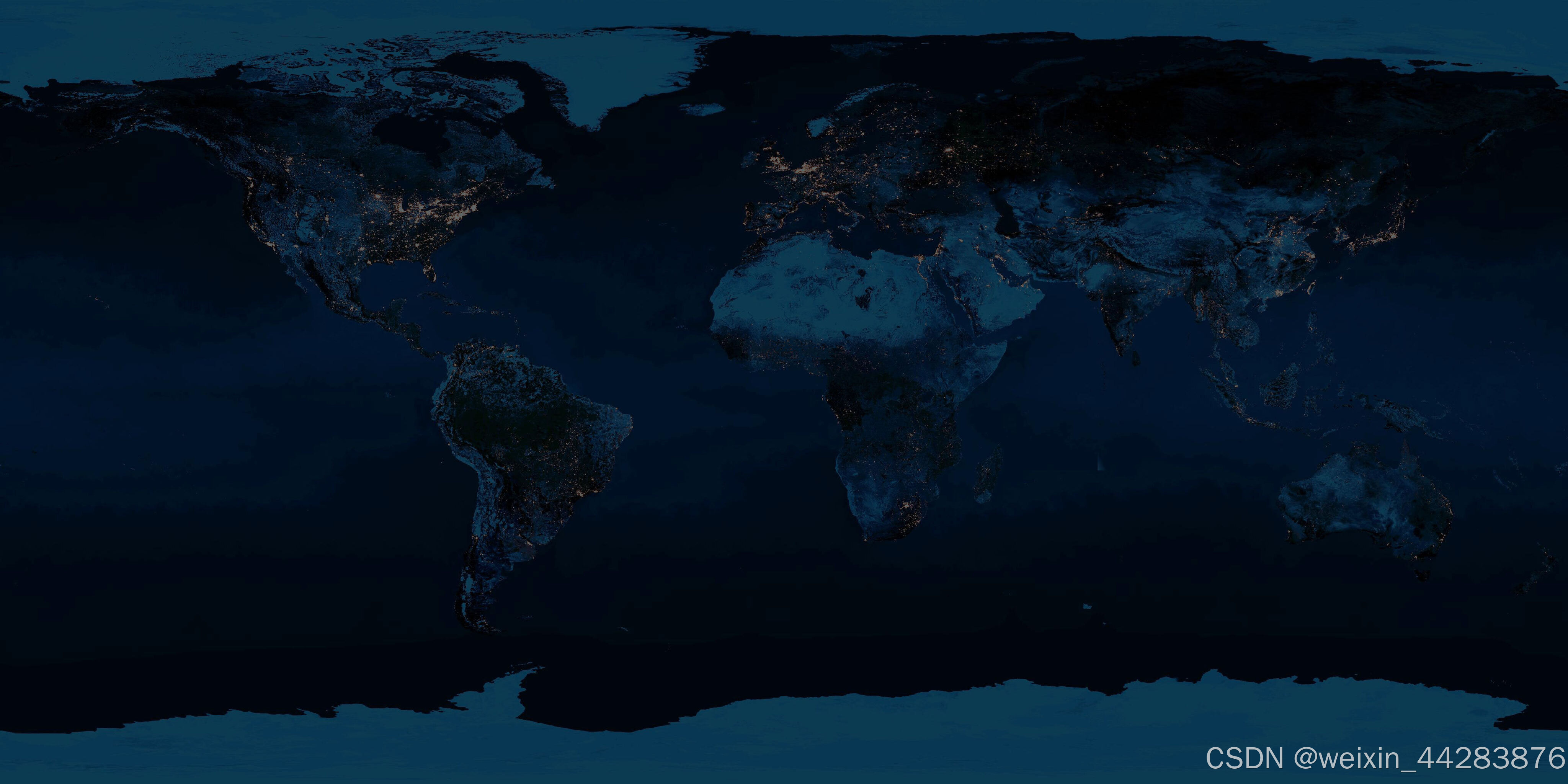
import marble from "@/assets/img/earth-night.jpg";
import * as THREE from "three";
import {OrbitControls} from 'three/addons/controls/OrbitControls.js';
import {CSS2DRenderer} from 'three/addons/renderers/CSS2DRenderer.js';
import {setWordData} from './data.ts';

function createGlobe(Globe: any, scene: THREE.Scene) {

    //设置3D地球 线,光点,光圈,文字
    setWordData(Globe);
    Globe.globeImageUrl(marble)
        .showAtmosphere(true) // 是否显示围绕地球的明亮光晕,代表大气层
        .atmosphereColor('rgba(94,165,196,0.24)') // 大气颜色
        .atmosphereAltitude(0.4) // 表示大气最大高
        .arcAltitudeAutoScale(0.6)
        .arcCurveResolution(128)
        .arcColor('color') // 线条颜色的 Arc 对象访问器函数或属性
        .arcDashLength('dashLength') // 用于表示圆弧中虚线段的长度
        .arcDashGap('dashGap') // 用于表示短划线段之间的间隙长度
        .arcDashInitialGap('dashInitialGap') // 初始间隙长度
        .arcStroke('stroke')
        .arcDashAnimateTime('dashAnimateTime') // 用于对整行长度从起点到终点置的运动进行动画处理。
        .arcsTransitionDuration(0); // 过渡持续时间
    // 环境光
    Globe.add(new THREE.AmbientLight(0xffffff, 10));
    // 设置相机
    const camera = new THREE.PerspectiveCamera();

    camera.aspect = window.innerWidth / window.innerHeight;
    camera.updateProjectionMatrix();
    camera.position.z = 450;
    //渲染器
    const renderer = new THREE.WebGLRenderer({
        alpha: true, antialias: true
    });
    renderer.setSize(window.innerWidth, window.innerHeight);
    const canvasContainer = document.getElementById('canvasEarth') as HTMLElement;
    canvasContainer.appendChild(renderer.domElement);
    var css2DRenderer = new CSS2DRenderer();
    css2DRenderer.setSize(window.innerWidth, window.innerHeight);
    css2DRenderer.domElement.style.position = 'absolute';  // 保持绝对定位
    css2DRenderer.domElement.style.top = '0px';
    css2DRenderer.domElement.style.zIndex = '1'; // 确保它不遮挡 WebGL 渲染器
    css2DRenderer.domElement.style.pointerEvents = 'none'; // 禁止捕获鼠标事件
    canvasContainer.appendChild(css2DRenderer.domElement);


    //  轨道偏移器
    const tbControls = new OrbitControls(camera, renderer.domElement);
    tbControls.enableZoom = false;
    tbControls.update();

    (function animate() {
        requestAnimationFrame(animate);
        Globe.rotateY(0.001);
        tbControls.update();
        renderer.render(scene, camera);
        css2DRenderer.render(scene, camera);
    })();
    // 监听窗口尺寸变化
    window.addEventListener('resize', () => {
        // 更新渲染器大小
        renderer.setSize(window.innerWidth, window.innerHeight);
        css2DRenderer.setSize(window.innerWidth, window.innerHeight);
        // 更新摄像机的纵横比
        camera.aspect = window.innerWidth / window.innerHeight;
        camera.updateProjectionMatrix();  // 更新投影矩阵
    });

}

export {createGlobe}
5 data.ts
import {getRandomItems} from "@/views/util/randomItems.ts";
import mygeo from "@/assets/json/mygeo.json";
import * as THREE from "three";
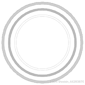
import aperture from "@/assets/img/aperture.png";
import pointJPG from "@/assets/img/point.png";
import {createTag} from "@/views/earth/tag.ts";
const apertureGroup = new THREE.Group();
const pointGroup = new THREE.Group()
let labelObject = new THREE.Group()
let arcsData: any[] = [];
let arcsDataCopy: any[] = [];
const mashNormal = new THREE.Vector3(0, 0, 1);
function setWordData(Globe:any){
setInterval(async () => {
arcsData = [];
arcsDataCopy = [];
pointGroup.clear();
apertureGroup.clear();
labelObject.clear();
// const elements = document.querySelectorAll(".label-country");
// elements.forEach(element => {
// element.remove()
// });
const coordItem = getRandomItems(mygeo, 10);
coordItem.forEach((arc: any) => {
arcsData.push({
startLat: arc.coordinate[1],
startLng: arc.coordinate[0],
endLat: 28.45892581576906,
endLng: 116.539649563166506,
size: Math.random() * 1,
dashLength: 1,
stroke: 0.5,
dashAnimateTime: 1,
dashInitialGap: 1,
dashGap: 0,
r: 1,
country: arc.country,
op: "-",
city: arc.city,
color: 'rgba(16,220,228,0.5)'
})
})
arcsData.push({
startLat: 28.45892581576906,
startLng: 116.539649563166506,
endLat: 28.45892581576906,
endLng: 116.539649563166506,
size: Math.random() * 1,
dashLength: 1,
stroke: 0.5,
dashAnimateTime: 1,
dashInitialGap: 1,
dashGap: 0,
r: 1.15,
country: '中国',
op: "-",
city: '南昌',
color: '#5fd0da'
})
arcsDataCopy = arcsData
arcsData.forEach(arc => {
arcsDataCopy.push({
startLat: arc.startLat,
startLng: arc.startLng,
endLat: 28.45892581576906,
endLng: 116.539649563166506,
size: Math.random() * 1,
dashLength: 0.02,
stroke: 1.5,
dashAnimateTime: Math.floor(Math.random() * (2500 - 1500 + 1)) + 1500,
dashInitialGap: 1.3,
dashGap: 1,
color: 'rgba(243,158,0,0.8)'
})
// 添加光圈
const geometry = new THREE.PlaneGeometry(12, 12);
const texture = new THREE.TextureLoader().load(aperture);
const apertureMaterial = new THREE.MeshBasicMaterial({
color: 0xffffff,
map: texture,
transparent: true,
aoMapIntensity: 0,
side: THREE.DoubleSide
})
const apertureMesh = new THREE.Mesh(geometry, apertureMaterial)
const apertureCoords = Globe.getCoords(arc.startLat, arc.startLng);
const apertureVector3 = new THREE.Vector3(apertureCoords.x, apertureCoords.y, apertureCoords.z).normalize()
apertureMesh.position.set(apertureCoords.x * arc.r, apertureCoords.y * arc.r, apertureCoords.z * arc.r);
apertureMesh.quaternion.setFromUnitVectors(mashNormal, apertureVector3)
apertureGroup.add(apertureMesh);
//添加光点
const pointGeometry = new THREE.PlaneGeometry(4, 4);
const pointTexture = new THREE.TextureLoader().load(pointJPG);
const pointMaterial = new THREE.MeshBasicMaterial({
color: 0xd2cccc,
map: pointTexture,
transparent: true
})
const pointMesh = new THREE.Mesh(pointGeometry, pointMaterial)
pointMesh.position.set(apertureCoords.x * 1.01, apertureCoords.y * 1.01, apertureCoords.z * 1.01);
pointMesh.quaternion.setFromUnitVectors(mashNormal, apertureVector3)
pointGroup.add(pointMesh);
var _s = Math.random();
(function aperturAnimate() {
_s += 0.01;
apertureMesh.scale.set(_s, _s, _s)
if (_s <= 1.7) {
apertureMesh.material.opacity = (_s - 1.0) / (1.7 - 1.0)
} else if (_s > 1.7 && _s <= 2.5) {
apertureMesh.material.opacity = 1 - (_s - 1.7) / (2.5 - 1.7)
} else {
_s = 1.0
}
requestAnimationFrame(aperturAnimate);
})();
})
labelObject = createTag(Globe, arcsData);
Globe.add(labelObject)
Globe.add(apertureGroup)
Globe.add(pointGroup)
Globe.arcsData(arcsDataCopy) // 弧映射图层中列表
}, 8000)
}
export {setWordData}
6 tag.ts
import { CSS2DObject } from 'three/addons/renderers/CSS2DRenderer.js';
import * as THREE from "three";

function createTag(Globe: any,arcsData:any){
    const labelGroup = new THREE.Group()

    arcsData.forEach((country: any)=>{
        const Gt = Globe.getCoords(country.startLat, country.startLng);
        var label = document.createElement('div');
        label.className = 'label-country';
        label.textContent = country.country;
        label.style.color = 'rgb(237,236,236)';
        label.style.fontSize = '0.8vw';
        label.style.opacity = '0.7';
        label.style.backgroundColor = 'rgba(42,142,196,0.53)';
        label.style.padding = '0.3vw 0.6vw';
        label.style.borderRadius = '0.2vw';
        label.style.pointerEvents ='none';//避免HTML标签遮挡三维场景的鼠标事件//·设置HTML元素标签在three.js世界坐标中位置
        var labelObject = new CSS2DObject(label);
        labelObject.position.set(Gt.x,Gt.y,Gt.z);
        labelGroup.add(labelObject)
    })

    return labelGroup;
}
export {createTag}
7 cone.ts
import * as THREE from "three"


function createCone(Globe: any){
    const Gt = Globe.getCoords(28.45892581576906, 116.539649563166506);
    const Vector3 = new THREE.Vector3(Gt.x, Gt.y, Gt.z).normalize()
    const mashNormal = new THREE.Vector3(0, 0, 1);
    // 设置棱锥
    const height = 15
    const coneGeometry = new THREE.ConeGeometry(4, height, 4);
    coneGeometry.rotateX(-Math.PI / 2)
    coneGeometry.translate(0, 0, height / 2)
    const coneMaterial = new THREE.MeshLambertMaterial({color: 0x10dce4});
    const coneMesh = new THREE.Mesh(coneGeometry, coneMaterial);
    const coneMesh2 = coneMesh.clone()
    coneMesh2.scale.z = 0.5
    coneMesh2.position.z = height * (1 + coneMesh2.scale.z)
    coneMesh2.rotateX(Math.PI)
    coneMesh.add(coneMesh2)
    coneMesh.position.set(Gt.x, Gt.y, Gt.z);
    coneMesh.quaternion.setFromUnitVectors(mashNormal, Vector3)
    Globe.add(coneMesh);
    var _r = 1.06;
    (function animate() {
        _r -= 0.001;
        if (_r <= 1.0) {
            _r = 1.06;
        }
        coneMesh.rotateZ(0.05);
        coneMesh.position.set(Gt.x * _r, Gt.y * _r, Gt.z * _r);
        requestAnimationFrame(animate);
    })();
}
export {createCone}
8 cityLine.ts
import * as THREE from "three"
import chinaInfoJson from '../china/json/china.json'


export const createMapStroke = (Globe:any) => {
    const cityStroke = new THREE.Object3D();
    cityStroke.name = "cityStroke";

    const lineMaterial = new  THREE.LineBasicMaterial({
        color: 0xb9995b,
        opacity: 0.5,    // 初始透明度
        transparent: true,  // 透明度控制
        side: THREE.DoubleSide
    });

    chinaInfoJson.features.forEach((elem: any) => {
        const provinceLine = new  THREE.Group();
        provinceLine.name = elem.properties.name;
        const coordinates = elem.geometry.coordinates;
        coordinates.forEach((multiPolygon: any) => {
            multiPolygon.forEach((polygon: any) => {
                const line = createCityLine(polygon, lineMaterial,Globe);
                provinceLine.add(line);
            });
        });
        cityStroke.add(provinceLine);
    })
    Globe.add(cityStroke);
}

/**
 * 球面画线
 * @param polygon
 * @param lineMaterial
 */
export const createCityLine = (polygon: any, lineMaterial:  THREE.LineBasicMaterial,Globe:any) => {
    const positions = [];
    const linGeometry = new  THREE.BufferGeometry();
    for (let i = 0; i < polygon.length; i++) {
        let pos = Globe.getCoords( polygon[i][1], polygon[i][0]);
        positions.push(pos.x, pos.y, pos.z);
    }
    linGeometry.setAttribute(
        "position",
        new THREE.Float32BufferAttribute(positions, 3)
    );

    return new THREE.Line(linGeometry, lineMaterial)
}
9 randomItems.ts 随机获取 number 条数据
function getRandomItems(arr:any, count:number) {
    const shuffled = arr.slice(); // 复制数组
    let i = arr.length, randomIndex, temp;

    // 洗牌算法(Fisher-Yates shuffle)
    while (i--) {
        randomIndex = Math.floor(Math.random() * (i + 1)); // 生成随机索引
        temp = shuffled[i];
        shuffled[i] = shuffled[randomIndex];
        shuffled[randomIndex] = temp;
    }

    // 返回前 count 条数据
    return shuffled.slice(0, count);
}
export {getRandomItems}
静态资源
GeoJSON 格式的全球,全国地理数据,这个可以去网上找
地球贴图
圆环
点
mygeo.json
[
  {
    "country": "科特迪瓦",
    "city": "阿比让",
    "coordinate": [
      4.016666666666667,
      5.316666666666666
    ]
  },
  ......  //这里填写更多的地区坐标信息
    {
    "country": "瑞士",
    "city": "苏黎世",
    "coordinate": [
      8.533333333333333,
      47.36666666666667
    ]
  }
]


 3182
3182

 被折叠的 条评论
为什么被折叠?
被折叠的 条评论
为什么被折叠?
 到【灌水乐园】发言


