


一、目的:
我们的小程序还设计了导航功能,方便用户可以实现从当前的定位到达目标地点的功能。这里我们确定目的地为省立医院,然后从当前位置进行导航。
二、实现过程:
首先我们需要高德地图SDK
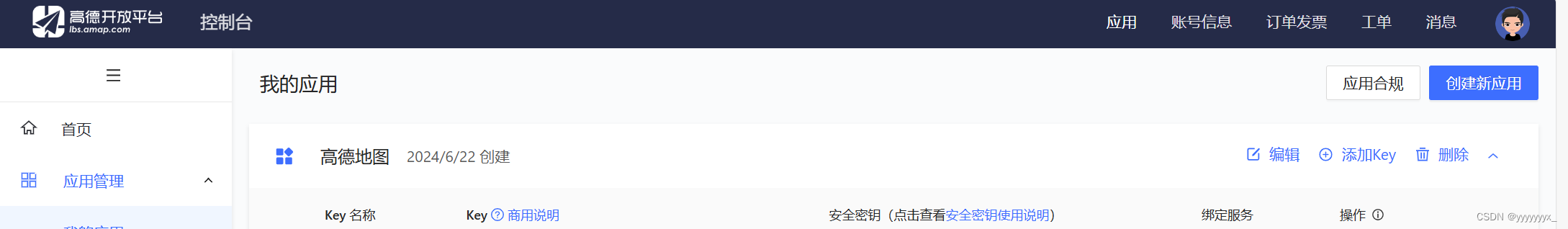
并且要获取高德地图的SDK。获取完高德地图的KEY,我们就可以将其运用于我们小程序的开发当中了。
这里因为我们进行了路线规划,因此分为三种出行方式,分别是打车、步行以及公交车。
我们先来看看我们的页面文件wxml的编写。
map.wxml:
<view class="flex-style">
<view class="flex-item active" bindtouchstart="goToCar">驾车</view>
<view class="flex-item" bindtouchstart="goToWalk">步行</view>
<view class="flex-item" bindtouchstart="goToBus">公交</view>
</view>
<view class="map_box">
<map id="navi_map" longitude="117.121787" latitude="36.662872" scale="12" markers="{{markers}}" polyline="{{polyline}}"></map>
</view>
<view class="text_box">
<view class="text">{{distance}}</view>
<view class="text">{{cost}}</view>
<view class="detail_button" bindtouchstart="goDetail">详情</view>
</view>
map.wxss:
flex-style{
display: -webkit-box;
display: -webkit-flex;
display: flex;
}
.flex-item{
height: 35px;
line-height: 35px;
text-align: center;
-webkit-box-flex: 1;
-webkit-flex: 1;
flex: 1
}
.flex-item.active{
color:#0091ff;
}
.map_box{
position:absolute;
top: 35px;
bottom: 90px;
left: 0px;
right: 0px;
}
#navi_map{
width: 100%;
height: 100%;
}
.text_box{
position:absolute;
height: 90px;
bottom: 0px;
left: 0px;
right: 0px;
}
.text_box .text{
margin: 15px;
}
.detail_button{
position:absolute;
bottom: 30px;
right: 10px;
padding: 3px 5px;
color: #fff;
background: #0091ff;
width:50px;
text-align:center;
border-radius:5px;
}
map.js:
// 引入高德地图 SDK
var amapFile = require('../../components/amap-wx.130.js');
Page({
data: {
distance: '',
cost: '',
polyline: [],
userLatitude: '',
userLongitude: ''
},
onLoad: function() {
var that = this;
// 获取用户当前位置
wx.getLocation({
type: 'gcj02',
success: function(res) {
that.setData({
userLatitude: res.latitude,
userLongitude: res.longitude,
markers: [{
iconPath: "../../images/地址.png",
id: 0,
latitude: res.latitude,
longitude: res.longitude,
width: 23,
height: 33
},{
iconPath: "../../images/地址.png",
id: 1,
latitude: 36.662872,
longitude: 117.121787,
width: 23,
height: 33
}]
});
// 设置用户当前位置为起点
var origin = `${res.longitude},${res.latitude}`;
console.log(origin)
var destination = '117.121787,36.662872'; // 目标位置
wx.setStorageSync('origin', origin);
wx.setStorageSync('destination', destination);
var myAmapFun = new amapFile.AMapWX({key: 'bb158e5992062d0949aeb34bd27c7d78'});
myAmapFun.getDrivingRoute({
origin: origin,
destination: destination,
success: function(data){
var points = [];
if(data.paths && data.paths[0] && data.paths[0].steps){
var steps = data.paths[0].steps;
for(var i = 0; i < steps.length; i++){
var poLen = steps[i].polyline.split(';');
for(var j = 0;j < poLen.length; j++){
points.push({
longitude: parseFloat(poLen[j].split(',')[0]),
latitude: parseFloat(poLen[j].split(',')[1])
})
}
}
}
that.setData({
polyline: [{
points: points,
color: "#0091ff",
width: 6
}]
});
if(data.paths[0] && data.paths[0].distance){
that.setData({
distance: data.paths[0].distance + '米'
});
}
if(data.taxi_cost){
that.setData({
cost: '打车约' + parseInt(data.taxi_cost) + '元'
});
}
},
fail: function(info){
console.log(info);
}
})
},
fail: function(err) {
console.error('获取定位失败:', err);
wx.showToast({
title: '获取定位失败',
icon: 'none'
});
}
});
},
goDetail: function(){
wx.navigateTo({
url: '../car_detail/car_detail?origin=${origin}&destination=${destination}'
})
},
goToCar: function (e) {
wx.redirectTo({
url: '../map/map'
})
},
goToBus: function (e) {
wx.redirectTo({
url: '../bus/bus'
})
},
goToWalk: function (e) {
wx.redirectTo({
url: '../walk/walk'
})
}
})
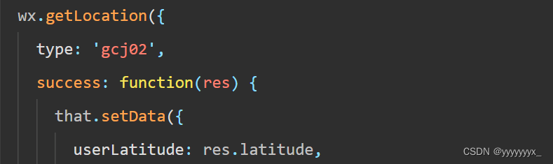
比较重要的就是这个map.js了,首先我们应该通过微信的接口wx.getLocation获取用户当前定位并进行存储。
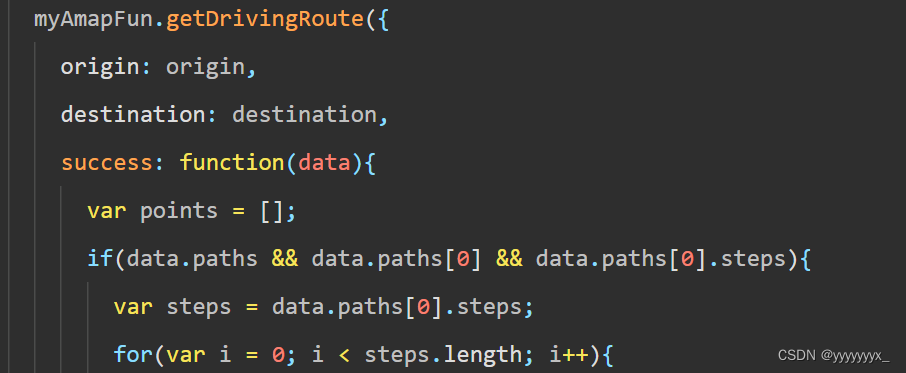
因为我们的目标地点是确定的所以我们可以固定经纬度,直接调用去获取路线规划。
实现效果:


 1370
1370


 被折叠的 条评论
为什么被折叠?
被折叠的 条评论
为什么被折叠?
 到【灌水乐园】发言


