


目录
1、通过样式信息和几何信息构建要素;
2、将要素添加到矢量数据源;
3、将矢量数据源添加到矢量图层;
4、添加矢量图层到地图容器。
1、添加点
//创建一个点
var point = new ol.Feature({
	geometry: new ol.geom.Point([117.2, 35.8] ),
  })
//设置点的样式信息
point.setStyle(
  new ol.style.Style({
	//填充色
	fill: new ol.style.Fill({
	  color: 'rgba(255, 255, 255, 0.2)',
	}),
	//边线颜色
	stroke: new ol.style.Stroke({
	  color: '#ffcc33',
	  width: 2,
	}),
	//形状
	image: new ol.style.Circle({
	  radius: 17,
	  fill: new ol.style.Fill({
		color: '#ffcc33',
	  }),
	}),
  })
)

// 需要一个vector的layer来放置点
var layer = new ol.layer.Vector({
  source: new ol.source.Vector()
})


var url = 'https://map.geoq.cn/ArcGIS/rest/services/ChinaOnlineCommunity/MapServer/tile/{z}/{y}/{x}';

var view = new ol.View({
	center: [117.23, 36.43],
	zoom: 10,
	projection: 'EPSG:4326'//设置坐标系,地图本身3857坐标系,即横轴墨卡托投影,因为中心点用的度,所以设置成wgs84代号是4326
  });
var map = new ol.Map({
  // 设置地图图层
  layers: [
	new ol.layer.Tile({ source: new ol.source.XYZ({ url: url }) }),
	layer
  ],
  // 设置显示地图的视图
  view: view,
  // 让id为map的div作为地图的容器
  target: 'mapCon',
});

layer.getSource().addFeature(point);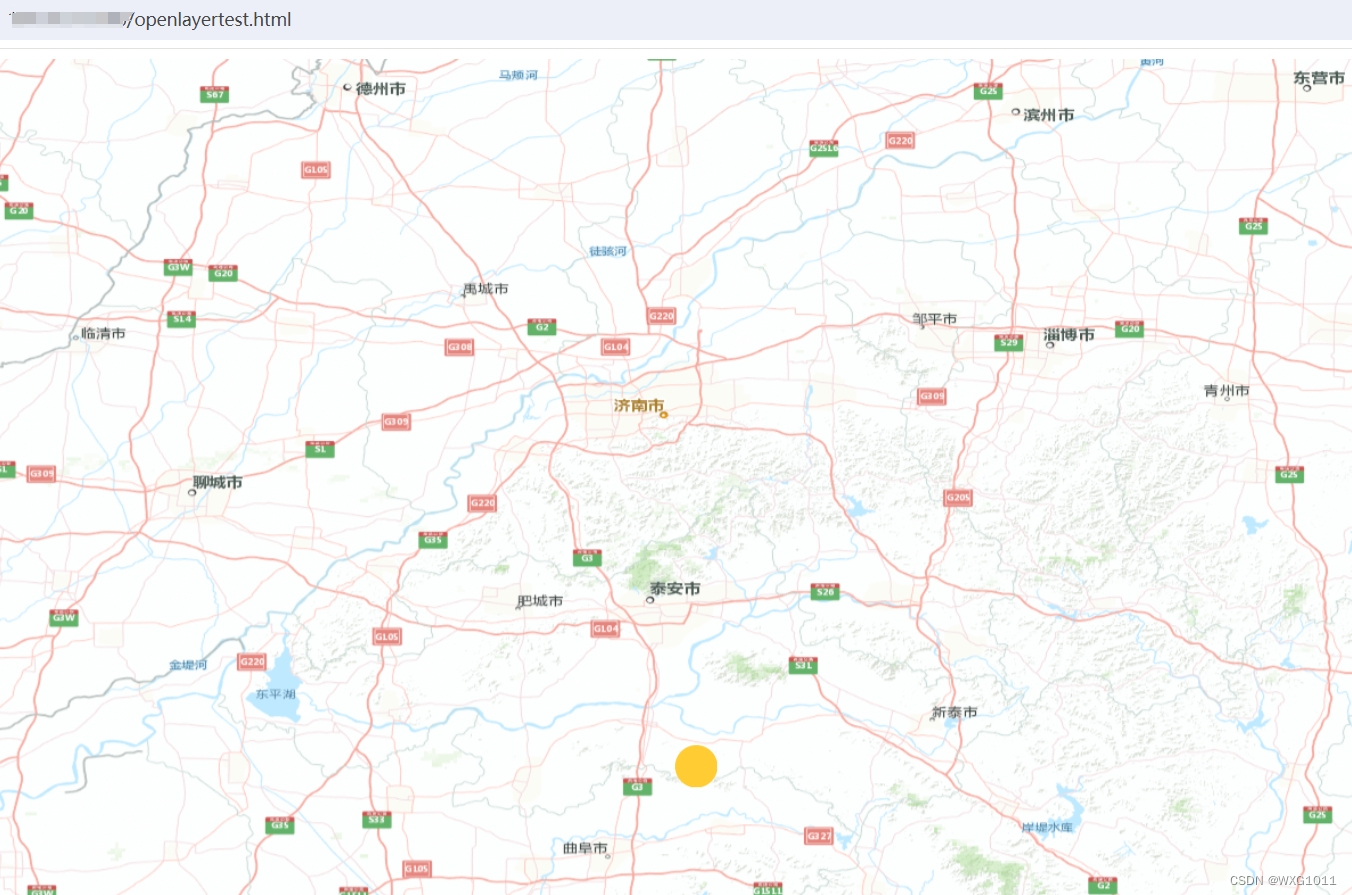
2、添加线
//创建一条线
var Line = new ol.Feature({
	geometry: new ol.geom.LineString([[117.2, 35.8], [117.48, 36.8]]),
})
//设置点的样式信息
Line.setStyle(
  new ol.style.Style({
	//填充色
	fill: new ol.style.Fill({
	  color: 'rgba(255, 255, 255, 0.2)',
	}),
	//边线颜色
	stroke: new ol.style.Stroke({
	  color: '#ffcc33',
	  width: 2,
	}),
	//形状
	image: new ol.style.Circle({
	  radius: 17,
	  fill: new ol.style.Fill({
		color: '#ffcc33',
	  }),
	}),
  })
)

。。。

layer.getSource().addFeature(Line);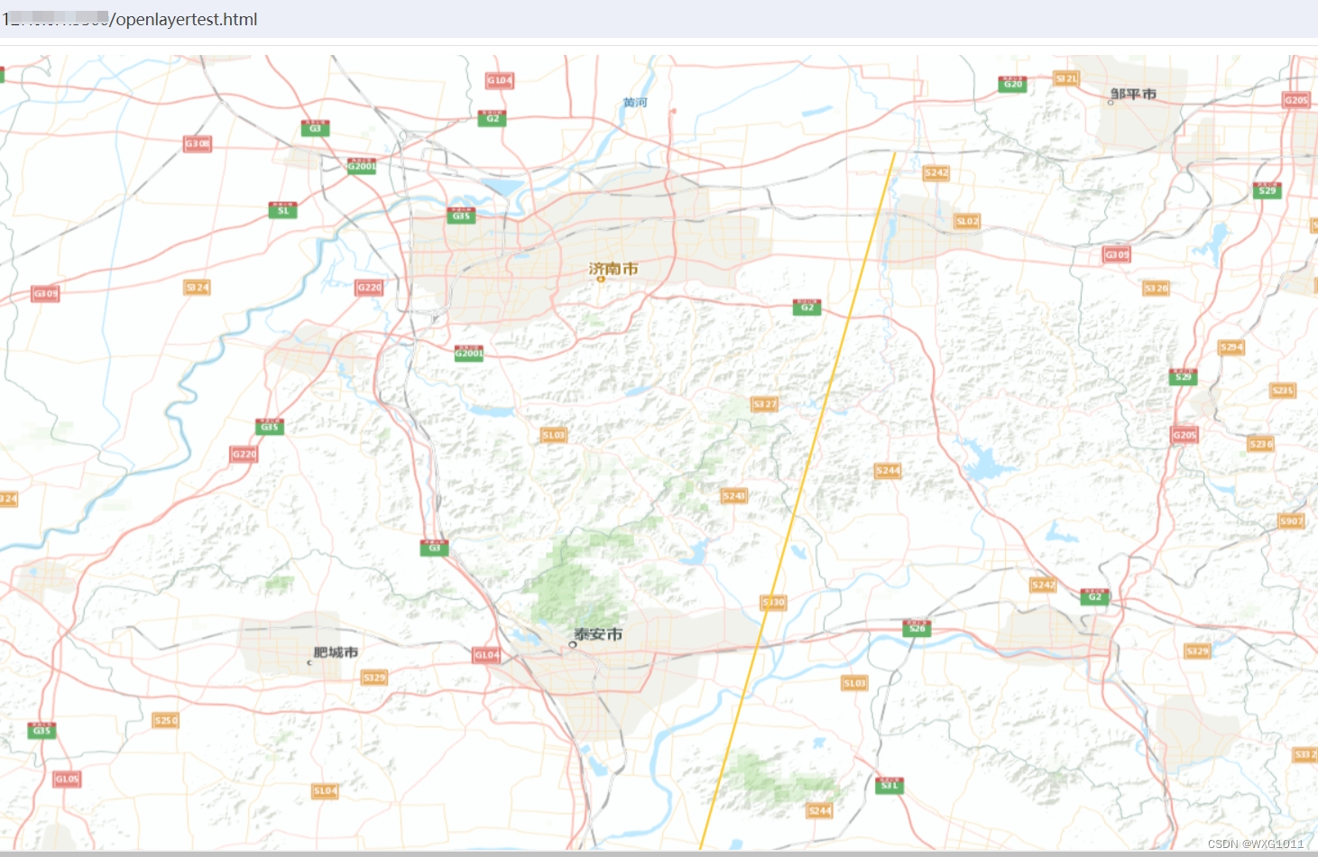
3、添加面
var Rectangle = new ol.Feature({
    geometry: new ol.geom.Polygon.fromExtent([117.2, 35.8, 117.48, 36.8])
});

Rectangle.setStyle(new ol.style.Style({
    fill: new ol.style.Fill({
        color: 'rgba(123, 237, 159,0.5)'
    }),
    stroke: new ol.style.Stroke({
        color: '#4a8fff',
        width: 4
    }),
    image: new ol.style.Circle({
        radius: 7,
        fill: new ol.style.Fill({
            color: '#4a8fff'
        })
    })
}));

。。。

layer.getSource().addFeature(Rectangle);
4、添加多边形
var Rectangle = new ol.Feature({
    geometry: new ol.geom.Polygon([[[117.56,35.32], [118.25, 36.23], [117.82, 37.25]]])
});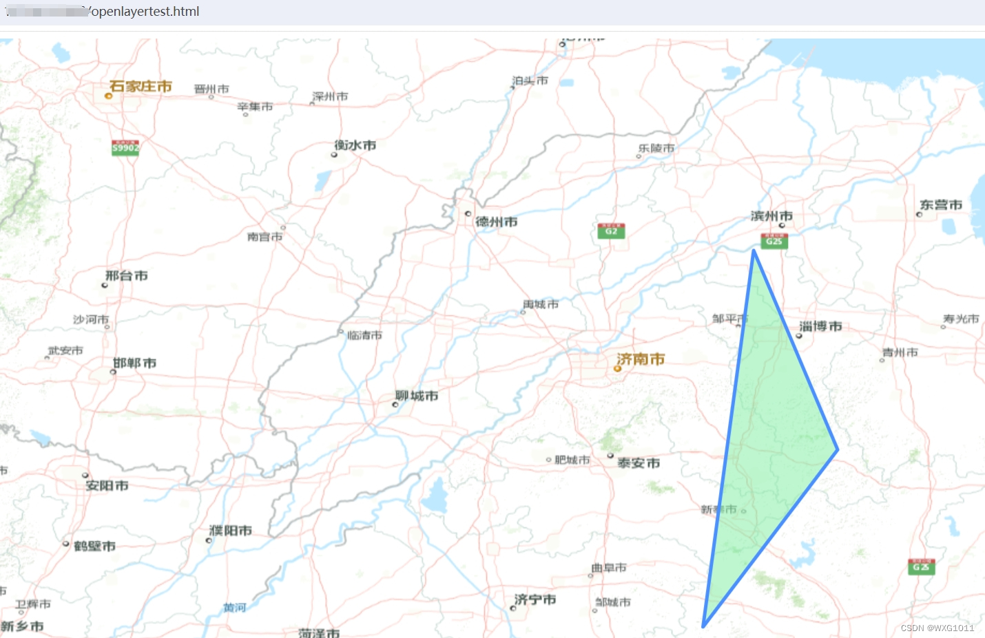
参考链接 openlayers-06-坐标添加点、线、面_openlayers 添加点-CSDN博客
5、定位到某个点
map.getView().animate({
	center: [117.403, 42.924],
	duration: 1000,
	zoom: 12,
 })


 5422
5422


 被折叠的 条评论
为什么被折叠?
被折叠的 条评论
为什么被折叠?
 到【灌水乐园】发言


