


 本文介绍了R语言中ggmap包的使用,包括get_map()、ggmap()和qmap()三个主要函数。get_map()用于获取地图,参数如location、zoom、maptype等可定制地图样式;ggmap()则用于在ggplot2环境中绘制地图;qmap()是前两者功能的结合。通过实例展示了如何获取并绘制北京地区的地图。
介绍
R语言中的ggmap包可以实现地图背景的绘制,里面的主要函数有get_map(),ggmap()以及ggmap()等。它们返回的是一个ggplot2对象,随后可以在此基础上绘制其他ggplot元素。
get_map()
get_map(location = c(lon = -95.3632715, lat = 29.7632836),
  zoom = "auto", scale = "auto", maptype = c("terrain",
  "terrain-background", "satellite", "roadmap", "hybrid", "toner",
  "watercolor", "terrain-labels", "terrain-lines", "toner-2010",
  "toner-2011", "toner-background", "toner-hybrid", "toner-labels",
  "toner-lines", "toner-lite"), source = c("google", "osm", "stamen"),
  force = ifelse(source == "google", TRUE, FALSE), messaging = FALSE,
  urlonly = FALSE, filename = NULL, crop = TRUE, color = c("color",
  "bw"), language = "en-EN", ...)
参数介绍
-
location
an address, longitude/latitude pair (in that order), or left/bottom/right/top bounding box,经常使用box来取地图,这样也不需要API key. -
zoom
map zoom, an integer from 3 (continent) to 21 (building), default value 10 (city). openstreetmaps limits a zoom of 18, and the limit on stamen maps depends on the maptype. “auto” automatically determines the zoom for bounding box specifications, and is defaulted to 10 with center/zoom specifications. maps of the whole world currently not supported. -
scale
scale argument of get_googlemap or get_openstreetmap -
maptype
character string providing map theme. options available are “terrain”, “terrain-background”, “satellite”, “roadmap”, and “hybrid” (google maps), “terrain”, “watercolor”, and “toner” (stamen maps), or a positive integer for cloudmade maps (see ?get_cloudmademap) -
source
Google Maps (“google”), OpenStreetMap (“osm”), Stamen Maps (“stamen”) -
force
force new map (don’t use archived version) -
messaging
turn messaging on/off -
urlonly
return url only -
filename
destination file for download (file extension added according to format). Default NULL means a random tempfile. -
crop
(stamen and cloudmade maps) crop tiles to bounding box -
== color==
color (“color”) or black-and-white (“bw”) -
language
language for google maps
ggmap
ggmap()就是对get_map()获得的地图结果进行绘制,接收的也是一个get_map对象
ggmap(get_map对象)
qmap()
qmap()=get_map()+ggmap(), 它是后两个函数的封装。
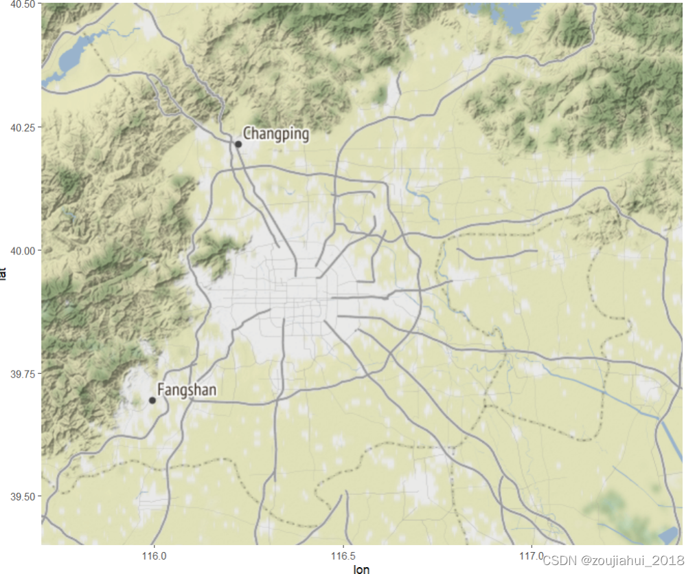
实例
b=get_map(location = c(left = 115.7, bottom = 39.4, right = 117.4, top = 40.5))
ggmap(b)


 845
845

 被折叠的 条评论
为什么被折叠?
被折叠的 条评论
为什么被折叠?
 到【灌水乐园】发言


