


python生成点矢量缓冲区(Arcgis的Buffer功能)
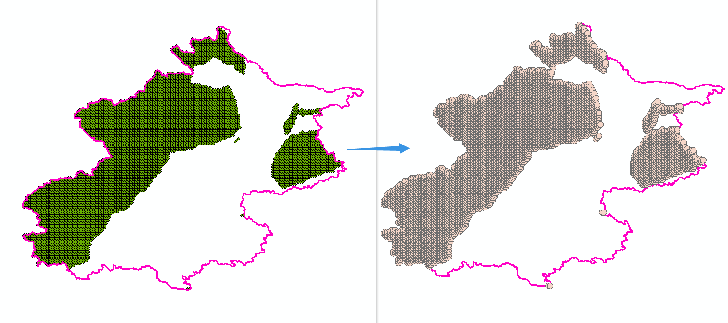 根据点矢量,设定缓冲区距离,生成面状矢量
1.导入库:
import glob
import os
import osgeo.ogr , osgeo.gdal
from osgeo import ogr,gdal,osr
2.构建函数:
def create_buffer(inputfns, outputBufferfns, bufferDist):
# @param inputfns:输入文件夹路径
# @param outputBufferfns:输出文件夹路径
# @param bufferDis:设定缓冲区距离,此处距离单位为度
    for inputfn in glob.glob(os.path.join(inputfns, '*.shp')):
        inputds = ogr.Open(inputfn)
        inputlyr = inputds.GetLayer()

        # 检查输入图层是否有要素
        if inputlyr.GetFeatureCount() == 0:
            print(f"跳过 {inputfn},因为它没有要素。")
            continue

        inputdefn = inputlyr.GetLayerDefn()
        inputfeature = inputlyr.GetFeature(0)
        prj = inputlyr.GetSpatialRef()
        driver = ogr.GetDriverByName('ESRI Shapefile')

		### 输出shp文件在输入文件名后加'_buffer.shp'后缀
        inpath_name = os.path.basename(inputfn).split('.')[0]
        outpath_name = outputBufferfns + inpath_name + '_buffer.shp'

		### 判断输出文件名是否存在,存在的话删除
        if os.path.exists(outpath_name):
            driver.DeleteDataSource(outpath_name)

        outputBufferds = driver.CreateDataSource(outpath_name)
        bufferlyr = outputBufferds.CreateLayer(outpath_name, srs=prj, geom_type=ogr.wkbPolygon)
        featureDefn = bufferlyr.GetLayerDefn()

        for feature in inputlyr:
            ingeom = feature.GetGeometryRef()
            geomBuffer = ingeom.Buffer(bufferDist)
            outFeature = ogr.Feature(featureDefn)
            outFeature.SetGeometry(geomBuffer)
            bufferlyr.CreateFeature(outFeature)
3.调用函数:
inpath_buffer = "Your_Path\\1_Select\\"  # 设置生成缓冲区的数据输入路径
outpath_buffer = r"Your_Path\\2_Buffer\\"
bufferDist = 0.018  # 设置缓冲区距离,单位为度,1800米缓冲区可以按0.018来算
create_buffer(inpath_buffer , outpath_buffer , bufferDist)


 3118
3118


 被折叠的 条评论
为什么被折叠?
被折叠的 条评论
为什么被折叠?
 到【灌水乐园】发言


