


作者:zhouyp
目录
一、前言
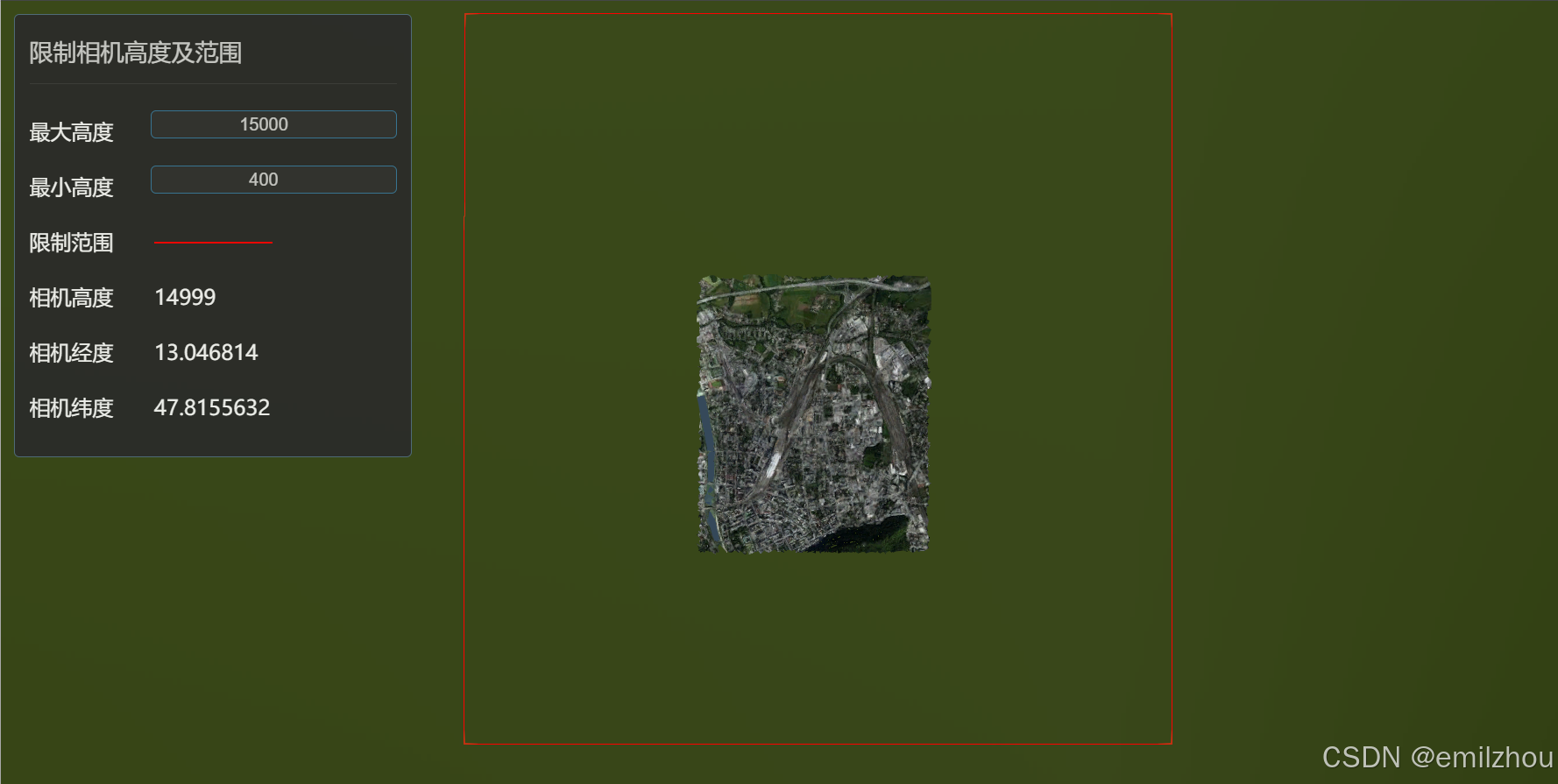
在iClient3D for WebGL中限制相机高度及范围可以提高用户体验,防止用户缩放到不合适的高度或超出预定的地理范围,一起来看看如何实现吧!
二、关键代码
监听scene.preRender事件,该事件将会在每帧渲染之前触发,事件回调中我们获取到当前帧的相机位置,当超出高度和范围限制条件时将相机位置修改为限制条件阈值。详情代码如需:
        let minHeight = 400, maxHeight = 15000;
        let west = 13.000, south = 47.785, east = 13.105, north = 47.858;

        viewer.scene.preRender.addEventListener(function () {
            updateCameraPositionWithConstrants(
                viewer.camera,
                minHeight,
                maxHeight,
                west,
                east,
                north,
                south);
        });

        // 获取约束条件下相机位置
        function updateCameraPositionWithConstrants(currentCamera, minHeight, maxHeight, west, east, north, south) {
            //获取 当前相机经度纬度高度
            let cartographic = SuperMap3D.Cartographic.fromCartesian(currentCamera.position);
            let longitude = SuperMap3D.Math.toDegrees(cartographic.longitude);
            let latitude = SuperMap3D.Math.toDegrees(cartographic.latitude);
            let height = cartographic.height;
            let trigger = false;

            // 判断相机位置是否触发高度约束,若触发将其值修改为高度约束阈值
            if (height < minHeight) {
                height = minHeight;
                trigger = true;
            }
            if (height > maxHeight) {
                height = maxHeight;
                trigger = true;
            }

            // 判断相机位置是否触发范围约束,若触发将其值修改为范围约束阈值
            if (longitude < west) {
                longitude = Math.max(longitude, west);
                trigger = true;
            }
            if (longitude > east) {
                longitude = Math.min(longitude, east);
                trigger = true;
            }
            if (latitude > north) {
                latitude = Math.min(latitude, north);
                trigger = true;
            }
            if (latitude < south) {
                latitude = Math.max(latitude, south);
                trigger = true;
            }

            if (trigger) {
                currentCamera.position = SuperMap3D.Cartesian3.fromDegrees(longitude, latitude, height);;
            }
        }
三、完整示例代码
注:复制后放入iClient3D for WebGL 范例沙盒中可以直接运行
<!DOCTYPE html>
<html lang="en">

<head>
    <meta charset="utf-8">
    <meta http-equiv="X-UA-Compatible" content="IE=Edge,chrome=1">
    <meta name="viewport"
        content="width=device-width, initial-scale=1, maximum-scale=1, minimum-scale=1, user-scalable=no">
    <title>限制相机高度及范围</title>
    <link href="../../Build/SuperMap3D/Widgets/widgets.css" rel="stylesheet">
    <link href="./css/pretty.css" rel="stylesheet">
    <link href="./css/style.css" rel="stylesheet">
    <link href="./style/cloudAndSky.css" rel="stylesheet">
    <script type="text/javascript" src="./js/jquery.min.js"></script>
    <script src="./js/tooltip.js"></script>
    <script src="./js/spectrum.js"></script>
    <script src="./js/config.js"></script>
    <script type="text/javascript" src="../../Build/SuperMap3D/SuperMap3D.js"></script>
</head>

<body>
    <div id="Container"></div>
    <div id='loadingbar' class="spinner">
        <div class="spinner-container container1">
            <div class="circle1"></div>
            <div class="circle2"></div>
            <div class="circle3"></div>
            <div class="circle4"></div>
        </div>
        <div class="spinner-container container2">
            <div class="circle1"></div>
            <div class="circle2"></div>
            <div class="circle3"></div>
            <div class="circle4"></div>
        </div>
        <div class="spinner-container container3">
            <div class="circle1"></div>
            <div class="circle2"></div>
            <div class="circle3"></div>
            <div class="circle4"></div>
        </div>
    </div>
    <div id="toolbar" class="param-container tool-bar">
        <div class="titleBox">
            <div class="titl">限制相机高度及范围</div>
        </div>
        <div class="param-item inputBox showCloud">
            <label class="lable">最大高度</label>
            <input id="maxVisual" type="number" value="15000" style="text-align: center">
        </div>
        <div class="param-item inputBox showCloud">
            <label class="lable">最小高度</label>
            <input id="minVisual" type="number" value="400" style="text-align: center">
        </div>
        <div class="param-item inputBox showCloud">
            <label class="lable">限制范围</label>
            <label class="lable">
                <div style="height: 1px;margin-top: 16px;background: red;
            "></div>
            </label>
        </div>
        <div class="param-item inputBox showCloud">
            <label class="lable">相机高度(米)</label>
            <label class="lable" id="currentH"></label>
        </div>
        <div class="param-item inputBox showCloud">
            <label class="lable">相机经度(度)</label>
            <label class="lable" id="currentLon"></label>
        </div>
        <div class="param-item inputBox showCloud">
            <label class="lable">相机纬度(度)</label>
            <label class="lable" id="currentLat"></label>
        </div>

    </div>
    <script type="text/javascript">
        function onload(SuperMap3D) {
            let viewer = new SuperMap3D.Viewer('Container', {
                contextOptions: {
                    contextType: Number(2), // Webgl2:2 ; WebGPU:3
                }
            });
            viewer.scenePromise.then(function (scene) {
                scene.globe.depthTestAgainstTerrain = false;
                init(SuperMap3D, scene, viewer);
            });
        }

        function init(SuperMap3D, scene, viewer) {
            viewer.resolutionScale = window.devicePixelRatio;
            let widget = viewer.Widget;
            try {
                // 打开三维场景
                let promise = scene.open(URL_CONFIG.SCENE_SRSB);
                SuperMap3D.when(promise, function (layers) {
                    layers.forEach(layer => {
                        layer.selectEnabled = false;
                        let style = new SuperMap3D.Style3D();
                        style.bottomAltitude = -58;
                        layer.style3D = style;
                        layer.setLodRangeScale(0.1)
                        layer.refresh();
                    })

                    // 获取界面高度范围
                    let minHeight = parseFloat($("#minVisual").val());
                    let maxHeight = parseFloat($("#maxVisual").val());
                    // 监听界面高度范围变化
                    $("#minVisual").on('input', function () {
                        minHeight = parseFloat($("#minVisual").val());
                        maxHeight = parseFloat($("#maxVisual").val());
                        if (minHeight > maxHeight) {
                            minHeight = maxHeight
                            $("#minVisual").val(minHeight)
                        }
                    });
                    $("#maxVisual").on('input', function () {
                        minHeight = parseFloat($("#minVisual").val());
                        maxHeight = parseFloat($("#maxVisual").val());
                        if (maxHeight < minHeight) {
                            maxHeight = minHeight
                            $("#maxVisual").val(maxHeight)
                        }
                    });

                    // 约束相机移动范围
                    let west = 13.000, south = 47.785, east = 13.105, north = 47.858;
                    let rectangle = SuperMap3D.Rectangle.fromDegrees(west, south, east, north);
                    viewer.camera.setView({
                        destination: rectangle
                    });
                    viewer.entities.add({
                        rectangle: {
                            coordinates: rectangle,
                            fill: false,
                            outline: true,
                            outlineColor: SuperMap3D.Color.RED,
                            outlineWidth: 10,
                        },
                    });

                    viewer.scene.preRender.addEventListener(function () {
                        updateCameraPositionWithConstrants(
                            viewer.camera,
                            minHeight,
                            maxHeight,
                            west,
                            east,
                            north,
                            south);
                    });

                    // 获取约束条件下相机位置
                    function updateCameraPositionWithConstrants(currentCamera, minHeight, maxHeight, west, east, north, south) {
                        //获取 当前相机经度纬度高度
                        let cartographic = SuperMap3D.Cartographic.fromCartesian(currentCamera.position);
                        let longitude = SuperMap3D.Math.toDegrees(cartographic.longitude);
                        let latitude = SuperMap3D.Math.toDegrees(cartographic.latitude);
                        let height = cartographic.height;
                        let trigger = false;

                        // 判断相机位置是否触发高度约束,若触发将其值修改为高度约束阈值
                        if (height < minHeight) {
                            height = minHeight;
                            trigger = true;
                        }
                        if (height > maxHeight) {
                            height = maxHeight;
                            trigger = true;
                        }

                        // 判断相机位置是否触发范围约束,若触发将其值修改为范围约束阈值
                        if (longitude < west) {
                            longitude = Math.max(longitude, west);
                            trigger = true;
                        }
                        if (longitude > east) {
                            longitude = Math.min(longitude, east);
                            trigger = true;
                        }
                        if (latitude > north) {
                            latitude = Math.min(latitude, north);
                            trigger = true;
                        }
                        if (latitude < south) {
                            latitude = Math.max(latitude, south);
                            trigger = true;
                        }

                        if (trigger) {
                            currentCamera.position = SuperMap3D.Cartesian3.fromDegrees(longitude, latitude, height);;
                        }
                    }

                    // 相机位置发生变化时同步状态到界面
                    viewer.scene.camera.changed.addEventListener(function () {
                        let cartographic = SuperMap3D.Cartographic.fromCartesian(viewer.camera.position);
                        let height = cartographic.height;
                        let longitude = SuperMap3D.Math.toDegrees(cartographic.longitude);
                        let latitude = SuperMap3D.Math.toDegrees(cartographic.latitude);
                        $("#currentH").text(Math.round(height));
                        $("#currentLon").text(longitude.toFixed(6));
                        $("#currentLat").text(latitude.toFixed(7));
                    })
                }, function () {
                    let title = '加载SCP失败,请检查网络连接状态或者url地址是否正确?';
                    widget.showErrorPanel(title, undefined, e);
                });
            }
            catch (e) {
                if (widget._showRenderLoopErrors) {
                    let title = '渲染时发生错误,已停止渲染。';
                    widget.showErrorPanel(title, undefined, e);
                }
            }

            $("#loadingbar").remove();
            $("#toolbar").show();
        }
        if (typeof SuperMap3D !== 'undefined') {
            window.startupCalled = true;
            onload(SuperMap3D);
        }
    </script>
</body>

</html>


 1427
1427

 被折叠的 条评论
为什么被折叠?
被折叠的 条评论
为什么被折叠?
 到【灌水乐园】发言


