


 本文介绍了如何通过遥感解译生成Mask,使用Python和gdal库进行大尺寸图像的滑动裁剪,以及如何剔除裁切后训练集中存在的黑边,以提高模型训练效率。
1、遥感解译建立Mask
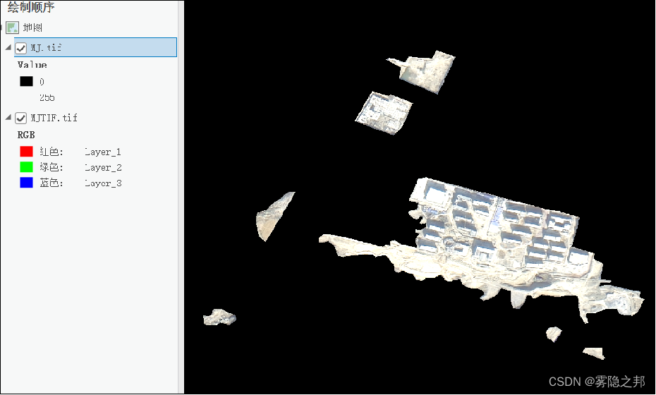
通过遥感解译,从完全覆盖遥感影像的面中切出想要的图斑,将图斑的属性赋值为255,其他区域赋值为0,同时Nodata值一定要重分类为0。
面转栅格,生成一个黑白Mask用来标记区域。 坐标系需要注意,两者完全一致。同时也要保证两者影像范围全部一样。
2、使用python滑动裁剪图像及标签
上述获得的影像数据和标签数据尺寸是几千几千,对于模型来说过大,这里使用python+gdal库自动裁剪YOLO适用的640X640(或其他尺寸,2的n次方)的图像,并按一定命名方式存储(0,1,2,3......命名) 同时对影像数据和标签数据裁剪。 代码:
运行中,这一步主要踩的雷就是GDAL库,这个看版本,有的是直接import,有的不行会提示没有,pip下载却会提醒已经下载。那就需要改为 from osgeo import gdal 。
import os
import sys
try:
    import gdal
except:
    from osgeo import gdal
import numpy as np
from PIL import Image


# 保存tif文件函数
def writeTiff(im_data, im_geotrans, im_proj, path):
    if 'int8' in im_data.dtype.name:
        datatype = gdal.GDT_Byte
    elif 'int16' in im_data.dtype.name:
        datatype = gdal.GDT_UInt16
    else:
        datatype = gdal.GDT_Float32
    if len(im_data.shape) == 3:
        im_bands, im_height, im_width = im_data.shape
    elif len(im_data.shape) == 2:
        im_data = np.array([im_data])
        im_bands, im_height, im_width = im_data.shape
    # 创建文件
    driver = gdal.GetDriverByName("GTiff")
    dataset = driver.Create(path, int(im_width), int(im_height), int(im_bands), datatype)
    if (dataset != None):
        dataset.SetGeoTransform(im_geotrans)  # 写入仿射变换参数
        dataset.SetProjection(im_proj)  # 写入投影
    for i in range(im_bands):
        dataset.GetRasterBand(i + 1).WriteArray(im_data[i])
    del dataset


# 像素坐标和地理坐标仿射变换
def CoordTransf(Xpixel, Ypixel, GeoTransform):
    XGeo = GeoTransform[0] + GeoTransform[1] * Xpixel + Ypixel * GeoTransform[2]
    YGeo = GeoTransform[3] + GeoTransform[4] * Xpixel + Ypixel * GeoTransform[5]
    return XGeo, YGeo


'''
滑动窗口裁剪Tif影像
TifPath 影像路径
SavePath 裁剪后影像保存目录
CropSize 裁剪尺寸
RepetitionRate 重叠度
'''
def TifCrop(TifPath, SavePath, CropSize, RepetitionRate):
    print("--------------------裁剪影像-----------------------")
    CropSize = int(CropSize)
    RepetitionRate = float(RepetitionRate)
    dataset_img = gdal.Open(TifPath)
    if dataset_img == None:
        print(TifPath + "文件无法打开")

    if not os.path.exists(SavePath):
        os.makedirs(SavePath)

    width = dataset_img.RasterXSize     # 获取行列数
    height = dataset_img.RasterYSize
    bands = dataset_img.RasterCount  # 获取波段数
    print("行数为:", height)
    print("列数为:", width)
    print("波段数为:", bands)

    proj = dataset_img.GetProjection()      # 获取投影信息
    geotrans = dataset_img.GetGeoTransform()        # 获取仿射矩阵信息
    img = dataset_img.ReadAsArray(0, 0, width, height)  # 获取数据

    #  行上图像块数目
    RowNum = int((height - CropSize * RepetitionRate) / (CropSize * (1 - RepetitionRate)))
    #  列上图像块数目
    ColumnNum = int((width - CropSize * RepetitionRate) / (CropSize * (1 - RepetitionRate)))
    print("裁剪后行影像数为:", RowNum)
    print("裁剪后列影像数为:", ColumnNum)

    # 获取当前文件夹的文件个数len,并以len+1命名即将裁剪得到的图像
    new_name = len(os.listdir(SavePath)) + 1

    # 裁剪图片,重复率为RepetitionRate
    for i in range(RowNum):
        for j in range(ColumnNum):
            # 如果图像是单波段
            if (bands == 1):
                cropped = img[
                          int(i * CropSize * (1 - RepetitionRate)): int(i * CropSize * (1 - RepetitionRate)) + CropSize,
                          int(j * CropSize * (1 - RepetitionRate)): int(j * CropSize * (1 - RepetitionRate)) + CropSize]
            # 如果图像是多波段
            else:
                cropped = img[:,
                          int(i * CropSize * (1 - RepetitionRate)): int(i * CropSize * (1 - RepetitionRate)) + CropSize,
                          int(j * CropSize * (1 - RepetitionRate)): int(j * CropSize * (1 - RepetitionRate)) + CropSize]
            # 获取地理坐标
            XGeo, YGeo = CoordTransf(int(j * CropSize * (1 - RepetitionRate)),
                                     int(i * CropSize * (1 - RepetitionRate)),
                                     geotrans)
            crop_geotrans = (XGeo, geotrans[1], geotrans[2], YGeo, geotrans[4], geotrans[5])

            # 生成Tif图像
            writeTiff(cropped, crop_geotrans, proj, SavePath + "/%d.tif" % new_name)

            # 文件名 + 1
            new_name = new_name + 1
    # 向前裁剪最后一行
    for i in range(RowNum):
        if (bands == 1):
            cropped = img[int(i * CropSize * (1 - RepetitionRate)): int(i * CropSize * (1 - RepetitionRate)) + CropSize,
                      (width - CropSize): width]
        else:
            cropped = img[:,
                      int(i * CropSize * (1 - RepetitionRate)): int(i * CropSize * (1 - RepetitionRate)) + CropSize,
                      (width - CropSize): width]
        # 获取地理坐标
        XGeo, YGeo = CoordTransf(width - CropSize,
                                 int(i * CropSize * (1 - RepetitionRate)),
                                 geotrans)
        crop_geotrans = (XGeo, geotrans[1], geotrans[2], YGeo, geotrans[4], geotrans[5])

        # 生成Tif影像
        writeTiff(cropped, crop_geotrans, proj, SavePath + "/%d.tif" % new_name)

        new_name = new_name + 1
    # 向前裁剪最后一列
    for j in range(ColumnNum):
        if (bands == 1):
            cropped = img[(height - CropSize): height,
                      int(j * CropSize * (1 - RepetitionRate)): int(j * CropSize * (1 - RepetitionRate)) + CropSize]
        else:
            cropped = img[:,
                      (height - CropSize): height,
                      int(j * CropSize * (1 - RepetitionRate)): int(j * CropSize * (1 - RepetitionRate)) + CropSize]
        # 获取地理坐标
        XGeo, YGeo = CoordTransf(int(j * CropSize * (1 - RepetitionRate)),
                                 height - CropSize,
                                 geotrans)
        crop_geotrans = (XGeo, geotrans[1], geotrans[2], YGeo, geotrans[4], geotrans[5])
        # 生成tif影像
        writeTiff(cropped, crop_geotrans, proj, SavePath + "/%d.tif" % new_name)

        # 文件名 + 1
        new_name = new_name + 1
    # 裁剪右下角
    if (bands == 1):
        cropped = img[(height - CropSize): height,
                  (width - CropSize): width]
    else:
        cropped = img[:,
                  (height - CropSize): height,
                  (width - CropSize): width]

    XGeo, YGeo = CoordTransf(width - CropSize,
                             height - CropSize,
                             geotrans)
    crop_geotrans = (XGeo, geotrans[1], geotrans[2], YGeo, geotrans[4], geotrans[5])
    # 生成Tif影像
    writeTiff(cropped, crop_geotrans, proj, SavePath + "/%d.tif" % new_name)

    new_name = new_name + 1


if __name__ == '__main__':
    # 将影像裁剪为重复率为0的640×641的数据集
    TifCrop(r"F:/test/MJ.tif",
            r"F:/test/TrainMJ", 640, 0)

3、裁切后训练集中大量黑边剔除
裁切后的影像如上图所述,由于影像本身不是矩形,存在不少Nodata导致的空值黑边以及没有目标区域的影像切片,利用python和GDAL剔除掉,只留下有标签的影像切片和标签Mask。
运行中需要注意,输入的路径采用的路径通配符一定是/,反斜杠,同时路径的最后有一个反斜杠。
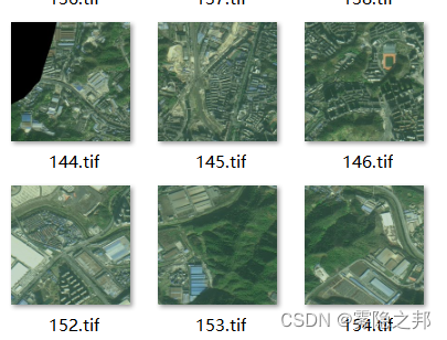
此步骤后,从825张图像和标签中选出128对含有目标地物的图像和标签。
import os, sys
try:
    import gdal
except:
    from osgeo import gdal
from numba import jit
import numpy as np

# 保存tif文件函数
def writeTiff(im_data, im_geotrans, im_proj, path):
    if 'int8' in im_data.dtype.name:
        datatype = gdal.GDT_Byte
    elif 'int16' in im_data.dtype.name:
        datatype = gdal.GDT_UInt16
    else:
        datatype = gdal.GDT_Float32
    if len(im_data.shape) == 3:
        im_bands, im_height, im_width = im_data.shape
    elif len(im_data.shape) == 2:
        im_data = np.array([im_data])
        im_bands, im_height, im_width = im_data.shape
    # 创建文件
    driver = gdal.GetDriverByName("GTiff")
    dataset = driver.Create(path, int(im_width), int(im_height), int(im_bands), datatype)
    if (dataset != None):
        dataset.SetGeoTransform(im_geotrans)  # 写入仿射变换参数
        dataset.SetProjection(im_proj)  # 写入投影
    for i in range(im_bands):
        dataset.GetRasterBand(i + 1).WriteArray(im_data[i])
    del dataset

'''
影像筛选函数
OriTifArrayPath 原始影像路径
MaskTifArrayPath 标签影像路径
EndImg 筛选后的原始影像路径
EndMask 筛选后的标签影像路径
'''
def TifScreen(OriTifArrayPath, MaskTifArrayPath, EndImg, EndMask):
    if not os.path.exists(EndImg):
        os.makedirs(EndImg)
    if not os.path.exists(EndMask):
        os.makedirs(EndMask)
    imgList = os.listdir(OriTifArrayPath)  # 读入文件夹
    imgList.sort(key=lambda x: int(x.split('.')[0]))  # 按照数字进行排序后按顺序读取文件夹下的图片
    ImgArray = []   #创建队列
    geotransArray = []
    projArray = []
    num_img = len(imgList)
    for TifPath in imgList:
        dataset_img = gdal.Open(OriTifArrayPath + TifPath)
        width_crop = dataset_img.RasterXSize  # 获取行列数
        height_crop = dataset_img.RasterYSize
        bands = dataset_img.RasterCount  # 获取波段数
        proj = dataset_img.GetProjection()  # 获取投影信息
        geotrans = dataset_img.GetGeoTransform()  # 获取仿射矩阵信息
        img = dataset_img.ReadAsArray(0, 0, width_crop, height_crop)  # 获取数据
        # print(TifPath)
        ImgArray.append(img)    # 将影像按顺序存入队列
        geotransArray.append(geotrans)
        projArray.append(proj)
    print("行数为:", height_crop)
    print("列数为:", width_crop)
    print("波段数为:", bands)
    print("读取全部影像数量为:", len(ImgArray))

    MaskList = os.listdir(MaskTifArrayPath)  # 读入文件夹
    MaskList.sort(key=lambda x: int(x.split('.')[0]))  # 按照数字进行排序后按顺序读取文件夹下的图片
    MaskArray = []
    geotrans_maskArray = []
    proj_maskArray = []
    for MaskTifPath in MaskList:
        dataset_mask = gdal.Open(MaskTifArrayPath + MaskTifPath)
        width_mask = dataset_mask.RasterXSize  # 获取行列数
        height_mask = dataset_mask.RasterYSize
        bands_mask = dataset_mask.RasterCount  # 获取波段数
        proj_mask = dataset_mask.GetProjection()  # 获取投影信息
        geotrans_mask = dataset_mask.GetGeoTransform()  # 获取仿射矩阵信息
        mask = dataset_mask.ReadAsArray(0, 0, width_mask, height_mask)  # 获取数据
        MaskArray.append(mask)    # 将影像按顺序存入队列
        geotrans_maskArray.append(geotrans_mask)
        proj_maskArray.append(proj_mask)
    print("行数为:", height_mask)
    print("列数为:", width_mask)
    print("波段数为:", bands_mask)
    print("读取全部掩膜数量为:", len(MaskArray))

    for i in range(len(MaskArray)):
        count = test_fast(MaskArray[i])
        name = i + 1
        if count != 0:
            print("图像保存成功")
            writeTiff(ImgArray[i], geotransArray[i], projArray[i], EndImg + "/%d.tif" % name)
            writeTiff(MaskArray[i], geotrans_maskArray[i], proj_maskArray[i], EndMask + "/%d.tif" % name)

# 循环加速,判断影像中是否有255标签
@jit(nopython=True)
def test_fast(img):
    count = 0
    for row in range(img.shape[0]):
        for col in range(img.shape[1]):
            if img[row, col] != 0:
                count = count + 1
    return count

if __name__ == '__main__':
    # 筛选出包含有255标签的图像
    TifScreen(r"F:/internship/code/ImagePreprocessing/data/test/img/",
              r"F:/internship/code/ImagePreprocessing/data/test/mask/",
              r"F:/internship/code/ImagePreprocessing/data/test/imgend",
              r"F:/internship/code/ImagePreprocessing/data/test/maskend")


 460
460

 被折叠的 条评论
为什么被折叠?
被折叠的 条评论
为什么被折叠?
 到【灌水乐园】发言


