


步行导航和公交导航其实方法与乘车导航方法类似,这里我们就做简单的代码讲解。
walk.wxml
<view class="flex-style">
<view class="flex-item " bindtouchstart="goToCar">驾车</view>
<view class="flex-item active" bindtouchstart="goToWalk">步行</view>
<view class="flex-item" bindtouchstart="goToBus">公交</view>
</view>
<view class="map_box">
<map id="navi_map" longitude="117.121787" latitude="36.662872" scale="12" markers="{{markers}}" polyline="{{polyline}}"></map>
</view>
<view class="text_box">
<view class="text">{{distance}}</view>
<view class="text">{{cost}}</view>
<view class="detail_button" bindtouchstart="goDetail">详情</view>
</view>
要注意把flex-item active切换成步行,我们上一个是驾车。
walk.wxss:
.flex-style{
display: -webkit-box;
display: -webkit-flex;
display: flex;
}
.flex-item{
height: 35px;
line-height: 35px;
text-align: center;
-webkit-box-flex: 1;
-webkit-flex: 1;
flex: 1
}
.flex-item.active{
color:#0091ff;
}
.map_box{
position:absolute;
top: 35px;
bottom: 90px;
left: 0px;
right: 0px;
}
#navi_map{
width: 100%;
height: 100%;
}
.text_box{
position:absolute;
height: 90px;
bottom: 0px;
left: 0px;
right: 0px;
}
.text_box .text{
margin: 15px;
}
.detail_button{
position:absolute;
bottom: 30px;
right: 10px;
padding: 3px 5px;
color: #fff;
background: #0091ff;
width:50px;
text-align:center;
border-radius:5px;
}
walk.js:
var amapFile = require('../../components/amap-wx.130.js');
Page({
data: {
distance: '',
cost: '',
polyline: []
},
onLoad: function() {
var that = this;
wx.getLocation({
type: 'gcj02',
success: function(res) {
that.setData({
userLatitude: res.latitude,
userLongitude: res.longitude,
markers: [{
iconPath: "../../images/地址.png",
id: 0,
latitude: res.latitude,
longitude: res.longitude,
width: 23,
height: 33
},{
iconPath: "../../images/地址.png",
id: 1,
latitude: 36.662872,
longitude: 117.121787,
width: 23,
height: 33
}]
});
// 设置用户当前位置为起点
var origin = `${res.longitude},${res.latitude}`;
var destination = '117.121787,36.662872'; // 目标位置
var myAmapFun = new amapFile.AMapWX({key: ''});
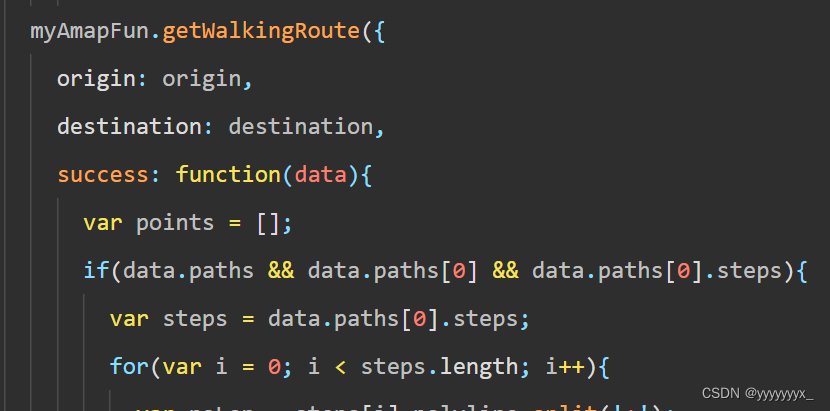
myAmapFun.getWalkingRoute({
origin: origin,
destination: destination,
success: function(data){
var points = [];
if(data.paths && data.paths[0] && data.paths[0].steps){
var steps = data.paths[0].steps;
for(var i = 0; i < steps.length; i++){
var poLen = steps[i].polyline.split(';');
for(var j = 0;j < poLen.length; j++){
points.push({
longitude: parseFloat(poLen[j].split(',')[0]),
latitude: parseFloat(poLen[j].split(',')[1])
})
}
}
}
that.setData({
polyline: [{
points: points,
color: "#0091ff",
width: 6
}]
});
if(data.paths[0] && data.paths[0].distance){
that.setData({
distance: data.paths[0].distance + '米'
});
}
if(data.paths[0] && data.paths[0].duration){
that.setData({
cost: parseInt(data.paths[0].duration/60) + '分钟'
});
}
},
fail: function(info){
}
})
}
})
},
goDetail: function(){
wx.navigateTo({
url: '../walk_detail/walk_detail'
})
},
goToCar: function (e) {
wx.redirectTo({
url: '../map/map'
})
},
goToBus: function (e) {
wx.redirectTo({
url: '../bus/bus'
})
},
goToWalk: function (e) {
wx.redirectTo({
url: '../walk/walk'
})
}
})
这里walk.js与 map.js的区别在于我们更换了查询路径的方法。
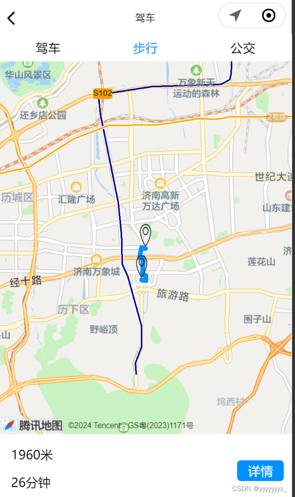
实现效果:
bus.wxml:
<view class="flex-style">
<view class="flex-item" bindtouchstart="goToCar">驾车</view>
<view class="flex-item" bindtouchstart="goToWalk">步行</view>
<view class="flex-item active" bindtouchstart="goToBus">公交</view>
</view>
<view class="map_box">
<map id="navi_map" longitude="117.121787" latitude="36.662872" scale="12" markers="{{markers}}" polyline="{{polyline}}"></map>
</view>
<view class="text_box" wx:for="{{transits}}" wx:for-item="i">
<text class="text_item" wx:for="{{i.transport}}" wx:for-item="j">
{{j}}
</text>
</view>
bus.wxss:
.flex-style{
display: -webkit-box;
display: -webkit-flex;
display: flex;
}
.flex-item{
height: 35px;
line-height: 35px;
text-align: center;
-webkit-box-flex: 1;
-webkit-flex: 1;
flex: 1
}
.flex-item.active{
color:#0091ff;
}
.text_box{
margin: 0 15px;
padding: 15px 0;
border-bottom: 1px solid #c3c3c3;
font-size: 13px;
}
.text_box .text_item{display:inline-block;line-height: 8px;}
bus.js:
var amapFile = require('../../components/amap-wx.130.js');
Page({
data: {
distance: '',
cost: '',
transits: [],
polyline: []
},
onLoad: function() {
var that = this;
// 获取用户当前位置
wx.getLocation({
type: 'gcj02',
success: function(res) {
that.setData({
userLatitude: res.latitude,
userLongitude: res.longitude,
markers: [{
iconPath: "../../images/地址.png",
id: 0,
latitude: res.latitude,
longitude: res.longitude,
width: 23,
height: 33
},{
iconPath: "../../images/地址.png",
id: 1,
latitude: 36.662872,
longitude: 117.121787,
width: 23,
height: 33
}]
});
// 设置用户当前位置为起点
var origin = `${res.longitude},${res.latitude}`;
var destination = '117.121787,36.662872'; // 目标位置
var myAmapFun = new amapFile.AMapWX({key: ''});
myAmapFun.getTransitRoute({
origin: origin,
destination: destination,
city: '济南',
success: function(data){
console.log(data)
if(data && data.transits){
var transits = data.transits;
for(var i = 0; i < transits.length; i++){
var segments = transits[i].segments;
transits[i].transport = [];
for(var j = 0; j < segments.length; j++){
if(segments[j].bus && segments[j].bus.buslines && segments[j].bus.buslines[0] && segments[j].bus.buslines[0].name){
var name = segments[j].bus.buslines[0].name
if(j!==0){
name = '--' + name;
}
transits[i].transport.push(name);
}
}
}
}
that.setData({
transits: transits
});
},
fail: function(info){
}
})
}
})
},
goToCar: function (e) {
wx.redirectTo({
url: '../map/map'
})
},
goToBus: function (e) {
wx.redirectTo({
url: '../bus/bus'
})
},
goToWalk: function (e) {
wx.redirectTo({
url: '../walk/walk'
})
}
})
这里bus调用的是getTransitRoute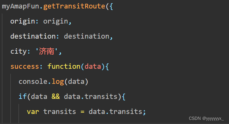
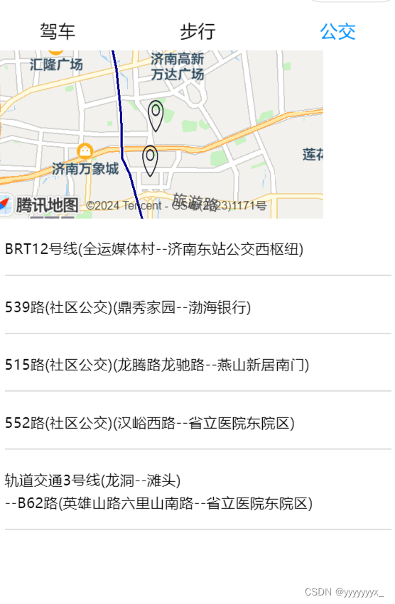
实现效果图:


 被折叠的 条评论
为什么被折叠?
被折叠的 条评论
为什么被折叠?
 到【灌水乐园】发言


