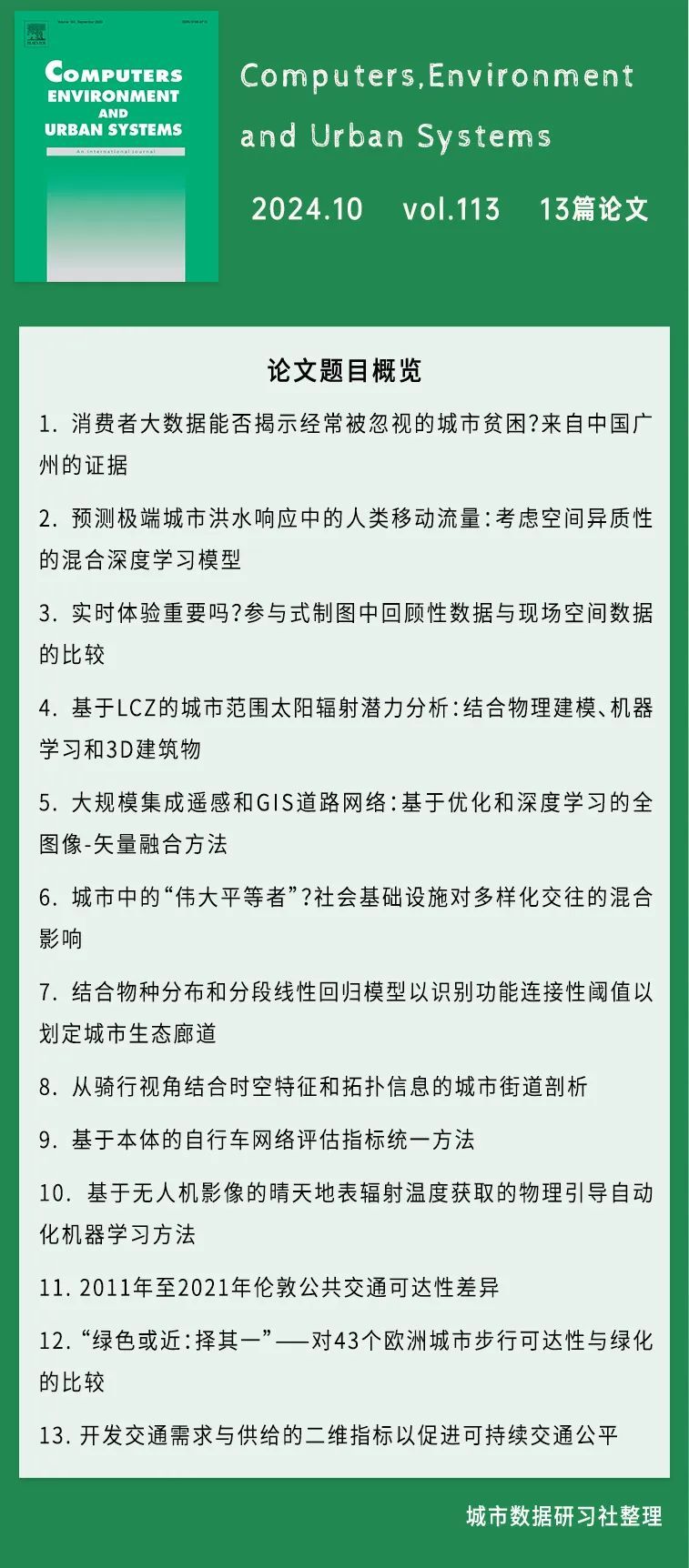
本次给大家整理的是《Computers, Environment and Urban Systems》杂志2024年10月第113期的论文的题目和摘要,一共包括13篇SCI论文!

论文1
Can consumer big data reveal often-overlooked urban poverty? Evidence from Guangzhou, China
消费者大数据能否揭示经常被忽视的城市贫困?来自中国广州的证据
【摘要】
In the evolving landscape of poverty research, especially in China, the focus has shifted from eliminating absolute poverty to relieving relative poverty. Although much of the existing studies have begun to use built environment big data, such as remote sensing and street view imagery, to measure poverty, peoples' consumption, an essential indicator of poverty receives less attention. This study delves into the relationship and spatial disparity between poverty measured by consumer big data and multidimensional poverty measured based on the census data. We investigated 1731 communities in Guangzhou as case study regions and combined their residents' mobile phone metadata and spatial cost of living data as the input consumer big data. Then, we constructed Index of Multiple Deprivation (IMD) levels based on the census data and built random forest classification model based on our consumer big data to predict IMD level at community level. The result shows that the predicted poverty of 81.11% communities were generally consistent with the IMD level, indicating that the consumer big data poverty mapping provided a viable poverty measurement from consumer behavior perspective. The SHapley Additive exPlanations' values result shows that Pinduoduo (a low-cost online shopping mobile application) contributes the most to predicted poverty from consumer behavior. For spatial disparities, poverty mapping based on consumer big data is more sensitive to the poverty in suburban developing neighborhoods and affordable housing communities compared with the IMD. The urban poverty mapping based on consumer big data offers a timely portray of communities' socio-economic challenges and consumption-related poverty, and provides support and evidence for accurate urban poverty alleviation strategies.
【摘要翻译】
在中国的贫困研究领域中,随着重点从消除绝对贫困转向缓解相对贫困,研究方向也在不断演变。尽管已有许多研究开始使用建筑环境大数据(如遥感和街景图像)来衡量贫困,但人们的消费——这一贫困的重要指标——却很少受到关注。本研究深入探讨了通过消费者大数据衡量的贫困与基于人口普查数据的多维贫困之间的关系及其空间差异。我们以广州的1731个社区为研究对象,结合其居民的手机元数据和空间生活成本数据作为消费者大数据的输入。随后,我们基于人口普查数据构建了多重剥夺指数(IMD)等级,并基于消费者大数据构建了随机森林分类模型,以预测社区层面的IMD等级。研究结果表明,81.11%的社区的预测贫困与IMD等级总体一致,表明从消费者行为角度进行的消费者大数据贫困映射提供了一种可行的贫困测量方法。SHapley Additive exPlanations(SHAP)值的结果显示,拼多多(一个低成本的线上购物应用)在预测贫困中对消费者行为的贡献最大。在空间差异方面,基于消费者大数据的贫困映射对郊区发展中的社区和经济适用房社区的贫困更为敏感,优于IMD。基于消费者大数据的城市贫困映射及时描绘了社区的社会经济挑战和与消费相关的贫困,为精准的城市贫困缓解策略提供了支持和证据。
【doi】
https://doi.org/10.1016/j.compenvurbsys.2024.102158
【作者信息】
Qingyu Wu, 中山大学地理与规划学院,广州510275,中国;广东省城市化与地理模拟重点实验室,中山大学,广州510275,中国
Yuquan Zhou, 南加州大学索尔普莱斯公共政策学院城市规划与空间分析系,美国加利福尼亚州洛杉矶90089-0626
Yuan Yuan, 中山大学地理与规划学院,广州510275,中国;广东省城市化与地理模拟重点实验室,中山大学,广州510275,中国
Xi Chen, 中山大学地理与规划学院,广州510275,中国;广东省城市化与地理模拟重点实验室,中山大学,广州510275,中国
Huiwen Liu,中山大学地理与规划学院,广州510275,中国;广东省城市化与地理模拟重点实验室,中山大学,广州510275,中国
论文2
Predicting human mobility flows in response to extreme urban floods: A hybrid deep learning model considering spatial heterogeneity
预测极端城市洪水响应中的人类移动流量:考虑空间异质性的混合深度学习模型
【摘要】
Resilient post-disaster recovery is crucial for the long-term sustainable development of modern cities, and in this regard, predicting the unusual flows of human mobility when disasters hit, could offer insights into how emergency responses could be managed to cope with such unexpected shocks more efficiently. For years, many studies have been dedicated to developing various models to predict human movement; however, abnormal human flows caused by large-scale urban disasters, such as urban floods, remain difficult to capture accurately using existing models. In this paper, we propose a spatiotemporal hybrid deep learning model based on a graph convolutional network and long short-term memory with a spatial heterogeneity component. Using 1.32 billion movement records from smartphone users, we applied the model to predict total hourly flows of human mobility in the “7.20” extreme urban flood in Zhengzhou, China. We found that the proposed model can significantly improve the prediction accuracy (i.e., R2from 0.887 to 0.951) for during-disaster flows while maintaining high accuracy for before- and after-disaster flows. We also show that our model outperforms selected mainstream machine learning models in every disaster stage in a set of sensitivity tests, which verifies not only its better performance for predicting both usual and unusual flows but also its robustness. The results underscore the effective role of spatial heterogeneity in predicting human mobility flow in a disaster context. This study offers a novel tool for better depicting human mobility under the impact of urban floods and provides useful insights for decision-makers managing how people move in large-scale disaster emergencies.
【摘要翻译】
灾后韧性恢复对于现代城市的长期可持续发展至关重要。在此背景下,预测灾害发生时异常的人类流动可以为如何更高效地应对突发冲击的应急响应提供有益见解。多年来,许多研究致力于开发各种预测人类移动的模型,但现有模型在准确捕捉由大规模城市灾害(如城市洪水)引发的异常人流方面仍存在困难。本文提出了一种基于图卷积网络和长短期记忆的时空混合深度学习模型,并结合了空间异质性组件。利用来自智能手机用户的13.2亿条移动记录,我们应用该模型预测了中国郑州“7·20”极端城市洪水中的每小时人类流动总量。研究发现,所提出的模型可以显著提高灾中流动的预测精度(即R²从0.887提高到0.951),同时在灾前和灾后流动的预测中也保持了较高的准确性。通过一系列敏感性测试,我们还证明了该模型在每个灾害阶段都优于选定的主流机器学习模型,不仅在预测常规和非常规流动方面表现更好,还验证了其鲁棒性。结果强调了空间异质性在预测灾害背景下人类流动中的有效作用。本研究提供了一种新的工具,更好地描绘城市洪水影响下的人类流动,为决策者管理大规模灾害应急中的人流提供了有价值的见解。
【doi】
https://doi.org/10.1016/j.compenvurbsys.2024.102160
【作者信息】
Junqing Tang, 北京大学深圳研究生院城市规划与设计学院,中国深圳518055,
Jing Wang, 北京大学深圳研究生院城市规划与设计学院,中国深圳518055
Jiaying Li, 北京大学深圳研究生院城市规划与设计学院,中国深圳518055
Pengjun Zhao, 北京大学深圳研究生院城市规划与设计学院,中国深圳518055;北京大学城市与环境学院,中国北京100871
Wei Lyu, 北京大学深圳研究生院城市规划与设计学院,中国深圳518055
Wei Zhai, 德克萨斯大学圣安东尼奥分校Klesse工程与综合设计学院建筑与规划学院,美国德克萨斯州圣安东尼奥78207
Li Yuan, 北京大学深圳研究生院电子与计算机工程学院,中国深圳518055
Li Wan, 剑桥大学土地经济系,英国剑桥CB3 9EP
Chenyu Yang,北京大学深圳研究生院城市规划与设计学院,中国深圳518055
论文3
Does real time experience matter? Comparison of retrospective and in-situ spatial data in participatory mapping
实时体验重要吗?参与式制图中回顾性数据与现场空间数据的比较
【摘要】
Public Participation GIS is a widely used method in research, planning, and many other domains. Approaches to participatory data collection have traditionally taken place retrospectively, whereby a digital mapping platform is used for participants to elucidate their spatial through to and feelings. More recently, enabled by the proliferation of smartphones, data collection has also taken place in-situ, whereby participants report their spatial thoughts and feelings at their current location and time. There has yet to be any investigation into the implications of choice between retrospective and in-situ data collection, nor has there been any investigation into how comparable or compatible datasets collected using these methods might be expected to be. This paper addresses this shortcoming by providing a comparative analysis of retrospective and in-situ data collected in Olomouc, Czech Republic. Through a combination of theoretical, quantitative and qualitative approaches, the differences between the two methods are formalised along with t


 最低0.47元/天 解锁文章


 1万+
1万+

 被折叠的 条评论
为什么被折叠?


