


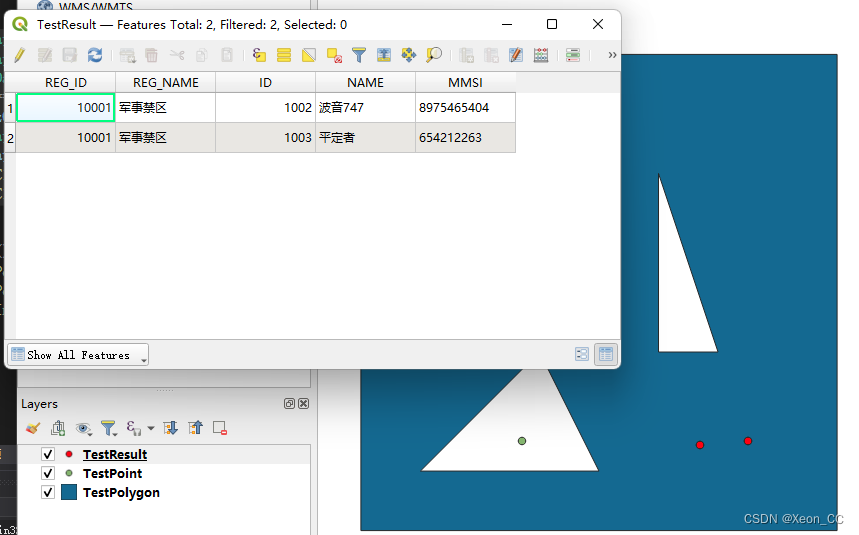
上两期文章,说明了如何创建点类型的图层和多边形类型的图层,创建好这两个图层之后,将两个图层求交得到TestResult.shp,此shp文件包含了求交后的结果。
int TestIntersection() {
    GDALAllRegister();
    GDALDriver* shpDriver = GetGDALDriverManager()->GetDriverByName("ESRI Shapefile");
    if (shpDriver == NULL) {
        printf("%s\n", "ESRI Shapefile驱动创建失败!");
        return -1;
    }
    GDALDataset* shipDataSet = (GDALDataset*)GDALOpenEx("..\\shp\\TestPoint.shp", GDAL_OF_VECTOR, NULL, NULL, NULL);
    GDALDataset* regDataSet = (GDALDataset*)GDALOpenEx("..\\shp\\TestPolygon.shp", GDAL_OF_VECTOR, NULL, NULL, NULL);

    OGRSpatialReference osr;
    //osr.SetWellKnownGeogCS("WGS84");
    if (osr.importFromEPSG(4326) != OGRERR_NONE) {
        printf("%s\n", "坐标系创建失败!");
        return -1;
    }

    OGRLayer* shipLayer = shipDataSet->GetLayerByName("TestPoint");
    OGRLayer* regLayer = regDataSet->GetLayerByName("TestPolygon");
    GDALDataset* resultDataSet = shpDriver->Create("..//shp//TestResult.shp", 0, 0, 0, GDT_Unknown, NULL);
    char** papszOptions = NULL;
    papszOptions = CSLSetNameValue(papszOptions, "ENCODING", "UTF-8");
    OGRLayer* resultLayer = resultDataSet->CreateLayer("resultLyr", &osr, wkbPoint, papszOptions);
    regLayer->Intersection(shipLayer, resultLayer, NULL, GDALTermProgress, NULL);
    GDALClose(shipDataSet);
    GDALClose(regDataSet);
}
TestPoint.shp的图层有三个点,与TestPolygon.shp的图层求交集以后得到TestResult.shp。它们求交集之后会自动合并字段。


 3506
3506


 被折叠的 条评论
为什么被折叠?
被折叠的 条评论
为什么被折叠?
 到【灌水乐园】发言


