


 本文介绍了如何使用MATLAB编程语言处理MOD13Q1数据,包括通过日期判断季度、合成年度NDVI最大值的过程,并展示了具体代码实现和最终的处理效果。
MOD13Q1数据的具体介绍可以到官方网站上进行阅读,这里就不再赘述,这里就直接上代码了。
一、处理过程
1、根据日期(天数)判断是那个月份。
2、根据月份将数据按照季度、年度进行NDVI最大值合成。
二、代码实现(MATLAB)
daycal.m
function [day]=daycal(year,month)
%根据某年某月推算出该月份的天数
num=[1,3,5,7,8,10,12];
if mod(year,4)==0   %&& mod(year,100) %判断year是否为闰年,因为闰年的2月是29天
    if month==2
        day=29;
    elseif sum(ismember(num,month))==1
        day=31;
    else
        day=30;
    end
else%非闰年的情况
    if month==2
        day=28;
    elseif sum(ismember(num,month))==1
        day=31;
    else
        day=30;
    end
end
end
DayToMonth.m
function Month = DayToMonth(date)
%DAYTOMONTH 此处显示有关此函数的摘要
%根据天数确定月数
year = floor(date / 1000);
days = mod(date,1000);
months = MonthdaysInYear(year);
for i=1:12
   if days <= months(1,i)
       Month = i;
       break;
   end
end
end
MonthdaysInYear.m
function  months = MonthdaysInYear(year)
% 此处显示有关此函数的摘要
% 根据年份获取该年份所有月的天数
    months = zeros(1,12);
    months(1,1) = 31;
    for i=2:12
        months(1,i) = months(1,i-1)+daycal(year,i);
    end
end
NDVIMerge.m
function ndvi = NDVIMerge(img1,img2)
%NDVIMERGE 此处显示有关此函数的摘要
%对输入数据进行NDVI最大合成
shape = size(img1);
row = shape(1,1);
col = shape(1,2);
ndvi = img1;
for i=1:row
    for j=1:col
        if ndvi(i,j) < img2(i,j)
            ndvi(i,j) = img2(i,j);
        end
    end
end
end
main.m
clc
clear
close all
%获取数据文件
dirPath=uigetdir(); %选择要进行计算文件路径
if isempty(dirPath) || length(dirPath) == 1
fprintf("未选择目录!\n");
return;
end
outputPath = 'C:\Users\23547\Desktop\others\yingying\result';
outputPath = [outputPath,'\'];
files=dir(dirPath);
fileNames={files.name};
pathName=[dirPath,'\'];
quarter=["春","夏","秋","冬"];
quarterNum = 1;
fprintf("开始计算...\n");
fullPath = [pathName,fileNames{3}];
fprintf("读取%s!\n",fileNames{3});
[Data,R]=geotiffread(fullPath); %加载数据
info = geotiffinfo(fullPath); % 读取tif数据的地理信息,为后面导出为tif数据提供地理信息
strArr = strsplit(fileNames{3},".");
dateRecord = strArr{2};
isNumber = isstrprop(dateRecord,'digit');
date=str2num(dateRecord(isNumber));
preyear = floor(date / 1000);
quarterResult = Data;
allResult = Data;
for m=4:size(fileNames,2)
fullPath = [pathName,fileNames{m}];
fprintf("读取%s!\n",fileNames{m});
[Data,R]=geotiffread(fullPath); %加载数据
strArr = strsplit(fileNames{m},".");
dateRecord = strArr{2};
isNumber = isstrprop(dateRecord,'digit');
date=str2num(dateRecord(isNumber));
year = floor(date / 1000);
month = DayToMonth(date);
if year-preyear>0
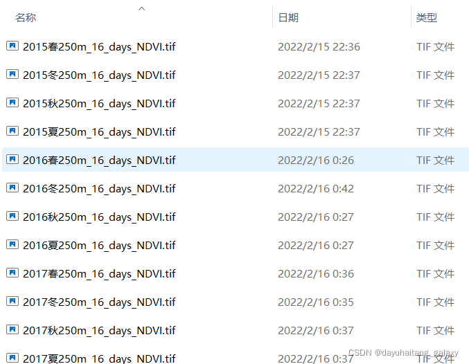
filename = [outputPath,num2str(floor(preyear)),num2str(quarter(quarterNum)),...
strArr{3},'.tif']; %存储位置和名字
quarterResult=double(quarterResult)/10000;
geotiffwrite(filename,quarterResult, R, 'GeoKeyDirectoryTag', info.GeoTIFFTags.GeoKeyDirectoryTag); %导出
filename = [outputPath,num2str(floor(preyear)),...
strArr{3},'all.tif']; %存储位置和名字
allResult=double(allResult)/10000;
geotiffwrite(filename,allResult, R, 'GeoKeyDirectoryTag', info.GeoTIFFTags.GeoKeyDirectoryTag); %导出
quarterResult = Data;
allResult = Data;
quarterNum = 1;
preyear = year;
continue;
elseif month > 3*quarterNum
filename = [outputPath,num2str(year),num2str(quarter(quarterNum)),...
strArr{3},'.tif']; %存储位置和名字
quarterResult=double(quarterResult)/10000;
geotiffwrite(filename,quarterResult, R, 'GeoKeyDirectoryTag', info.GeoTIFFTags.GeoKeyDirectoryTag); %导出
quarterResult = Data;
allResult=NDVIMerge(allResult,Data);
quarterNum=quarterNum+1;
continue;
end
quarterResult=NDVIMerge(quarterResult,Data);
allResult=NDVIMerge(allResult,Data);
end
filename = [outputPath,num2str(floor(year)),num2str(quarter(quarterNum)),...
strArr{3},'.tif']; %存储位置和名字
quarterResult=double(quarterResult)/10000;
geotiffwrite(filename,quarterResult, R, 'GeoKeyDirectoryTag', info.GeoTIFFTags.GeoKeyDirectoryTag); %导出
filename = [outputPath,num2str(floor(year)),...
strArr{3},'all.tif']; %存储位置和名字
allResult=double(allResult)/10000;
geotiffwrite(filename,allResult, R, 'GeoKeyDirectoryTag', info.GeoTIFFTags.GeoKeyDirectoryTag); %导出
fprintf("计算成功!\n");
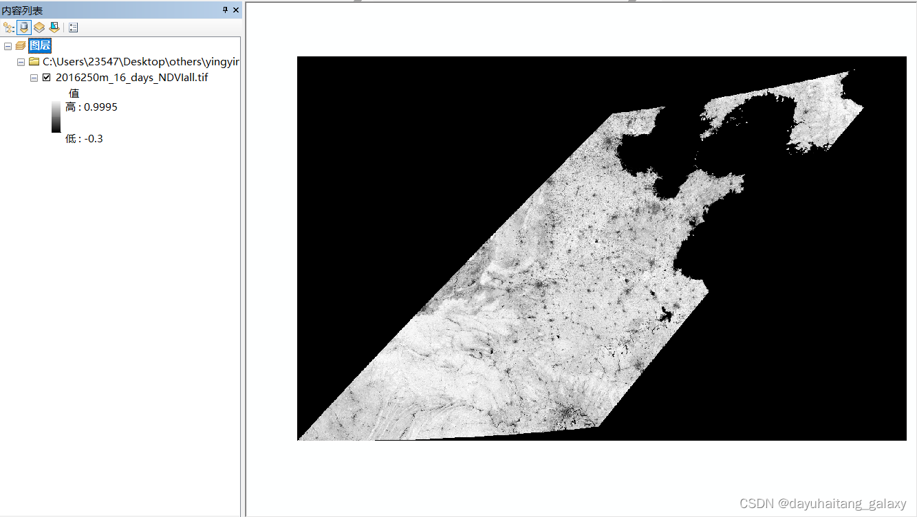
三、实现效果


 59
59

 被折叠的 条评论
为什么被折叠?
被折叠的 条评论
为什么被折叠?
 到【灌水乐园】发言


