


Java生成Shp文件-点(Point)
生成面相关Shp:
1. 使用的依赖和面相同
同上
2. 待处理的JSON数据格式
[
{"yield":"226.82","coordinates":[123.6705525,48.434689999999996],"wybm":"050116802"},
{"yield":"763.78","coordinates":[123.67096099999999,48.484783],"wybm":"050116801"},
{"yield":"221.35","coordinates":[123.6707525,48.431956500000005],"wybm":"050116800"},
{"yield":"764.45","coordinates":[123.671904,48.585055499999996],"wybm":"050116809"},
{"yield":"753.23","coordinates":[123.66973899999999,48.4300209996],"wybm":"050116805"},
{"yield":"252.20","coordinates":[120.545404,50.141742666666666],"wybm":"0501041678"},{"yield":"490.28","coordinates":[120.56136329855504,50.30223093866174],"wybm":"0501041679"},
{"yield":"771.18","coordinates":[123.662247,48.707646000000004],"wybm":"0501161576"}
]
3.生成shp示例方法
 /**
     * 生成shape文件
     *
     * @param shpPath  生成shape文件路径(包含文件名称)
     * @param encode   编码
     * @param geoType  图幅类型,Point和Rolygon
     * @param shpKey   data中图幅的key
     * @param attrKeys 属性key集合
     * @param data     图幅和属性集合
     */
    public static void write2Shape(String shpPath, String encode, String geoType, String shpKey, List<String> attrKeys, List<Map<String, Object>> data) {
        try {
            if (data == null || data.size() == 0) {
                return;
            }
            //创建shape文件对象
            File file = new File(shpPath);
            Map<String, Serializable> params = new HashMap<>();
            params.put(ShapefileDataStoreFactory.URLP.key, file.toURI().toURL());
            ShapefileDataStore ds = (ShapefileDataStore) new ShapefileDataStoreFactory().createNewDataStore(params);

            //定义图形信息和属性信息
            SimpleFeatureTypeBuilder tb = new SimpleFeatureTypeBuilder();
            tb.setCRS(DefaultGeographicCRS.WGS84);
            tb.setName("shapefile");

            if ("Polygon".equals(geoType)) {
                tb.add("the_geom", Polygon.class);
            } else if ("MultiPolygon".equals(geoType)) {
                tb.add("the_geom", MultiPolygon.class);
            } else if ("Point".equals(geoType)) {
                tb.add("the_geom", Point.class);
            } else if ("MultiPoint".equals(geoType)) {
                tb.add("the_geom", MultiPoint.class);
            } else if ("LineString".equals(geoType)) {
                tb.add("the_geom", LineString.class);
            } else if ("MultiLineString".equals(geoType)) {
                tb.add("the_geom", MultiLineString.class);
            } else {
                throw new Exception("Geometry中没有该类型:" + geoType);
            }

            for (String field : attrKeys) {
                tb.add(field, String.class);
//                tb.add(field.toUpperCase(), String.class);
            }

            ds.createSchema(tb.buildFeatureType());
            //设置编码
            Charset charset = Charset.forName(encode);
            ds.setCharset(charset);
            //设置Writer
            FeatureWriter<SimpleFeatureType, SimpleFeature> writer = ds.getFeatureWriter(ds.getTypeNames()[0], Transaction.AUTO_COMMIT);
            //写入文件信息
            for (int i = 0; i < data.size(); i++) {
                SimpleFeature feature = writer.next();
                Map<String, Object> row = data.get(i);
                Geometry geom = (Geometry) row.get(shpKey);
                feature.setAttribute("the_geom", geom);
                for (String key : row.keySet()) {
                    if (!key.equals(shpKey)) {
                        if (row.get(key) != null) {
                            feature.setAttribute(key, row.get(key).toString());
                        } else {
                            feature.setAttribute(key, "");
                        }
                    }
                }
            }
            writer.write();
            writer.close();
            ds.dispose();

            //添加到压缩文件
            //zipShapeFile(shpPath);
        } catch (Exception e) {
            e.printStackTrace();
        }
    }

    /**
     * 处理 点
     *
     * @param rangeArray
     * @param yield
     * @return
     */
    private Map<String, Object> getMapForPoint(JSONArray rangeArray, String yield, String wybm) {
        // 创建点.并设置经纬度
        Point point = new GeometryFactory().createPoint(new Coordinate(rangeArray.getDouble(0), rangeArray.getDouble(1)));
        Map<String, Object> map = new HashMap<>();
        // 设置属性设置值
        map.put("yield", yield);
        map.put("geom", point);
        map.put("wybm", wybm);
        return map;
    }

    /**
     * 生成地块的shp文件
     */
    @Test
    public void getSharp() {
        // 最终图层List 存储每个点的数据
        List<Map<String, Object>> data = new ArrayList<>();
        String json = FileUtil.readString("C:\\Users\\57589\\Desktop\\merge\\finalData.json", StandardCharsets.UTF_8);
        JSONArray baseArray = JSONObject.parseArray(json);
        for (int i = 0; i < baseArray.size(); i++) {
            JSONObject jsonObject = baseArray.getJSONObject(i);
            // 获取产量
            String yield = jsonObject.get("yield").toString();
            // 获取属性
            String wybm = jsonObject.get("wybm").toString();
            // 获取坐标
            JSONArray range = jsonObject.getJSONArray("coordinates");
            // 获取处理后的点
            Map<String, Object> map = getMapForPoint(range, yield, wybm);
            data.add(map);
        }

        // 指定属性
        List<String> list = new ArrayList<>();
        list.add("yield");
        list.add("wybm");
        // geoType, 这里选择MultiPoint. 即多个点
        write2Shape("C:\\Users\\xxx\\Desktop\\wybm-yield\\wybm-yield.shp", "utf-8", "MultiPoint", "geom", list, data);
    }
在指定路径可以查看到如下文件:
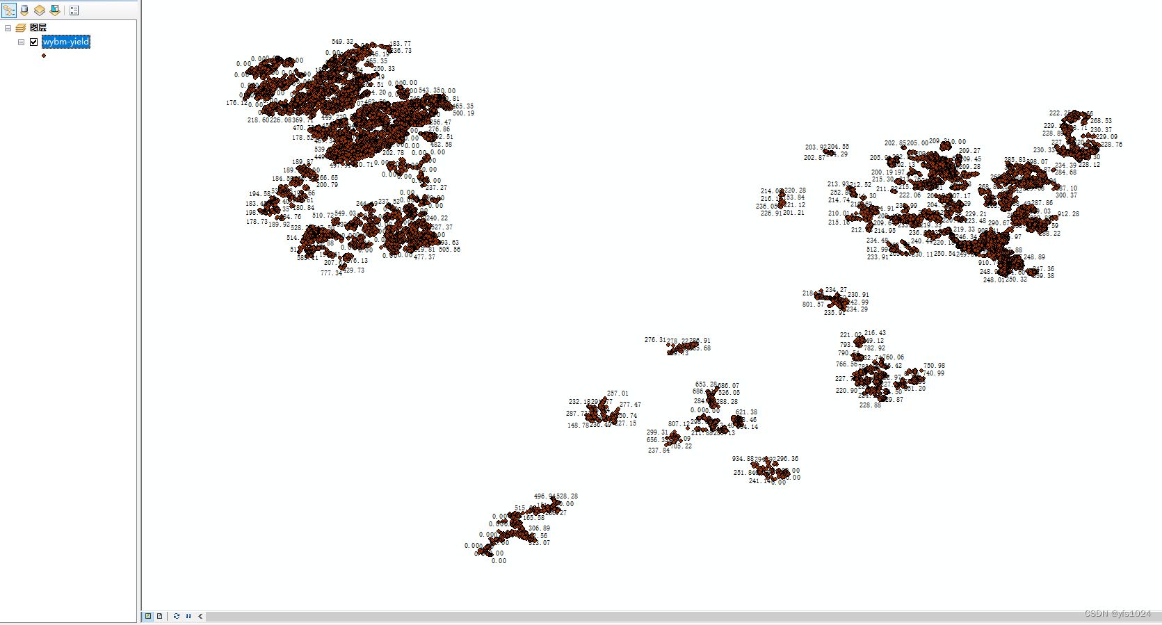
在arcmap中可以查看一下具体的情况. 并选择 想要展示的属性
具体详细的操作方法在这个笔记中
到此"点"的shp文件就生成了


 626
626


 被折叠的 条评论
为什么被折叠?
被折叠的 条评论
为什么被折叠?
 到【灌水乐园】发言


