


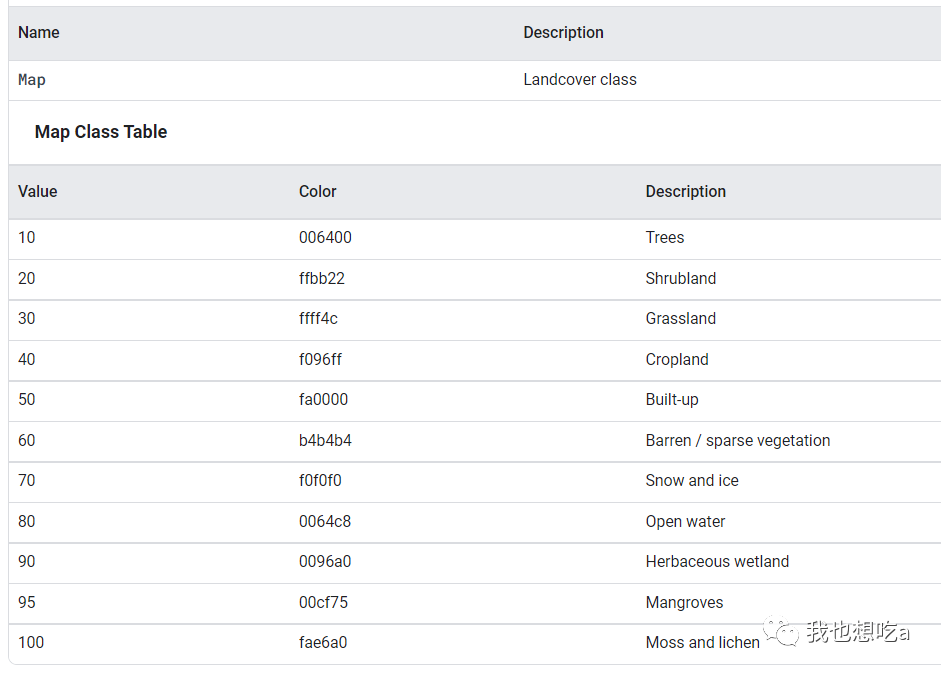
欧洲航天局 (ESA) WorldCover 10 m 2020 产品基于 Sentinel-1 和 Sentinel-2 数据以 10 m 分辨率提供 2020 年全球土地覆盖图。WorldCover 产品有 11 个土地覆盖等级,是在 ESA WorldCover 项目的框架内生成的,该项目是欧洲航天局第五个地球观测包络计划 (EOEP-5) 的一部分。
The European Space Agency (ESA) WorldCover 10 m 2020 product provides a global land cover map for 2020 at 10 m resolution based on Sentinel-1 and Sentinel-2 data. The WorldCover product comes with 11 land cover classes and has been generated in the framework of the ESA WorldCover project, part of the 5th Earth Observation Envelope Programme (EOEP-5) of the European Space Agency.
Dataset Availability
2020-01-01T00:00:00Z–2021-01-01T00:00:00
Dataset Provider
ESA/VITO/Brockmann Consult/CS/GAMMA Remote Sensing/IIASA/WUR
Earth Engine Snippet
ee.ImageCollection("ESA/WorldCover/v100")
Bands
代码
var dataset = ee.ImageCollection("ESA/WorldCover/v100").first();
var visualization = {
bands: ['Map'],
};
Map.centerObject(dataset);
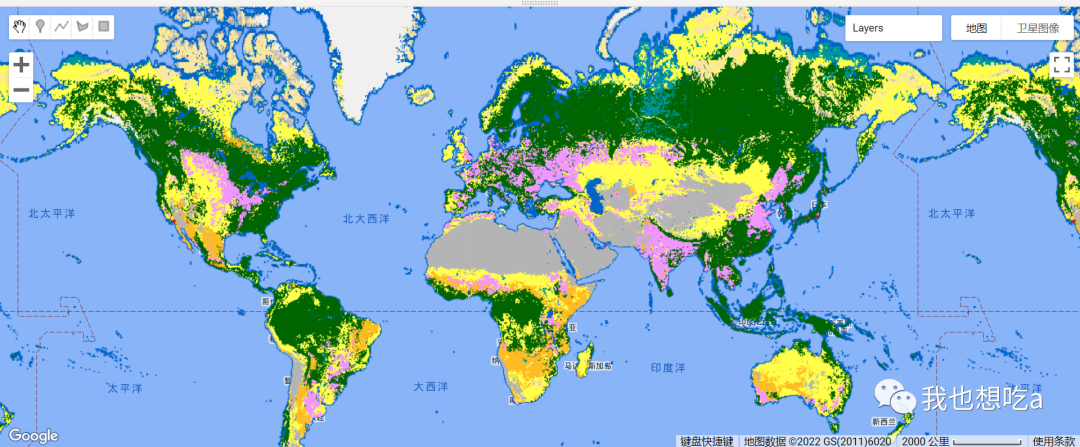
Map.addLayer(dataset, visualization, "Landcover");展示


 596
596

 被折叠的 条评论
为什么被折叠?
被折叠的 条评论
为什么被折叠?
 到【灌水乐园】发言


