


使用 Cartopy 绘制区域地图
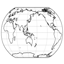
绘制亚洲地区的地形图(Miller 投影),并根据中国地区的 shapefile 绘制各个省份自治区的边界。
import matplotlib.pyplot as plt
import cartopy.crs as ccrs
import cartopy.feature as cfeature
from cartopy.io.shapereader import Reader
Read shapefiles for provinces of China
shp = Reader('CHN_adm/CHN_adm1')
define the range of the area of interest
asia_west = 70
asia_east = 135
asia_south = 15
asia_north = 55
calculate the central longitude of the area
centrallongitude = (asia_west+asia_east)/2

fig = plt.figure()
set the projection to Miller
proj = ccrs.Miller(central_longitude = centrallongitude)
ax = fig.add_subplot(1, 1, 1,projection = proj)
set the range of the area of interest
img_extent = [asia_west, asia_east, asia_south, asia_north]
ax.set_extent(img_extent,crs = ccrs.PlateCarree())
set the background image to the 1cm:500km raster
fname = 'HYP_50M_SR_W/HYP_50M_SR_W.tif'
ax.imshow(plt.imread(fname), origin='upper', transform=ccrs.PlateCarree(),extent=[-180, 180, -90, 90])
set the gridlines to dashed line and the transparency to 0.7
ax.gridlines(linestyle='--',alpha=0.7)
add borders, coastline, rivers, lakes, and provinces of China
ax.add_feature(cfeature.BORDERS.with_scale('10m')) # high resolution
ax.add_feature(cfeature.COASTLINE.with_scale('50m')) # mediate resolution
ax.add_feature(cfeature.RIVERS) # low resolution
ax.add_feature(cfeature.LAKES) # low resolution
ax.add_geometries(shp.geometries(), crs=ccrs.PlateCarree(),edgecolor='k', linewidths=0.5,facecolor='none')
plt.show()


 1061
1061

 被折叠的 条评论
为什么被折叠?
被折叠的 条评论
为什么被折叠?
 到【灌水乐园】发言


