


从点云生成图像个人理解有很多种方式,可以虚拟相机的位置,然后就可以生成图像了,但是经常使用的可能就是看一下BEV的图,
我这里写了一个简单的函数,用于从pcd点云文件生成bev的图
def pcl2bev(pcl_path, ratio=10, width=80, height=120):
    """
        pcl点云中的一般都是m的坐标,
        ratio: 1m代表几个像素的意思.
        比如width5m ,height,10m的一个范围
    """
    img_width = int(ratio * width)
    img_height = int(ratio * height)
    img = np.zeros((img_height, img_width, 3))
    pcd, pcl_points = read_pcd(pcl_path)
    colors = np.asarray(pcd.colors) * 255
    colors = colors.astype("uint8")

    for i, pt in enumerate(pcl_points):
        x, y, z = pt
        u = int(x*ratio) - (- img_width//2)
        v = int(y*ratio) - (- img_height//2)
        if (u>=0 and u<= img_width-1) and (v>=0 and v<= img_height-1):
            img[v,u] = colors[i]
    img = np.flip(img, 0)
    cv2.imwrite("pcl2bev.jpg", img.astype("uint8"))
这样写,容易理解。仅作参考.
下面是可视化,
原点云如图

俯视图看的点云如下
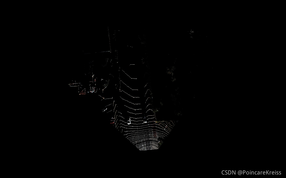
转成图片之后的结果如下

我这里是把激光雷达作为图片的中心点来考虑的。


 1万+
1万+


 被折叠的 条评论
为什么被折叠?
被折叠的 条评论
为什么被折叠?
 到【灌水乐园】发言


