


 本文介绍了NASA/NOAA的VIIRS和MODIS传感器提供的375米及1公里热异常/活动火情产品,这些产品用于近实时火灾管理和科学应用。VIIRS数据提供更高的空间分辨率和夜间性能,适合火点定位。文章还提到了数据的来源、格式、存档方式以及在EarthEngine中的访问方法。
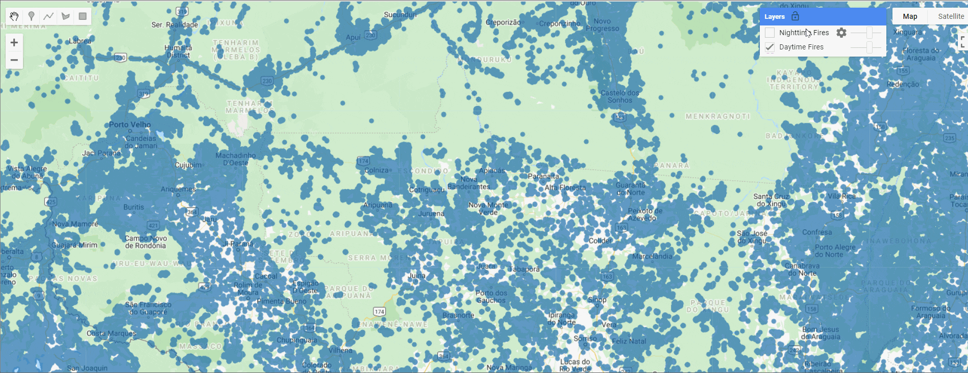
存档的NRT FIRMS全球VIIRS和MODIS矢量数据
可见光红外成像辐射仪套件(VIIRS)375米热异常/活动火情产品提供了来自NASA/NOAA索米国家极轨伙伴关系(索米NPP)和NOAA-20联合卫星上的VIIRS传感器的数据。375米数据是对中分辨率成像分光仪(MODIS)火灾探测的补充;它们在热点探测方面都显示出良好的一致性,但375米数据的空间分辨率提高,对相对较小区域的火灾有更大的反应,并提供了更好的大火周界图。375米的数据还具有更好的夜间性能。因此,这些数据很适合用于支持火灾管理(如近实时警报系统),以及其他需要提高火灾绘图保真度的科学应用。前言 – 人工智能教程
VIIRS NRT 375米活动火灾产品来自:Suomi NPP(VNP14IMGTDL_NRT)和NOAA-20,正式称为JPSS-1,(VJ114IMGTDL_NRT)。
备注
为了统一Suomi NPP的VIIRS文件名称,VIIRS NRT 375米产品的简称从VNP14IMGT改为VNP14IMGTDL_NRT(2016年4月18日)。
MODIS C61从2000年11月(针对Terra)和2002年7月(针对Aqua)至今都有。
VIIRS 375米的数据目前可从2012年1月20日到现在。
低可信度的夜间像素仅出现在东经11度至西经110度、北纬7度至南纬55度的地理区域。该区域描述了南大西洋磁异常的影响区域,该区域可能导致中红外通道I4的虚假亮度温度,从而导致潜在的假阳性警报。这些已从FIRMS分发的NRT数据中删除。
每一年的档案数据都被下载,并以shapefiles的形式摄入。你可以在这里下载档案资料:
Archive Download - NASA | LANCE | FIRMS
你可以在这里阅读更多关于MODIS产品的信息,以及VIIRS产品的信息。
参考文献
NRT VIIRS 375 m Active Fire product VJ114IMGTDL_NRT distributed from NASA FIRMS. Available on-line [https://earthdata.nasa.gov/firms]. doi: 10.5067/FIRMS/VIIRS/VJ114IMGT_NRT.002
NRT VIIRS 375 m Active Fire product VNP14IMGT distributed from NASA FIRMS. Available on-line [https://earthdata.nasa.gov/firms]. doi:10.5067/FIRMS/VIIRS/VNP14IMGT_NRT.002
MODIS Collection 61 NRT Hotspot / Active Fire Detections MCD14DL distributed from NASA FIRMS.Available on-line [https://earthdata.nasa.gov/firms]. 10.5067/FIRMS/MODIS/MCD14DL.NRT.0061
MODIS Collection 6 Hotspot / Active Fire Detections MCD14ML distributed from NASA FIRMS. Available on-line [https://earthdata.nasa.gov/firms]. doi: 10.5067/FIRMS/MODIS/MCD14ML
Attribute fields for NRT VIIRS 375 m active fire data distributed by FIRMS
| Attribute | Short Description | Long Description |
|---|---|---|
| Latitude | Latitude | Center of nominal 375 m fire pixel |
| Longitude | Longitude | Center of nominal 375 m fire pixel |
| Bright_ti4 | Brightness temperature I-4 | VIIRS I-4 channel brightness temperature of the fire pixel measured in Kelvin. |
| Scan | Along Scan pixel size | The algorithm produces approximately 375 m pixels at nadir. Scan and track reflect actual pixel size. |
| Track | Along Track pixel size | The algorithm produces approximately 375 m pixels at nadir. Scan and track reflect actual pixel size. |
| Acq_Date | Acquisition Date | Date of VIIRS acquisition. |
| Acq_Time | Acquisition Time | Time of acquisition/overpass of the satellite (in UTC). |
| Satellite | Satellite | N= Suomi National Polar-orbiting Partnership (Suomi NPP), 1=NOAA-20 (designated JPSS-1 prior to launch) |
| Confidence | Confidence | This value is based on a collection of intermediate algorithm quantities used in the detection process. It is intended to help users gauge the quality of individual hotspot/fire pixels. Confidence values are set to low, nominal and high. Low confidence daytime fire pixels are typically associated with areas of sun glint and lower relative temperature anomaly (<15K) in the mid-infrared channel I4. Nominal confidence pixels are those free of potential sun glint contamination during the day and marked by strong (>15K) temperature anomaly in either day or nighttime data. High confidence fire pixels are associated with day or nighttime saturated pixels. |
| Version | Version (Collection and source) | Version identifies the collection (e.g. VIIRS Collection 1) and source of data processing: Near Real-Time (NRT suffix added to collection) or Standard Processing (collection only). "1.0NRT" - Collection 1 NRT processing, "1.0" - Collection 1 Standard processing |
| Bright_ti5 | Brightness temperature I-5 | I-5 Channel brightness temperature of the fire pixel measured in Kelvin. |
| FRP | Fire Radiative Power | FRP depicts the pixel-integrated fire radiative power in MW (megawatts). FRP depicts the pixel-integrated fire radiative power in MW (megawatts). Given the unique spatial and spectral resolution of the data, the VIIRS 375 m fire detection algorithm was customized and tuned in order to optimize its response over small fires while balancing the occurrence of false alarms. Frequent saturation of the mid-infrared I4 channel (3.55-3.93 µm) driving the detection of active fires requires additional tests and procedures to avoid pixel classification errors. As a result, sub-pixel fire characterization (e.g., fire radiative power [FRP] retrieval) is only viable across small and/or low-intensity fires. Systematic FRP retrievals are based on a hybrid approach combining 375 and 750 m data. In fact, starting in 2015 the algorithm incorporated additional VIIRS channel M13 (3.973-4.128 µm) 750 m data in both aggregated and unaggregated format. |
| DayNight | Day or Night | D= Daytime fire, N= Nighttime fire |
Attribute fields for MCD14ML (standard quality) data active fire data distributed by FIRMS
| Attribute | Short Description | Long Description |
|---|---|---|
| Latitude | Latitude | Center of 1km fire pixel but not necessarily the actual location of the fire as one or more fires can be detected within the 1km pixel. |
| Longitude | Longitude | Center of 1km fire pixel but not necessarily the actual location of the fire as one or more fires can be detected within the 1km pixel. |
| Brightness | Brightness temperature 21 (Kelvin) | Channel 21/22 brightness temperature of the fire pixel measured in Kelvin. |
| Scan | Along Scan pixel size | The algorithm produces 1km fire pixels but MODIS pixels get bigger toward the edge of scan. Scan and track reflect actual pixel size. |
| Track | Along Track pixel size | The algorithm produces 1km fire pixels but MODIS pixels get bigger toward the edge of scan. Scan and track reflect actual pixel size. |
| Acq_Date | Acquisition Date | Data of MODIS acquisition. |
| Acq_Time | Acquisition Time | Time of acquisition/overpass of the satellite (in UTC). |
| Satellite | Satellite | A = Aqua and T = Terra. |
| Confidence | Confidence (0-100%) | This value is based on a collection of intermediate algorithm quantities used in the detection process. It is intended to help users gauge the quality of individual hotspot/fire pixels. Confidence estimates range between 0 and 100% and are assigned one of the three fire classes (low-confidence fire, nominal-confidence fire, or high-confidence fire). |
| Version | Version (Collection and source) | Version identifies the collection (e.g. MODIS Collection 6) and source of data processing: Near Real-Time (NRT suffix added to collection) or Standard Processing (collection only). "6.1NRT" - Collection 61 NRT processing, "6.1" - Collection 61 Standard processing |
| Bright_T31 | Brightness temperature 31 (Kelvin) | Channel 31 brightness temperature of the fire pixel measured in Kelvin. |
| FRP | Fire Radiative Power (MW - megawatts) | Depicts the pixel-integrated fire radiative power in MW (megawatts). |
| Type* | Inferred hot spot type | 0 = presumed vegetation fire,1 = active volcano, 2 = other static land source, 3 = offshore |
| DayNight | Day or Night | D= Daytime fire, N= Nighttime fire |
Dataset structure
The MODIS and VIIRS yearly exports were ingested and names based on their years (MODIS 2000-2020) and (VIIRS 2012-2021)
MODIS Path: projects/sat-io/open-datasets/MODIS_MCD14DL/MCD14DL_YYYY Example Path: projects/sat-io/open-datasets/MODIS_MCD14DL/MCD14DL_2000
VIIRS Path: projects/sat-io/open-datasets/VIIRS/VNP14IMGTDL_NRT_YYYY Example Path: projects/sat-io/open-datasets/VIIRS/VNP14IMGTDL_NRT_2012
Earth Engine Snippet
Sample paths are provided for two years only change the year to get different years
var viirs_2012 = ee.FeatureCollection("projects/sat-io/open-datasets/VIIRS/VNP14IMGTDL_NRT_2012");
var modis_2012 = ee.FeatureCollection("projects/sat-io/open-datasets/MODIS_MCD14DL/MCD14DL_2012");
License
The FIRMS data is distributed under a license similar to Public domain license and distributed by Land, Atmosphere Near real-time Capability for EOS (LANCE) for Fire Information for Resource Management System (FIRMS)
Acknowledgements
We acknowledge the use of data and/or imagery from NASA's Fire Information for Resource Management System (FIRMS) (Fire Information for Resource Management System (FIRMS) | Earthdata), part of NASA's Earth Observing System Data and Information System (EOSDIS).
Created by: Land, Atmosphere Near real-time Capability for EOS (LANCE) for Fire Information for Resource Management System (FIRMS), NASA
Curated in GEE by : Samapriya Roy
Keywords: Archival fire, MODIS, VIIRS, Daytime, Nigh time, Thermal anomalies, FIRMS, LANCE, NASA, vector
Last updated: 2022-04-28
Last updated on GEE: 2022-04-28


 被折叠的 条评论
为什么被折叠?
被折叠的 条评论
为什么被折叠?
 到【灌水乐园】发言


