


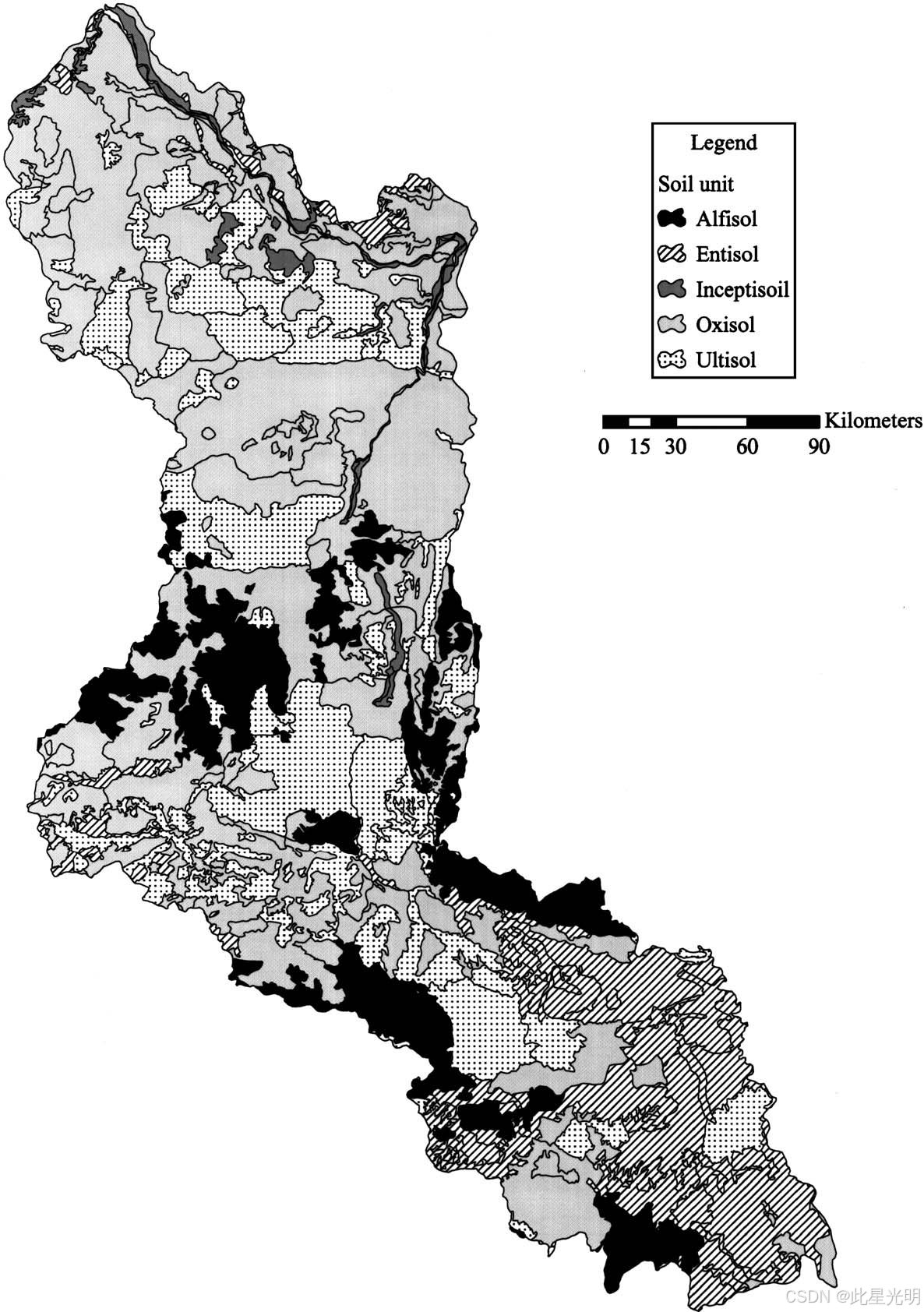
LBA-ECO CD-06 Soil Classification Map, Ji-Parana River Basin, Rondonia, Brazil
简介
本数据集提供了巴西朗多尼亚州(西亚马逊地区)吉-巴拉那河流域土级数字地图。土级数据由巴西农业与环境科学研究所(EMBRAPA)1983 年发布的 1:500,000 比例尺地图手工数字化。氧化土和老成土是该流域的主要土壤类型,分别占流域总面积的 47%和 24%。新成土(Entisols)占流域总面积的 14%,淋溶土(Alfisols)占 13%,继成土(Eptisols)占 2%(Ballester 等人,2003)。数据文件以 ESRI ArcGIS Shapefile 格式提供,并压缩为单个 zip 文件(*.zip)。
摘要
Site boundaries: (All latitude and longitude given in decimal degrees)
| Site (Region) | Westernmost Longitude | Easternmost Longitude | Northernmost Latitude | Southernmost Latitude | Geodetic Datum |
|---|---|---|---|---|---|
| Rondonia- Rio Ji-Parana(Rondonia) | -63.41528 | -60.015 | -8.0333 | -12.92694 | World Geodetic System, 1984 (WGS-84) |
代码
!pip install leafmap
!pip install pandas
!pip install folium
!pip install matplotlib
!pip install mapclassify

import pandas as pd
import leafmap

url = "https://github.com/opengeos/NASA-Earth-Data"
df = pd.read_csv(url, sep="\t")
df

leafmap.nasa_data_login()


results, gdf = leafmap.nasa_data_search(
    short_name="CD06_Soils_JiParana_1088",
    cloud_hosted=True,
    bounding_box=(-63.42, -12.93, -60.01, -8.03),
    temporal=("1983-01-01", "1983-12-31"),
    count=-1,  # use -1 to return all datasets
    return_gdf=True,
)


gdf.explore()

#leafmap.nasa_data_download(results[:5], out_dir="data")
网址推荐
个人主页
https://sites.google.com/view/xingguang/main
知识星球
知识星球 | 深度连接铁杆粉丝,运营高品质社群,知识变现的工具 (zsxq.com)![]() https://wx.zsxq.com/group/48888525452428
https://wx.zsxq.com/group/48888525452428


 被折叠的 条评论
为什么被折叠?
被折叠的 条评论
为什么被折叠?
 到【灌水乐园】发言


