


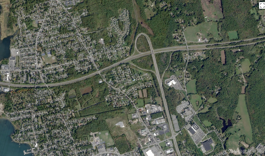
This data from Planet labs Inc. SkySat satellites was collected for the experimental "Skybox for Good Beta" program in 2015, as well as for various crisis response events and a few other projects. The data is available in both a 5-band Multispectral/Pan collection, and a Pansharpened RGB collection.
Each image's asset ID contains the acquisition date and time, for example, image s01_20150304T080608Z was acquired on March 4, 2015 at 08:06 Zulu (UTC). For more information, please see the [Planet Imagery Product Specifications] (https://www.planet.com/products/satellite-imagery/files/Planet_Combined_Imagery_Product_Specs_December2017.pdf) and visit the [Planet Imagery and Archive] (Satellite Imagery and Archive | Planet) site.
This RGB collection contains images with three pansharpened, 8-bit bands. The resolution is approximately 0.8m per pixel (closer to 1m for off-nadir images).
这些数据来自Planet labs Inc. SkySat卫星在2015年为实验性的 "Skybox for Good Beta "项目,以及各种危机应对事件和其他一些项目收集的数据。这些数据有5个波段的多光谱/全景收集,以及一个全景锐化的RGB收集。
每张图像的资产ID包含了采集日期和时间,例如,图像s01_20150304T080608Z是在2015年3月4日08:06 Zulu(UTC)采集的。欲了解更多信息,请参见[行星图像产品规格](https://www.planet.com/products/satellite-imagery/files/Planet_Combined_Imagery_Product_Specs_December2017.pdf),并访问[行星图像和档案](https://www.planet.com/products/planet-imagery/)网站。
这个RGB系列包含有三个泛锐化的8位带的图像。分辨率约为每像素0.8米(离地图像接近1米)。
Dataset Availability
2014-07-03T00:00:00 - 2016-12-24T00:00:00
Dataset Provider
Collection Snippet
ee.ImageCollection("SKYSAT/GEN-A/PUBLIC/ORTHO/RGB")
Resolution
0.8 meters
Bands Table
| Name | Description | Min* | Max* | Wavelength |
|---|---|---|---|---|
| R | Red | 1 | 255 | 605-695nm |
| G | Green | 1 | 255 | 515-595nm |
| B | Blue | 1 | 255 | 450-515nm |
* = Values are estimated
影像属性:
| Name | Type | Description |
|---|---|---|
| catalogID | String | Unique catalog ID corresponding to a single collection event; same across all three detectors. |
| collectionEndTime | String | ISO 8601 collection end time (UTC). |
| collectionStartTime | String | ISO 8601 collection start time (UTC). |
| collectionType | String | 'Strip', 'Point', 'Area', or 'Path'. |
| productType | String | Product type identifying the product level ('Orthorectified Imagery'). |
| productionID | String | ID of this version of this product, generated by Singer/TileMill. |
| productionSystemVersion | String | N/A |
| resamplingMethod | String | The method used for interpolated pixel values. |
| satelliteAzimuthAngleMax | Double | Maximum satellite azimuth angle over the collection (degrees). |
| satelliteAzimuthAngleMean | Double | Mean satellite azimuth angle over the collection (degrees). |
| satelliteAzimuthAngleMin | Double | Minimum satellite azimuth angle over the collection (degrees). |
| satelliteElevationAngleMax | Double | Maximum satellite elevation angle over the collection (degrees). |
| satelliteElevationAngleMean | Double | Mean satellite elevation angle over the collection (degrees). |
| satelliteElevationAngleMin | Double | Minimum satellite elevation angle over the collection (degrees). |
| satelliteName | String | Unique name identifying the spacecraft. |
| snaptoAlignmentConfidence | Double | N/A |
| snaptoReferenceAssets | String | N/A |
| solarAzimuthAngle | Double | Solar azimuth angle at the time of collection. |
| solarElevationAngle | Double | Solar elevation angle at the time of collection. |
| terrainBlendEpoch | Double | N/A |
代码:
var dataset = ee.ImageCollection('SKYSAT/GEN-A/PUBLIC/ORTHO/RGB');
var rgb = dataset.select(['R', 'G', 'B']);
var rgbVis = {
min: 11.0,
max: 190.0,
};
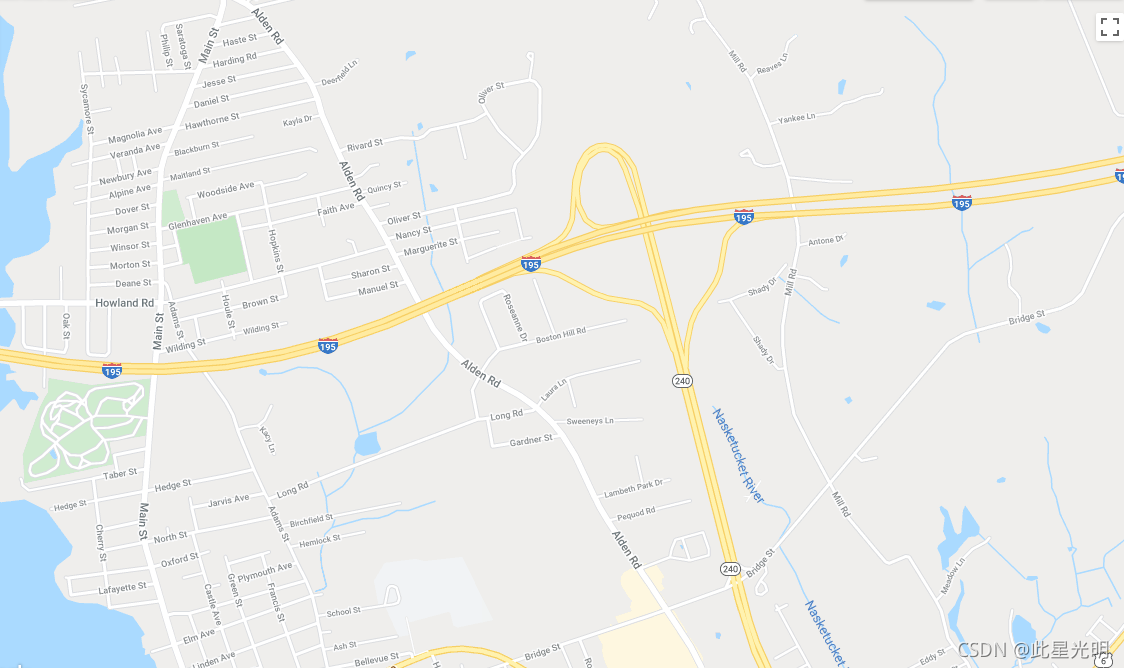
Map.setCenter(-70.892, 41.6555, 15);
Map.addLayer(rgb, rgbVis, 'RGB');


 被折叠的 条评论
为什么被折叠?
被折叠的 条评论
为什么被折叠?
 到【灌水乐园】发言


