


简介
LANDFIRE(LF),景观火灾和资源管理规划工具,是美国农业部林务局、美国内政部地质调查局和自然资源保护协会共同开展的项目。
about the Landfire 2023 updates here![]() https://landfire.gov/data/lf2023
https://landfire.gov/data/lf2023
LANDFIRE (LF) 图层是基于广泛的实地参照数据、卫星影像和生物物理梯度层,使用分类和回归树构建的预测景观模型创建的。您可以在这里阅读 Landfire 2023 的更新信息。
LANDFIRE 2023 更新(LF 2023)代表了持续向年度更新和降低延迟目标迈进的重要一步。与 LF 2022 更新类似,在 LF 2023 中,上一年度的干扰情况被反映在本年度的产品中。这意味着 LANDFIRE 团队提高了生产效率,可以比以往任何时候都更快地处理干扰,为用户提供最新数据。
数据集说明
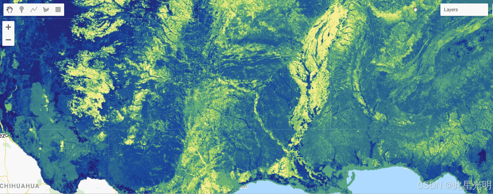
空间信息
| Theme 主题 | Product Name 产品名称 | Abbreviation 缩写 |
|---|---|---|
| Disturbance 干扰 | Limited Disturbance 有限干扰 | LDIST |
| Preliminary Annual Disturbance 预先年度扰动 | PDIST | |
| 2023 Annual Disturbance 2023 年度扰动 | DIST | |
| Historical Disturbance 历史扰动 | HDIST | |
| Fuel Disturbance 燃料扰动 | FDist | |
| Historic Fire Regime 历史火灾制度 | Fire Regime Groups 火灾制度组 | FRG |
| Fire Return Interval 火灾回归间隔 | FRI | |
| Percent Fire Severity 百分比火灾严重程度 | PFS | |
| Fuel 燃料 | 13 Anderson Fire Behavior Fuel Models 13 安德森火灾行为燃料模型 | FBFM13 |
| 40 Scott and Burgan Fire Behavior Fuel Models 40 斯科特和伯格南火灾行为燃料模型 | FBFM40 | |
| Forest Canopy Bulk Density 森林冠层体积密度 | CBD | |
| Forest Canopy Base Height 森林冠层基高 | CBH | |
| Forest Canopy Cover 森林冠层覆盖率 | CC | |
| Forest Canopy Height 森林冠层高度 | CH | |
| Canadian Forest Fire Danger Rating System 加拿大森林火灾危险等级评定系统 | CFFDRS | |
| Operational Roads 运营道路 | Roads 道路 | |
| Fuel Vegetation Cover 燃料植被覆盖 | FVC | |
| Fuel Vegetation Height 燃料植被高度 | FVH | |
| Fuel Vegetation Type 燃料植被类型 | FVT | |
| Fuel Rulesets Database 燃料规则集数据库 | FRDB | |
| Fuel Characteristic Classification System Fuelbeds 燃料特性分类系统燃料床 | FCCS | |
| Reference 参考 | Public Events Geodatabase 公共事件地理数据库 | EventsDB 事件数据库 |
| Public Exotics Geodatabase 公共外来物种地理数据库 | ExoticsDB 异种数据库 | |
| Public Model Ready Events Geodatabase 公共模型就绪事件地理数据库 | ModelReadyDB 模型就绪数据库 | |
| Vegetation 植被 | Biophysical Settings 生物物理设置 | BPS |
| Existing Vegetation Type 现有植被类型 | EVT | |
| Existing Vegetation Cover 现有植被覆盖 | EVC | |
| Existing Vegetation Height 现有植被高度 | EVH | |
| Succession Classes 群落演替类型 | SClass S 类 | |
| Vegetation Condition Class 植被状况类型 | VCC | |
| Vegetation Departure Index 植被退去指数 | VDep |
LF 2023 更新中的亮点改进
这些图层已进行改进,您可以在下面找到类别和改进信息。
| Category 类别 | Improvement 改善 |
|---|---|
| Imagery 图像 | Use of 4 seasonal composites in disturbance mapping, doubling satellite imagery usage 在扰动制图中使用 4 个季节复合图像,卫星图像使用量翻倍 |
| Coverage 覆盖范围 | Mapped disturbance events in the 90km buffer area surrounding CONUS 美国本土地区周围 90 公里缓冲区内的扰动事件图 |
| Products 产品 | Two new types of Annual Disturbance products – Limited and Preliminary Annual Disturbance 两种新的年度扰动产品类型——限制性和初步年度扰动 |
| Calibration 校准 | New fuels calibration for the Southeast GeoArea, Colorado, and Oklahoma 东南地区、科罗拉多州和俄克拉荷马州的新燃料校准 |
| Infrastructure 基础设施 | Updated Operational Roads product for CONUS incorporating NLCD 2021 包含 NLCD 2021 的 CONUS 更新操作道路产品 |
| Fire Regime 火险制度 | Return of FRG, FRI, and PFS as standalone products FRG、FRI 和 PFS 作为独立产品回归 |
| Alaska Products 阿拉斯加产品 | Updated BPS, FRG, FRI, and PFS products for AK 更新后的 AK BPS、FRG、FRI 和 PFS 产品 |
| Fuel Classification 燃料分类 | Updated FCCS product for all extents 更新了所有范围的 FCCS 产品 |
| Methodology 方法论 | New approach for Existing Vegetation Cover (EVC), Height (EVH), and Type (EVT) within CONUS 在 CONUS 内对现有植被覆盖(EVC)、高度(EVH)和类型(EVT)的新方法 |
LF 2023 新的扰动产品
为了更早地提供 LANDFIRE 年度干扰数据并确保更完整的记录,LANDFIRE 现在分发三种年度干扰产品:有限、初步和最终版。
展开查看单个版本中的干扰产品
| Product 产品 | Abbreviation 缩写 | Description 描述 | Features 特征 |
|---|---|---|---|
| Limited Annual Disturbance 限制性年度干扰 | LDist | First cut of landscape change information 景观变化信息的首次切割 | • Supports time-sensitive updates • 支持时效性更新 • Does not include satellite change detection • 不包括卫星变化检测 • Does not provide image-based severity for contributed events • 不提供贡献事件的基于图像的严重程度 • Includes fire program perimeters and burn severity where available • 包含火灾项目边界和可用的燃烧严重程度 |
| Preliminary Annual Disturbance 初步年度扰动 | PDist | Second "draft" of landscape change information 第二版“草案”的景观变化信息 | • Released by geographic area • 按地理区域发布 • Includes disturbance events from regional sources • 包含来自区域来源的干扰事件 • Includes LANDFIRE satellite change detection • 包含 LANDFIRE 卫星变化检测 • Includes image-based severity 包含基于图像的严重程度 • Used to update Vegetation and Fuel products 用于更新植被和燃料产品 |
| Annual Disturbance 年度扰动 | Dist 扰动 | "Final" draft of Annual Disturbance data 年度扰动数据“最终”草案 | • Includes additional fires and disturbance events • 包含额外的火灾和扰动事件 • Harvested from second "pull" of national online sources • 从全国在线资源的第二次“拉取”中收集 • Included in the Public Events Geodatabase • 包含在公共事件地理数据库中 |
新的植被建模方法
对于 2023 年的 LF,LANDFIRE 利用机器学习方法绘制了过去二十年被标记为受干扰区域的现有植被的生命形态、覆盖度和高度图。这与之前依赖于数百万由地方和国家专家开发的规则集的更新不同。
变量
Earth Engine Snippet: Disturbance 2.4.0
// LANDFIRE Disturbance Layers
var dist = ee.ImageCollection("projects/sat-io/open-datasets/landfire/DISTURBANCE/DIST");
var hdist = ee.ImageCollection("projects/sat-io/open-datasets/landfire/DISTURBANCE/HDIST");
var ldist = ee.ImageCollection("projects/sat-io/open-datasets/landfire/DISTURBANCE/LDIST");
var pdist = ee.ImageCollection("projects/sat-io/open-datasets/landfire/DISTURBANCE/PDIST");Earth Engine Snippet FIRE REGIME: v2.4.0
// LANDFIRE Fire Regime Collections
var frg = ee.ImageCollection("projects/sat-io/open-datasets/landfire/FIRE-REGIME/FRG");
var fri = ee.ImageCollection("projects/sat-io/open-datasets/landfire/FIRE-REGIME/FRI");
var pfs = ee.ImageCollection("projects/sat-io/open-datasets/landfire/FIRE-REGIME/PFS");Earth Engine Snippet: Fuel 2.4.0
// Landfire FUEL Layers
var cbd = ee.ImageCollection("projects/sat-io/open-datasets/landfire/FUEL/CBD");
var cbh = ee.ImageCollection("projects/sat-io/open-datasets/landfire/FUEL/CBH");
var cc = ee.ImageCollection("projects/sat-io/open-datasets/landfire/FUEL/CC");
var cffdrs = ee.ImageCollection("projects/sat-io/open-datasets/landfire/FUEL/CFFDRS");
var ch = ee.ImageCollection("projects/sat-io/open-datasets/landfire/FUEL/CH");
var fbfm13 = ee.ImageCollection("projects/sat-io/open-datasets/landfire/FUEL/FBFM13");
var fbfm40 = ee.ImageCollection("projects/sat-io/open-datasets/landfire/FUEL/FBFM40");
var fccs = ee.ImageCollection("projects/sat-io/open-datasets/landfire/FUEL/FCCS");
var fdist = ee.ImageCollection("projects/sat-io/open-datasets/landfire/FUEL/FDIST");
var fvc = ee.ImageCollection("projects/sat-io/open-datasets/landfire/FUEL/FVC");
var fvh = ee.ImageCollection("projects/sat-io/open-datasets/landfire/FUEL/FVH");
var fvt = ee.ImageCollection("projects/sat-io/open-datasets/landfire/FUEL/FVT");
var roads = ee.ImageCollection("projects/sat-io/open-datasets/landfire/FUEL/ROADS");
Sample Code: https://code.earthengine.google.com/?scriptPath=users/sat-io/awesome-gee-catalog-examples:agriculture-vegetation-forestry/LANDFIRE-FUEL
示例代码:https://code.earthengine.google.com/?scriptPath=users/sat-io/awesome-gee-catalog-examples:agriculture-vegetation-forestry/LANDFIRE-FUEL
Earth Engine Snippet: Vegetation 2.4.0
// LANDFIRE Vegetation Collections
var bps = ee.ImageCollection("projects/sat-io/open-datasets/landfire/VEGETATION/BPS");
var evc = ee.ImageCollection("projects/sat-io/open-datasets/landfire/VEGETATION/EVC");
var evh = ee.ImageCollection("projects/sat-io/open-datasets/landfire/VEGETATION/EVH");
var evt = ee.ImageCollection("projects/sat-io/open-datasets/landfire/VEGETATION/EVT");
var sclass = ee.ImageCollection("projects/sat-io/open-datasets/landfire/VEGETATION/SCLASS");
var vcc = ee.ImageCollection("projects/sat-io/open-datasets/landfire/VEGETATION/VCC");
var vdep = ee.ImageCollection("projects/sat-io/open-datasets/landfire/VEGETATION/VDEP");
Sample Code: https://code.earthengine.google.com/?scriptPath=users/sat-io/awesome-gee-catalog-examples:agriculture-vegetation-forestry/LANDFIRE-VEGETATION
示例代码:https://code.earthengine.google.com/?scriptPath=users/sat-io/awesome-gee-catalog-examples:agriculture-vegetation-forestry/LANDFIRE-VEGETATION
Earth Engine Snippet: Topography 2.3.0
Earth Engine Snippet: 地形 2.3.0 
// LANDFIRE Vegetation Collections
var slpp = ee.ImageCollection("projects/sat-io/open-datasets/landfire/TOPOGRAPHY/SLPP");
var slpd = ee.ImageCollection("projects/sat-io/open-datasets/landfire/TOPOGRAPHY/SLPD");
var elev = ee.ImageCollection("projects/sat-io/open-datasets/landfire/TOPOGRAPHY/ELEV");
var asp = ee.ImageCollection("projects/sat-io/open-datasets/landfire/TOPOGRAPHY/ASP");
Sample Code: https://code.earthengine.google.com/?scriptPath=users/sat-io/awesome-gee-catalog-examples:agriculture-vegetation-forestry/LANDFIRE-VEGETATION
示例代码:https://code.earthengine.google.com/?scriptPath=users/sat-io/awesome-gee-catalog-examples:agriculture-vegetation-forestry/LANDFIRE-VEGETATION
Resolution: approx 30m 分辨率:约 30 米
引用
LANDFIRE spatial data products
LANDFIRE 空间数据产品
关键词:doi、火灾、landfire、自然保护、usda、usgs、植被、野火
Last updated: 2025-03-16
最后更新:2025-03-16
干旱监测平台
慧天干旱监测与预警-首页https://www.htdrought.com/https://www.htdrought.com/![]() https://www.htdrought.com/
https://www.htdrought.com/


 被折叠的 条评论
为什么被折叠?
被折叠的 条评论
为什么被折叠?
 到【灌水乐园】发言


