


简介
威龙开放数据计划提供免费的中分辨率(5.30 米)高光谱卫星图像,这些图像由龙女高光谱卫星星座捕获。数据集包含从 503nm 到 799nm 的 23 个光谱波段,每天重访率为 2 次。初始发布包含 25 张图像,覆盖各种土地覆盖特征,包括森林、野火事件、轮作和行作田地、海岸地形、露天矿、太阳能农场和全球各地的井场。
技术规格
| Parameter 参数 | Value 价值 |
|---|---|
| Spatial Resolution 空间分辨率 | 5.30 m 5.30 米 |
| Spectral Bands 光谱波段 | 23 bands (503-799 nm) 23 波段(503-799 nm) |
| Processing Level 处理级别 | Level 1B 一级 B |
| Bit Depth 位深 | 12-bit (delivered as 32-bit) 12 位(以 32 位形式提供) |
| Revisit Rate 复访率 | Every 2 days 每隔两天 |
| Swath Width 行宽 | 20 km 20 公里 |
| Geographic Coverage 地理覆盖范围 | Global 全球 |
数据集说明
空间信息
| Band Number 波段号 | Band Center (nm) 波段中心(nm) | Wavelength Range (nm) 波长范围(nm) | Spectral Region 光谱区域 |
|---|---|---|---|
| 1 | 500 | 480-520 | Green 绿色 |
| 2 | 510 | 490-530 | Green 绿色 |
| 3 | 520 | 499-541 | Green 绿色 |
| 4 | 540 | 514-566 | Green 绿色 |
| 5 | 550 | 528-572 | Green 绿色 |
| 6 | 570 | 547-593 | Green 绿色 |
| 7 | 585 | 562-608 | Yellow 黄色 |
| 8 | 608.5 | 576-641 | Yellow 黄色 |
| 9 | 615 | 590-640 | Yellow 黄色 |
| 10 | 635 | 610-660 | Red 红色 |
| 11 | 650 | 624-676 | Red 红色 |
| 12 | 660 | 634-686 | Red 红色 |
| 13 | 670 | 643-697 | Red 红色 |
| 14 | 680 | 653-707 | Red 红色 |
| 15 | 690 | 662-718 | Red 红色 |
| 16 | 700 | 672-728 | Red 红色 |
| 17 | 712 | 684-740 | Red Edge 红色边缘 |
| 18 | 722 | 693-751 | Red Edge 红色边缘 |
| 19 | 735 | 706-764 | Red Edge 红色边缘 |
| 20 | 750 | 720-780 | Red Edge 红色边缘 |
| 21 | 765 | 734-796 | Red Edge 红色边缘 |
| 22 | 782 | 751-813 | Red Edge 红色边缘 |
| 23 | 800 | 768-832 | Near-Infrared 近红外 |
变量
代码
// Load the Wyvern collection
var wyvernCollection = ee.ImageCollection('projects/sat-io/open-datasets/disaster/wyvern-open-data')
.filter(ee.Filter.eq('system:index','wyvern_dragonette-001_20240823T172127_4ef5c7ec'));
var image = wyvernCollection.first()

// Visualization parameters
var visParams = {
  // Natural Color-like composite
  naturalColor: {
    bands: ['Band_635nm', 'Band_549nm', 'Band_503nm'],
    min: 35,
    max: 188,
    gamma: 1.2
  },
  // False Color Vegetation composite (NIR, Red, Green)
  falseColor: {
    bands: ['Band_799nm', 'Band_669nm', 'Band_549nm'],
    min: 34,
    max: 145,
    gamma: 1.2
  }
};

// Add the layers to the map
Map.addLayer(image, visParams.naturalColor, 'Natural Color');
Map.addLayer(image, visParams.falseColor, 'False Color Vegetation');

// Center map on the image
Map.centerObject(image, 10);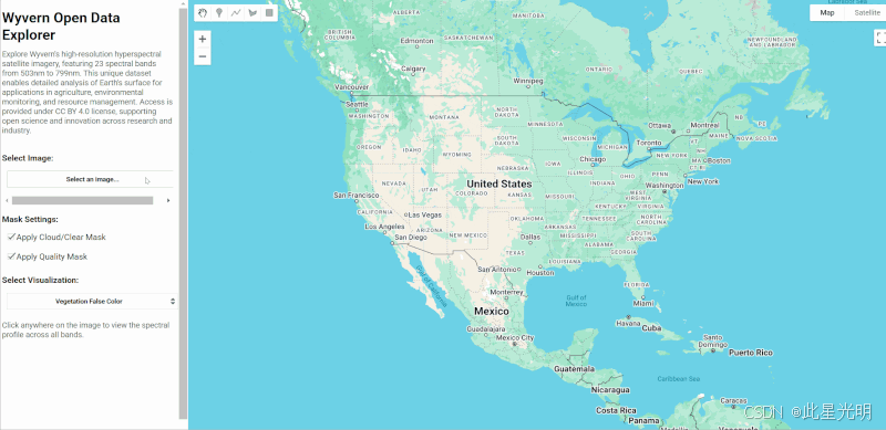
代码链接
App Link: wyvern-open-data
引用
使用以下版权声明在源图像数据产品及其任何改编或修改旁边,包括定义为“增值产品(VAP)”和“派生产品(DP)”的衍生品,如《Wyvern 通用条款和条件》所述:
"©[YEAR] Wyvern Incorporated. All Rights Reserved."
©[年份] Wyvern 公司。版权所有。
[年份]必须反映任何给定的图像数据产品由飞龙卫星收集的年份,如数据集获取的'datetime'元数据字段所示。
许可
This dataset is made available under Creative Commons Attribution 4.0 International License (CC BY 4.0).
知识星球
机器学习
干旱监测平台
慧天干旱监测与预警-首页https://www.htdrought.com/https://www.htdrought.com/![]() https://www.htdrought.com/
https://www.htdrought.com/


 被折叠的 条评论
为什么被折叠?
被折叠的 条评论
为什么被折叠?
 到【灌水乐园】发言


