


LBA-ECO CD-04 LAI Estimated from Photos, km 83 Tower Site, Tapajos National Forest
简介
该数据集包含巴西帕拉州塔帕若斯国家森林 83 公里塔楼站月度叶面积指数 (LAI) 和植物面积指数 (PAI) 的汇总数据。LAI 是根据 2000 年至 2003 年间收集的叶片半球形照片,使用直方图和间隙分数分析法估算得出的。
该数据集包含两个数据文件:一个以逗号分隔的 ASCII 数据文件,其中包含每月的 LAI 和 PAI 汇总数据;另一个压缩文件 (*.zip),其中包含 2000-2001 年的半球形照片图像 (.bmp)。这些图像包括在测井前和测井后在测量地点拍摄的,用于比较 LAI。此外,还有一个配套文件,其中包含为 LAI 分析而开发的程序代码,以 ASCII 文本文件的形式提供。
摘要
File 1: CD04_LAI_PAI_photos.csv:
Summary data for the calculations of LAI and PAI between 2000 and 2003 as a comma-delimited ASCII file.
| Column | Heading | Units/format | Description |
|---|---|---|---|
| 1 | Year | yyyy | Year in which the hemispherical photos were taken (yyyy): 2000-2003 |
| 2 | Month | mm | Month in which the hemispherical photos were taken: 1= January and 12= December |
| 3 | Row | Location of photographs within the sampling grid: A-M (see data set documentation ) | |
| 4 | Status | Status of the site with respect to logging operations: Pre-logging or Logged. Selective logging began in September 2001. | |
| 5 | No_photos | Number of hemispherical photos included in the calculation of PAI and LAI | |
| 6 | PAI | m2 per m2 | Mean plant area index for the sampling row in meters squared per meter squared (m2 per m2) calculated using the Beer-Lambert equation |
| 7 | LAI | m2 per m2 | Mean leaf area index for the row in meters squared per meter squared (m2 per m2) calculated from hemispherical photos |
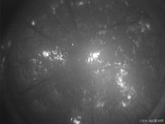
File 2: CD04_LAI_Hemispherical_Images.zip
This data file is comprised of three compressed files which contain hemispherical photo images (.bmp) taken at the forest measurement site between 2000-2001. The images include those taken pre-logging and post-logging at the measurement site for the purpose of comparing LAI.
File names:
CD04_LAI_precut.zip
CD04_LAI_postcut.zip
CD04_LAI_May2001.zip
Companion file: LAI_OTV_gap_fraction_program.txt:
Individual file names indicate the row-column-month-year that the image was taken. See figure 2.
The text file of the program code developed for LAI analysis was run on a 1GHz Pentium III PC using the Interactive Data Language IDL 6.0.
Site boundaries: (All latitude and longitude given in decimal degrees)
| Site (Region) | Westernmost Longitude | Easternmost Longitude | Northernmost Latitude | Southernmost Latitude | Geodetic Datum |
|---|---|---|---|---|---|
| Para Western (Santarem) - km 83 Logged Forest Tower Site (Para Western (Santarem)) | -54.97070 | -54.97070 | -3.01700 | -3.01700 | World Geodetic System, 1984 (WGS-84) |
代码
!pip install leafmap
!pip install pandas
!pip install folium
!pip install matplotlib
!pip install mapclassify

import pandas as pd
import leafmap

url = "https://github.com/opengeos/NASA-Earth-Data"
df = pd.read_csv(url, sep="\t")
df

leafmap.nasa_data_login()


results, gdf = leafmap.nasa_data_search(
    short_name="CD04_LAI_Estimates_1103",
    cloud_hosted=True,
    bounding_box=(-54.97, -3.02, -54.96, -2.75),
    temporal=("2000-06-01", "2006-02-28"),
    count=-1,  # use -1 to return all datasets
    return_gdf=True,
)


gdf.explore()

#leafmap.nasa_data_download(results[:5], out_dir="data")
引用
Juarez, R.N., H.R. da Rocha, A.M. Figueira, M.L. Goulden, and S.D. Miller. 2010. LBA-ECO CD-04 LAI Estimated from Photos, km 83 Tower Site, Tapajos National Forest. Data set. Available on-line [http://daac.ornl.gov] from Oak Ridge National Laboratory Distributed Active Archive Center, Oak Ridge, Tennessee, U.S.A.
网址推荐
个人主页
https://sites.google.com/view/xingguang/main
知识星球
知识星球 | 深度连接铁杆粉丝,运营高品质社群,知识变现的工具 (zsxq.com)![]() https://wx.zsxq.com/group/48888525452428
https://wx.zsxq.com/group/48888525452428


 997
997

 被折叠的 条评论
为什么被折叠?
被折叠的 条评论
为什么被折叠?
 到【灌水乐园】发言


